🥾 ActiveWeekend · from Asheville, NC

Linville Gorge: Table Rock & Linville Falls

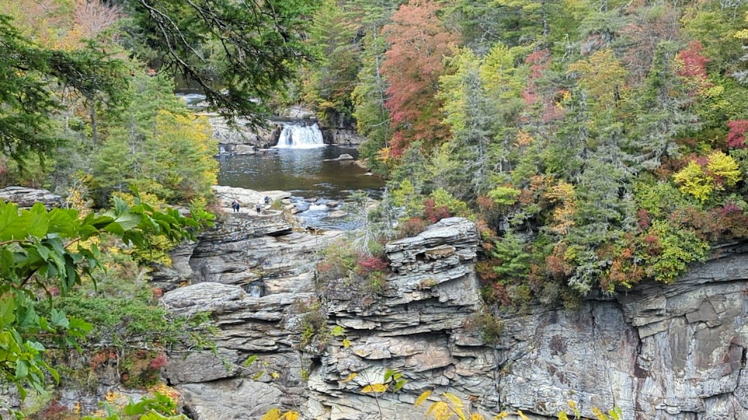
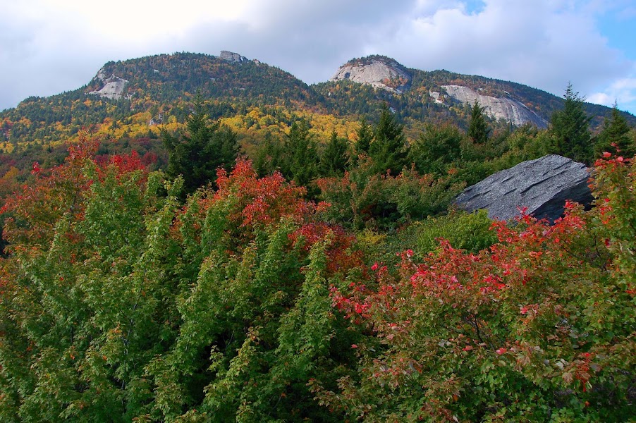
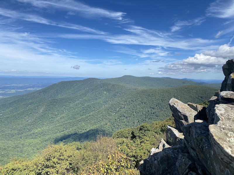
Linville Gorge in Burke County is the deepest gorge in the eastern United States — 2,000 feet from the Table Rock and Hawksbill summits on the western rim to the Linville River below, carved through billion-year-old Cranberry Gneiss. The wilderness designation means no trails are marked from the gorge interior and no motor vehicles are allowed; the rim trails are strenuous but clearly signed and deliver views that match anything in the southern Appalachians. Table Rock is the first objective — a half-mile scramble from the parking area to a 3,909-foot summit with sheer face drops and views south down the gorge. Linville Falls on the second morning, before the return, is the most dramatic waterfall in western North Carolina: the Linville River drops 45 feet into a pool, then another 12 feet into the Upper Plunge Basin at the top of a 2,000-foot gorge — visible from three separate overlooks on a loop trail from the visitor center.

Day 1 — Table Rock: Gorge rim scramble (3,909ft summit, sheer face drops), Linville Gorge Wilderness overnightDay 2 — Linville Falls: three-overlook loop trail, plunge basin views, return to Asheville
Day 1Linville Gorge Wilderness

Day 1Linville Gorge Wilderness

🚗 1 hr driving📍 4 stops
🌅
Morning
🚗
Drive
Asheville, NCTable Rock Trailhead, Linville Gorge
1 hr8:00 AM9:00 AM
Table Rock — Linville Gorge Wilderness
4.8
A 2.1-mile round-trip scramble from the Table Rock parking area to a 3,909-foot summit on the western rim of Linville Gorge — a massive quartzite massif with sheer face drops into the gorge on the east side and clear views south to the Catawba Valley and north toward Grandfather Mountain. The final approach involves hand-and-foot scrambling on exposed rock. The gorge below is a federally designated wilderness; from the rim the depth and remoteness of the canyon are fully apparent.
🍽️
Lunch
Hawksbill Mountain — Linville Gorge
4.8
A 2.5-mile round-trip to the second major rim summit at 4,020 feet — the highest point directly above the gorge interior, with views looking north toward Table Rock and south down the full gorge length. The trail runs through second-growth hardwood on the approach and opens to exposed rock for the final section. Combines well with Table Rock for a full gorge rim day.
☀️
Afternoon
Linville Falls Campground
4.7
A National Park Service campground at the Linville Falls entrance to the Blue Ridge Parkway — tent and RV sites in a second-growth hardwood setting, a short walk from the Linville Falls trailhead. Reserve well in advance for summer weekends. The campground is the most convenient overnight for a two-day Linville Gorge visit; the falls trail is a short walk the following morning.
🌙
Evening
Eseeola Lodge — Linville, NC
4.7
A historic mountain resort in Linville, NC — built in 1892 and operating as the anchor of the Linville Land Harbour resort community on the back slope of Grandfather Mountain. Full-service dining, a golf course, and rooms in the original lodge buildings. The closest full-service lodging to the Linville Falls and Gorge area and a significant step up from campground alternatives.
Day 2Linville Falls — Asheville

Day 2Linville Falls — Asheville

🚗 1 hr 35 min driving📍 2 stops
🌅
Morning
🚗
Drive
Linville, NCLinville Falls Visitor Center
5 min8:00 AM8:05 AM
Linville Falls — Three-Overlook Loop Trail
A 1.6-mile loop from the Blue Ridge Parkway visitor center to three separate overlooks above Linville Falls — the Linville River's 45-foot main drop into the Upper Plunge Basin and the subsequent 12-foot drop into the Lower Plunge Basin, where the river enters the top of the 2,000-foot Linville Gorge. The Chimney View overlook on the east branch of the loop looks back at the gorge walls receding south. The most dramatic waterfall complex in western North Carolina.
🍽️
Lunch
Grandfather Mountain State Park — Mile High Swinging Bridge
4.8
A privately-operated nature park and state park hybrid on the slopes of Grandfather Mountain (5,964 feet) — accessible via a winding toll road to the summit area where a pedestrian suspension bridge spans a 228-foot chasm between two rocky peaks. The surrounding 3,000 acres of old-growth spruce-fir forest support one of the most biodiverse ecosystems in the southern Appalachians; wildlife habitats for black bear, river otter, and bald eagle are on the lower grounds. The summit views on clear days extend over 100 miles.
🌙
Evening
🚗
Drive
Grandfather Mountain, NCAsheville, NC
1 hr 30 min5:00 PM6:30 PM
Plan your own escapeExplore more trips →