🥾 ActiveDay trip · from Bozeman, MT

Hyalite Canyon: Palisade Falls & Hyalite Peak

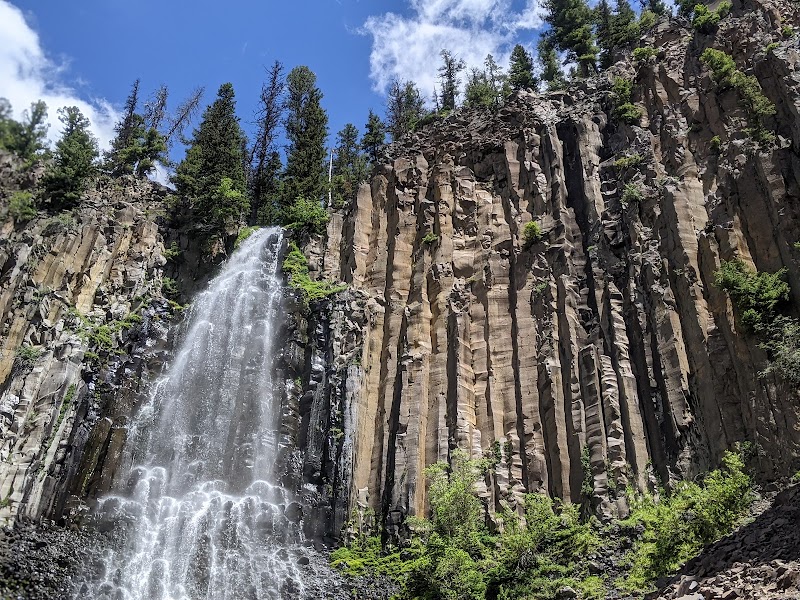
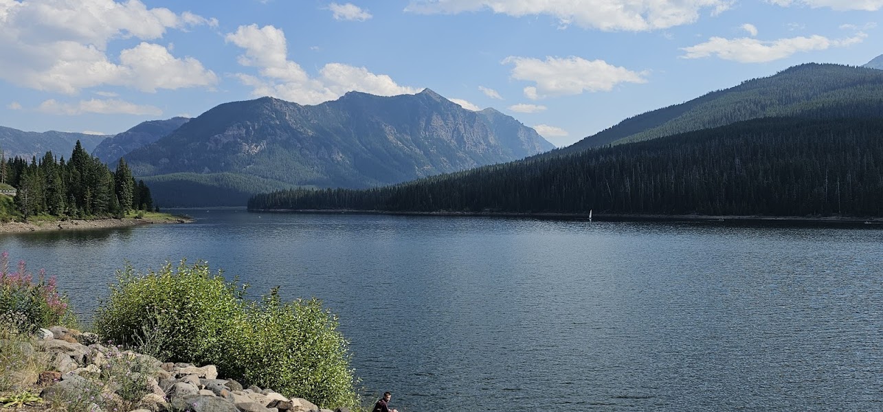
Hyalite Canyon is Bozeman's backyard wilderness — a Gallatin National Forest drainage 12 miles south of downtown that rises from 6,500 feet at the reservoir to 10,299 feet at Hyalite Peak, covering more vertical in less horizontal distance than almost any trail system accessible from a Montana city. The canyon holds a series of twelve named waterfalls, including Palisade Falls — a 90-foot free-falling plunge over columnar basalt accessible on a paved ADA trail — and Hyalite Falls, the headwater cascade at the base of the peak circuit. The Hyalite Peak trail is a 9-mile round trip gaining 3,200 feet to a summit with panoramic views of the Gallatin Range, the Madison Range, and the Absaroka-Beartooth Wilderness to the east. The combination of the accessible lower-canyon waterfall trail and the demanding peak circuit gives the canyon unusual range for a single day.

Day 1 — Hyalite Canyon: Palisade Falls (90ft basalt plunge, paved trail), Hyalite Peak summit (10,299ft, 9mi RT, 3,200ft gain), return to Bozeman
Day 1Hyalite Canyon — Gallatin National Forest

Day 1Hyalite Canyon — Gallatin National Forest

🚗 50 min driving📍 3 stops
🌅
Morning
🚗
Drive
Bozeman, MTHyalite Canyon — Upper Reservoir Trailhead
25 min8:00 AM8:25 AM
Palisade Falls — Hyalite Canyon
4.7
A 90-foot free-falling waterfall over a columnar basalt face at the south end of Hyalite Canyon — accessible via a 0.9-mile paved, ADA-compliant trail that rises gently from the parking area through a mixed conifer forest. The basalt columns visible in the fall face are remnants of a Tertiary volcanic flow; the canyon walls in this section show a geologic transition between the Precambrian metamorphic core of the Gallatin Range and the overlying Tertiary volcanics. Morning visits in summer have the falls in full shadow and full flow from snowmelt.
🍽️
Lunch
📍
Hyalite Peak Trail — Summit Circuit
A 9-mile round trip from the Hyalite Reservoir trailhead to the summit of Hyalite Peak (10,299 feet) — a 3,200-foot gain through alpine forest, past Hyalite Falls and Hyalite Lake, and above treeline to the granite summit cone. The Gallatin Range summit panorama includes the Madison Range to the west, the Bridger Range to the north, and the Absaroka-Beartooth Wilderness stretching east to the Wyoming border. Technical difficulty is moderate: the trail is well-marked but the final 0.5 miles involves hands-on scrambling on talus and granite blocks.
☀️
Afternoon
Hyalite Lake — Summit Descent Rest
4.8
Hyalite Lake on the descent from Hyalite Peak — a cirque lake at approximately 9,100 feet, ringed by the Gallatin Range above treeline. The lake holds native cutthroat trout and is a popular backcountry fishing destination; a valid Montana fishing license allows bank fishing during the descent. The lake is typically still frozen into mid-June; after July 1 the surrounding tundra is accessible for an off-trail approach to the nearby Overlook Mountain (9,882 feet).
🌙
Evening
🚗
Drive
Hyalite Canyon TrailheadBozeman, MT
25 min5:00 PM5:25 PM
Plan your own escapeExplore more trips →