🥾 ActiveLong weekend · from Bozeman, MT

Beartooth Highway & Absaroka-Beartooth Wilderness

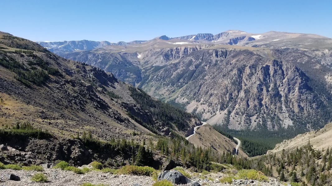
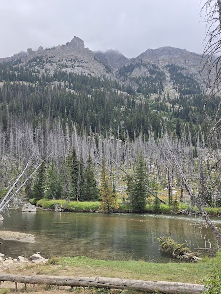
Three days using the Beartooth Highway — designated by Charles Kuralt as 'the most beautiful drive in America' — as the spine of a high-alpine active circuit. The Beartooth Highway (US-212) climbs from Red Lodge, Montana to 10,947 feet at Beartooth Pass, running 68 miles across the Beartooth Plateau at an elevation above timberline for most of its length. The plateau above the highway provides some of the most accessible above-10,000-foot hiking in the lower 48: short off-trail walks from the road reach alpine lakes in cirques still covered in July snow. The Absaroka-Beartooth Wilderness adjacent to the highway protects the largest high-elevation wilderness in the continental US; the trails off the Beartooth Plateau's northern and eastern slopes descend into the wilderness interior. The return via the Gallatin Canyon and Hyalite on day three completes an active Black-Hills-to-Yellowstone-to-Bozeman circuit that touches the full geological range of southwest Montana.

Day 1 — Beartooth Highway drive (Red Lodge to Beartooth Pass 10,947ft), Beartooth Plateau hiking above treeline, overnight Red Lodge
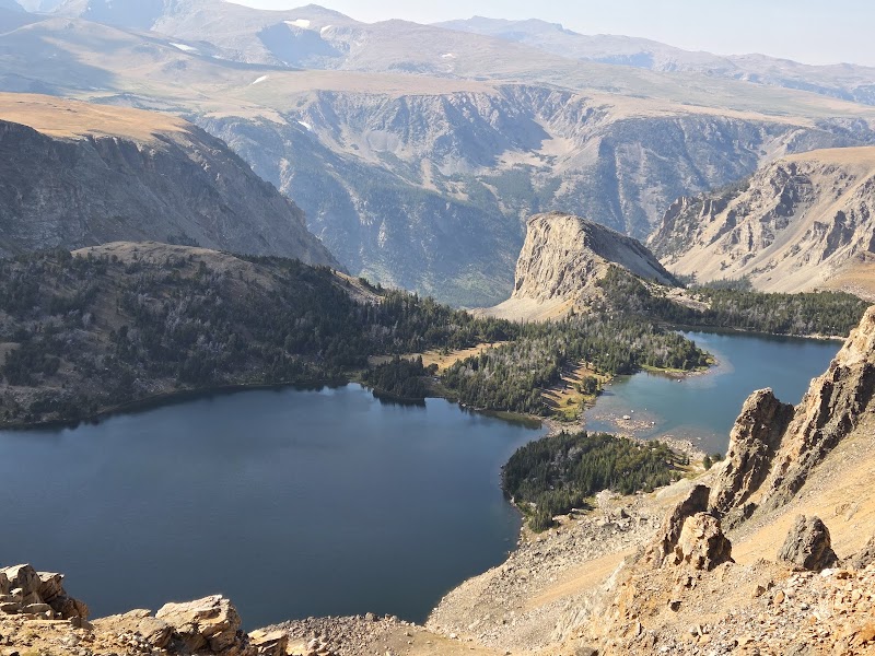
Day 2 — Absaroka-Beartooth Wilderness
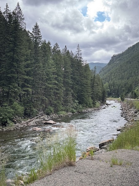
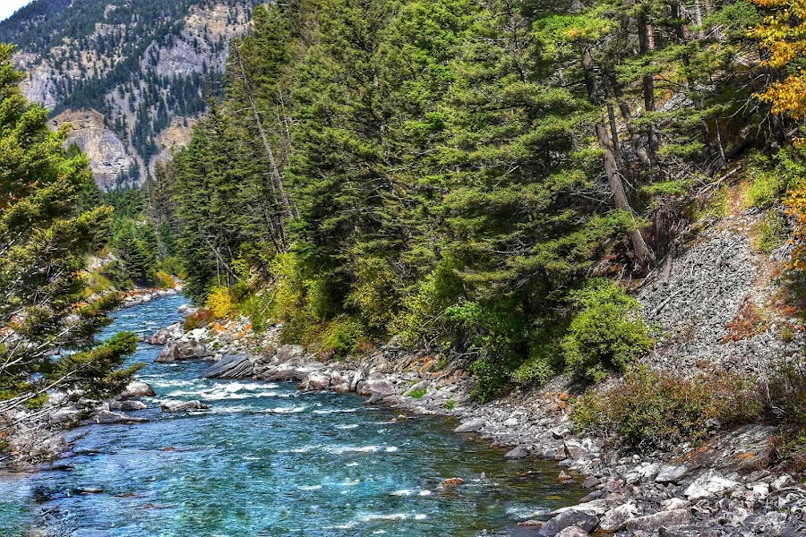
: Lake Fork Rock Creek trail, return to Cooke CityDay 3 — Gallatin Canyon return to Bozeman via Hyalite Canyon (waterfall circuit)
Day 1Beartooth Highway — Red Lodge

Day 1Beartooth Highway — Red Lodge

🚗 2 hr 15 min driving📍 4 stops
🌅
Morning
🚗
Drive
Bozeman, MTRed Lodge, MT — Beartooth Highway Start
2 hr 15 min8:00 AM10:15 AM
📍
Beartooth Highway — Red Lodge Canyon Section
The lower section of the Beartooth Highway (US-212) ascending from Red Lodge through the Rock Creek canyon — a series of 11% grade switchbacks that gain 5,000 feet in 12 miles, transitioning from ponderosa pine forest at 5,500 feet to alpine tundra at 10,000 feet. The Rock Creek canyon walls expose 3.4-billion-year-old Precambrian metamorphic basement rock, among the oldest exposed rock in North America. Waterfall pulloffs and Rock Creek overlooks mark the lower section.
🍽️
Lunch
Beartooth Pass (10,947ft) — Plateau Hiking
The summit of Beartooth Pass at 10,947 feet — one of the highest paved highway passes in the United States, with a restaurant and gift shop at the top. The pass sits above treeline on the Beartooth Plateau, a tilted Precambrian granite surface that was glacially planed nearly flat and now supports a tundra ecosystem with hundreds of alpine lakes. Off-trail hiking from the pass pulloffs reaches Beartooth Lake and several unnamed plateau lakes within 1-2 miles; no trail is required above the pass on the open tundra.
☀️
Afternoon
Long Lake & Beartooth Butte Plateau Tundra
4.8
The Long Lake pulloff and Beartooth Butte section of the highway — Long Lake is one of the largest plateau lakes visible from the road, with Beartooth Butte (10,514 feet, an isolated mesa of Devonian limestone sitting atop the Precambrian granite plateau) rising above it. The Beartooth Butte Devonian limestone contains 375-million-year-old fish fossils exposed during highway construction. Off-trail hiking around Long Lake crosses tundra meadows with the Absaroka Range visible to the south.
🌙
Evening
Red Lodge Mountain Inn — Red Lodge
4.3
Overnight in Red Lodge — a small coal-and-gold-boom town at the foot of the Beartooth Range, now a ski and summer gateway town with an intact 1890s brick main street. The Pollard Hotel (1893) is the most historic accommodation; the main street restaurants and bars are lively in summer. Red Lodge's ethnic diversity (Italian, Scandinavian, Finnish, Slavic immigrant miners) is reflected in the food traditions still maintained at local restaurants.
Day 2Absaroka-Beartooth Wilderness

Day 2Absaroka-Beartooth Wilderness

🚗 1 hr 20 min driving📍 4 stops
🌅
Morning
🚗
Drive
Red Lodge, MTLake Fork Trailhead — Rock Creek
20 min8:00 AM8:20 AM
Lake Fork Rock Creek Trail — Wilderness Interior
4.8
A strenuous wilderness trail climbing the Lake Fork drainage of Rock Creek into the Absaroka-Beartooth Wilderness — the largest high-elevation wilderness in the continental United States, with 944,000 acres almost entirely above 10,000 feet. The Lake Fork trail ascends 3,500 feet over 8 miles to Quinnebaugh Meadows, passing through the full elevation transition from ponderosa canyon bottom to alpine cirque. The wilderness holds more than 1,000 named lakes; even the first 5-6 miles reach several lake-filled cirques.
🍽️
Lunch
Wilderness Lake Circuit — Mid-Drainage
4.7
The lake-filled cirques of the Lake Fork Rock Creek mid-drainage — Quinnebaugh Meadows at 10,500 feet with the 12,500-foot peaks of the Beartooth Range above. The meadows and cirques are accessible to day hikers turning around at this point; the wilderness requires no permit and is open year-round. Grizzly bears are present in the wilderness; bear spray is required. Westslope cutthroat and golden trout inhabit the drainage lakes.
☀️
Afternoon
🚗
Drive
Lake Fork Trailhead, Red LodgeCooke City, MT
1 hr12:00 PM1:00 PM
Beartooth Highway Western Descent
4.9
The western descent of the Beartooth Highway from the plateau toward Cooke City — a different perspective on the Beartooth Pass views, with the Wyoming mountains opening to the south and the Absaroka Range visible ahead. This section passes Top of the World Resort and the western plateau pulloffs before dropping toward Pilot Peak and Index Peak — the two spires that mark the Beartooth Front visible from Cooke City.
🌙
Evening
Cooke City, MT — Overnight
Overnight in Cooke City, MT — a population-75 mining and outfitter town at the northeast entrance to Yellowstone National Park, accessible only via the Beartooth Highway from the east in summer (the northeast park entrance road closes in winter). The Soda Butte Lodge and a handful of cabins provide accommodation; the Beartooth Cafe is the dinner option. Positioned for the morning Gallatin Canyon return to Bozeman.
Day 3Gallatin Canyon — Bozeman

Day 3Gallatin Canyon — Bozeman

🚗 3 hr driving📍 2 stops
🌅
Morning
🚗
Drive
Cooke City, MTGallatin Canyon — US-191
2 hr 15 min8:00 AM10:15 AM
Gallatin Canyon — Storm Castle Creek Trail
5
A moderate 4-mile round trip from the Gallatin Canyon floor to the base of Storm Castle Peak — a limestone pinnacle rising above the west wall of the canyon, accessible via a trail that climbs through aspen and conifer forest to the rocky subalpine slopes below the summit. The Gallatin Canyon trail network on the east (Madison Range) side is less used than the Spanish Peaks side; Storm Castle is the most photogenic objective.
🍽️
Lunch
Gallatin River — Riverside Lunch Stop
4.8
A riverside picnic stop on the Gallatin River in the lower canyon — the river runs crystal clear over a cobble bed, with the canyon walls on both sides. The Gallatin is one of three rivers whose confluence forms the Missouri River; Norman Maclean's A River Runs Through It is set on its sister river, the Blackfoot, but the Gallatin's clear limestone-canyon character matches Maclean's descriptions more closely than most Montana rivers. Fishing access is available along the canyon from pulloffs.
🌙
Evening
🚗
Drive
Gallatin CanyonBozeman, MT
45 min5:00 PM5:45 PM
Plan your own escapeExplore more trips →