🥾 ActiveLong weekend · from Denver, CO
Rocky Mountain National Park: Bear Lake, Trail Ridge Road & Wild Basin
Three days in Rocky Mountain National Park — 265,000 acres of alpine wilderness 90 miles north of Denver with more than 350 miles of trails, 150 lakes, and 78 mountain peaks above 12,000 feet. Bear Lake's cirque-trail network gives the most concentrated alpine scenery per mile of any trail in the park. Trail Ridge Road (the highest continuous paved road in the United States) crosses the tundra at 12,183 feet. Wild Basin's Ouzel Falls trail is one of the park's most rewarding longer walks.
Day 1 — Bear Lake loop, Dream Lake, Trail Ridge Road (Alpine Visitor Center at 11,796 ft), overnight Estes ParkDay 2 — Wild Basin: Ouzel Falls trail (5.4mi RT), Calypso Cascades, Longs Peak viewpoint, overnight Estes ParkDay 3 — Chautauqua Park / First Flatiron (Boulder), Pearl Street, return Denver
Day 1 — Rocky Mountain National Park — Estes Park, CO
Day 1 — Rocky Mountain National Park — Estes Park, CO
🚗 1 hr 55 min driving📍 4 stops
🌅
Morning
🚗
Drive
Denver, CO → Bear Lake Trailhead — Rocky Mountain National Park
1 hr 30 min8:00 AM → 9:30 AM
Bear Lake — Nymph, Dream & Emerald Lake Trail
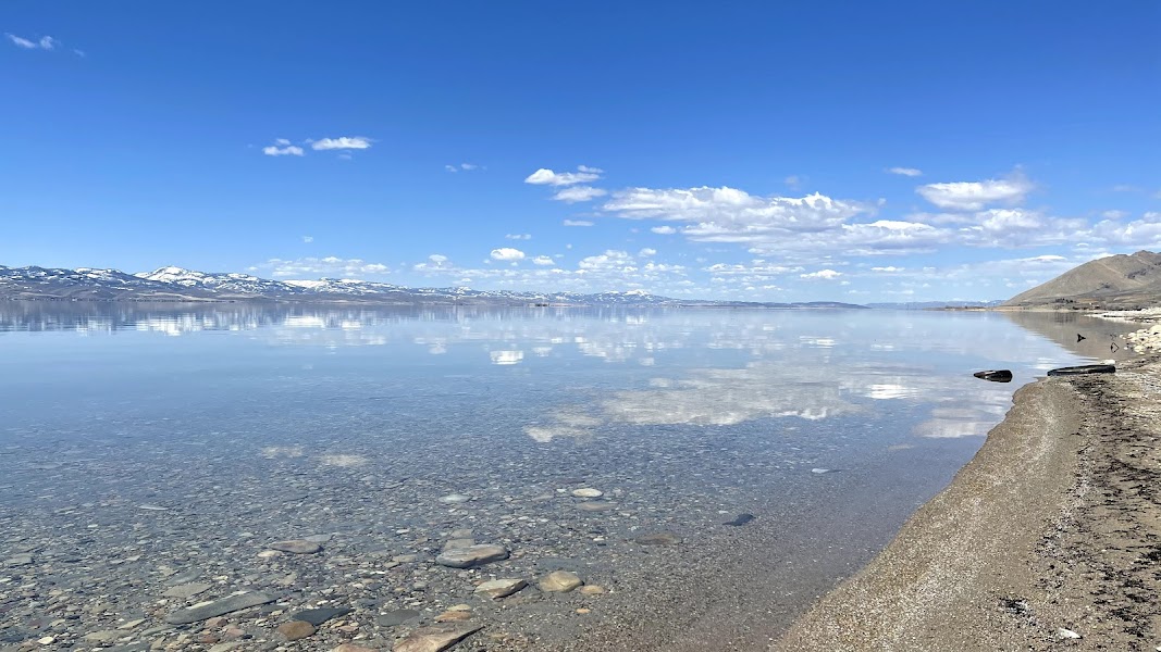
★ 4.8The Bear Lake circuit is the most-visited trail in RMNP — connecting four glacially carved lakes in a 4.1-mile round trip with 605 feet of elevation gain. Bear Lake at 9,475 feet is the trailhead; Nymph Lake (0.6 miles) is surrounded by pond lilies in summer; Dream Lake (1.1 miles) reflects Hallett Peak and Flattop Mountain in calm mornings; Emerald Lake (1.8 miles) sits directly below the cliff walls at the cirque headwall. The trail is above treeline for the upper section; take the Bear Lake shuttle from Estes Park to avoid parking issues.
9:30 AM📍 See location
🍽️
Lunch
🚗
Drive
Bear Lake Trailhead → Trail Ridge Road — Alpine Visitor Center
25 min10:30 AM → 10:55 AM
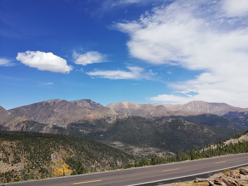
Trail Ridge Road — Tundra Communities & Fall River Pass
Trail Ridge Road is the highest continuous paved highway in the United States — 11 miles above treeline at elevations between 11,000 and 12,183 feet. The Alpine Visitor Center at Fall River Pass (11,796 feet) has exhibits on alpine tundra ecology; the Tundra Communities Trail nearby (0.5-mile loop) walks through the arctic-like vegetation 4 inches tall that takes 100 years to grow back if damaged. In summer, the tundra has wildflower blooms of alpine forget-me-nots and moss campion; in any season, wind and temperature can drop dramatically within minutes.
10:55 AM📍 See location
☀️
Afternoon
Flattop Mountain Trail — Start
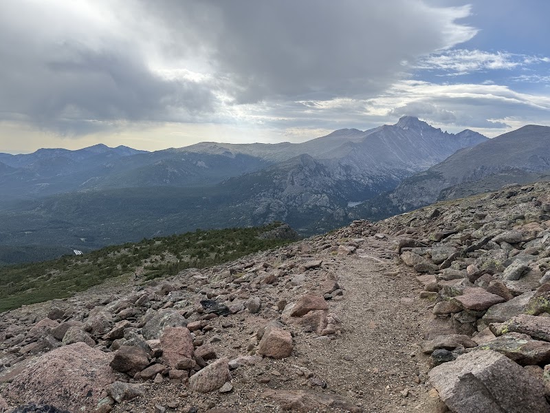
★ 5The Flattop Mountain Trail from Bear Lake gains 2,849 feet over 4.4 miles to the summit plateau at 12,324 feet — entirely above treeline for the upper half. The afternoon light on the Never Summer Mountains to the west is best from Flattop's broad summit plateau. Even hiking the lower sections (to the first above-treeline viewpoints at about 2 miles) gives dramatically open views above the forest. Note: afternoon thunderstorms are common in RMNP in summer — turn around by 2pm if clouds develop.
12:00 PM📍 See location
🌙
Evening
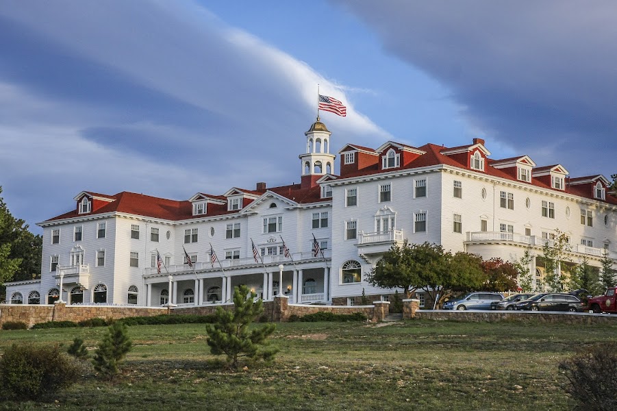
The Stanley Hotel — Estes Park, CO
★ 4.4The 1909 Georgian Revival hotel above Estes Park that inspired Stephen King's The Shining — F.O. Stanley (of Stanley Steamer automobile fame) built it for his wife's tuberculosis treatment in the mountain air. The hotel's white-and-green facade faces the Continental Divide; the front porch views toward Long's Peak are the best in Estes Park. Ghost tours run nightly (Room 217, where King stayed). Tomorrow's Wild Basin trailhead is 30 minutes south in the park.
5:00 PM📍 See location
Day 2 — Wild Basin — Rocky Mountain National Park
Day 2 — Wild Basin — Rocky Mountain National Park
🚗 30 min driving📍 4 stops
🌅
Morning
🚗
Drive
Estes Park, CO → Wild Basin Trailhead — Rocky Mountain National Park
30 min8:00 AM → 8:30 AM
Ouzel Falls Trail — Wild Basin
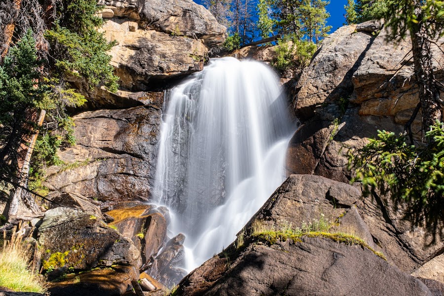
★ 4.9A 5.4-mile round trip to Ouzel Falls in the southern Wild Basin area — one of RMNP's best waterfall trails, passing Copeland Falls (0.3 miles, easy), Calypso Cascades (1.8 miles, a tumbling cascade through old-growth spruce), and Ouzel Falls (2.7 miles, a 40-foot plunge named for the American dipper that nests behind the falls). The Wild Basin area is dramatically less crowded than the Bear Lake corridor; the trail gains 950 feet at a consistent moderate grade through subalpine forest.
8:30 AM📍 See location
🍽️
Lunch
Calypso Cascades & Wild Basin Backcountry
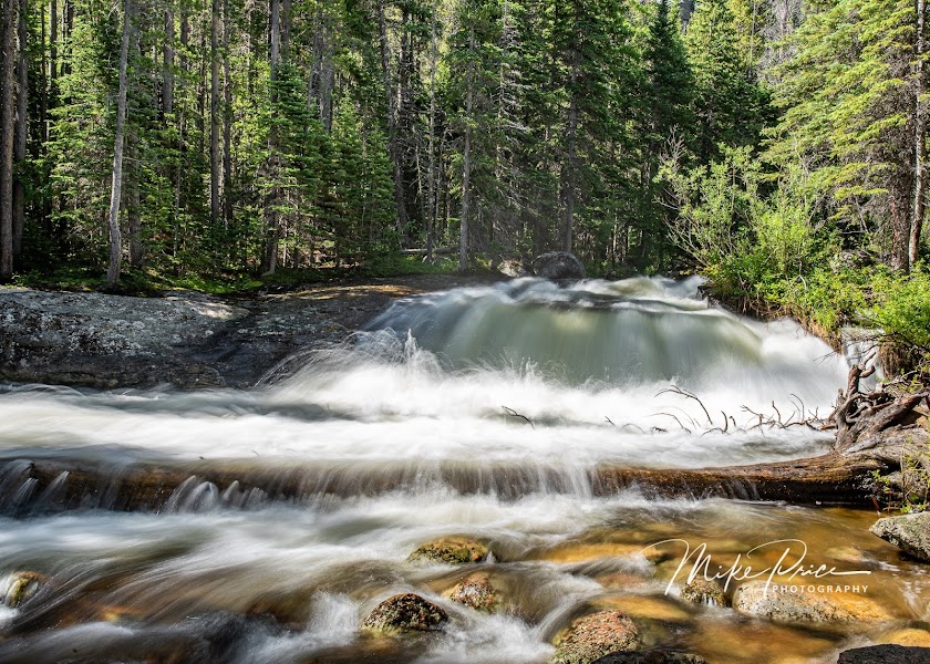
★ 4.9Calypso Cascades on North St. Vrain Creek — a broad waterfall tumbling through a boulder field in an old spruce-fir forest, accessible on the same trail toward Ouzel Falls. The cascade is named for the Calypso orchid (Calypso bulbosa) that blooms here in June in the moist subalpine soil. Wild Basin burned in the 2020 East Troublesome Fire, and the fire-altered forest landscape (standing dead trees, wildflower explosions in newly opened areas, and regenerating forest) is visible from the trail — an unusual chance to see post-fire ecological succession.
9:30 AM📍 See location
☀️
Afternoon
Longs Peak Viewpoint — Estes Park Area
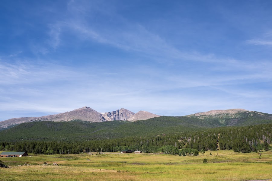
★ 4.9Longs Peak (14,259 feet) is the dominant summit visible from Estes Park and much of the Front Range — a 14er requiring technical climbing for the final 1,000 feet (the Keyhole Route is the standard approach but requires good physical condition and early start). For a non-technical afternoon, the Longs Peak Trail to Chasm Lake (4.2 miles one-way, gaining 2,360 feet) reaches the lake beneath the east face's Diamond cliff. Or the viewpoint from Lily Lake (0.8 miles flat) below the peak gives the standard photographic view of the summit across the lake.
12:00 PM📍 See location
🌙
Evening
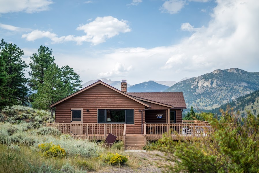
YMCA of the Rockies — Estes Park, CO
★ 4.1A 860-acre conference and family resort within Rocky Mountain National Park's boundary — lodge rooms and cabins with direct trail access. The YMCA of the Rockies is the largest single property in Estes Park, with its own hiking and cross-country ski trails on the property. Tomorrow's drive to Boulder for the Flatirons is 45 minutes southeast.
5:00 PM📍 See location
Day 3 — Boulder Flatirons — Return to Denver
Day 3 — Boulder Flatirons — Return to Denver
🚗 1 hr 30 min driving📍 3 stops
🌅
Morning
🚗
Drive
Estes Park, CO → Chautauqua Park — Boulder, CO
45 min8:00 AM → 8:45 AM
Chautauqua Park — Flatirons Vista Trail
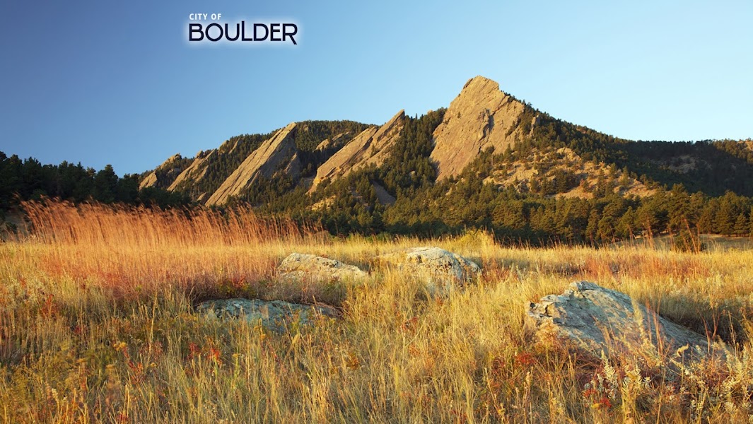
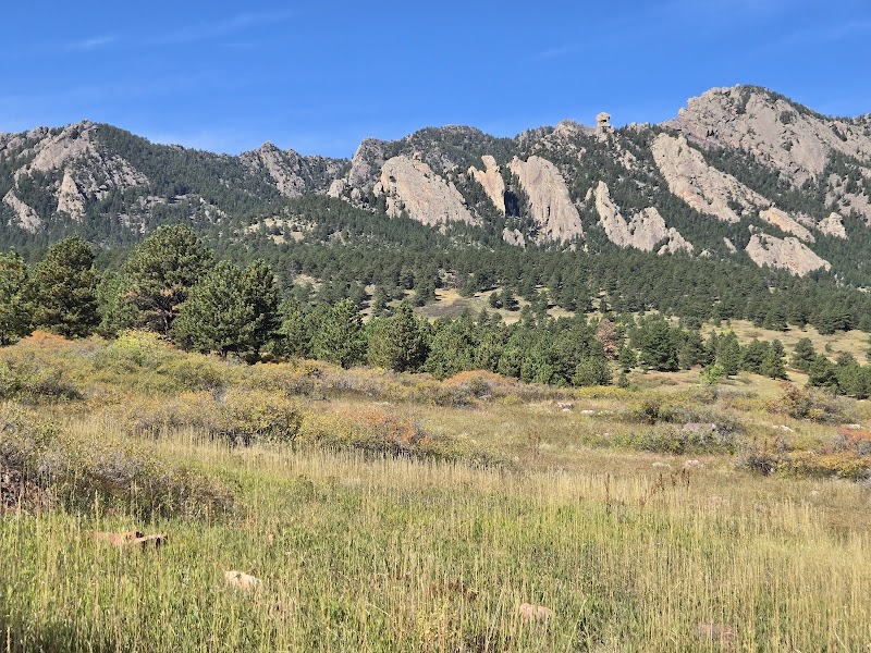
★ 4.8The 1898 Chautauqua Park at the base of the Flatirons — Boulder's defining landform, a series of five tilted sandstone slabs rising 1,400 feet above the city at a 45-degree angle. The Chautauqua Trail (0.4 miles to the base of the First Flatiron) and the Royal Arch Trail (3.6 miles RT, gaining 1,370 feet to a natural stone arch) are the most popular routes. The First Flatiron can be scrambled by experienced hikers without technical gear (Class 3); the view from the Flatirons Vista viewpoint (an easier 1.4-mile trail) gives the full formation context.
8:45 AM📍 See location
🍽️
Lunch
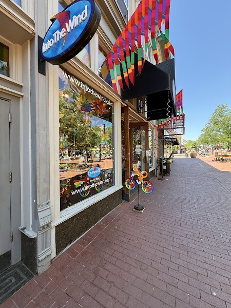
Pearl Street Mall — Boulder, CO
★ 4.6Boulder's pedestrian main street — a 4-block brick-paved mall that concentrates the city's outdoor gear shops, bookstores, and restaurants with constant street performance. The Flatirons are visible at the end of every cross street. Boulder's food scene is strong; the Full Moon Grill at the Boulderado Hotel (1909 Victorian landmark) or Kitchen Boulder for the local food ethos. The University of Colorado campus is adjacent.
9:45 AM📍 See location
☀️
Afternoon
South Mesa Trailhead — Shadow Canyon
★ 4.8An alternative Boulder Flatirons trail system south of Chautauqua — the Shadow Canyon Trail (3.2 miles RT) accesses the South Flatiron and the area behind the formation, with views into the canyon between the slabs. Less crowded than the main Chautauqua area in the afternoon; the trail surface is rough sandstone and the canyon gives a different perspective on the Flatirons' geology (Fountain Formation sandstone, 300 million years old).
12:00 PM📍 See location
🌙
Evening
🚗
Drive
Boulder, CO → Denver, CO
45 min5:00 PM → 5:45 PM
Plan your own escapeExplore more trips →