← The Weekend Getaways
🥾 ActiveLong weekend · from Milwaukee, WI

Mississippi River Bluffs — Wyalusing & the Great River Road

Three hours west of Milwaukee, at the far southwestern corner of Wisconsin, the Wisconsin River pours into the Mississippi beneath towering, forest-cloaked bluffs — a confluence so commanding that Wyalusing State Park, perched 500 feet above the water on its point, is one of the oldest and most spectacular parks in the state. This is the deep Driftless country, unglaciated and dramatically dissected, where the Great River Road threads between limestone bluffs and the vast braided channels of the Upper Mississippi flyway. Day one takes in Wyalusing's clifftop overlooks, Native American effigy mounds, and the Sugar Maple Nature Trail; day two ranges inland to Governor Dodge State Park near Dodgeville, with its sandstone bluffs, twin lakes, and the hidden Stephens Falls; day three follows the Great River Road along the Mississippi to the historic river town of Prairie du Chien before the long drive home. Nights are spent near Prairie du Chien and Dodgeville.

Day 1 — Wyalusing State Park & the Wisconsin–Mississippi confluenceDay 2 — Governor Dodge State Park & the Driftless trailsDay 3 — The Great River Road & Prairie du Chien
Day 1Wyalusing State Park, WI

Day 1Wyalusing State Park, WI

🚗 3 hr driving📍 6 stops
🌅
Morning
🚗
Drive
Milwaukee, WIWyalusing State Park
3 hr8:00 AM11:00 AM
Wyalusing State Park — Point Lookout & Green Cloud Overlook
4.8
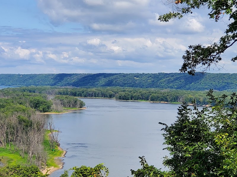
Wyalusing crowns a 500-foot bluff at the exact point where the Wisconsin River empties into the Mississippi, and its overlooks are among the grandest river views in the Midwest. From Point Lookout and the Green Cloud Overlook the two great rivers spread below in a maze of braided channels, wooded islands, and backwater sloughs, with the Iowa bluffs rising blue on the far shore. It is a short walk from the parking areas to the clifftop railings, making this the ideal first stop after the drive. A Wisconsin state park vehicle sticker is required; buy it at the office. Established in 1917, Wyalusing is one of Wisconsin's oldest parks, and the view has drawn travelers for far longer than that.
🍽️
Lunch
Sentinel Ridge Trail & Effigy Mounds
4.7
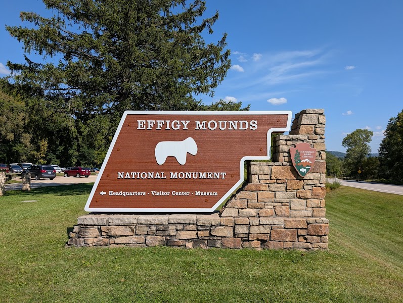
The Sentinel Ridge Trail runs along the very spine of the bluff, linking a string of overlooks with a remarkable group of Native American burial and effigy mounds — including rare linear and conical mounds built more than a thousand years ago on this commanding ground above the confluence. The trail is a gentle-to-moderate walk with the Mississippi glinting through the oaks on your right the whole way, and interpretive signs explain the mound-builders and the deep human history of this place. It is both a hike and a walk through time, and one of the most atmospheric trails in the park. Stay on the path and treat the mounds as the sacred sites they are.
Continue at Picnic at Wyalusing (Point Lookout)
4.8
Use the afternoon to explore a different trail, cool off at a swimming hole, or find a scenic spot to watch the sunset.
1:00 PM📍 See location
☀️
Afternoon
Sugar Maple Nature Trail & Sand Cave
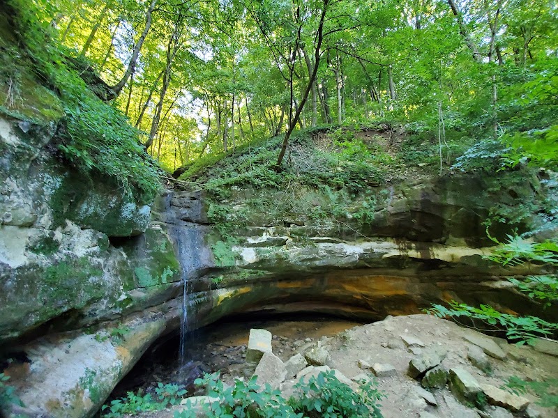
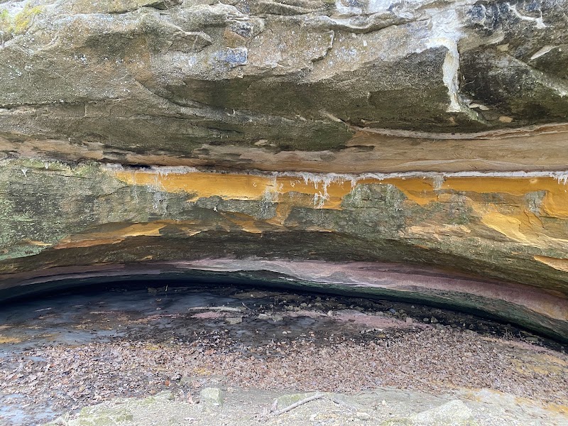
The Sugar Maple Nature Trail descends off the bluff into a cool, shaded ravine of maple, basswood, and fern, leading to the Sand Cave — a grotto worn into the soft sandstone where a thin waterfall trickles over the lip and ferns cling to the damp walls. It is a steeper, rockier walk than the ridge trails, dropping toward the river valley floor and back, with a genuinely different feel from the airy overlooks above. The contrast between the sunlit clifftops and this dim, dripping hollow captures the layered geology of the Driftless bluffs. Footing can be slick near the cave, so take care on the descent. A rewarding way to spend the afternoon before heading to town.
🌙
Evening
🍽️ Dinner5:00 PM
Prairie du Chien dinner
Prairie du Chien, the second-oldest European settlement in Wisconsin, sits on the Mississippi twenty minutes north of the park and makes the natural base for the first night. Its taverns, supper clubs, and riverside grills serve up classic Wisconsin fare — a fish fry, broasted chicken, a river-town burger — and a few spots look out over the water. After a day on the bluffs it's an easy, unpretentious place to settle in for dinner, with the great river rolling past just beyond the levee.
4.8$$restaurant📍 Maps →
2 options · tap to switch
🛏️
Prairie du Chien lodging
Prairie du Chien offers the fullest range of lodging in the area — several chain hotels along the highway, a riverfront inn or two, and a scattering of B&Bs in its historic core — all a short drive from Wyalusing and well placed for tomorrow's run inland to Governor Dodge. Booking here for the first night keeps you close to the river and the park. St. Feriole Island and the historic Villa Louis mansion are worth a note for a morning stroll before you head east.
Day 2Governor Dodge State Park, WI

Day 2Governor Dodge State Park, WI

🚗 55 min driving📍 6 stops
🌅
Morning
🚗
Drive
Prairie du Chien, WIGovernor Dodge State Park
55 min8:00 AM8:55 AM
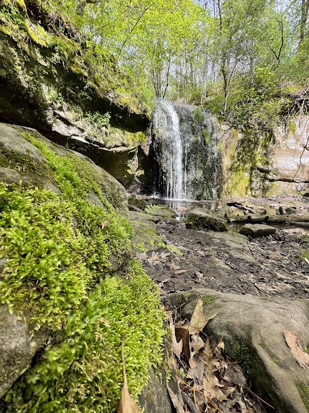
Stephens Falls & the White Oak Trail
4.7
Governor Dodge, near Dodgeville, is one of Wisconsin's largest state parks — 5,000 acres of steep sandstone bluffs, deep valleys, and two spring-fed lakes carved into the heart of the Driftless. Start at Stephens Falls, where a short trail leads to a delicate cascade tumbling over a mossy sandstone ledge into a fern-lined grotto, with a stone stairway and a historic springhouse below. Continue onto the White Oak Trail or Lost Canyon Trail to climb through oak forest to bluff-top views over Cox Hollow Lake. A Wisconsin state park sticker is required. The morning combination of waterfall and ridge captures the park's dramatic, dissected terrain and makes an ideal start to the middle day.
🍽️
Lunch
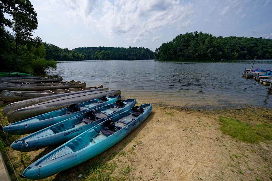
Cox Hollow Lake & Beach
4.7
Cox Hollow Lake, one of the park's two lakes, sits cupped among the bluffs with a sandy swimming beach, a boat launch, and a shoreline trail that loops the water beneath wooded slopes. It is the perfect midday spot to swim, rent a paddle craft, or simply rest on the beach between hikes, with the sandstone cliffs reflected in the still water. Kayaks and canoes are available seasonally, and the flat-water paddle around the lake's quiet coves is easy and scenic. A relaxed, restorative middle to the day before the afternoon's driftless trails.
📍
Lunch in Dodgeville or lakeside picnic
Dodgeville, just south of the park, has cafes, a brewpub, and taverns for a midday meal — or pack a picnic and eat at the Cox Hollow beach with the bluffs and water in front of you. Nearby Mineral Point, a beautifully preserved old lead-mining town settled by Cornish immigrants, is a worthwhile lunch detour for its historic main street and pasties if you want to range a little wider. Keeping midday simple leaves the afternoon for more trail before the second night.
10:55 AM📍 See location
☀️
Afternoon
Lost Canyon Trail & Twin Valley Lake
4.7
In the afternoon, explore the park's deeper trails — the Lost Canyon Trail winds through a narrow, cliff-walled gorge of sandstone that ranks among the most striking passages in the Wisconsin park system, and connects toward Twin Valley Lake, the park's larger and quieter body of water. The trail threads between towering rock walls draped in moss and fern, cool and shaded even on hot days, before opening onto lake and meadow views. The Driftless geology is on full display here, carved and dissected in ways the glaciated rest of the state never was. A satisfying final hike before returning to town for the night.
🌙
Evening
🍽️ Dinner5:00 PM
Dodgeville / Mineral Point dinner
For the second night's dinner, choose between Dodgeville's brewpub and taverns or the historic charm of Mineral Point ten minutes away, where restored stone buildings house a genuinely good restaurant scene, a brewery, and the Cornish tradition of pasties and figgyhobbin. A supper-club dinner or a farm-to-table meal caps a day on the bluffs and lakes. Both towns are compact and walkable, making it easy to stroll after dinner before turning in.
4.8$$bar📍 Maps →
2 options · tap to switch
🛏️
Dodgeville lodging
Dodgeville, at the junction of major highways just south of Governor Dodge, offers a solid range of chain hotels and a few inns, and is well positioned for both tonight's park and tomorrow's return along the Great River Road. Mineral Point, ten minutes away, has characterful B&Bs and restored historic guesthouses if you'd prefer more atmosphere. Either keeps the final day's drive back toward the Mississippi and home manageable. Book ahead in fall foliage season, when the Driftless draws crowds.
Day 3Great River Road & Prairie du Chien, WI
Day 3Great River Road & Prairie du Chien, WI
🚗 4 hr 5 min driving📍 4 stops
🌅
Morning
🚗
Drive
Dodgeville, WIPrairie du Chien / Great River Road
55 min8:00 AM8:55 AM
St. Feriole Island & Villa Louis
4.7
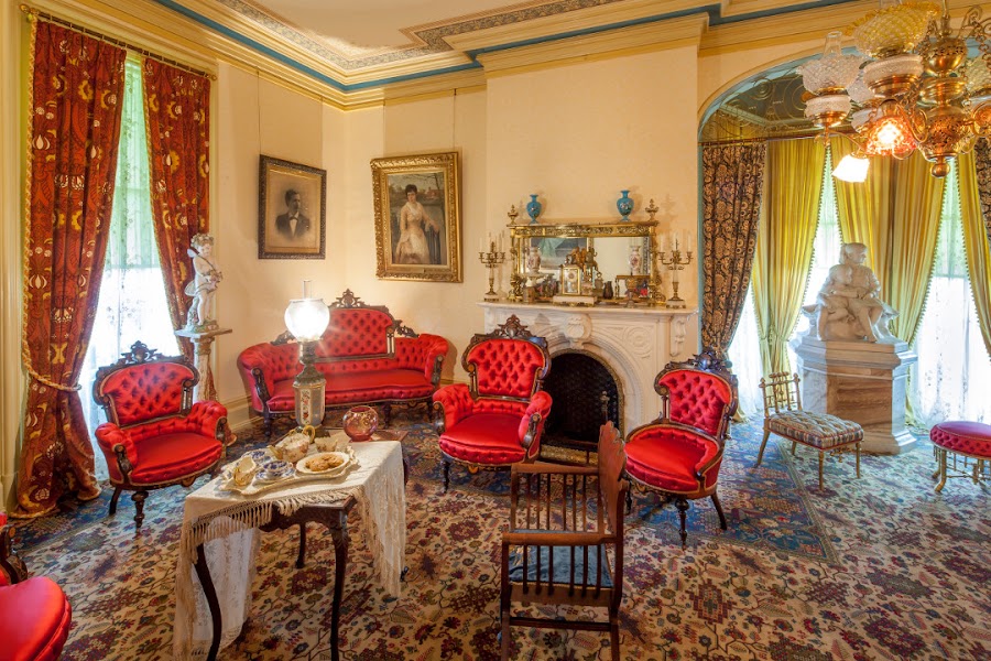
Begin the final day back on the Mississippi at Prairie du Chien's St. Feriole Island, a broad riverfront park with paths along the water, the site of the 1814 Battle of Prairie du Chien, and the elegant Villa Louis — a restored Victorian mansion built by the Dousman fur-trading family on an ancient Native American and French colonial site. A morning walk here, with the great river sliding past and the bluffs rising across the water, sets the tone for the Great River Road drive ahead. The Villa Louis grounds and the riverside trails are an easy, flat stroll, and the fur-trade history brings the deep story of this river crossroads to life.
🍽️
Lunch
Great River Road Scenic Overlooks
4.7
The Great River Road runs along the Wisconsin bank of the Mississippi as a designated National Scenic Byway, threading between limestone bluffs and the vast braided channels of the Upper Mississippi River National Wildlife and Fish Refuge. Drive a stretch south from Prairie du Chien with frequent pull-offs and overlooks where the river spreads into island-dotted backwaters below towering bluffs, prime habitat for bald eagles, herons, and migrating waterfowl on one of the continent's great flyways. It is a slow, scenic drive rather than a hike, and the overlooks reward a stop with binoculars. A final immersion in the river country before turning east for home.
📍
Lunch in Prairie du Chien or riverside picnic
Prairie du Chien's downtown and riverfront hold a handful of cafes, taverns, and grills for a final lunch before the long drive — a river-town burger, a fish sandwich, or a supper-club plate. Or pack a picnic and eat at a Great River Road overlook or on St. Feriole Island with the Mississippi rolling past. Keeping the midday relaxed and early leaves plenty of daylight for the three-hour drive back to Milwaukee. Grab local cheese or river-town treats to carry home.
10:55 AM📍 See location
☀️
Afternoon
Wyalusing Sentinel Ridge farewell overlook
4.8
Before pointing the car east, swing back up to Wyalusing for one last look at the confluence — a short walk out to Point Lookout or along Sentinel Ridge gives a fitting farewell to the two great rivers, the Iowa bluffs, and the island-braided valley 500 feet below. The afternoon light falls warm on the water and the bluffs, and the walk is easy enough to leave a full three hours for the drive home. Take a final long look at where the Wisconsin meets the Mississippi, then wind down off the bluff and turn east toward Milwaukee.
🌙
Evening
🚗
Drive
Wyalusing State ParkMilwaukee, WI
3 hr 10 min5:00 PM8:10 PM
Plan your own escapeExplore more trips →