🌿 RelaxedLong weekend · from Raleigh, NC
Outer Banks: Sand Dunes, Lighthouses & the Graveyard of the Atlantic
Three days on North Carolina's Outer Banks — the 130-mile chain of barrier islands where the Wright Brothers first flew, Blackbeard last anchored, and more than 3,000 ships have wrecked on the Diamond Shoals where the Labrador Current and Gulf Stream collide. Day one reaches Nags Head for the continent's tallest natural sand dunes and the Wright Brothers Memorial. Day two drives south through Pea Island's migratory bird refuge to Cape Hatteras — and its 198-foot lighthouse moved 2,900 feet inland in 1999 to save it from the advancing ocean. Day three visits the Graveyard of the Atlantic Museum before the drive home.
Day 1 — Jockey's Ridge State Park (tallest East Coast dunes), Wright Brothers National Memorial, overnight Nags HeadDay 2 — Pea Island NWR (migratory birds), Cape Hatteras Lighthouse (198 ft, 218 steps), overnight AvonDay 3 — Graveyard of the Atlantic Museum (Hatteras Village), Manteo waterfront, return Raleigh
Day 1 — Nags Head & Kill Devil Hills, NC
Day 1 — Nags Head & Kill Devil Hills, NC
🚗 2 hr 40 min driving📍 4 stops
🌅
Morning
🚗
Drive
Raleigh, NC → Jockey's Ridge State Park — Nags Head, NC
2 hr 30 min8:00 AM → 10:30 AM
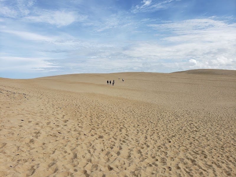
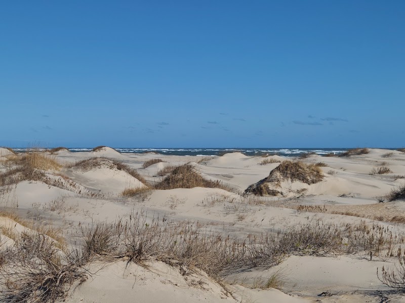
Jockey's Ridge State Park — Main Dune
★ 4.8The tallest living natural sand dune on the East Coast — 80 to 100 feet depending on the season, as the dune is constantly migrating westward. Jockey's Ridge is an active dune (no vegetation on its surface) of medano type — rare in the eastern US. The summit provides a 360-degree view of the Outer Banks: Pamlico Sound to the west, the Atlantic to the east, and the narrow chain of islands stretching north and south. Hang gliding instruction happens here daily from the Kitty Hawk Kites operation on the dune's east flank. Walking the dune face is free and takes about 20 minutes to the top.
10:30 AM📍 See location
🍽️
Lunch
Nags Head Beach & Soundside Road
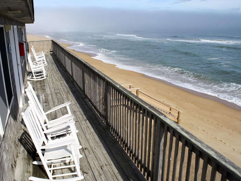
★ 4.9The Nags Head oceanfront is the classic wide barrier beach of the northern Outer Banks — broad, flat, and backed by large shingled cottages built in the 'Nags Head style' of elevated Outer Banks vernacular architecture. The beach access is free at multiple points; the soundside road (Roanoke Sound) gives a calmer swimming option with views of Roanoke Island. The town has good lunch options; the Outer Banks Brewing Station in Kill Devil Hills is a locally owned spot with a windmill.
11:30 AM📍 See location
☀️
Afternoon
🚗
Drive
Nags Head, NC → Wright Brothers National Memorial — Kill Devil Hills, NC
10 min12:30 PM → 12:40 PM
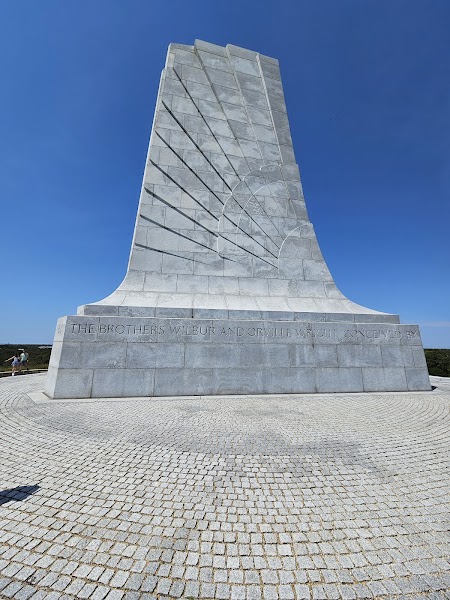
Wright Brothers National Memorial
★ 4.8The site of the first powered flights on December 17, 1903 — Orville Wright flew 120 feet in 12 seconds on the first attempt; the fourth flight covered 852 feet in 59 seconds before the wind damaged the Flyer. Stone markers on the ground show where each flight ended. The 60-foot granite memorial on Kill Devil Hill (where the brothers tested gliders for three years) overlooks the flight field; the visitor center has life-size reproductions of the 1903 Wright Flyer and the 1902 glider, plus the reconstructed camp buildings where the brothers lived during their test seasons.
12:40 PM📍 See location
🌙
Evening
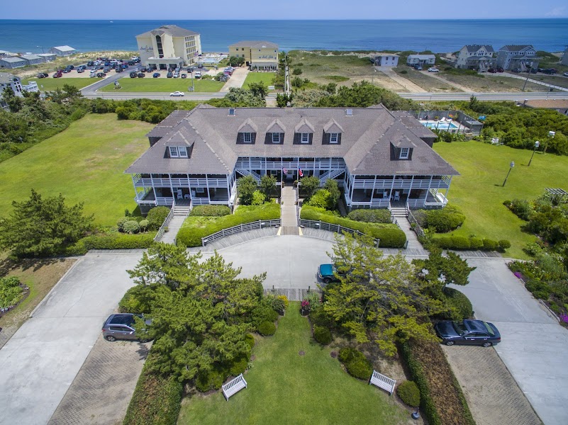
The First Colony Inn — Nags Head, NC
★ 4.7A historic 1932 Outer Banks inn moved from its original location and restored — one of the few remaining examples of the old Nags Head shingle-style hotel architecture. Wraparound porches on two floors overlook the ocean. Centrally located between Kill Devil Hills and the Cape Hatteras drive that starts tomorrow.
5:00 PM📍 See location
Day 2 — Pea Island & Cape Hatteras, NC
Day 2 — Pea Island & Cape Hatteras, NC
🚗 1 hr 10 min driving📍 4 stops
🌅
Morning
🚗
Drive
Nags Head, NC → Pea Island National Wildlife Refuge
30 min8:00 AM → 8:30 AM
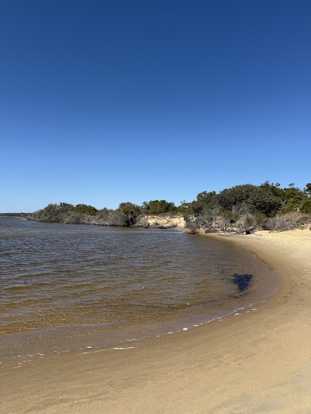
Pea Island National Wildlife Refuge
★ 4.8A 5,915-acre refuge covering the northern section of Hatteras Island — two freshwater impoundments (North Pond and South Pond) accessible from a 4-mile trail along the dike system. In winter, the ponds hold tens of thousands of snow geese, tundra swans, and ducks; in spring and fall, they attract migrating shorebirds, warblers, and raptors making the Atlantic Flyway crossing. The beach side of the refuge is sea turtle nesting habitat; the visitor contact station has a small exhibit on the refuge's history (the site includes the 1896 Pea Island Life-Saving Station, the first to be staffed by an all-Black crew).
8:30 AM📍 See location
🍽️
Lunch
🚗
Drive
Pea Island NWR, NC → Cape Hatteras Lighthouse — Buxton, NC
40 min9:30 AM → 10:10 AM
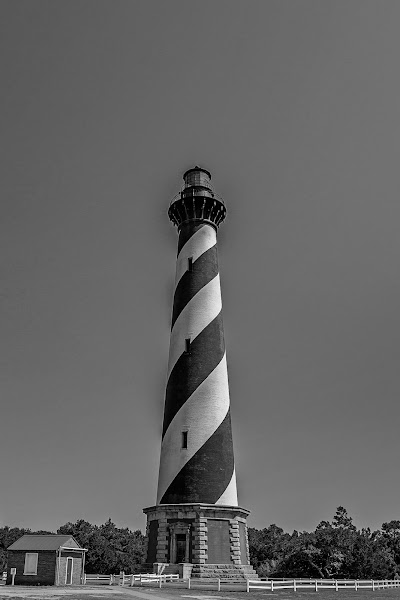
Cape Hatteras Lighthouse
★ 4.8The tallest brick lighthouse in the United States — 198 feet, with a distinctive black-and-white spiral candy-stripe pattern and 218 steps to the lantern room. Built in 1870 to warn ships away from Diamond Shoals, where the Labrador Current and Gulf Stream converge and create the turbulent conditions responsible for more than 3,000 shipwrecks offshore. The lighthouse was moved 2,900 feet inland in 1999 — the most complex historic structure relocation in US history — after the ocean eroded to within 120 feet of its base. The climb is open to visitors in season (April–Columbus Day).
10:10 AM📍 See location
☀️
Afternoon
Cape Point — Diamond Shoals Overlook
★ 4.7The southern tip of Hatteras Island — the closest land point to Diamond Shoals, where the cold Labrador Current and warm Gulf Stream collide and create the unpredictable seas responsible for the Outer Banks' reputation as the Graveyard of the Atlantic. On calm days, the point is a wide beach where surf fishermen cast for red drum; on rough days, the wave interaction where the two currents meet is visibly dramatic from the shore. A 4WD beach drive reaches the actual point; hikers can access the broader beach area near the lighthouse on foot.
12:00 PM📍 See location
🌙
Evening
Cape Hatteras Motel — Buxton, NC
★ 4.4A modest oceanfront motel in Buxton — the closest lodging to the Cape Hatteras Lighthouse, walking distance to the lighthouse grounds for sunrise. The Buxton area has several seafood restaurants; the Diamond Shoals Restaurant on NC-12 is the most established. Tomorrow's Graveyard of the Atlantic Museum is 10 minutes south in Hatteras Village.
5:00 PM📍 See location
Day 3 — Hatteras Village & Manteo — Return to Raleigh
Day 3 — Hatteras Village & Manteo — Return to Raleigh
🚗 3 hr 50 min driving📍 3 stops
🌅
Morning
🚗
Drive
Buxton, NC → Graveyard of the Atlantic Museum — Hatteras Village, NC
10 min8:00 AM → 8:10 AM
Graveyard of the Atlantic Museum
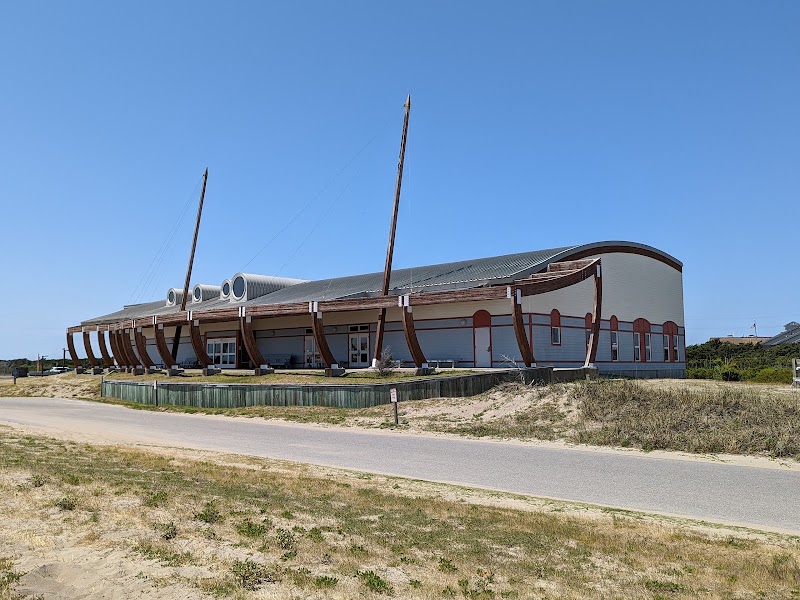
★ 4.6A museum dedicated to the 3,000+ ships lost off the North Carolina coast — the highest concentration of shipwrecks in the Western Hemisphere, spanning from the 1585 Roanoke expeditions through World War II. Major exhibits cover the U-352, a German submarine sunk by the USS Icarus in May 1942 just 26 miles offshore (now a popular dive site); the CSS Neuse Confederate gunboat; and the Huron disaster of 1877 that killed 98 US Navy sailors and directly drove the creation of the US Life-Saving Service. Artifacts include anchors, cannons, ship bells, and a complete collection of Diamond Shoals lighthouse equipment.
8:10 AM📍 See location
🍽️
Lunch
🚗
Drive
Hatteras Village, NC → Manteo — Roanoke Island, NC
1 hr9:10 AM → 10:10 AM
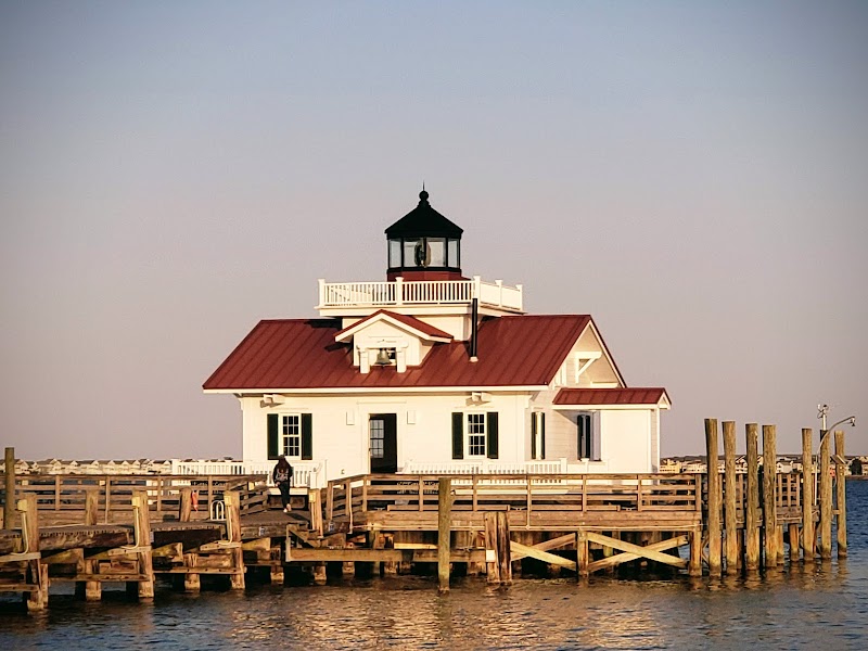
Manteo Waterfront & Roanoke Island
★ 4.7Manteo sits on the Shallowbag Bay side of Roanoke Island — the town between the Outer Banks barrier islands and the mainland where the English attempted their first settlement in 1587. The Lost Colony (125 settlers who vanished between 1587 and 1590) is one of America's first historical mysteries. The Manteo waterfront has a good lunch restaurant selection; Fort Raleigh National Historic Site (site of the 1587 settlement earthwork) is a 5-minute drive away. The Elizabeth II — a 69-foot replica of a 16th-century bark — is docked at the Roanoke Island Festival Park adjacent to downtown.
10:10 AM📍 See location
☀️
Afternoon
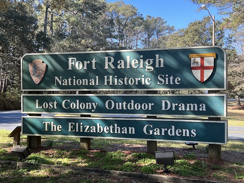
Fort Raleigh National Historic Site
★ 4.6The site of the 1585 and 1587 English settlements on Roanoke Island — the Earthwork Fort, a small earthen enclosure reconstructed on the original 1585 site, is the tangible remnant of England's first serious attempt at a permanent colony in North America. The visitors center covers the attempts at colonization, the mystery of the Lost Colony's disappearance, and the Freedmen's Colony that occupied Roanoke Island during the Civil War when 3,000 formerly enslaved people built a self-governing community here under Union protection.
12:00 PM📍 See location
🌙
Evening
🚗
Drive
Manteo / Roanoke Island, NC → Raleigh, NC
2 hr 40 min5:00 PM → 7:40 PM
Plan your own escapeExplore more trips →