🥾 ActiveWeekend · from San Francisco, CA
Marin Headlands, Muir Woods & Point Reyes: Redwoods, Ridgelines & Coastal Bluffs
Two days across the Golden Gate Bridge into the Marin County wilderness — a landscape that exists only because voters rejected a freeway in 1969 and the National Park Service acquired the Marin Headlands before development reached them. Hawk Hill above the Golden Gate gives the most famous single view in California. Muir Woods' Cathedral Grove holds old-growth coast redwoods up to 1,000 years old and 250 feet tall within 45 minutes of downtown San Francisco. Point Reyes National Seashore — the continent's sharpest geographic peninsula — extends 10 miles into the Pacific and holds one of the largest undeveloped tule elk herds on the coast.
Day 1 — Marin Headlands Hawk Hill (Golden Gate panorama), Muir Woods Cathedral Grove (old-growth redwoods), Mount TamalpaisDay 2 — Point Reyes NS Bear Valley Trail (Arch Rock coastal bluffs), Limantour Beach, return San Francisco
Day 1 — Marin Headlands & Mount Tamalpais
Day 1 — Marin Headlands & Mount Tamalpais
🚗 1 hr 15 min driving📍 4 stops
🌅
Morning
🚗
Drive
San Francisco, CA → Hawk Hill — Marin Headlands, CA
30 min8:00 AM → 8:30 AM
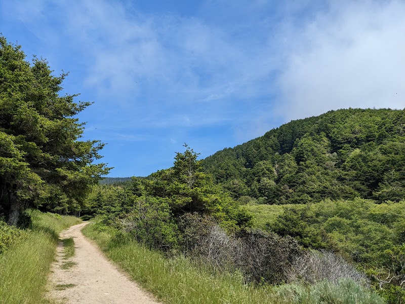
Hawk Hill & Coastal Trail — Marin Headlands
The promontory above the north end of the Golden Gate Bridge — Hawk Hill (elevation 900 feet) gives the most reproduced single view in California: the Golden Gate Bridge in its full span, the city behind it, and the bay opening to the Pacific. The Marin Headlands Coastal Trail runs north along the ridge from Hawk Hill, passing WWII-era gun batteries (Battery Townsley, Battery Spencer) whose 16-inch guns were positioned to shell Japanese ships in 1941–1945 and never fired in combat. In autumn, Hawk Hill is one of the premier hawk migration count sites in North America, recording 20,000+ raptors on peak days.
8:30 AM📍 See location
🍽️
Lunch
🚗
Drive
Marin Headlands → Muir Woods National Monument — Mill Valley, CA
20 min9:30 AM → 9:50 AM
Muir Woods National Monument — Cathedral Grove
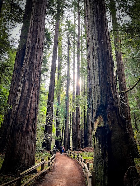
★ 4.8A 558-acre stand of old-growth coast redwoods in a Marin County creek valley — the nearest old-growth redwood grove to San Francisco, protected as a national monument in 1908 at the urging of William Kent, who donated the land. Cathedral Grove contains trees up to 1,200 years old and 258 feet tall, with trunk diameters above 12 feet. The floor of the grove is essentially unchanged from its pre-European state: the canopy excludes enough light to prevent undergrowth, leaving a cathedral-like open space beneath the columns of ancient trunks. Parking requires advance reservations in all seasons; the Stinson Beach shuttle from Sausalito is the alternative. The Main Trail (1.0-mile loop in the monument's core) goes directly through Cathedral Grove.
9:50 AM📍 See location
☀️
Afternoon
🚗
Drive
Muir Woods, CA → Mount Tamalpais East Peak — Mill Valley, CA
25 min12:00 PM → 12:25 PM
Mount Tamalpais East Peak — Summit Trail
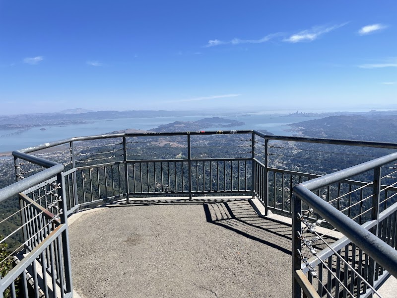
★ 4.9The 2,571-foot summit of Mount Tamalpais — accessible by the Ridgecrest Boulevard road to the East Peak parking area and a 0.4-mile walk to the fire lookout tower. The 360-degree panorama covers the entire Bay Area from the Farallon Islands (27 miles offshore in the Pacific) through the Golden Gate and across the bay to the Sierra Nevada on exceptionally clear days. The Mountain Theater (an outdoor stone amphitheater built by the CCC in 1934 with seating for 3,750) is 1 mile west on the road back toward the Pantoll Ranger Station. Mount Tam was the birthplace of mountain biking in the 1970s — the Repack race down the mountain's fire roads began in 1976.
12:25 PM📍 See location
🌙
Evening
Stinson Beach Village — Sandpiper Inn
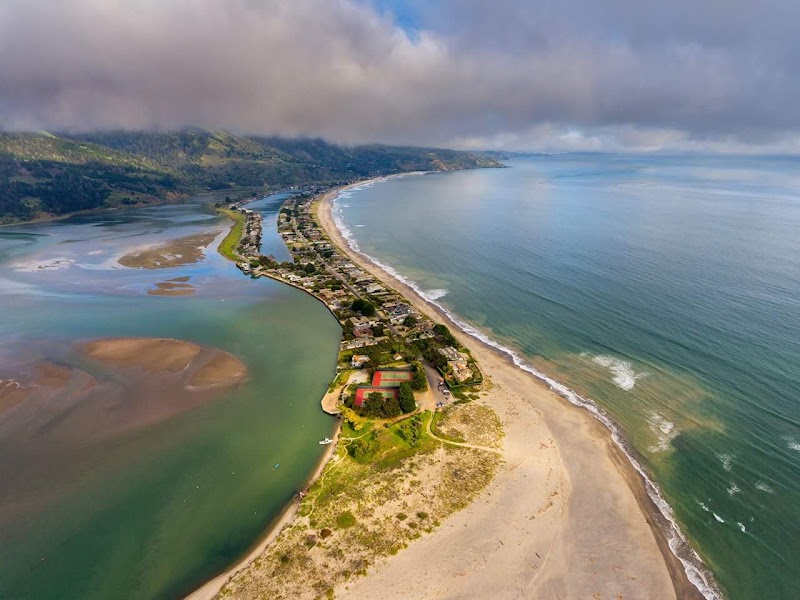
A small inn in the Stinson Beach village — the only community on the Pacific side of Marin County with a sandy beach, accessed via the switchback descent from Mount Tamalpais. The Stinson Beach General Store and the Parkside Café are the village's two main eating options; the beach itself is a 3.5-mile stretch of Pacific coast with cold water and reliable fog. Tomorrow's drive to Point Reyes is 30 minutes north on CA-1 along the coastal bluffs.
5:00 PM📍 See location
Day 2 — Point Reyes National Seashore — Return to San Francisco
Day 2 — Point Reyes National Seashore — Return to San Francisco
🚗 2 hr driving📍 3 stops
🌅
Morning
🚗
Drive
Stinson Beach, CA → Bear Valley Visitor Center — Point Reyes NS
30 min8:00 AM → 8:30 AM
Bear Valley Trail to Arch Rock — Point Reyes NS
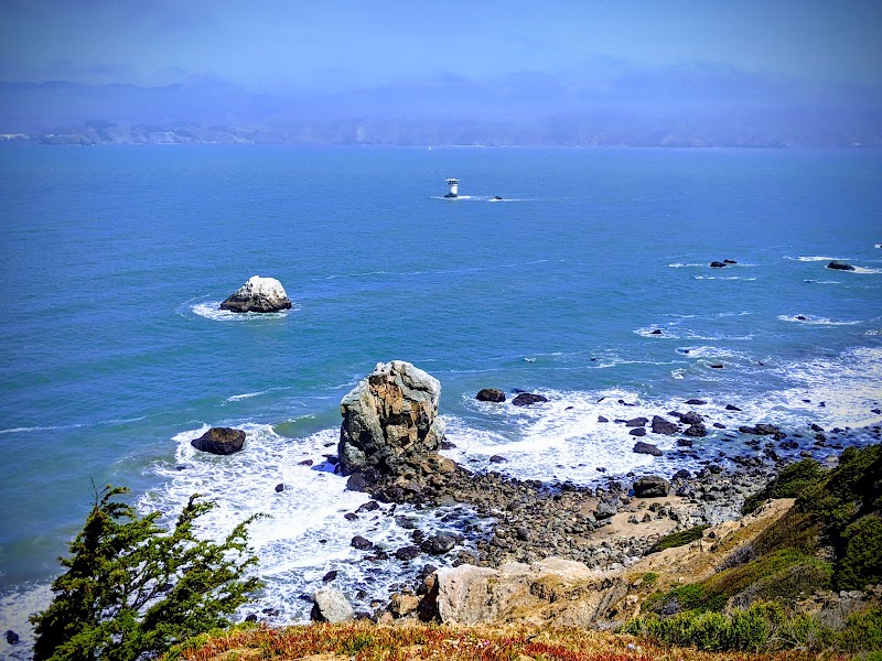
★ 4.9The main hiking artery through Point Reyes National Seashore — Bear Valley Trail (8.2 miles round trip, flat) runs along Coast Miwok tribal territory through Douglas fir forest and coastal scrub to Arch Rock, a sea arch at the cliff edge where a stream meets the Pacific. The trail passes the Kelham Beach junction and the Divide Meadow, where the forest ends and the coastal bluffs begin; the final 0.5 miles descend to the ocean. The Coast Miwok people lived in the Point Reyes peninsula for at least 3,000 years before Spanish colonization; the visitor center has a reconstructed Coast Miwok village. The peninsula itself sits on the Pacific Plate and moves northwest approximately 2 inches per year — the 1906 San Francisco earthquake generated 20 feet of lateral movement here in 40 seconds.
8:30 AM📍 See location
🍽️
Lunch
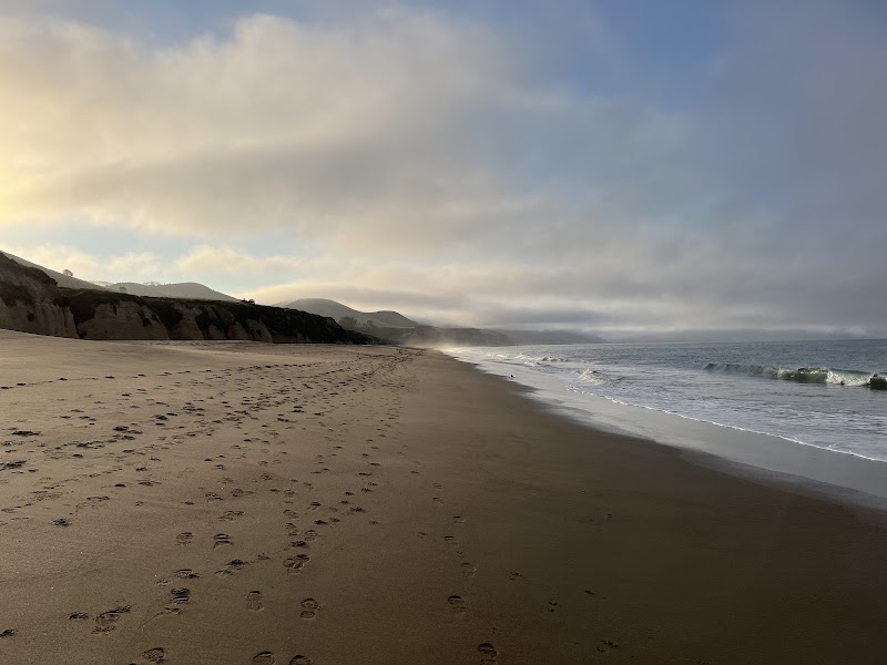
Limantour Beach — Point Reyes NS
★ 4.9A 2-mile crescent of Pacific beach on the inner shore of Drakes Estero — sheltered from the northwest swell by the outer peninsula, warmer in summer than the exposed outer beaches, and backed by the Limantour Spit. Harbor seals haul out on the estero beaches year-round; shorebirds follow the tide line in winter. Limantour is also the most accessible of the Point Reyes beaches (15 minutes from the visitor center), and the beach walk south toward the estero mouth is the most consistently rewarding afternoon activity in the seashore.
9:30 AM📍 See location
☀️
Afternoon
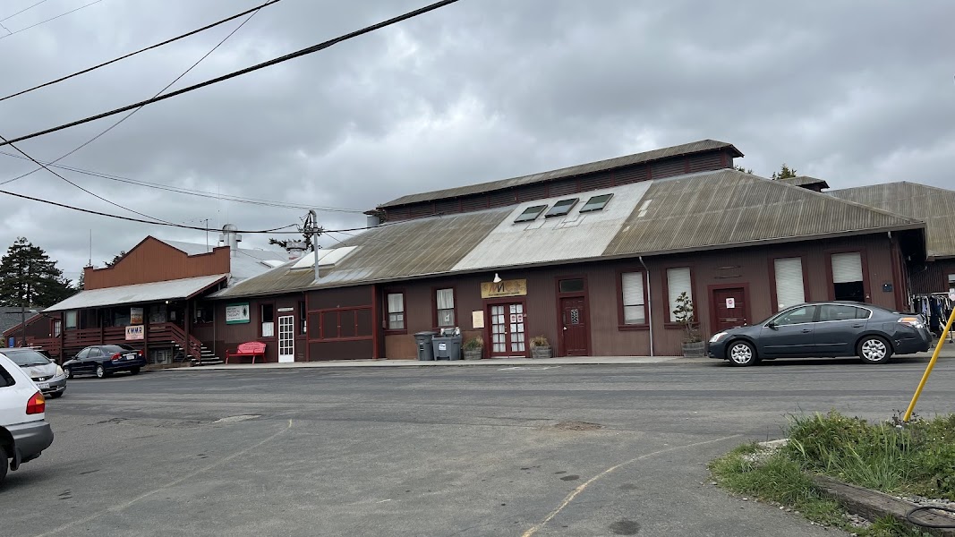
Point Reyes Station — West Marin Farmstead Village
The unincorporated community at the inland end of the Point Reyes peninsula — a village of dairy farms, an oyster bar (Hog Island Oyster Company's roadside counter), independent bakeries, and the Bovine Bakery (whose morning buns and coffee have a cult following among Bay Area hikers). The community has maintained a low-key agricultural character despite proximity to San Francisco; the local dairies (Straus Family Creamery, Cowgirl Creamery) have sustained the West Marin foodshed economy. The return to San Francisco via Sir Francis Drake Boulevard and US-101 takes approximately 90 minutes.
12:00 PM📍 See location
🌙
Evening
🚗
Drive
Point Reyes Station, CA → San Francisco, CA
1 hr 30 min5:00 PM → 6:30 PM
Plan your own escapeExplore more trips →