← The Weekend Getaways
🥾 ActiveWeekend · from Phoenix, AZ

Santa Catalina Mountains — Romero Pools & the Mount Lemmon Sky Island

Rising abruptly from the Sonoran floor north of Tucson, the Santa Catalinas are a classic Southwestern sky island — a lone mountain range that climbs so high and so fast it stacks the ecosystems of a continent into a single afternoon's drive. Day one starts at the foot of the range in Catalina State Park, where the Romero Canyon Trail threads a forest of saguaro up into a rocky canyon to a chain of seasonal pools carved into the bedrock. Day two ascends the Catalina Highway, the Sky Island Scenic Byway, one of the most dramatic elevation-gaining drives in the country — from cactus and creosote at the base to spruce and fir near the top, the biological equivalent of driving from Mexico to Canada in under an hour. It tops out at the tiny mountain village of Summerhaven and the cool conifer trails of the Mount Lemmon high country before the long descent back to the desert and the drive home to Phoenix. Note: the Mount Lemmon Highway and Summerhaven sit above 8,000 feet and regularly see snow and icy closures from roughly November through April — check road and weather conditions before winter trips.

Day 1 — Catalina State Park & Romero Canyon to Romero PoolsDay 2 — Mount Lemmon Sky Island Scenic Byway & the Summerhaven high country
Day 1Catalina State Park & Oro Valley, AZ

Day 1Catalina State Park & Oro Valley, AZ

🚗 2 hr 30 min driving📍 5 stops
🌅
Morning
🚗
Drive
Phoenix, AZCatalina State Park
2 hr 30 min8:00 AM10:30 AM
Catalina State Park
Catalina State Park
4.7
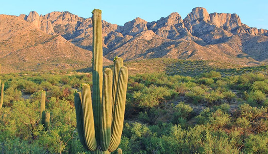
Spread across 5,500 acres at the northwestern foot of the Santa Catalinas near Oro Valley, Catalina State Park is one of the finest stretches of intact upper Sonoran Desert in the state and the gateway to the range's western canyons. Dense stands of saguaro march up the alluvial slopes toward the jagged granite crest, and washes lined with mesquite and cottonwood draw hummingbirds, Gila woodpeckers, and, in wet years, wildflowers by the acre. Stop at the entrance station for a trail map, current conditions, and the water status in Romero Canyon, and fill water bottles here — there is none on the trail. The park is the launch point for the day's hike and a superb place to catch the low morning light on the mountains.
🍽️
Lunch
Continue at Romero Canyon Trail to Romero Pools
4.7
Use the afternoon to explore a different trail, cool off at a swimming hole, or find a scenic spot to watch the sunset.
🍽️ Lunch12:30 PM
Harvest Restaurant Sonoita — Oro Valley
A polished farm-to-table kitchen in Oro Valley, minutes from the park entrance and a natural place to refuel after the canyon. The menu leans on local and seasonal produce — hearty salads, wood-grilled plates, and a well-stocked bar — with a shaded patio that catches the afternoon breeze off the mountains. Portions are generous and the pace unhurried, ideal for a late, well-earned lunch after a morning on the trail. Reservations are wise on weekend evenings.
4.3$$bar📍 Maps →
2 options · tap to switch
☀️
Afternoon
Continue at Nature Trail & Birding Loop, Catalina State Park
4.7
Use the afternoon to explore a different trail, cool off at a swimming hole, or find a scenic spot to watch the sunset.
🌙
Evening
🛏️
Overnight in Oro Valley / North Tucson
Base for the night in Oro Valley or north Tucson, both a short drive from the park and well positioned for an early start up the Catalina Highway in the morning. Oro Valley offers resort-style hotels and desert lodges tucked against the mountains, several with pools and mountain-view patios ideal for unwinding after the hike; north Tucson along Oracle Road adds the full range of dependable chain hotels at lower rates. Whichever you choose, aim to be up and moving early — the Sky Island drive is best in the cool of the morning, and the mountaintop can be twenty degrees cooler than the desert floor. Stock up on water and trail snacks tonight, as options thin out once you climb into the range.
Day 2Mount Lemmon & Summerhaven, AZ

Day 2Mount Lemmon & Summerhaven, AZ

🚗 3 hr 30 min driving📍 5 stops
🌅
Morning
🚗
Drive
Oro Valley / North Tucson, AZCatalina Highway — Sky Island Scenic Byway
1 hr8:00 AM9:00 AM
Catalina Highway — Sky Island Scenic Byway
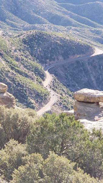
The Catalina Highway, the Sky Island Scenic Byway, is one of the most dramatic elevation-gaining drives in the United States — a 27-mile climb of nearly 6,000 feet from the Sonoran Desert floor to spruce-fir forest near the crest. In the space of an hour the roadside marches through the biological equivalent of a drive from Mexico to Canada: saguaro and cactus at the base give way to oak and juniper woodland, then ponderosa pine, and finally cool stands of fir and aspen near the top. The road climbs in an unbroken series of switchbacks past hoodoo-studded rock walls and sheer canyon drops, with pullouts every few miles. Take it slowly, use the turnouts, and watch for cyclists and rockfall on the tighter bends.
Windy Point Vista
Windy Point Vista
4.9
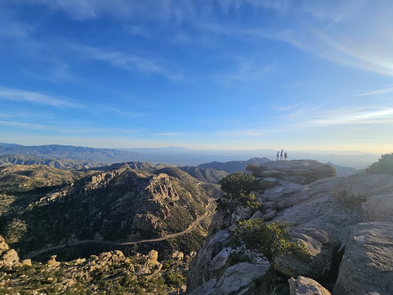
The signature overlook of the Catalina Highway, perched around 6,400 feet on an outcrop of wind-carved granite hoodoos and balanced boulders. The view sweeps back down the range and across the entire Tucson basin to distant desert ranges on the horizon — vast, hazy, and best in the clear light of morning. The rock formations here are a magnet for climbers, and short scrambles from the parking area lead to airy perches above the drop. Wind is nearly constant, which gives the point its name; hold onto hats and mind children near the unfenced edges. It is the obvious place to stretch your legs and take in how far you've climbed.
🍽️
Lunch
Marshall Gulch & Aspen Loop Trail
4.8
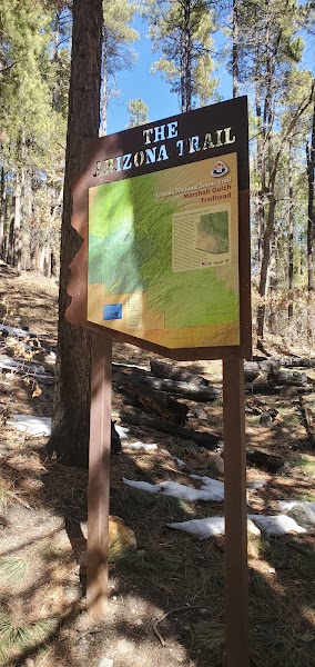
At the very top of the highway above Summerhaven, the Marshall Gulch trailhead is the launch for the Aspen Loop, a roughly 3.8-mile forested circuit that is the finest short hike in the Mount Lemmon high country. The trail follows a cool shaded creek up through Douglas fir, ponderosa pine, and stands of quaking aspen that blaze gold in late autumn, then climbs to Marshall Saddle before looping back — a world away in temperature and character from the desert five thousand feet below. Wildflowers line the creek in summer, and the air near the top can be twenty degrees cooler than Tucson. Afternoon monsoon thunderstorms are common in July and August; hike early and be off the exposed sections by early afternoon.
🍽️ Lunch12:00 PM
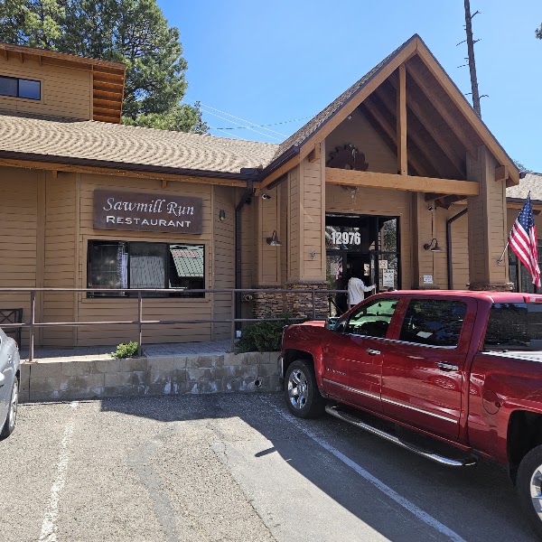
Sawmill Run Restaurant, Summerhaven
The main sit-down kitchen in the tiny mountain village of Summerhaven, a welcome mountaintop refuge after a morning on the trail. Sawmill Run serves hearty American plates — burgers, sandwiches, soups, and pizza — from a timber-framed dining room and deck cooled by the surrounding pines. It sits steps from the village's handful of shops and the famous Cookie Cabin next door, whose oversized cookies are a local institution and an easy dessert or trail snack for the descent. At nearly 8,000 feet this is one of the few warm meals on the mountain, so plan lunch here before the long drive down.
4.1$$restaurant📍 Maps →
2 options · tap to switch
☀️
Afternoon
Continue at Summerhaven Village & Mount Lemmon Overlook
4.9
Use the afternoon to explore a different side of Windy Point Vista — there's more to discover beyond the morning highlights.
🌙
Evening
🚗
Drive
Summerhaven, AZPhoenix, AZ
2 hr 30 min5:00 PM7:30 PM
Plan your own escapeExplore more trips →