← The Weekend Getaways
🥾 ActiveLong weekend · from Richmond, VA

Grayson Highlands — Wild Ponies, Virginia's Highest Peaks & the Virginia Creeper Trail

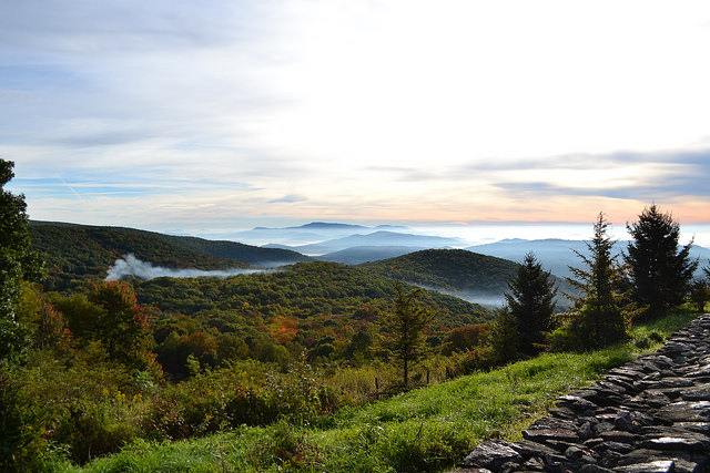
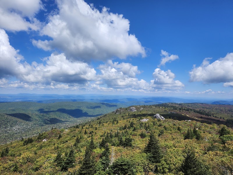
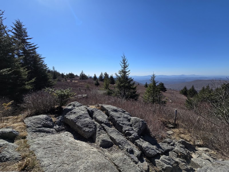
Four hours southwest of Richmond, in the far corner of the state, the Grayson Highlands rise to an alpine country unlike anywhere else in Virginia — windswept balds above 5,000 feet, granite outcrops, and open meadows roamed by a herd of famously photogenic wild ponies. Day one explores Grayson Highlands State Park, where the ponies graze the high balds and rock scrambles open onto vast mountain views. Day two climbs to the roof of the state: Mount Rogers, at 5,729 feet Virginia's highest summit, and neighboring Whitetop Mountain, reached along the Appalachian Trail through the Lewis Fork and Mount Rogers high country. Day three descends to Damascus to ride or walk the legendary Virginia Creeper Trail — a rail-trail that coasts downhill through gorge and trestle country — before the long drive home. Overnighting in the trail towns of Damascus and Abingdon puts mountain dining, outfitters, and early trailheads within easy reach. Note: the Grayson Highlands / Mount Rogers high country regularly gets heavy snow and ice in winter, with seasonal road and Creeper-shuttle closures — best May through October. Day 2's Mount Rogers summit is a full 8+ mile day on its own; pick either the summit hike or the Whitetop/Grindstone add-ons, not all three.

Day 1 — Grayson Highlands State Park & the wild poniesDay 2 — Mount Rogers & Whitetop Mountain via the Appalachian TrailDay 3 — the Virginia Creeper Trail from Damascus
Day 1Grayson Highlands State Park, VA

Day 1Grayson Highlands State Park, VA

🚗 4 hr driving📍 5 stops
🌅
Morning
🚗
Drive
Richmond, VAGrayson Highlands State Park
4 hr8:00 AM12:00 PM
Grayson Highlands State Park Visitor Center
4.9
Perched near 4,900 feet, the Grayson Highlands visitor center is the gateway to Virginia's alpine corner — a park of high balds, spruce-fir forest, and granite outcrops abutting the Mount Rogers National Recreation Area. Exhibits cover the mountain heritage of the region, the geology of the high country, and the famous free-roaming pony herd introduced to keep the balds open. Rangers post current trail conditions, weather (which turns fast and cold at this elevation), and the best places to find the ponies. Pick up a map and fill water here — the high trails have no services, and cell coverage is essentially nonexistent above the tree line.
🍽️
Lunch
Massie Gap & the Wilburn Ridge Ponies
4.8
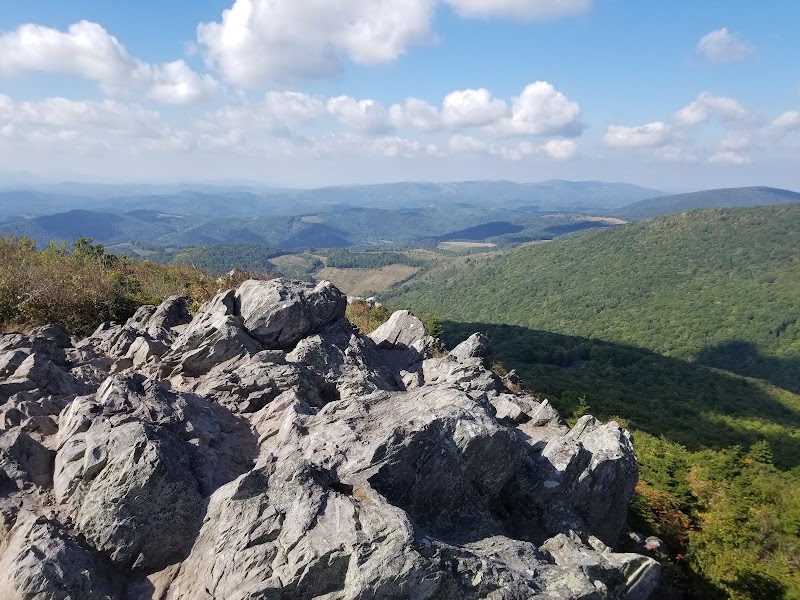
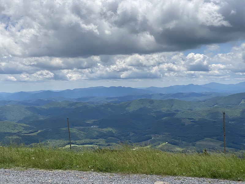
From Massie Gap, the park's high trailhead, a short climb reaches the open balds of Wilburn Ridge, where the Grayson Highlands ponies — small, shaggy, and utterly wild — graze among the granite outcrops and are often seen at close range. The scenery is genuinely alpine: treeless meadows, wind-sculpted rock, and views that stretch across ridge after ridge into North Carolina and Tennessee. Rock scrambles onto the ridge crest open onto some of the finest panoramas in the East. The ponies are wild animals — enjoy them, photograph them, but do not feed or touch them. This is the heart of the day.
Ollie's Deli, Mouth of Wilson / Independence
4.2
Dining is sparse in this remote high country, so plan around it. In the small crossroads communities below the park — Mouth of Wilson, Independence, and Troutdale — a handful of country delis and cafes serve hearty sandwiches, soups, and homemade pie to hikers and locals. It's simple, filling mountain fare and a welcome warm stop after the windy balds. Better still, pack a picnic and eat it up on the ridge among the ponies with the whole highland country spread below.
2:00 PM📍 See location
☀️
Afternoon
Twin Pinnacles & Big Pinnacle Trail
5
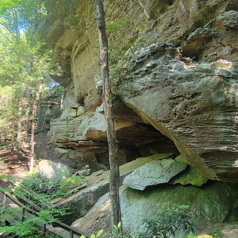
From the visitor-center area, the Twin Pinnacles Trail loops through stunted, wind-bent spruce and fir — a boreal forest more typical of Canada than Virginia — to the rocky summits of Little and Big Pinnacle, the highest points inside the park at over 5,000 feet. The outcrops give 360-degree views across the Blue Ridge crest, the balds where the ponies graze, and the distant blue ranges of three states. It's a moderate afternoon walk that caps the day's high-country immersion. Bring a layer: even in summer the wind up here is cold, and the weather can shift within minutes.
🌙
Evening
🛏️
Overnight in Damascus / Abingdon
Descend to the trail towns for the night. Damascus — 'Trail Town USA,' where the Appalachian Trail runs down Main Street and the Virginia Creeper Trail begins — offers hiker hostels, cozy inns, cabins, and B&Bs, plus outfitters and casual eateries. Larger Abingdon, a half-hour west, adds the historic Martha Washington Inn, boutique hotels, and a lively restaurant scene along its brick Main Street. Either base positions you for tomorrow's high peaks and the following day's Creeper ride. Book ahead in fall foliage season and during trail events, when the towns fill with hikers.
Day 2Mount Rogers & Whitetop Mountain, VA

Day 2Mount Rogers & Whitetop Mountain, VA

🚗 45 min driving📍 4 stops
🌅
Morning
🚗
Drive
Damascus, VAElk Garden / Mount Rogers AT Trailhead
45 min8:00 AM8:45 AM
Mount Rogers Summit via the Appalachian Trail
5
At 5,729 feet, Mount Rogers is the highest point in Virginia, and the finest approach climbs the Appalachian Trail from Elk Garden through open balds and into a hushed, moss-floored spruce-fir forest that cloaks the summit. The high meadows en route are among the most spectacular walking in the state — wide, treeless, and grazed by ponies, with views across the whole Blue Ridge crest. The wooded summit itself is famously viewless, marked only by a survey benchmark, but the journey through the balds and the boreal forest is the reward. It's a strenuous all-day hike; start early, carry layers and plenty of water, and watch the fast-changing mountain weather.
🍽️
Lunch
Whitetop Mountain Balds
4.8
Whitetop Mountain, at 5,520 feet Virginia's second-highest peak, is crowned by broad grassy balds that give it its name — and unlike Mount Rogers, its open summit delivers enormous, unobstructed views across three states. A forest road climbs near the top, and short walks over the balds reach the high meadows where the wind combs the grass and the ridges roll away in every direction. It's the ideal midday high point, an easy add after the Mount Rogers effort. Pack lunch and eat on the bald with the whole southern Blue Ridge at your feet; there are no services on the mountain.
9:45 AM📍 See location
☀️
Afternoon
📍
Grindstone & the Lewis Fork High Country
Below the peaks, the Lewis Fork high country around the Grindstone area offers gentler forest walking to wind down a big mountain day — trails threading through hardwoods and hemlock along clear headwater streams, with the great mass of Mount Rogers rising behind. The Little Wilson Creek and lower AT connectors here are quieter and shadier than the exposed balds above. It's a relaxed afternoon leg that eases the legs before the drive back to town. Listen for the rush of the creeks and watch for deer in the cool of the forest.
🌙
Evening
🛏️
Overnight in Damascus / Abingdon
A second night in Damascus or Abingdon keeps you close to tomorrow's Creeper Trail start. Damascus puts you steps from the trailhead and the town's casual restaurants and breweries, ideal after a long day on the peaks. Abingdon offers a more refined evening — dinner along Main Street, a show at the historic Barter Theatre, and the grand Martha Washington Inn. Rest up: tomorrow's rail-trail ride is a downhill glide, but you'll want an early start to arrange the shuttle from Whitetop Station.
Day 3Virginia Creeper Trail — Damascus, VA
Day 3Virginia Creeper Trail — Damascus, VA

🚗 4 hr 35 min driving📍 3 stops
🌅
Morning
🚗
Drive
Abingdon, VADamascus — Virginia Creeper Trail
20 min8:00 AM8:20 AM
Virginia Creeper Trail — Whitetop to Damascus
4.9
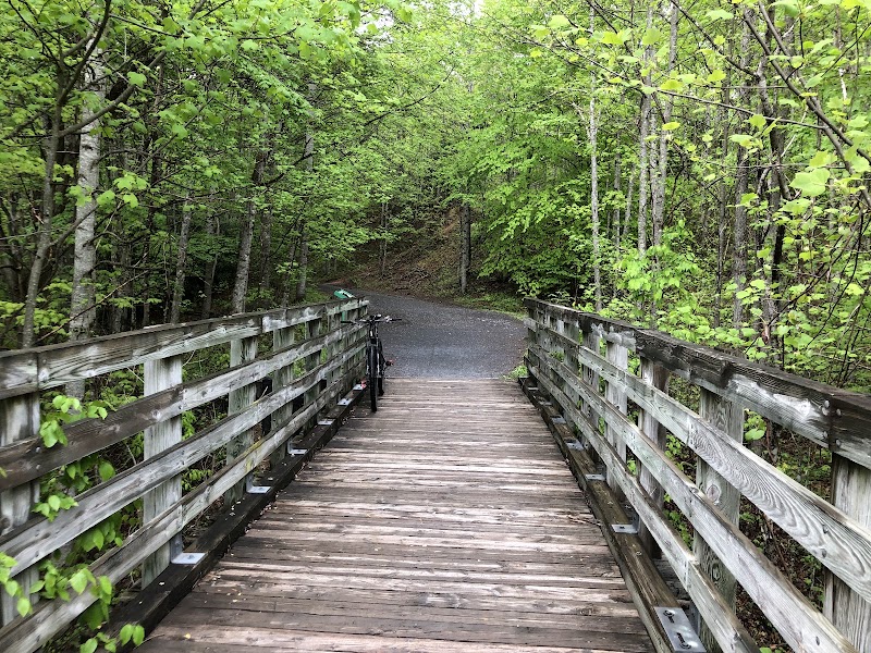
The Virginia Creeper Trail is one of the great rail-trails in the country — a 34-mile former railroad grade named for the straining steam trains that once crept up these grades. The classic outing is the 17-mile downhill glide from Whitetop Station to Damascus: local outfitters shuttle you and a rental bike to the top, and you coast almost entirely downhill through spruce forest, across dozens of wooden trestles, and alongside the tumbling waters of Whitetop Laurel Creek. It's easy, exhilarating, and suitable for nearly all abilities, with the gorge scenery unfolding the whole way. Arrange the shuttle in advance; walkers can sample the trail's lower miles from Damascus.
🍽️
Lunch
Whitetop Laurel Gorge & the Creeper Trestles
4.8
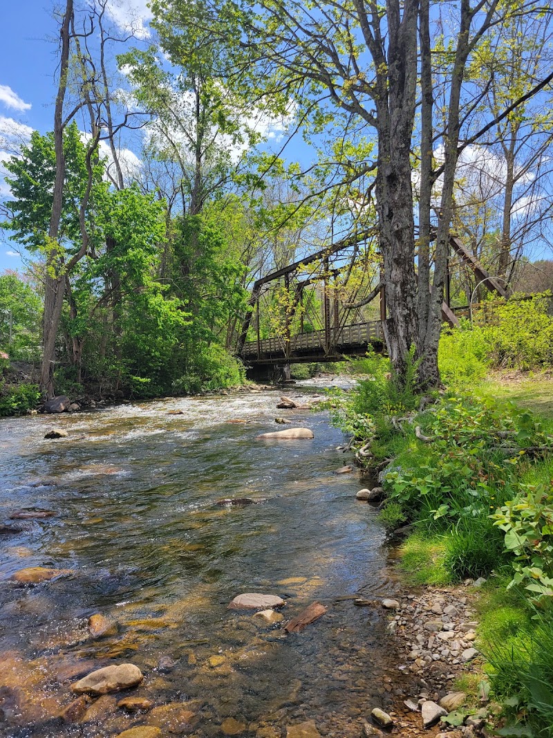
The middle third of the Creeper descent, through the Whitetop Laurel gorge, is the trail's scenic climax — the grade clings to the canyon wall high above a rushing trout stream, crossing it again and again on tall wooden trestles with the water roaring below. Pull off at Creek Junction or Straight Branch to walk down to the water, wade, and eat a packed lunch on the rocks beside the creek. It's the most memorable stretch of the ride and worth lingering over. The cool of the gorge and the clatter of the creek make an idyllic midday pause before the final glide into town.
9:20 AM📍 See location
☀️
Afternoon
Damascus Town Park & Trail Town Main Street
4.7
The Creeper ride ends in Damascus, where the Appalachian Trail, the Creeper, and several other long paths all converge — earning the town its 'Trail Town USA' fame. Return your rental, then wander the town park where the trails meet and the Creeper's old rail bridge crosses Laurel Creek, or grab a coffee or ice cream on the short Main Street among the through-hikers. It's a relaxed, celebratory close to three days in Virginia's highest country before the long drive home. Refuel and rest here — Richmond is four hours east.
🌙
Evening
🚗
Drive
Damascus, VARichmond, VA
4 hr 15 min5:00 PM9:15 PM
Plan your own escapeExplore more trips →