🥾 ActiveLong weekend · from Salt Lake City, UT
Wasatch High Route: Big Cottonwood Lakes, Little Cottonwood Cirque, and Mount Olympus Summit
The three-day Wasatch high route makes a progressive circuit through the central range's finest alpine terrain, starting with the Lake Blanche granite cirque in Big Cottonwood Canyon, moving to Little Cottonwood's Red Pine Lake and Snowbird's aerial tram, and finishing with the Mount Olympus summit climb — a 9,026-foot peak that rises directly above Salt Lake City and delivers the full Wasatch Front and Great Salt Lake panorama on the return day. The three hikes combined represent roughly 22 miles and 8,000 feet of cumulative elevation gain across three days.
Day 1 — Big Cottonwood Canyon, UTDay 2 — Little Cottonwood Canyon, UTDay 3 — Mount Olympus, UT
Day 1 — Big Cottonwood Canyon, UT
Day 1 — Big Cottonwood Canyon, UT
🚗 35 min driving📍 5 stops
🌅
Morning
🚗
Drive
Salt Lake City, UT → Mill B South Fork Trailhead, Big Cottonwood Canyon
35 min
Lake Blanche Trail — Big Cottonwood Canyon
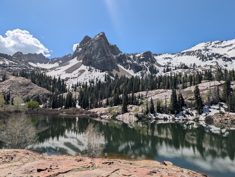
★ Reviews →The 7-mile round-trip trail from Mill B South Fork trailhead at 7,600 feet is one of the signature alpine hikes of the central Wasatch: 2,700 feet of elevation gain through old-growth spruce and fir, aspen groves, and open granite slabs to the Lake Blanche cirque at 10,200 feet. The cirque contains three glacially carved alpine lakes — Lake Blanche, Lake Florence, and Lake Lillian — in a granite bowl ringed by 2,000-foot walls; the Sundial Peak ridge (11,400 ft) dominates the skyline to the southeast. Wildflower season peaks mid-July with Indian paintbrush, columbine, and glacier lilies on the upper slopes. Plan 5-6 hours for the round trip with time at the lakes.
~5.5 hrs📍 See location
🍽️
Lunch
🍽️ Lunch~1 hr
Silver Fork Lodge — Big Cottonwood Canyon
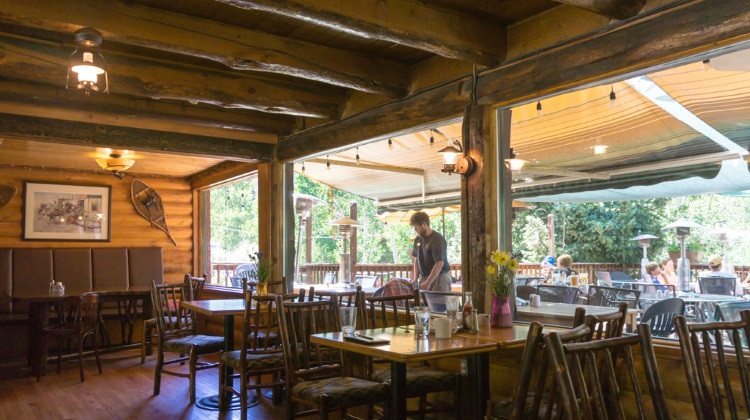
The canyon's most reliable dining option at 8,000 feet: elk burgers, fresh trout, house-baked pie, and Utah craft beers in a log-and-stone dining room with Wasatch views and a fireplace that runs year-round. The combination of elevation, physical effort, and immediate mountain setting makes the Silver Fork burger a recurring feature of Big Cottonwood Canyon hiker lore.
3 options · tap to switch
☀️
Afternoon
Donut Falls — Mill D North Fork
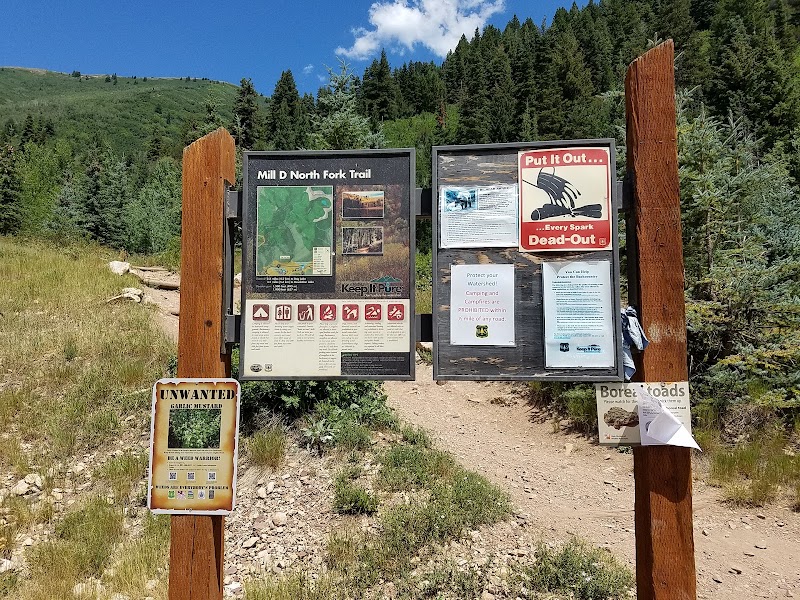
★ Reviews →An easy 1.7-mile round-trip recovery hike to the waterfall that flows through a natural donut-shaped hole in granite — the right scale for an afternoon after the Lake Blanche morning effort. The trail gains minimal elevation through riparian forest along Mill D Creek; the geological curiosity of the formation and the family-friendly character of the trail make it the most visited waterfall in Big Cottonwood Canyon.
~45 min📍 See location
🌙
Evening
🍽️ Dinner~1 hr
Silver Fork Lodge Dinner — Big Cottonwood Canyon
The Silver Fork's evening menu includes heartier options than the afternoon café: slow-cooked game, house-smoked meat platters, and a rotating seasonal menu that uses Wasatch-area ingredients in straightforward mountain preparations.
2 options · tap to switch
🛏️
Brighton Chalets — Brighton Ski Resort
Slope-side condominium-style units at 8,700 feet with direct trail access to the Lake Mary circuit and Catherine Pass, the highest lodging in Big Cottonwood Canyon.
Day 2 — Little Cottonwood Canyon, UT
Day 2 — Little Cottonwood Canyon, UT
🚗 20 min driving📍 6 stops
🌅
Morning
🚗
Drive
Brighton, UT (Big Cottonwood Canyon) → White Pine Trailhead, Little Cottonwood Canyon
20 min
Red Pine Lake Trail — Little Cottonwood Canyon
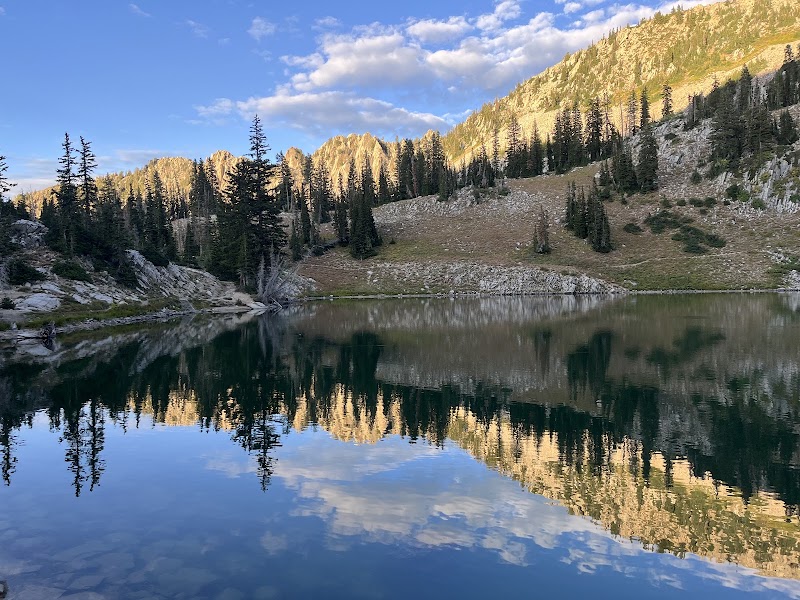
★ Reviews →The 6.9-mile round-trip trail from the White Pine Trailhead at 7,680 feet climbs through dense Engelmann spruce and subalpine fir, gaining 2,100 feet over 3.5 miles to the Red Pine cirque at 10,000 feet. The turquoise alpine lake sits at the foot of the Pfeifferhorn's northwest ridge (11,326 ft), ringed by granite walls and populated by one of the Wasatch's densest yellow-bellied marmot colonies. The trail shares its first mile with the White Pine Lake trail before diverging; the Red Pine fork is steeper and less traveled, with wildflower meadows in the cirque basin that peak in mid-July.
~6 hrs📍 See location
🍽️
Lunch
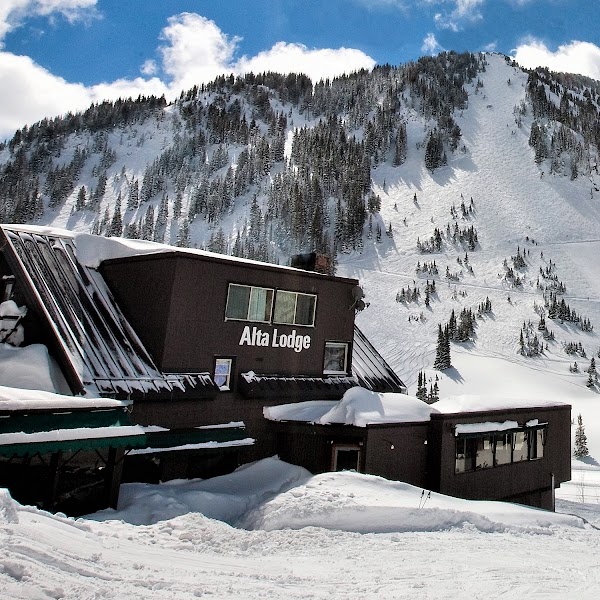
Alta Lodge Deck Lunch
★ Reviews →Alta's oldest ski lodge (1939) serves lunch on its summer deck at 8,500 feet with views up Little Cottonwood Canyon toward the Pfeifferhorn and the Albion Basin wildflower meadows. Simple mountain fare — sandwiches, soups, cold drinks — served at the right elevation and with the right view for a midday recovery.
~1.5 hrs📍 See location
☀️
Afternoon
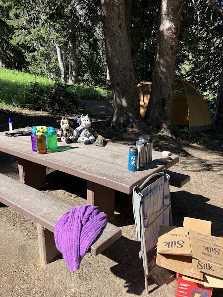
Albion Basin Summer Road & Wildflower Loop
★ Reviews →The narrow seasonal road above Alta climbs to 9,500 feet through the Albion Basin, where a concentration of subalpine wildflowers — columbine, paintbrush, shooting stars, larkspur, elephant heads, and phlox — covers the open meadows above the treeline in what is consistently cited as one of the finest wildflower displays in the contiguous United States, peaking in late July.
~1.5 hrs📍 See location
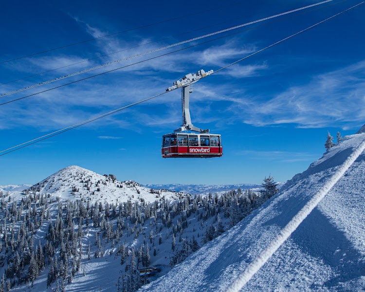
Snowbird Aerial Tram — Hidden Peak
★ Reviews →The 8-minute aerial tram from Snowbird base (8,100 ft) to Hidden Peak (11,000 ft) delivers the full Wasatch panorama: Great Salt Lake to the northwest, Uinta Mountains to the east, Mount Timpanogos to the south. The Cirque Traverse trail along the summit ridge offers technical ridge walking at 10,500 feet above the Peruvian Gulch.
~1 hr📍 See location
🌙
Evening
🍽️ Dinner~1 hr
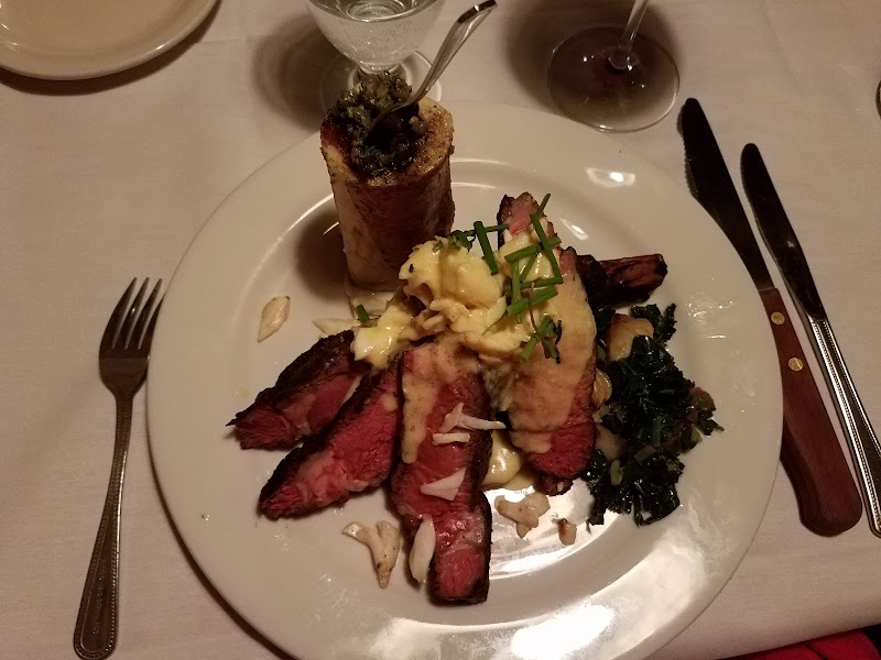
Shallow Shaft Restaurant — Alta
Alta's most serious dinner restaurant occupies a subterranean dining room in the Snowpine Lodge, serving American cooking with European technique at a quality level that consistently surprises visitors expecting ski-resort food: house-cured meats, Colorado lamb, Utah trout, and seasonal vegetable preparations that draw diners from Salt Lake City.
3 options · tap to switch
🛏️
Alta Lodge — Alta Ski Resort
The historic Alta Lodge (1939) at 8,500 feet in Little Cottonwood Canyon is one of the oldest continuously operated ski lodges in Utah, with simple but warm rooms, family-style dining, and the immediate access to Albion Basin and the Pfeifferhorn trails that makes it the ideal base for the Little Cottonwood hiking day.
Day 3 — Mount Olympus, UT
Day 3 — Mount Olympus, UT
🚗 45 min driving📍 5 stops
🌅
Morning
🚗
Drive
Alta, UT (Little Cottonwood Canyon) → Mount Olympus Trailhead, Wasatch Blvd
30 min
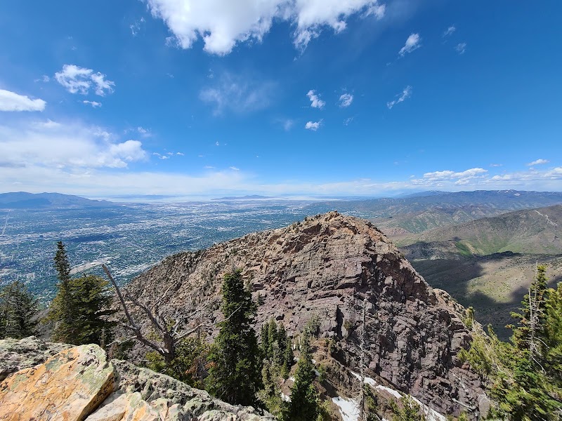
Mount Olympus Summit Trail
★ Reviews →The Mount Olympus trail gains 4,058 feet over 4 miles from the Wasatch Boulevard trailhead at 4,968 feet to the 9,026-foot summit — the peak that rises directly above Salt Lake City's eastern bench and dominates the central valley's visual horizon. The trail ascends through oak scrub, then mahogany, then quartzite slabs and ridgeline exposure in the final mile to the twin-summited peak; the route is non-technical but sustained and requires 5-6 hours round trip. The summit panorama is the finest single viewpoint in the Wasatch Front: the entire Salt Lake Valley, the Great Salt Lake and its islands, the Oquirrh Mountains, and — on clear days — the Nevada ranges beyond the lake. The Mount Olympus Wilderness was designated in 1984 and the trail is one of the most heavily used in the Wasatch, particularly on weekday mornings when Salt Lake residents treat it as their training peak.
~5.5 hrs📍 See location
🍽️
Lunch
📍
Pack Summit Lunch — Wasatch Blvd Trailhead
There are no food services at the Mount Olympus trailhead. Pack lunch before leaving your hotel — the summit flat below the peak is an ideal lunch spot with views of the Salt Lake Valley.
~1.5 hrs📍 See location
Continue at Mount Olympus Summit — Rock Scramble
★ Reviews →Use the afternoon to explore a different side of Mount Olympus Summit Trail — there's more to discover beyond the morning highlights.
~2.5 hrs📍 See location
☀️
Afternoon
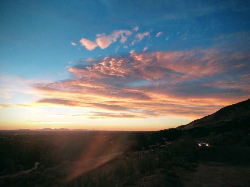
Bonneville Shoreline Trail — Return Descent
★ Reviews →The Bonneville Shoreline Trail runs along the base of the Wasatch — if you have energy after Olympus, the section nearest the trailhead makes a gentle 1-2 mile cool-down walk. Do not plan this as a separate afternoon destination; treat it as an optional extension of the Olympus descent.
~2 hrs📍 See location
🌙
Evening
🍽️ Dinner~1 hr
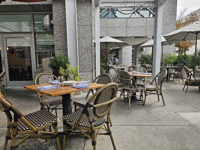
The Copper Onion — Salt Lake City
Salt Lake City's flagship farm-to-table restaurant on the 200 South dining corridor: house-cured charcuterie, wood-grilled meats, and seasonal vegetable preparations sourced from Utah farms, in a warm convivial dining room that is the right setting for the final evening of a three-day Wasatch circuit.
4 options · tap to switch
🚗
Drive
Mount Olympus Trailhead, UT → Salt Lake City, UT
15 min
← All Salt Lake City trips
More getaways from Salt Lake City
Big Cottonwood Canyon: Alpine Lakes, Granite Cirques, and Donut Falls — Day trip🥾Wasatch Alpine Circuit: Big Cottonwood Lakes, Red Pine Cirque, and Snowbird's 11,000-Foot Summit — Weekend🥾Moab Full Circuit: Arches Devil's Garden, Canyonlands Island in the Sky, and Dead Horse Point — Long weekend🥾Park City's Silver Boomtown: Mining History & the Olympic Legacy — Day trip🏛️Park City & Sundance: The Olympic Legacy, Robert Redford's Mountain, and Heber Valley Steam — Weekend🏛️Utah Pioneer & Carbon County: Olympic Heritage, Coal Country, and the World's Longest Art Gallery — Long weekend🏛️Antelope Island: Bison, the Great Salt Lake, and a Pioneer Ranch at the Water's Edge — Day trip🌿Park City Galleries & Heber Valley: Mountain Gondola, Whiskey Saloon, and a Swiss Crater Soak — Weekend🌿
© 2026 theweekendgetaways.com · All itineraries are original content. Terms
Plan your own escapeExplore more trips →