← The Weekend Getaways
🥾 ActiveWeekend · from San Antonio, TX

Seminole Canyon — Ancient Rock Art & the Pecos River Country

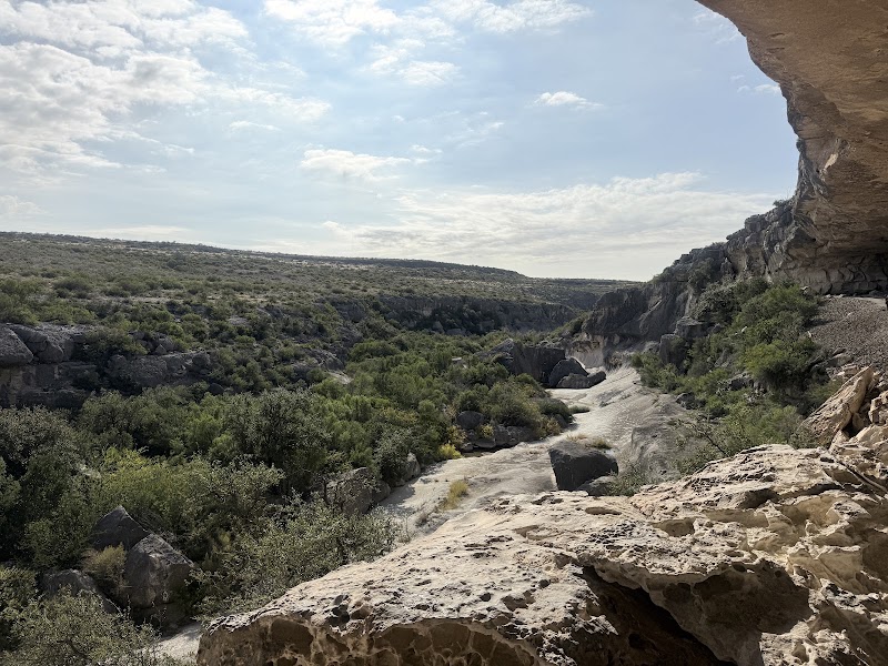
Two days at the far western edge of the Hill Country's reach, where the land dries and opens into the Lower Pecos canyonlands and the Rio Grande — a three-hour drive west of San Antonio into some of the oldest and most spectacular rock-art country in North America. Day one centers on Seminole Canyon State Park and its guided hike down to the Fate Bell Shelter, a vast rock overhang whose walls carry pictographs painted four thousand years ago, followed by a walk out along the canyon rim above the Rio Grande. Day two turns to water and engineering: the sprawling blue reservoir of Amistad National Recreation Area, backed up behind Amistad Dam on the Rio Grande, and the dizzying Pecos River High Bridge, the highest highway bridge in Texas. It is a big-sky, wide-horizon weekend of hiking, boating, and deep human history, with a night in the desert crossroads of Comstock or the border city of Del Rio.

Day 1 — The Fate Bell Shelter rock-art tour & the canyon rimDay 2 — Amistad National Recreation Area & the Pecos River High Bridge
Day 1Seminole Canyon State Park, TX

Day 1Seminole Canyon State Park, TX

🚗 3 hr 5 min driving📍 4 stops
🌅
Morning
🚗
Drive
San Antonio, TXSeminole Canyon State Park & Historic Site
3 hr 5 min8:00 AM11:05 AM
Seminole Canyon Visitor Center & Museum
4.8
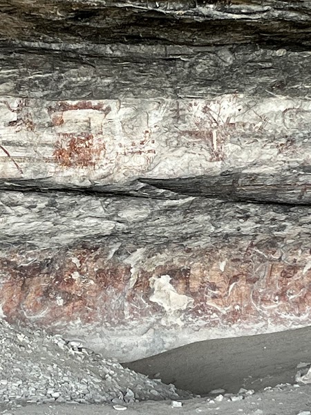
Begin at the park's excellent visitor center, perched on the rim of the canyon country, where a museum lays the groundwork for everything to come. Exhibits trace twelve thousand years of human presence in the Lower Pecos and, crucially, explain the Pecos River style of rock art you are about to see — the vivid, enigmatic shamanic figures painted by hunter-gatherers on these canyon walls. The guided hike to the Fate Bell Shelter can only be booked here and departs on a set schedule, usually mornings, so check times and sign up the moment you arrive; the number of spots is limited and the summer heat pushes tours to early slots. Load up on water — this is genuine desert, exposed and hot, and there is none on the trail. Buy the trail guide and note the park's remote setting: the nearest real services are back toward Comstock and Del Rio.
🍽️
Lunch
Fate Bell Shelter Rock-Art Tour
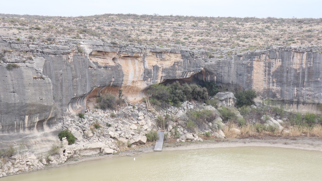
The reason to make the drive: a ranger-guided hike down into Seminole Canyon to the Fate Bell Shelter, one of the oldest cave-dwelling sites in North America and home to some of the finest Pecos River style pictographs anywhere. The trail descends the canyon wall to a huge, cool rock overhang whose ceiling and walls are painted with towering anthropomorphic figures — shamans, mythic animals, and abstract forms rendered in red, yellow, black, and white as much as four thousand years ago. The guide interprets the imagery and the archaeology while you stand where the painters stood, and rules forbid touching the fragile art, so keep to the marked path. The round trip is a couple of miles of moderate hiking with a steep, rocky descent and climb-out, all under open sun — this is the physical and emotional heart of the trip. Wear boots, a hat, and carry all your water.
12:05 PM📍 See location
☀️
Afternoon
Canyon Rim Trail to the Rio Grande Overlook
In the afternoon, walk the park's Canyon Rim Trail out to the overlook above the confluence of Seminole Canyon and the Rio Grande. The wide, mostly level path crosses open desert scrub of lechuguilla, sotol, and prickly pear to a bluff-top view over the river — brown, broad, and international, with Mexico rising on the far bank and the deep gash of the canyon dropping away below. Interpretive signs mark old rail-camp sites and point across to Panther Cave, a famous rock shelter on the far wall of the canyon whose great red panther pictograph is best seen with binoculars. The trail can be biked as well as hiked. Time it for the late-day light, when the desert colors deepen and the heat begins to ease over the vast, silent canyonlands. Carry water even on this easier walk.
🌙
Evening
🛏️
Lodging in Comstock or Del Rio
The country out here is thinly settled, so plan lodging deliberately. The tiny crossroads of Comstock, minutes from the park, offers a rustic motel or two and the closest bed to the canyon — spare, quiet, and under some of the darkest skies in Texas for stargazing. For a fuller range of options, the border city of Del Rio, about forty minutes southeast, has the region's chain hotels, restaurants, and services, and sits conveniently on the way to the next day's Amistad reservoir and Pecos River bridge. Fuel up and buy groceries or supplies in Del Rio if you pass through, as the desert stretches offer little. Whichever you choose, book ahead — rooms are few, and hunting seasons and events can fill them.
Day 2Amistad National Recreation Area, TX

Day 2Amistad National Recreation Area, TX

🚗 3 hr 45 min driving📍 3 stops
🌅
Morning
🚗
Drive
Comstock / Del Rio, TXAmistad National Recreation Area
30 min8:00 AM8:30 AM
Amistad Reservoir — Diablo East & the shoreline
4.6
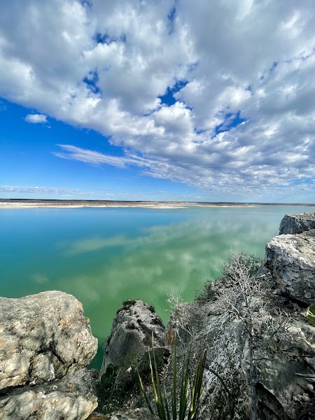
Day two opens on water. Amistad National Recreation Area protects the U.S. side of a vast reservoir on the Rio Grande, its impossibly blue water backed up for miles behind Amistad Dam and shared by the United States and Mexico — amistad is Spanish for "friendship." Start at the Diablo East area, the main hub, where the boat ramps, marina, and swimming coves make the reservoir accessible. If you can arrange a boat rental or a guided trip, the lake is the way to reach hidden canyons and more rock-art shelters along the flooded tributaries; otherwise, swim in the clear coves, walk the shoreline, and take in the sheer scale of the water against the desert hills. Anglers know Amistad as one of the country's premier bass lakes. Bring everything you need — it is a wide-open, sun-blasted landscape with services concentrated near Del Rio.
🍽️
Lunch
Del Rio lunch — Tex-Mex on the border
4.2
Head into Del Rio for a midday meal before the drive home. As a true border city, Del Rio's strength is its Tex-Mex and interior-Mexican cooking — long-running family restaurants turning out enchiladas, cabrito, fresh tortillas, and cold aguas frescas, all comfortably in the $$ range. It is the region's commercial center and the last real cluster of restaurants before the long open highway back east, so eat well, fill the tank, and stock the cooler. A relaxed, flavorful break to fortify for the afternoon's high-bridge stop and the three-hour-plus run to San Antonio.
9:30 AM📍 See location
☀️
Afternoon
Pecos River High Bridge Overlook
4.8
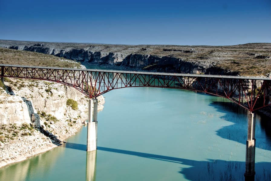
Make the short run west from Del Rio to the Pecos River High Bridge, the highest highway bridge in Texas, where U.S. 90 leaps the deep gorge of the Pecos just above its junction with the Rio Grande. A signed rest-area overlook on the canyon rim gives a vertiginous view down to the green ribbon of the Pecos hundreds of feet below, walled by sheer limestone cliffs riddled with caves and, unseen from here, still more ancient rock shelters. It is a short, easy stop with an outsized payoff — the scale of the canyon and the slender bridge spanning it is genuinely arresting, and it makes a fitting last look at the Pecos country before the highway carries you back toward the Hill Country. Mind the wind and the drop at the overlook railings. From here it is a long, straight desert drive home.
🌙
Evening
🚗
Drive
Pecos River High Bridge, TXSan Antonio, TX
3 hr 15 min5:00 PM8:15 PM
Plan your own escapeExplore more trips →