🥾 ActiveWeekend · from Washington, DC
Potomac Gorge Circuit & Catoctin Ridgeline
Two days along the Potomac's dramatic gorge country and Maryland's Catoctin ridge: Scott's Run Nature Preserve and Difficult Run's wooded ravine on day one, then Sugarloaf Mountain's lone quartzite peak and Catoctin Mountain Park — where Camp David sits hidden in the Appalachian hardwoods — on day two.
Day 1 — Fairfax County, VADay 2 — Sugarloaf Mountain & Catoctin Mountain Park
Day 1 — Fairfax County, VA
Day 1 — Fairfax County, VA
🚗 25 min driving📍 6 stops
🌅
Morning
🚗
Drive
Washington, DC → Scott's Run Nature Preserve, McLean, VA
25 min
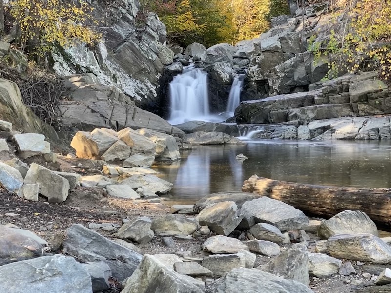
Scott's Run Nature Preserve
★ Reviews →Scott's Run is a Fairfax County park in McLean where Scott's Run creek carves a steep gorge to its confluence with the Potomac. The 1.5-mile trail to the Potomac is the finest short hike in Northern Virginia — the creek drops over several small falls before ending in a dramatic gorge where the Potomac runs through sculpted schist. The river access point has extraordinary views upstream toward Great Falls, and the hemlock-shaded ravine stays cool even in summer. The trailhead on Georgetown Pike is accessible in 25 minutes from DC.
~30 min📍 See location
🍽️
Lunch
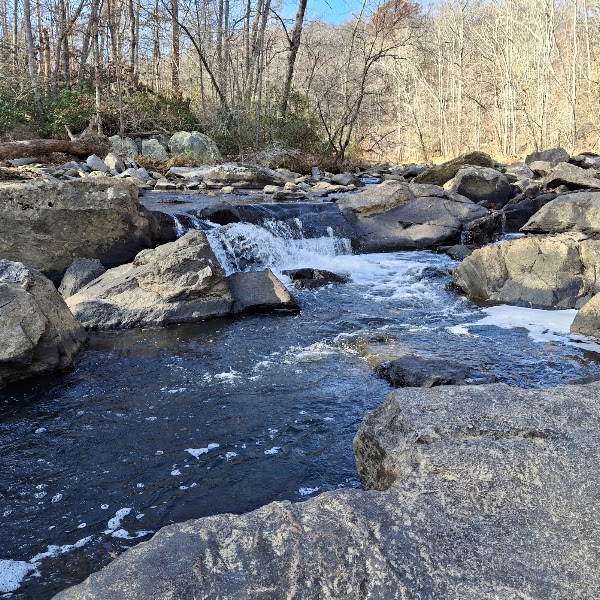
Difficult Run Stream Valley Trail
★ Reviews →The Difficult Run Stream Valley trail system follows the creek for 4 miles through a wooded Fairfax County ravine, passing through mature floodplain forest and over the creek at multiple rocky crossings before reaching the Potomac River at Georgetown Pike. The contrast between the wooded ravine interior and the open Potomac gorge at the trail's end gives the route a satisfying narrative arc. Combined with Scott's Run, this makes a full morning of varied Potomac-gorge hiking without leaving Fairfax County.
~2 hrs📍 See location
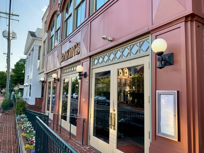
Bazin's on Church
★ Reviews →A genuine sit-down restaurant in an 1882 building on Church Street in Vienna, VA, serving American cuisine with seasonal Virginia sourcing — local beef, farm vegetables, and Chesapeake seafood depending on the week's supply. Ten minutes from the Difficult Run trailhead and a significant step above the chain options in the surrounding suburb. A well-matched post-hike lunch before the afternoon on the C&O Canal.
~1 hr📍 See location
☀️
Afternoon
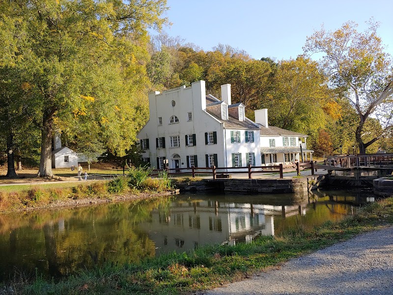
Great Falls Tavern — C&O Canal
★ Reviews →Cross into Maryland to view the Great Falls from the C&O Canal side and walk a stretch of the towpath. The 1831 Great Falls Tavern visitor center provides context for the 184.5-mile canal project — completed in 1850 after 22 years of construction, immediately challenged by the Baltimore & Ohio Railroad, and shut down in 1924 after a devastating flood. The Olmsted Island overlook gives the best upstream view of the Potomac's 76-foot plunge through Mather Gorge.
~1.5 hrs📍 See location
🌙
Evening
🍽️ Dinner~1 hr
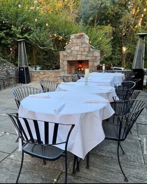
Old Angler's Inn
A C&O Canal–era roadhouse open since the 1860s, with a shaded terrace overlooking the Potomac. The kitchen produces reliable mid-Atlantic cooking — crab cake sandwiches, fish tacos, wood-grilled meats — and the bar stocks a thoughtful selection of Maryland and Virginia craft beers. A natural dinner stop before heading north to overnight near Seneca Creek.
4 options · tap to switch
🛏️
Seneca Creek State Park Campground
The 5,420-acre Seneca Creek State Park maintains a campground at Clopper Lake with electric sites and tent sites, 30 minutes north of the Scott's Run trailhead. The lake itself has a boat launch and beach, making it a good base for an early start the next morning before heading north toward Sugarloaf and Catoctin.
Day 2 — Sugarloaf Mountain & Catoctin Mountain Park
Day 2 — Sugarloaf Mountain & Catoctin Mountain Park
🚗 2 hr 20 min driving📍 3 stops
🌅
Morning
🚗
Drive
Seneca Creek State Park → Sugarloaf Mountain
25 min
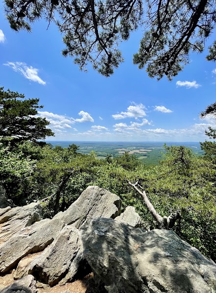
Sugarloaf Mountain
★ Reviews →Sugarloaf is a rare geological feature — a monadnock, a lone resistant quartzite peak that survived millions of years of erosion that leveled everything around it. The 2.5-mile summit loop climbs 800 feet through hardwood forest to a rocky cap at 1,282 feet with views across the Potomac Valley into Virginia. Privately owned since 1902 and managed as a free public preserve by the Gordon Strong Foundation under a 1946 deed of trust — an unusual stewardship model that has kept it undeveloped despite enormous development pressure.
~1.5 hrs📍 See location
🍽️
Lunch
🚗
Drive
Sugarloaf Mountain → Catoctin Mountain Park
40 min
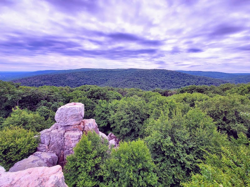
Catoctin Mountain Park — Thurmont
★ Reviews →Catoctin Mountain Park covers 5,810 acres of western Maryland ridge-and-valley terrain and is administered by the NPS. The classified portion of the park — the land surrounding Camp David — is closed to the public, but the remainder has 26 miles of trails through second-growth forest on land that was devastated by charcoal production in the 1800s. Chimney Rock and Cat Rock offer the best views, accessible via a 2.7-mile out-and-back with 700 feet of gain.
~1.5 hrs📍 See location
☀️
Afternoon
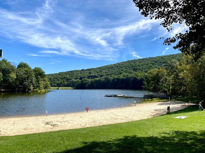
Cunningham Falls State Park
★ Reviews →Adjacent to Catoctin Mountain Park and connected by trail, Cunningham Falls preserves Maryland's largest cascading waterfall — a 78-foot slide-and-plunge sequence down a lichen-covered schist face. The falls trail from William Houck Area is 1.3 miles round-trip with minimal elevation gain. The park also has Hunting Creek Lake for swimming and a beach area that gets packed on hot summer weekends.
~45 min📍 See location
🌙
Evening
🚗
Drive
Catoctin Mountain Park → Washington, DC
1 hr 15 min
← All Washington trips
More getaways from Washington
Mather Gorge & the Billy Goat Trail — Day trip🥾Shenandoah Waterfalls & Old Rag Summit — Weekend🥾Maryland Piedmont, Old Rag Summit & Skyline — Long weekend🥾Annapolis: Colonial Capital & Chesapeake Waterfront — Day trip🏛️Chesapeake Shore: Colonial Capital & Maritime Maryland — Weekend🏛️Colonial Arc: Capital, Plantation & Living History — Long weekend🏛️Middleburg Hunt Country & Virginia Wine — Day trip🌿Chesapeake Waterfront: St. Michaels & Easton — Weekend🌿
© 2026 theweekendgetaways.com · All itineraries are original content. Terms
Plan your own escapeExplore more trips →