Bighorn Canyon & the Pryor Mountains — Wild Horses, Deep Canyons & Big History
Southeast of Bozeman, where the plains fold up against the Wyoming line, lies a starkly different Montana — a country of desert-red canyons, wild mustang ranges, and Crow history far from the alpine forests of the Gallatin. This three-day escape, about three hours from Bozeman, explores the Bighorn Canyon National Recreation Area and the mysterious Pryor Mountains. Day one drops into Bighorn Canyon, where the Bighorn River has carved a chasm up to 1,000 feet deep through banded rock, and reaches the breathtaking Devil Canyon Overlook. Day two climbs into the Pryor Mountain Wild Horse Range — one of the last strongholds of free-roaming mustangs in America, home to a genetically distinct herd descended from Spanish colonial horses — along the historic Bad Pass Trail once used by Native peoples and fur traders. Day three visits Chief Plenty Coups State Park, honoring the last great chief of the Crow Nation, and the rolling foothills below Red Lodge before the drive home. Deep canyons, wild horses, and layered human history define this wilder, drier corner of the state.
Day 1 — Bighorn Canyon & the Devil Canyon OverlookDay 2 — Pryor Mountain wild horses & the Bad Pass TrailDay 3 — Chief Plenty Coups State Park & the Red Lodge foothills
Day 1 — Bighorn Canyon National Recreation Area, MT/WY
Day 1 — Bighorn Canyon National Recreation Area, MT/WY
🚗 4 hr 20 min driving📍 4 stops
🌅
Morning
🚗
Drive
Bozeman, MT → Bighorn Canyon National Recreation Area (Lovell / south district)
3 hr8:00 AM → 11:00 AM
Bighorn Canyon Visitor Center, Lovell
★ 4.8
The Cal S. Taggart Bighorn Canyon Visitor Center in Lovell is the essential orientation point for the recreation area's rugged south district, with exhibits on the canyon's geology, the Pryor Mountain wild horses, and the deep Native and fur-trade history of the region. Rangers post current road conditions, wildlife sightings, and the status of the gravel routes into the Pryors — vital information before you head into this remote country where services and cell coverage vanish. Pick up maps, fill water, and top off fuel here; the desert canyon country beyond has no amenities. It is a fitting first stop after the long drive, setting the stage for the overlooks and wild-horse ranges ahead.
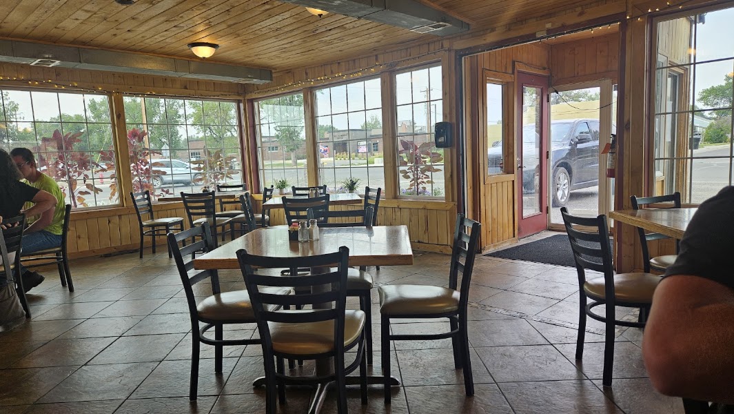
Lovell is the gateway town to the south district of Bighorn Canyon, and its handful of down-home cafes and diners are the best chance for a sit-down meal before you head into the roadless canyon country. Expect classic small-town American fare — burgers, sandwiches, hearty breakfasts served all day — in a friendly, unpretentious setting. Fuel up well here, because there are no services once you drive out to the overlooks and wild-horse ranges. If you would rather picnic on the canyon rim, stock up on provisions at the town grocery before leaving.
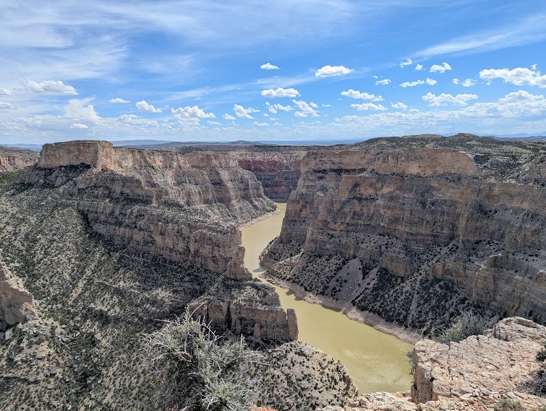
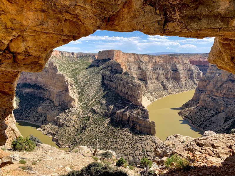
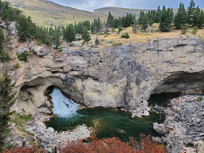
The Devil Canyon Overlook is the jaw-dropping centerpiece of Bighorn Canyon — a railed viewpoint perched on the rim where the Bighorn River and its tributary have sliced a chasm roughly 1,000 feet deep through banded gray, red, and buff rock laid down over hundreds of millions of years. Far below, the turquoise water of Bighorn Lake threads the bottom of the gorge, and swallows and raptors ride the updrafts along the sheer walls; watch for wild horses grazing the sagebrush flats along the approach road. Short interpretive paths trace the rim, and the sheer scale and color of the canyon make this one of the great overlooks of the Northern Plains. Hold onto children and hats — the drop is vertical and the wind constant.
Lovell offers the most convenient overnight for the south district, with a cluster of simple, reliable independent motels along the main highway close to the visitor center and tomorrow's route into the Pryors. It is a plain ranching town rather than a resort, but the rooms are clean and the location keeps morning drives short. Reserve ahead in summer, as options are limited. If you prefer to shift closer to the wild-horse range and canyon for the second night, tiny Fort Smith on the north end of the recreation area has a handful of fishing lodges catering to Bighorn River anglers.
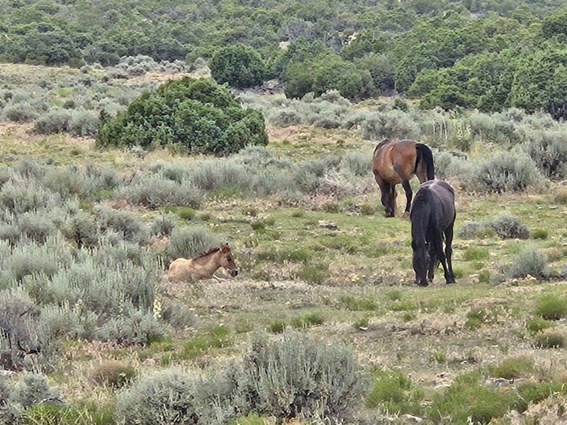
The Pryor Mountain Wild Horse Range, established in 1968 as the nation's first federally protected refuge for wild horses, shelters a genetically distinct herd of mustangs descended from Spanish colonial horses — many bearing the primitive dun coloring, dorsal stripes, and zebra-like leg bars of their ancient bloodline. Roughly 38,000 acres of sagebrush flats, juniper benches, and limestone canyons climb from the desert floor toward the mountains, and bands of horses can often be spotted grazing and sparring along the lower range, especially in the cooler morning hours. Move slowly, keep a respectful distance, and never approach or feed the animals — they are genuinely wild. Watch too for bighorn sheep on the crags. This is remote, roadless country, so carry water and check conditions before venturing far.
There are no restaurants out in the wild-horse country, so the day's meal is a packed picnic carried from Lovell and eaten in the immense silence of the range — a fitting way to experience this roadless landscape. Spread lunch at a pullout along the Bad Pass Road with the sagebrush plateau rolling away and the Pryors rising behind, watching for horse bands and raptors while you eat. Carry plenty of water and pack out everything; there are no trash or water services anywhere in the range. The solitude and scale of the country are the point here, and a simple trailside meal lets you soak them in.
The Bad Pass Trail is an ancient overland route that skirts the rugged, impassable stretch of Bighorn Canyon, used for thousands of years by Native peoples and later by nineteenth-century fur trappers to move along the river country when the canyon itself blocked the way. Rock cairns built by generations of travelers still mark portions of the old path across the sagebrush benches above the gorge. Walking a stretch of it on foot connects you to a deep human history layered over the wild-horse range, with the canyon rim and desert vistas as your companions and the chance of spotting mustangs along the way. The terrain is open, dry, and exposed, so carry water, wear a hat, and keep an eye on the weather as afternoon builds over this high desert country.
Return to Lovell for a second night's rest, with dinner at one of the town's cafes and an early evening to recover from the day in the high desert. Staying put keeps logistics simple and positions you for the drive north toward Chief Plenty Coups State Park in the morning. Alternatively, if you would rather break up tomorrow's route home, shift your base tonight toward the Fort Smith area on the north end of the recreation area, where fishing lodges serve anglers on the tailwater Bighorn River.
Day 3 — Chief Plenty Coups State Park & the Red Lodge Foothills, MT
Day 3 — Chief Plenty Coups State Park & the Red Lodge Foothills, MT
🚗 5 hr 30 min driving📍 3 stops
🌅
Morning
🚗
Drive
Lovell, WY → Chief Plenty Coups State Park, Pryor, MT
1 hr 30 min8:00 AM → 9:30 AM
Chief Plenty Coups State Park
★ 4.6
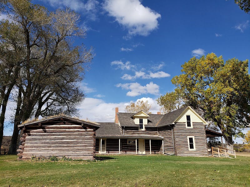
Chief Plenty Coups State Park preserves the home, farmstead, and sacred spring of Plenty Coups, the last great traditional chief of the Crow Nation, who chose alliance and adaptation to protect his people and willed his land to the public as a park and place of memory for all. The visitor center museum holds a moving collection of Crow artifacts and tells the story of his life and his famous prophetic vision, while short interpretive trails lead past his two-story log home, the trading post, and the cottonwood-shaded medicine spring still held sacred by the Crow. It is a quiet, deeply reflective place that adds essential human depth to a trip otherwise focused on canyons and wild country. Walk the grounds slowly and read the panels; the setting on Pryor Creek is peaceful and beautiful.
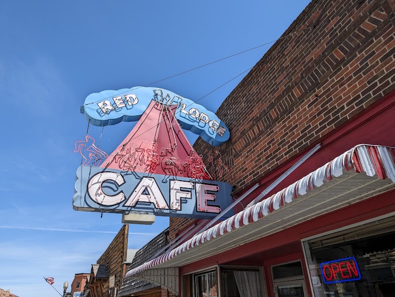
The historic mountain town of Red Lodge, tucked against the foothills where the plains meet the high country, has a lively main street full of good places to eat after the morning's history and drive. A classic Western cafe on Broadway serves hearty Montana fare — trout, steaks, big breakfasts, and burgers — in a warm, wood-paneled room that has fed travelers for generations. It is an ideal lunch before the final leg of foothill walking and the drive back to Bozeman. Browse the town's shops and galleries afterward, or pick up provisions for a picnic in the foothills if the weather is fine.
Red Lodge Foothills — Willow Creek & Nichols Creek Trails
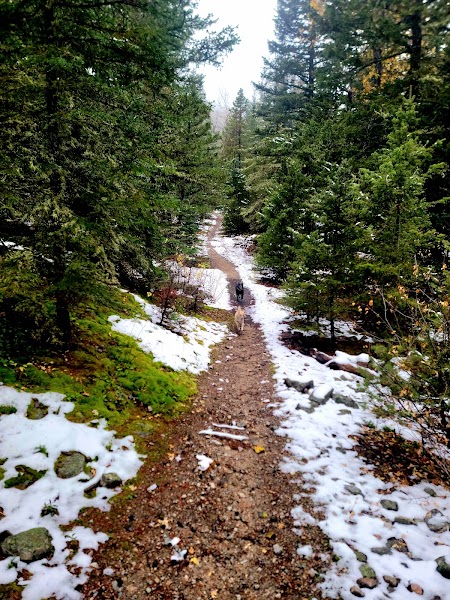
Above Red Lodge, a network of foothill trails climbs from the edge of town into the aspen-and-pine benchlands where the plains rise toward the mountains, offering accessible walks with wide views back over the valley. Routes like the Willow Creek and Nichols Creek paths wind through meadow and forest with modest elevation gain, ideal for a final afternoon stretch of the legs without committing to a big alpine climb. Wildflowers, songbirds, and grazing deer are common along the way, and the crisp foothill air makes a fitting close to three days in Montana's southeast canyon country. Carry water and bear spray, and keep an eye on the afternoon sky before starting the drive home.