← The Weekend Getaways
🥾 ActiveLong weekend · from Chattanooga, TN

Cherokee National Forest — The Hiwassee, the Cherohala Skyway & Bald River Falls

East of Chattanooga the Cherokee National Forest spreads across the Tennessee side of the southern Appalachians, a landscape of clear whitewater rivers, high mountain skyways, and thundering waterfalls. Three days trace it from river bottom to ridgeline and back. Day one settles at Reliance on the Hiwassee River, where the John Muir Trail hugs the water and outfitters run gentle floats through a forested gorge. Day two climbs the Cherohala Skyway, one of the great scenic mountain drives in the East, topping out above 5,000 feet before dropping to the cascades of Coker Creek. Day three explores Tellico Plains and the Tellico River road to Bald River Falls, a roadside 90-foot cataract, before the drive home. Nights are spent in the river hamlets of Reliance and the mountain gateway town of Tellico Plains.

Day 1 — The Hiwassee River at Reliance & the John Muir TrailDay 2 — The Cherohala Skyway & Coker Creek FallsDay 3 — Tellico Plains & Bald River Falls
Day 1Hiwassee River — Reliance, TN

Day 1Hiwassee River — Reliance, TN

🚗 1 hr 15 min driving📍 4 stops
🌅
Morning
🚗
Drive
Chattanooga, TNReliance, TN (Hiwassee River)
1 hr 15 min8:00 AM9:15 AM
John Muir Trail — Hiwassee River Section
4.8
The John Muir National Recreation Trail begins at the Childers Creek trailhead near Reliance and follows the Hiwassee River upstream through a forested gorge, hugging the water for its most scenic miles. The path is gentle and largely level along the river bottom, threading rhododendron thickets and passing rapids, quiet pools, and rocky beaches where you can sit and watch the anglers and paddlers pass. Spring wildflowers along this stretch are exceptional. It is an easy, beautiful first-morning leg — walk out as far as you like along the clear, cold river and turn back for lunch in the hamlet.
🍽️
Lunch
The Webb Bros. Store & Float Country
4.6
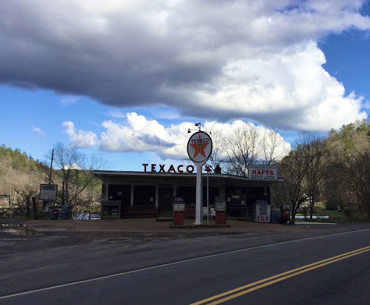
The historic Webb Bros. general store has anchored Reliance on the riverbank since 1936 and is the heart of this tiny river community — part outfitter, part deli, part local institution. Grab a sandwich, a cold drink, and river-float information at the counter, then eat at a picnic table overlooking the Hiwassee. The store rents rafts and funyaks and runs a shuttle for the gentle Class I–II float down the gorge, an easy and cooling way to see the river from the water. It is the natural midday hub for the day.
10:15 AM📍 See location
☀️
Afternoon
Hiwassee River Float
4.7
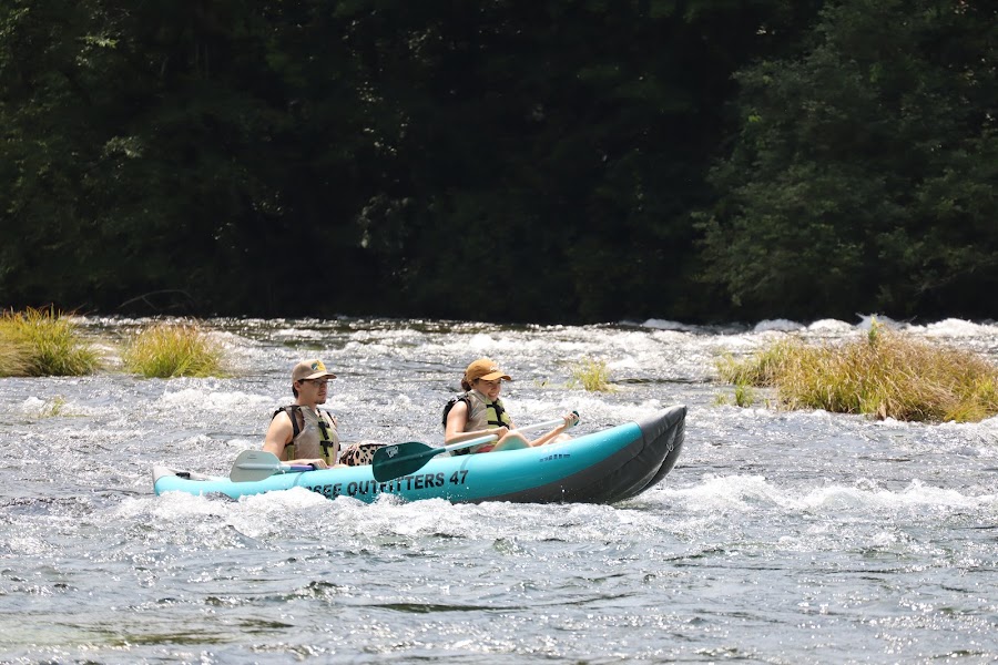
The afternoon is for the water: a gentle Class I–II float down the Hiwassee gorge, one of the most relaxed and scenic river trips in the Southeast. Fed by cold releases from Apalachia Dam, the river runs clear and lively over gravel bars and easy rapids through a steep, forested canyon closed to development, so the banks are wild the whole way. Outfitters in Reliance provide rafts or funyaks and the shuttle; the run is family-friendly and mellow, with plenty of calm stretches to drift and swim. It is the signature experience of the day and a fine counterpoint to the mountain miles ahead.
🌙
Evening
🛏️
Reliance riverside cabin or Tellico Plains lodging
Reliance and the surrounding Hiwassee valley have a scattering of riverside cabins and small lodges — booking one on the water is the ideal way to end a day on the river, with the sound of the Hiwassee outside the door. For more services, the mountain town of Tellico Plains, about forty minutes northeast at the foot of the Cherohala Skyway, has cabins, motels, and a few inns and positions you at the base of tomorrow's climb. Either makes a workable base for the first night.
Day 2The Cherohala Skyway & Coker Creek, TN
Day 2The Cherohala Skyway & Coker Creek, TN
🚗 40 min driving📍 5 stops
🌅
Morning
🚗
Drive
Reliance, TNCherohala Skyway (Tellico Plains gateway)
40 min8:00 AM8:40 AM
Cherohala Skyway — Overlooks & Ridge Trails
4.8
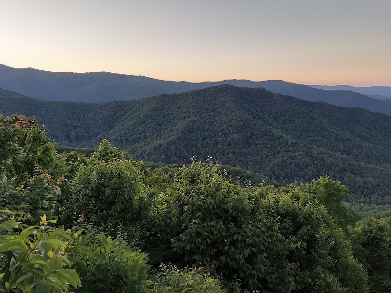
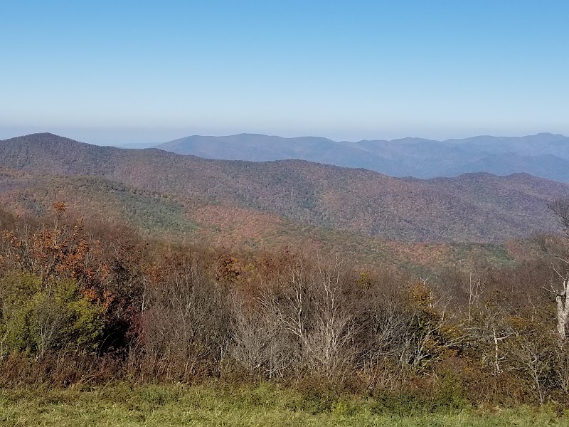
The Cherohala Skyway is one of the great scenic mountain drives of the eastern United States — a 43-mile National Scenic Byway that climbs from Tellico Plains over the crest of the Unicoi Mountains, topping out above 5,000 feet before descending into North Carolina. The road is strung with overlooks that open onto vast, layered ranges, and short trails at the high gaps lead to grassy balds and spruce forest that feel far more northern than their latitude. Stop at the high overlooks near Santeetlah and Huckleberry Knob, walk out to a summit vista, and take your time — the drive itself, sweeping and empty, is the point. Fog and cold can arrive fast at elevation, so carry a layer.
🍽️
Lunch
Huckleberry Knob Trail
4.9
Huckleberry Knob is the highest point on the Cherohala Skyway at 5,560 feet, and the trail to its summit is the finest short hike on the byway. A gentle 2.5-mile round trip on an old grassy roadbed climbs through high meadow and scattered forest to a broad, open bald where the views run unobstructed in every direction across the Unicoi and Nantahala ranges. The summit is a superb spot to spread a picnic in the high mountain air, with wildflowers in summer and long light in the afternoon. It is an easy, exhilarating leg that captures the whole character of the skyway country.
9:40 AM📍 See location
☀️
Afternoon
Coker Creek Falls
Coker Creek Falls
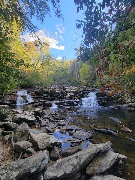
4.8
South of the skyway near the old gold-mining community of Coker Creek, the Coker Creek Falls trail follows the tumbling creek through a rugged hemlock gorge past a chain of cascades. The upper falls drop in a series of stepped chutes and slides, and the trail continues downstream past several more cascades for those wanting a longer walk. The footing is rocky and can be steep and slick near the water, so take care on the descents. It is a quiet, uncrowded waterfall stop and a satisfying way to close the mountain day before returning to Tellico Plains for the night.
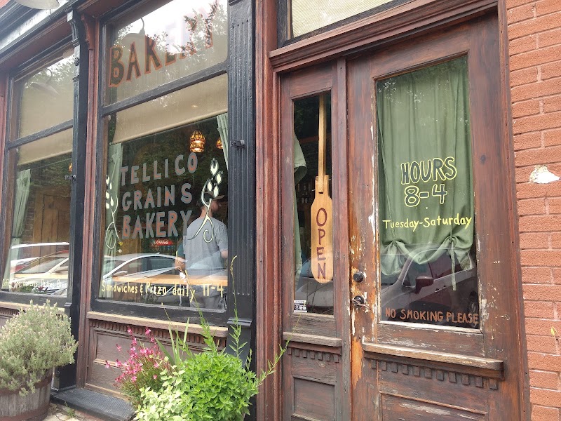
Tellico Grains Bakery, Tellico Plains
4.8
Back down in Tellico Plains, this beloved artisan bakery and café on the main street is the town's standout kitchen — wood-fired pizzas, hearty sandwiches on house-baked bread, and pastries that draw skyway travelers and locals alike. The warm, informal room is the natural spot for an early dinner after a day at elevation. It fills at peak hours in season, but the food is worth the wait and a great reward for the day's miles.
🌙
Evening
🛏️
Tellico Plains cabin or lodge
Tellico Plains is the gateway town for the Cherohala Skyway and the Tellico River, and it has a good range of cabins, riverside lodges, and small motels. Staying here a second night puts you within a short drive of tomorrow's run up the Tellico River road to Bald River Falls, letting you get an early, unhurried start. Cabins along the river or up in the hills give the quietest nights and the best mountain mornings.
Day 3Tellico River & Bald River Falls, TN

Day 3Tellico River & Bald River Falls, TN

🚗 1 hr 10 min driving📍 4 stops
🌅
Morning
🚗
Drive
Tellico Plains, TNBald River Falls (Tellico River Road)
25 min8:00 AM8:25 AM
Bald River Falls
Bald River Falls
4.9
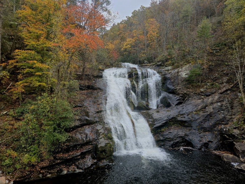
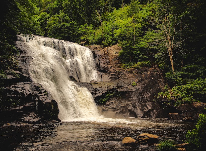
Bald River Falls is one of the most spectacular and accessible waterfalls in Tennessee — a roughly 90-foot cataract where the Bald River pours over tiered bedrock and crashes into the Tellico River, framed by an arched stone bridge that carries the road directly across its base. You can take in the full plunge from the bridge itself, then walk up the Bald River Trail alongside the cascade for closer views from the gorge above. The scenic Tellico River road that reaches it runs along a famous trout stream through deep forest, an attraction in its own right. Arrive early to beat the crowds at this popular roadside marvel.
🍽️
Lunch
Bald River Trail — Gorge Walk
For a closer, quieter look, the Bald River Trail climbs from the falls up into the gorge above, following the river past a succession of cascades, chutes, and clear pools that most roadside visitors never see. The path clings to the steep, rhododendron-clad slope with the whitewater churning below, and even a mile or two out delivers a genuine wilderness feel far from the crowded bridge. Trout anglers work the pools along the way. Turn back at a comfortable point and return to the falls, then continue along the Tellico River road for a riverside picnic.
9:25 AM📍 See location
🍽️ Lunch10:25 AM
Tellico Grains Bakery, Tellico Plains
Coming back off the river, the town's artisan bakery and café makes a fitting last real meal of the trip — wood-fired pizza, sandwiches on house-baked bread, and strong coffee in a warm, informal room on the main street. It is an easy, satisfying stop before the drive west, and a chance to pick up pastries for the road. A relaxed lunch here lets the morning's river miles settle before turning back toward Chattanooga.
4.8$$bakery📍 Maps →
2 options · tap to switch
☀️
Afternoon
Charleston & the Hiwassee Riverwalk
4.6
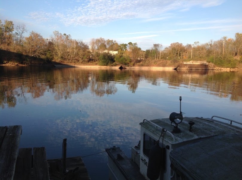
On the way home, a stop where the route crosses the lower Hiwassee near Charleston makes a gentle final leg. The riverside greenways and the wide, slow river here are a peaceful contrast to the mountain whitewater of the past two days, with herons working the shallows and open views across the water. It is a low-key place to stretch the legs and watch the river one last time before the last stretch of highway. From here it is under an hour back to Chattanooga.
🌙
Evening
🚗
Drive
Charleston, TNChattanooga, TN
45 min5:00 PM5:45 PM
Plan your own escapeExplore more trips →