← The Weekend Getaways
🥾 ActiveWeekend · from Colorado Springs, CO

Wet Mountain Valley — Bishop Castle, the Rainbow Trail & Dark Skies Beneath the Sangre de Cristos

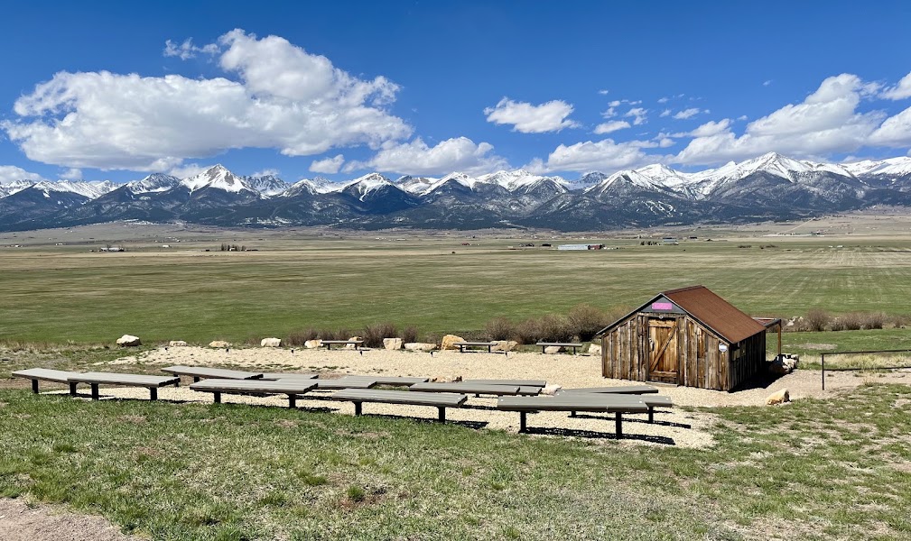
About two hours southwest of Colorado Springs the plains give way to the Wet Mountain Valley, a high, quiet ranching basin in Custer County pinned between two ranges — the rolling, forested Wet Mountains to the east and the abrupt, glacier-carved wall of the Sangre de Cristo Range to the west, where a dozen peaks top 14,000 feet in an unbroken line. Day one climbs into the San Isabel National Forest for the most improbable landmark in Colorado, Bishop Castle, a 160-foot hand-built stone fortress raised single-handedly over more than half a century, then walks the cool spruce-fir forest of the Wet Mountains before dropping into the twin frontier towns of Westcliffe and Silver Cliff for dinner and the night. Day two is spent at the foot of the Sangre de Cristos on the Rainbow Trail, the hundred-mile path that traces the entire base of the range, with side roads climbing toward Hermit Pass and Music Pass for crest-line views straight up into the wilderness. Westcliffe and Silver Cliff together form one of the world's few certified International Dark Sky Communities, so the day closes with genuinely dark, star-choked skies before the drive back over the Wet Mountains to Colorado Springs.

Day 1 — Bishop Castle & the Wet MountainsDay 2 — The Rainbow Trail & Sangre de Cristo Dark Skies
Day 1Westcliffe & the Wet Mountains, CO

Day 1Westcliffe & the Wet Mountains, CO

🚗 1 hr 45 min driving📍 6 stops
🌅
Morning
🚗
Drive
Colorado Springs, COBishop Castle, San Isabel National Forest
1 hr 45 min8:00 AM9:45 AM
Bishop Castle
Bishop Castle
4.7
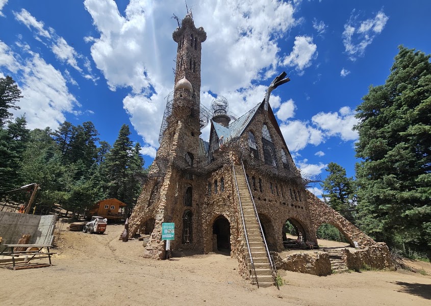
Rising out of the pines along Highway 165 in the San Isabel National Forest above Rye, Bishop Castle is one of the strangest and most affecting sights in Colorado — a 160-foot hand-built stone-and-iron fortress that Jim Bishop raised almost entirely by himself, one rock at a time, from 1969 until his death, hauling and setting every stone with no crew and no blueprint. Soaring towers, arched stone bridges, grated steel catwalks and an iron fire-breathing dragon's head made from old hospital trays make it feel like a medieval castle grown wild in the woods. The stairs and towers are steep, exposed and famously unregulated — climb the spiral tower staircases at your own pace and hold the rails, because the higher walkways sway and the drop-offs are real. Admission is free and the site is open daylight hours; it sits about 45 minutes east of Westcliffe over the Wet Mountains, an easy detour on the way into the valley. Give yourself a full hour to climb, and go slowly on the upper catwalks with children.
🍽️
Lunch
Lake Isabel & the St. Charles Trail, San Isabel National Forest
4.6
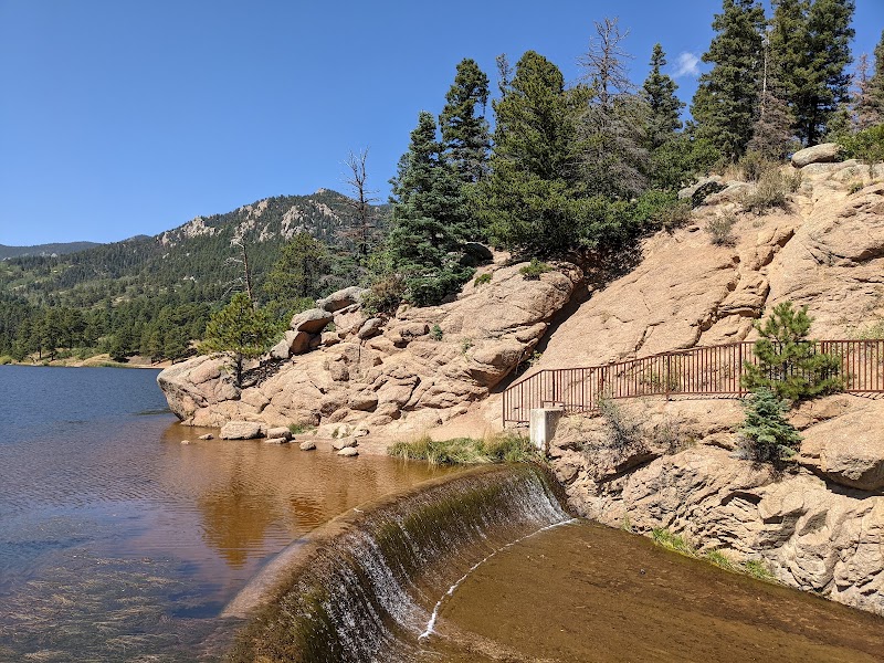
A few miles down Highway 165 from Bishop Castle, Lake Isabel is the green heart of the Wet Mountains — a small forest-service reservoir ringed by ponderosa and Douglas fir with an easy paved loop around the water and quiet picnic sites at the shore. For a real leg-stretch, the St. Charles Trail and the connecting forest paths climb from the lake into the cool spruce-fir uplands, a shaded, well-graded introduction to the range before the higher country of day two. This is the classic Wet Mountains contrast to the Sangre de Cristos across the valley: rounded, forested and gentle rather than jagged and alpine. Watch for wild turkey and mule deer in the timber, and note that afternoon thunderstorms build fast over these hills in summer — plan to be off the higher trail sections by early afternoon.
Picnic at Lake Isabel
4.7
There is no restaurant at Lake Isabel and few services on the forest highway between Bishop Castle and Westcliffe, so a packed lunch is the practical and pleasant choice for midday. The lakeside picnic area has shaded tables right at the water with the Wet Mountains rising behind — an ideal spot to eat before the drive down into the Wet Mountain Valley. Stock up on sandwiches, snacks and plenty of water before leaving Colorado Springs, since the nearest reliable groceries are back in Westcliffe.
11:45 AM📍 See location
☀️
Afternoon
Downtown Westcliffe & Silver Cliff
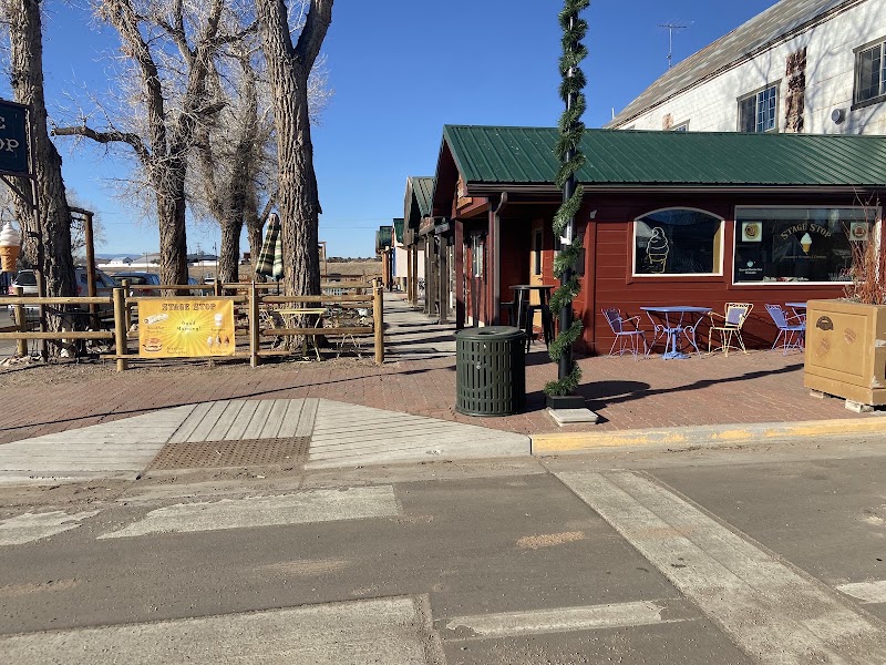
The twin towns of Westcliffe and Silver Cliff sit side by side at nearly 7,900 feet on Main Street, remnants of an 1870s–80s silver boom that once made Silver Cliff one of the largest towns in Colorado before the mines played out. Today it is a compact, walkable ranching community with a restored 1901 schoolhouse, the historic Silver Cliff town hall and fire station, a handful of galleries, outfitters and cafes, and one of the finest uninterrupted views of a Colorado fourteener range from any town's main street — the whole Sangre de Cristo crest fills the western sky. Spend the late afternoon wandering the two blocks of shops, picking up trail information and dark-sky details at the local businesses, and letting the light warm the peaks. This is your resupply point: gas, groceries and last-minute gear are all here and essentially nowhere else nearby.
🌙
Evening
🍽️ Dinner5:00 PM
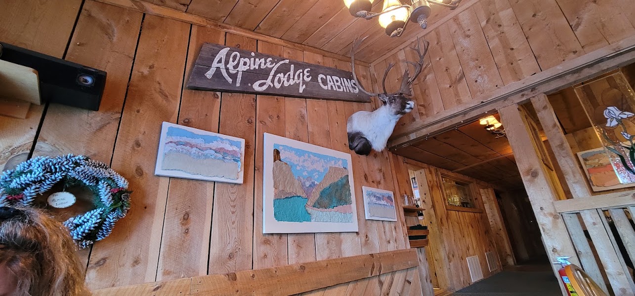
The Alpine Lodge & Restaurant
A longtime Wet Mountain Valley institution just west of Westcliffe on the road toward the mountains, The Alpine Lodge serves hearty, unpretentious mountain fare — steaks, trout, burgers and big breakfasts — in a rustic log dining room with the Sangre de Cristos framed in the windows. It is the natural dinner stop after a day on the forest trails, popular with locals and hikers alike, so arrive early or expect a short wait on summer weekends. If you would rather stay in town, Westcliffe's small Main Street has a couple of casual cafes and a pub as alternatives. Fuel up well tonight — tomorrow's Rainbow Trail miles and thin high-country air both reward a solid meal.
4.5$$restaurant📍 Maps →
2 options · tap to switch
🛏️
Overnight in Westcliffe
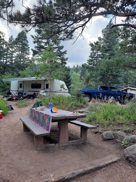
Westcliffe and Silver Cliff offer a small but characterful range of places to stay right in the heart of the valley — historic-town inns and B&Bs, a couple of simple motels, and cabins and guest ranches scattered along the roads toward the Sangre de Cristos. Book directly in town to be steps from Main Street's restaurants and minutes from the Rainbow Trail access roads. Because this is a certified Dark Sky Community with almost no light pollution, any lodging here puts a spectacular night sky right outside the door, so ask for a place away from the few streetlights and step out after dark. Options are limited and fill quickly in summer and during festival weekends, so reserve well ahead; the towns of Cañon City and Colorado Springs are the fallback but undo the point of an overnight in the valley.
Day 2Rainbow Trail & the Sangre de Cristos, CO
Day 2Rainbow Trail & the Sangre de Cristos, CO
🚗 2 hr 20 min driving📍 4 stops
🌅
Morning
🚗
Drive
Westcliffe, CORainbow Trail — Music Pass / Hermit Pass access
20 min8:00 AM8:20 AM
The Rainbow Trail
The Rainbow Trail
4.8
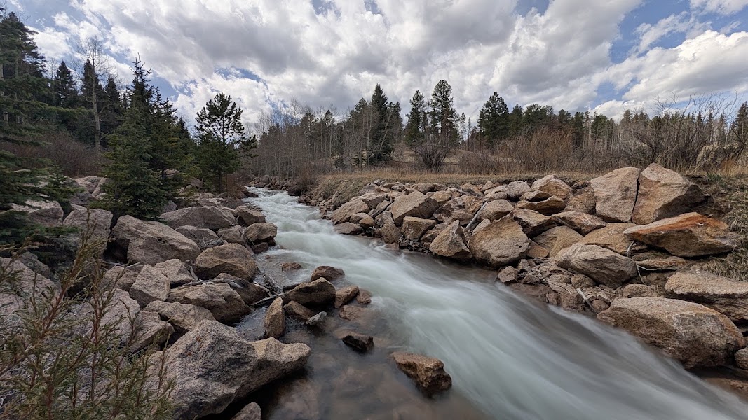
The Rainbow Trail is one of Colorado's great long-distance paths — roughly 100 miles of tread running the entire eastern base of the Sangre de Cristo Range, from Salida south past Westcliffe, threading through aspen groves, ponderosa parks and creek crossings just below the abrupt rise of the wilderness peaks. From the access roads west of Westcliffe you can pick up the trail for an out-and-back of any length, following the contour beneath the crest with the fourteeners of the Sangre de Cristo Wilderness towering directly above and the Wet Mountain Valley opening out below. Early morning is the time to walk it: the air is cool, the light rakes across the peaks, and you are back below timberline before the reliable afternoon storms. Numerous side trails climb steeply west from the Rainbow Trail toward alpine lakes and passes, so you can turn a gentle valley-base stroll into a serious climb simply by turning uphill.
🍽️
Lunch
Hermit Pass Road & Sangre de Cristo Overlooks
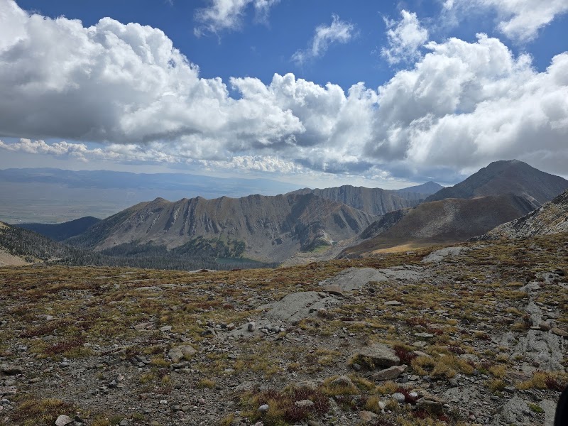
Two rough mountain roads climb straight into the Sangre de Cristo crest from the Westcliffe side and offer the day's best high views. Hermit Pass Road grinds up past Middle Taylor Creek toward Horseshoe and Hermit lakes and, for high-clearance vehicles, on to 13,000-foot Hermit Pass itself, one of the highest drivable passes in the state, with the whole valley spread out to the east. To the south, the Music Pass road ends at a trailhead from which a steep hike crosses into the wild Sand Creek basin with the jagged Crestone peaks overhead. Even a short way up either road delivers dramatic overlooks straight up into the wilderness — but both are rocky, narrow and often snow-choked into early summer, so check conditions in Westcliffe, carry water, and turn around at any point that outmatches your vehicle or the weather. Pack a lunch to eat at an overlook; there are no services beyond town.
9:20 AM📍 See location
☀️
Afternoon
🍽️ Lunch12:00 PM
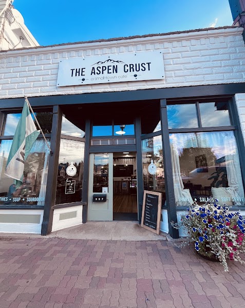
Lunch & Rest in Westcliffe
Back down in the valley, Westcliffe's Main Street cafes and pub are the place to refuel after a morning at altitude — soups, sandwiches, burgers and coffee in a laid-back small-town setting with the Sangre de Cristos still filling the western view. Take the afternoon slowly: browse the galleries, resupply on water and snacks, and let the legs recover before the evening's stargazing and the drive home. If the weather has held, this is also a fine time for a short, flat spin on the valley-floor stretches of the Rainbow Trail or the town's open-space paths, staying low while afternoon storms pass over the peaks.
4.7$$restaurant📍 Maps →
2 options · tap to switch
🌙
Evening
Dark Sky Stargazing — Westcliffe & Silver Cliff
4.8
Westcliffe and Silver Cliff are together certified as an International Dark Sky Community — one of only a handful in the world and among the first in the United States — thanks to their remote high-valley location, dry mountain air and hard-won dark-sky lighting ordinances. On a clear, moonless night the Milky Way arches from horizon to horizon over the black silhouette of the Sangre de Cristos, and the local community observatory near the schoolhouse hosts public star parties in the warmer months. Give your eyes twenty minutes to adjust, keep white lights off, and simply look up — from open ground just outside the towns the sky here is as dark and star-crowded as almost anywhere in the Lower 48. This is the trip's fitting finale before the drive back over the Wet Mountains; if you can, linger past full dark before pointing the car east.
🚗
Drive
Westcliffe, COColorado Springs, CO
2 hr6:00 PM8:00 PM
Plan your own escapeExplore more trips →