Great Sand Dunes — North America's Tallest Dunes, Alpine Trails & the San Luis Valley Floor
Three days in the high, arid heart of the San Luis Valley, where the tallest sand dunes in North America pile nearly 750 feet against the abrupt wall of the Sangre de Cristo Mountains. Day one is the dunefield itself — a lung-burning barefoot climb up High Dune and the far-off Star Dune, and, in late spring, a wade in Medano Creek, the seasonal stream that runs in surging pulses along the dunes' western base. Day two trades sand for forest and stone, ascending the Mosca Pass Trail up a cottonwood-and-aspen drainage into the Sangre de Cristos, then dropping south to Zapata Falls, a 25-foot cascade hidden inside a narrow rock cleft. Day three works the valley floor itself — the wetlands and lakes of the San Luis State Wildlife Area, alive with migrating birds beneath the dunes and peaks, and a final walk in the Sangre de Cristo foothills before the drive north back to Colorado Springs. Nights are spent in the farming towns of Mosca and Alamosa on the valley floor, at 7,500 feet under some of the darkest skies in the Lower 48.
Day 1 — The Great Sand Dunes dunefield & Medano CreekDay 2 — Mosca Pass Trail & Zapata FallsDay 3 — San Luis Lakes & the Sangre de Cristo foothills
Day 1 — Great Sand Dunes National Park & Preserve, CO
Day 1 — Great Sand Dunes National Park & Preserve, CO
🚗 2 hr 30 min driving📍 7 stops
🌅
Morning
🚗
Drive
Colorado Springs, CO → Great Sand Dunes Visitor Center
2 hr 30 min8:00 AM → 10:30 AM
Great Sand Dunes Visitor Center
★ 4.7
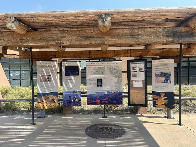
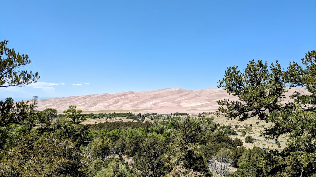
The park visitor center is the essential first stop, set at 8,200 feet with the full sweep of the 30-square-mile dunefield rising straight ahead against the Sangre de Cristo peaks. Rangers post the day's Medano Creek flow level — the seasonal stream that runs strongest from late May into early June — plus wind, surface-sand temperature, and afternoon thunderstorm forecasts, all of which shape how you tackle the dunes. Exhibits explain the improbable geology: sand blown for millennia off the valley floor, trapped against the mountains, and recycled by two creeks into the tallest dune system on the continent. Fill water bottles and check sand-temperature warnings here; on summer afternoons the surface can exceed 150°F, so an early climb is strongly advised.
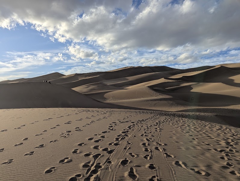
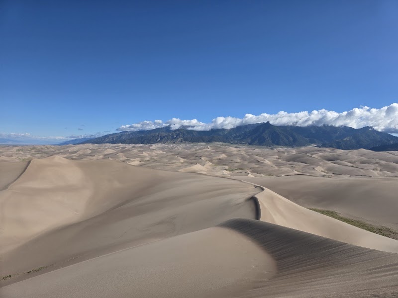
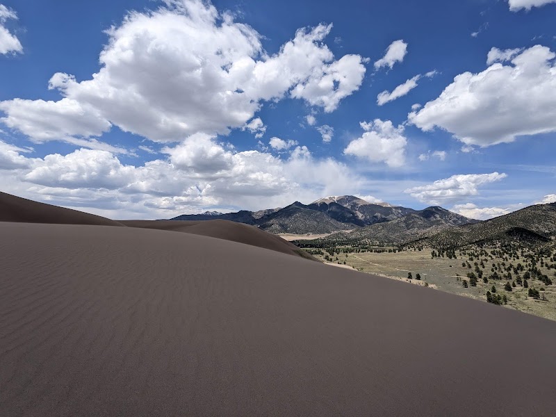
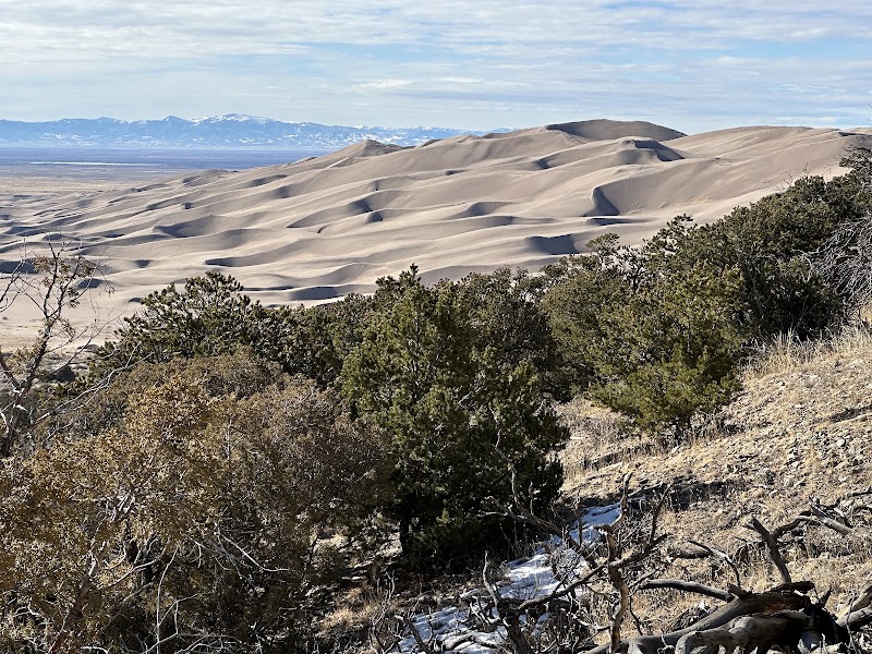
High Dune, at roughly 693 feet above the valley floor, is the most-climbed summit in the dunefield and the classic first ascent — the high point visible on the skyline from the main parking area. There is no trail; you simply choose a ridgeline and follow the crests, since walking the firm spine of a dune is far easier than sinking into the loose faces. The round trip is only about 2.5 miles but climbs through soft sand at 8,000-plus feet, so it feels much longer — plan on two to three hours and carry more water than seems necessary. From the top the entire dunefield ripples away toward the abrupt granite wall of the Sangre de Cristos, and Star Dune is visible to the southwest. Go barefoot on cool morning sand or wear closed shoes once the surface heats up.
Star Dune, rising about 741 feet from base to crest, is tied with the remote Hidden Dune as the tallest dune in North America — a pyramid deep in the interior of the dunefield that far fewer visitors reach than nearby High Dune. Getting there is a committing off-trail effort — most parties follow the bed of Medano Creek to approach from the southwest, a route of roughly 6 to 8 miles round trip depending on line, with continuous soft-sand climbing near the top. There is no shade, no water, and no marked path anywhere in the dunes, so this is a strong-hiker objective best begun at dawn in warm months. The reward is genuine solitude and a summit panorama over the whole rippled sea of sand. If time or energy is short, treat Star Dune as a distant view from High Dune rather than a same-day climb.
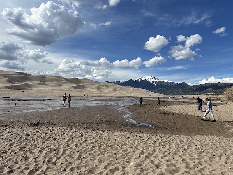
Medano Creek is the seasonal stream that flows along the eastern base of the dunes, fed by snowmelt off the Sangre de Cristos and running most reliably from late May through mid-June before it dwindles to damp sand by midsummer. Its signature is 'surge flow' — buried sand ridges on the streambed collapse and release in rhythmic pulses, sending shallow waves rolling down the wide, beach-like channel, a phenomenon found in only a handful of places on Earth. When it runs, the creek turns the dunes' base into a warm-water play area: families wade, build sand, and float, all beneath the towering dunes and peaks. After a hot climb it is the perfect cool-down; check the park's current flow level, as the timing shifts every year with the snowpack.
For a gentler counterpoint to the dune climb, the short Montville Nature Trail loops half a mile through a shaded pinyon-and-cottonwood pocket near the site of a vanished 1870s settlement, following a small spring-fed stream at the mountain's edge. From its junction the Mosca Pass Trail's lower reaches climb quickly to the Dunes Overlook, a viewpoint that frames the entire dunefield against the valley floor with the San Juan Mountains on the far western horizon. It is an easy, cooling late-afternoon walk with excellent low-angle light on the sand. This spur also serves as a scouting look at tomorrow's Mosca Pass ascent, which begins from the same trailhead area.
In downtown Alamosa, a 40-minute drive southwest of the dunes, the San Luis Valley Brewing Company occupies a restored 1908 bank building and is the valley's most dependable sit-down dinner after a long day on the sand. The kitchen leans on regional produce — the valley is famous for its potatoes — with hearty burgers, green-chile dishes, and house-brewed ales at 7,500 feet. It is a relaxed, welcoming place to refuel and rehydrate before the overnight. Alamosa is the largest town in the valley and the natural evening hub for supplies, fuel, and food.
The farming hamlet of Mosca, on the valley floor between Alamosa and the dunes, has the closest lodging to the park — a scattering of small inns and the Great Sand Dunes Oasis just outside the entrance. For more choice, Alamosa (about 35 minutes southwest) offers the valley's fullest range of chain hotels, motels, and restaurants. Staying on the valley floor keeps you positioned for an early return to the Mosca Pass trailhead in the morning and puts you under some of the darkest, most star-filled skies in the Lower 48 — the park is a certified International Dark Sky area, so step outside after dinner and look up.
Day 2 — Mosca Pass & Zapata Falls, CO
Day 2 — Mosca Pass & Zapata Falls, CO
🚗 40 min driving📍 6 stops
🌅
Morning
🚗
Drive
Mosca / Alamosa, CO → Mosca Pass Trailhead, Great Sand Dunes
40 min8:00 AM → 8:40 AM
Mosca Pass Trail
★ 4.5
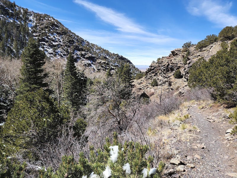
The Mosca Pass Trail is the park's premier forest hike, climbing about 3.5 miles one way from the Montville trailhead near the dunes up Mosca Creek to Mosca Pass at 9,745 feet on the crest of the Sangre de Cristos. It gains roughly 1,500 feet through a shaded drainage of cottonwood, aspen, and Douglas-fir, crossing and recrossing the creek and following the route of a historic wagon and toll road that once linked the San Luis Valley to the Wet Mountain Valley beyond. The contrast with yesterday's open sand is total — this is cool, green, birdsong-filled mountain forest, brilliant with aspen gold in late September. Turn around at the pass or anywhere along the way; the lower two miles alone deliver the drainage's best scenery, and afternoon thunderstorms make an early start wise.
Below the Mosca Pass trailhead, the shaded picnic ground along Mosca Creek makes an ideal midday base after the morning climb, with tables tucked among cottonwoods beside the running water. It is a cool, quiet spot to spread out a packed lunch before driving south to Zapata Falls, with the dunes and the valley opening up just beyond the trees. Bring your own food — there is no service inside the park — and refill water at the nearby visitor center. Watch for mule deer and wild turkeys that frequent the creekside cottonwoods.
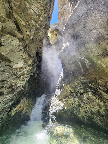
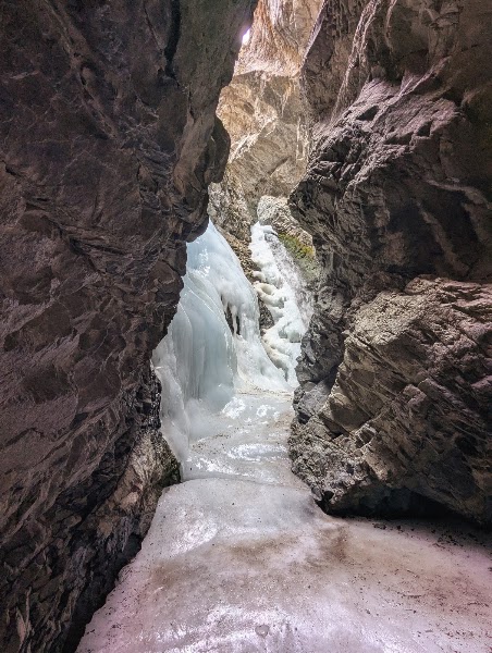
Zapata Falls hides a few miles south of the park boundary on BLM land, a 25-foot cascade concealed inside a narrow slot in the rock so that you must wade up the shallow, ankle-numbing creek and squeeze between the cleft walls to see it. The trailhead sits at about 9,000 feet at the end of a rough 3.5-mile gravel road, and the walk in is a half-mile each way on a rocky path with sweeping views back across the valley to the dunes. Inside the cleft the falls thunder in a cool, echoing grotto — spray-slick rock demands care, and in winter the whole thing freezes into a climbers' ice column. The overlook by the parking area alone offers one of the finest panoramas of the entire dunefield framed against the San Juans.
From the same trailhead, the South Zapata Creek Trail climbs west into the Sangre de Cristo Wilderness for those with energy left in the afternoon, threading aspen and spruce toward South Zapata Lake far above. Even a short out-and-back on its lower reaches earns quiet forest and rushing water away from the falls crowds. Back at the overlook, the elevated vantage over the whole valley — dunes, wetlands, and the distant San Juan range — is the best big-picture view of the trip and superb in the low, warm light of late afternoon. Linger here before the short drive back down to the valley floor for the night.
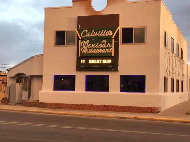
A long-running Alamosa institution, Calvillo's is known across the San Luis Valley for its generous buffet and made-from-scratch New Mexican and Mexican cooking — smothered burritos, green chile, and sopaipillas that hit the spot after two hard days at altitude. It is casual, family-run, and popular with locals, which is the surest recommendation in a small valley town. An easy, filling stop before settling in for the second night. Alamosa's grocery stores nearby are also the place to restock picnic supplies for tomorrow's day on the valley floor.
Stay a second night on the valley floor near Mosca or in Alamosa, keeping the same base for an easy morning at the San Luis Lakes to the north. Mosca's small inns put you closest to tomorrow's wildlife area, while Alamosa offers more dining and the fullest choice of rooms. The valley's dark skies are again the after-dinner reward — with no city glow for a hundred miles, the Milky Way arches clear over the dunes and the Sangre de Cristos. Turn in early to make the most of the cool morning bird activity at the lakes.
Day 3 — San Luis Lakes & Sangre de Cristo Foothills, CO
Day 3 — San Luis Lakes & Sangre de Cristo Foothills, CO
🚗 3 hr driving📍 3 stops
🌅
Morning
🚗
Drive
Mosca / Alamosa, CO → San Luis State Wildlife Area
30 min8:00 AM → 8:30 AM
San Luis Lakes
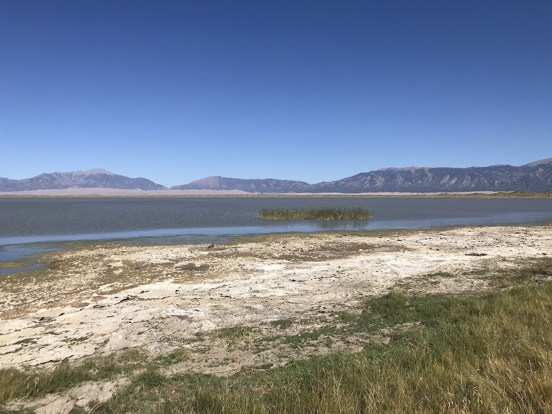
The San Luis Lakes lie on the open valley floor a few miles west of the dunes, a pair of shallow, wind-rippled lakes and surrounding wetlands within the San Luis State Wildlife Area that form one of the most surprising landscapes in this high desert — open water beneath the towering dunes and the snow-streaked Sangre de Cristos. Fed by the valley's shallow aquifer, the lakes and marshes are a magnet for migrating birds: avocets, ibis, herons, waterfowl, and, in spring and fall, sandhill cranes staging by the thousands across the valley. Flat, easy walking on the shore and dike paths makes this a gentle, restorative morning after two strenuous days, with the dunes reflected in the water at first light. Bring binoculars; note the wildlife area may close seasonally for nesting, so check current access.
The day-use area on the shore of San Luis Lakes is the natural midday stop, with picnic tables and open views across the water to the dunes and the wall of the Sangre de Cristos beyond. It is an exposed, wide-open spot — the valley wind is nearly constant — but the sweep of lake, dune, and mountain in a single frame is the trip's most expansive panorama. Spread out a packed lunch here and scan the shallows for shorebirds and waterfowl. There is no food service, so bring everything you need from Alamosa.
For a final walk before the drive north, return toward the park and take a stretch of the Sand Ramp Trail, which runs along the transition zone where the dunes meet the Sangre de Cristo foothills — the 'sand ramp' of grass-anchored dunes climbing toward the mountain front. The path threads pinyon, juniper, and rabbitbrush with the full dunefield spread out below and the peaks rising close above, an easy-to-moderate grade you can turn around on whenever you like. It is the trip's best vantage on how sand, valley, and mountain interlock, and a quiet, uncrowded contrast to the busy main dunes. Watch for pronghorn on the flats and elk in the foothill draws in the softening late-afternoon light before heading back to Colorado Springs.