Rocky Mountain National Park — Bear Lake, Trail Ridge Road & the Wild Basin
Three days on the highest ground in the Colorado Rockies, based in the gateway town of Estes Park at the eastern threshold of Rocky Mountain National Park. Day one works the Bear Lake corridor, the park's alpine heart, climbing past a chain of glacier-carved lakes — Nymph, Dream, and Emerald — beneath the sheer walls of the Continental Divide. Day two drives Trail Ridge Road, the highest continuous paved road in the United States, cresting above 12,000 feet into the fragile alpine tundra of the Alpine Visitor Center and the Tundra Communities Trail. Day three drops south into the quiet Wild Basin to walk the Ouzel Falls and Calypso Cascades trail before an easy loop around Lily Lake and the drive home. Two practical notes shape any trip here: Trail Ridge Road is CLOSED in winter (typically late October through late May, when the alpine section is buried in snow), and in summer the park requires TIMED-ENTRY PERMITS reserved in advance for both the Bear Lake corridor and general park entry — plan your day-one and day-two entry windows before you leave.
Day 1 — The Bear Lake Corridor & Emerald LakeDay 2 — Trail Ridge Road & the Alpine TundraDay 3 — Wild Basin, Ouzel Falls & Lily Lake
Day 1 — Estes Park & the Bear Lake Corridor, CO
Day 1 — Estes Park & the Bear Lake Corridor, CO
🚗 2 hr 45 min driving📍 5 stops
🌅
Morning
🚗
Drive
Colorado Springs, CO → Estes Park
2 hr 45 min8:00 AM → 10:45 AM
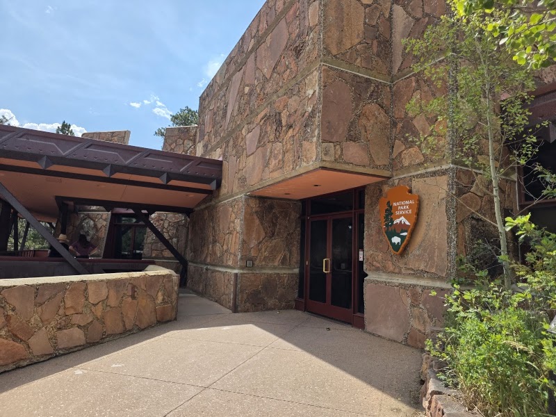
Beaver Meadows Visitor Center
★ 4.6
The main eastern gateway to Rocky Mountain National Park, this Frank Lloyd Wright-inspired visitor center on US 36 west of Estes Park is the logical first stop for orientation, maps, and current trail and weather conditions. Rangers here confirm the status of the day's timed-entry permits, which the park requires in summer for both general entry and the Bear Lake corridor — you must reserve your entry window in advance online, so arrive within your booked time. Pick up the shuttle schedule as well: parking at the Bear Lake trailheads fills before dawn in peak season, and the free park-and-ride shuttle from the Bear Lake Road corridor is often the smarter way in. The meadow behind the center is prime elk habitat, especially at dawn and dusk in the autumn rut.
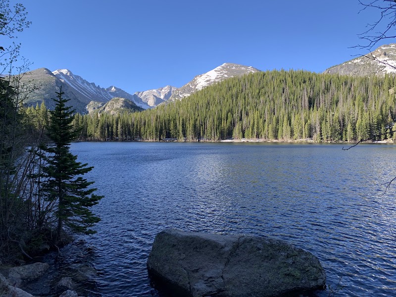
At 9,450 feet, Bear Lake is the storied hub of Rocky Mountain National Park's alpine hiking, a small glacial lake cradled directly beneath the towering wall of Hallett Peak and the Continental Divide. A gentle, mostly level 0.8-mile loop circles the shore, delivering ever-changing reflections of the surrounding summits in the still water — an easy, spectacular warm-up and the launch point for the day's bigger climb. The corridor is the busiest in the park; the timed-entry permit for Bear Lake Road is separate from the general park permit, and the parking lot at the trailhead fills earliest of anywhere in RMNP. Ride the free shuttle from the park-and-ride if you arrive after mid-morning.
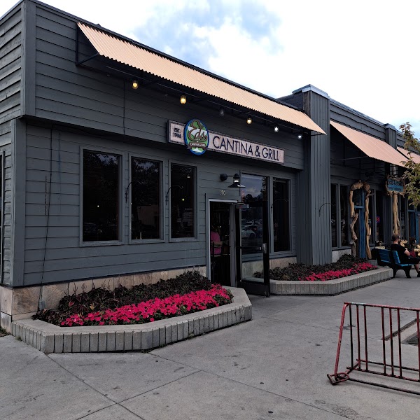
A longtime Estes Park favorite on the Big Thompson River in the heart of downtown, Ed's serves generous Colorado-Mexican plates, green-chile-smothered burritos, and cold local beer on a riverside patio. It's an easy, unpretentious spot to refuel between the morning drive and the afternoon climb, ten minutes from the park's Beaver Meadows entrance. Come hungry after altitude; the portions are large and the margaritas are a local institution. Expect a wait at peak lunch hours in summer.
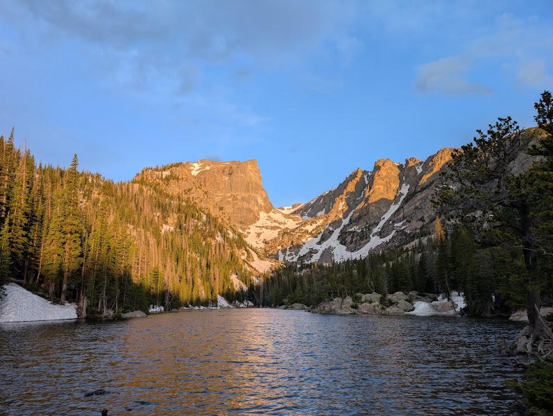
The signature hike of the Bear Lake corridor climbs a chain of three glacier-carved lakes in a single 3.6-mile round trip, gaining roughly 700 feet. Nymph Lake comes first, its surface blanketed in yellow pond lilies in summer; Dream Lake follows, a long, narrow tarn framed by the jagged spires of Hallett Peak and Flattop Mountain; and Emerald Lake is the finale, a startlingly green pool held in a rock cirque directly beneath the Continental Divide. The trail is one of the most rewarding moderate hikes in the American West, but you are working between 9,500 and 10,100 feet — pace yourself, carry water, and watch for fast-building afternoon thunderstorms, which are a serious lightning hazard above treeline in July and August. Turn around at Dream Lake if legs or weather run short; the payoff is already extraordinary.
Estes Park, the historic gateway town on the eastern edge of Rocky Mountain National Park in Larimer County, is the natural base for all three days of this trip. Riverside cabins and lodges line the Fall and Big Thompson Rivers, and the walkable downtown along Elkhorn Avenue is full of restaurants, taffy shops, and outfitters. Book directly in town to be minutes from the Beaver Meadows entrance for tomorrow's early Trail Ridge Road start. The grand Stanley Hotel above town — the inspiration for The Shining — is the landmark splurge; elk routinely wander the streets and golf course at dusk.
Day 2 — Trail Ridge Road & the Alpine Tundra, CO
Day 2 — Trail Ridge Road & the Alpine Tundra, CO
🚗 25 min driving📍 6 stops
🌅
Morning
🚗
Drive
Estes Park, CO → Trail Ridge Road / Rainbow Curve
25 min8:00 AM → 8:25 AM
Trail Ridge Road
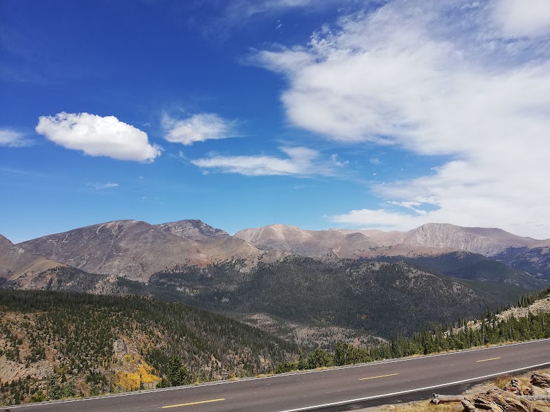
Trail Ridge Road is the highest continuous paved road in the United States, cresting at 12,183 feet as it carries US 34 across the spine of Rocky Mountain National Park from Estes Park to Grand Lake. Eleven miles of the route run above treeline through open alpine tundra, with pull-offs at Rainbow Curve, Many Parks Curve, and the Gore Range Overlook opening onto vast panoramas of the peaks and glacial valleys below. CRITICAL: the road is CLOSED in winter — typically from mid-to-late October until late May, when the alpine section is buried under deep snow — so this day only works from roughly Memorial Day through the first heavy snowfall. In summer a timed-entry permit for general park entry is required to drive the road; reserve your window in advance. Fill the tank and dress in layers: temperatures at the top run 20 to 30 degrees colder than in Estes Park, and afternoon lightning is a genuine danger up here.
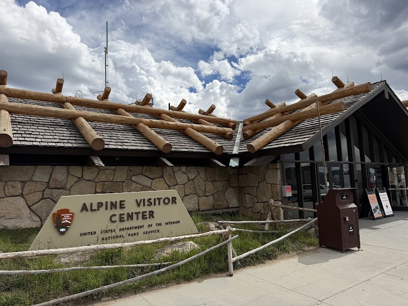
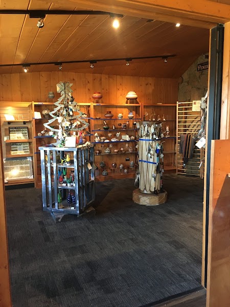
Perched at 11,796 feet at Fall River Pass, the Alpine Visitor Center is the highest facility of its kind in the National Park System, a windswept outpost surrounded by pure alpine tundra. Exhibits explain the fragile, slow-growing tundra ecosystem, where cushion plants may be centuries old and a single footprint off-trail can scar the ground for decades. A short but lung-searing stairway climbs the ridge behind the center to a sweeping overlook of the Never Summer Mountains and the headwaters of the Cache la Poudre. The center and its adjoining cafe and gift shop are open only in the warm months, closing along with Trail Ridge Road once winter snow arrives. Expect wind, thin air, and possible snow flurries even in July.
The Cafe at Trail Ridge, adjoining the Alpine Visitor Center, is the only food service at the top of the park and quite possibly the highest cafe you'll ever eat in, at nearly 11,800 feet. It's a simple counter-service operation — soups, sandwiches, chili, hot drinks, and grab-and-go items — but a bowl of something warm out of the alpine wind is worth the modest price. Like everything on the alpine section of Trail Ridge Road, it operates only during the summer season and shutters for the winter. A packed lunch eaten at a tundra pull-off is an excellent alternative if the line is long.
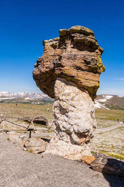
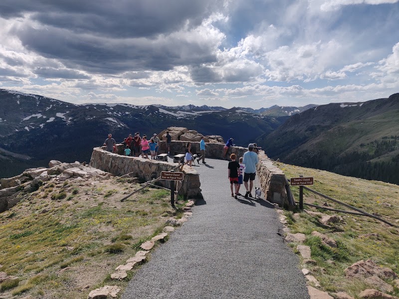
The Tundra Communities Trail is the finest short walk on the alpine tundra, a paved-then-gravel path that runs about a mile round trip from the Rock Cut pull-off at 12,110 feet out to a cluster of wind-sculpted rock formations known as the Mushroom Rocks. Interpretive signs identify the tiny alpine wildflowers — moss campion, alpine forget-me-not, sky pilot — that bloom in a brief summer flush across ground that spends most of the year under snow and wind. Stay strictly on the trail; the tundra is extraordinarily fragile and recovers from damage over decades, not seasons. Yellow-bellied marmots and pikas are common among the rocks, and the 360-degree view takes in the Never Summer Range, Longs Peak, and the Gore Range. Descend promptly if clouds build — there is no shelter from lightning above treeline.
A short paved path from the Trail Ridge Road pull-off leads to the Forest Canyon Overlook at roughly 11,700 feet, one of the most dramatic viewpoints in the park. From the railing the land drops away into Forest Canyon, a deep, glacier-gouged trench with the Big Thompson River far below and a horizon crowded with the sharp summits and hanging cirque lakes of the Gore Range and the Continental Divide. It's an easy, high-payoff stop on the return leg toward Estes Park — a last long look at the alpine country before the road switchbacks back down through the subalpine forest. Keep an eye on the weather and the clock, as afternoon storms roll in fast and the drive down is slow.
A second night back in Estes Park keeps you positioned for tomorrow's drive south to the Wild Basin. Downtown along Elkhorn Avenue is the place for an evening meal after a long day at altitude — brewpubs, steakhouses, and casual patios line the riverwalk beside the Big Thompson. Book the same lodging as the first night to avoid moving your bags, and take an evening stroll along the river path, where elk frequently graze at dusk. Turn in early; the Wild Basin trailhead parking fills fast on summer mornings.
Day 3 — Wild Basin & Lily Lake, CO
Day 3 — Wild Basin & Lily Lake, CO
🚗 3 hr 20 min driving📍 4 stops
🌅
Morning
🚗
Drive
Estes Park, CO → Wild Basin Trailhead
35 min8:00 AM → 8:35 AM
Ouzel Falls & Calypso Cascades Trail
★ 4.9
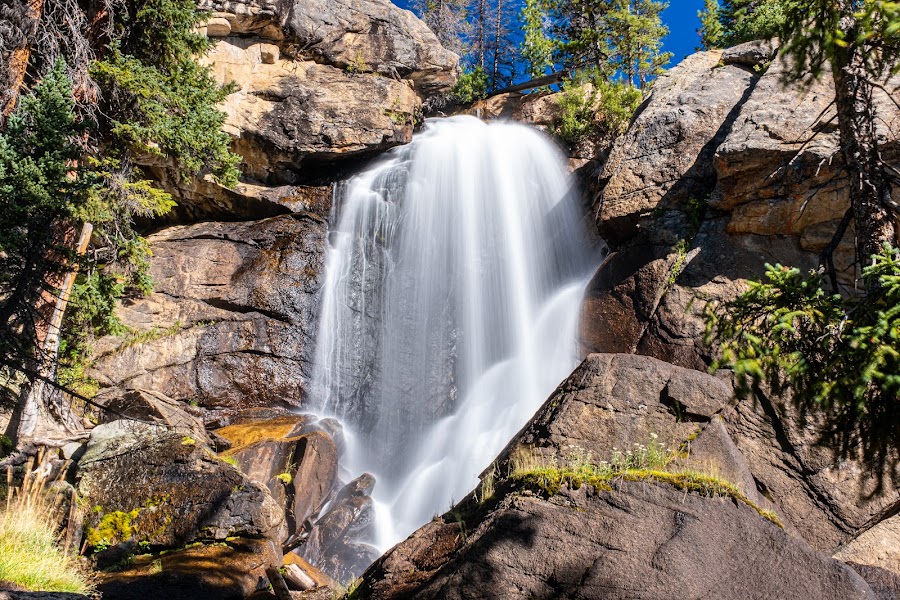
The Wild Basin, in the quiet southern corner of Rocky Mountain National Park, is the park's waterfall country and a far less crowded alternative to the Bear Lake corridor. From the Wild Basin trailhead the classic hike climbs along the North St. Vrain Creek past Copeland Falls, then up to Calypso Cascades — a long, tumbling staircase of whitewater named for the pink calypso orchids that bloom beside it in early summer — and on to Ouzel Falls, a powerful 40-foot plunge at about the 2.7-mile mark, roughly 5.4 miles round trip with 950 feet of gain. The route runs through dense subalpine forest still recovering from historic burns, with the North St. Vrain rushing alongside much of the way. The trailhead lot is small and fills early; the timed-entry permit still applies for general park entry in summer, so arrive within your window.
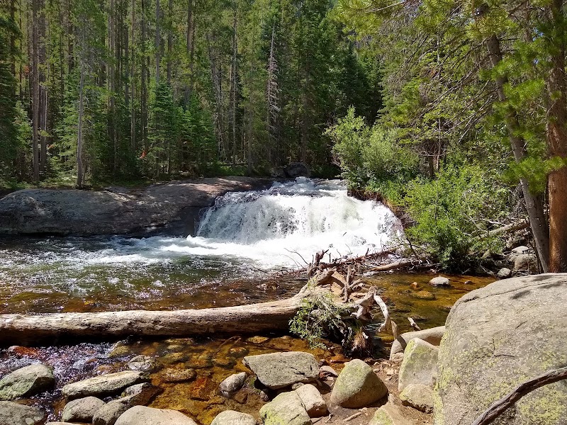
Just three-tenths of a mile up the Wild Basin trail, Copeland Falls is a pair of modest but pretty drops on the North St. Vrain Creek, with flat granite ledges and streamside logs that make an ideal lunch stop on the way back down from Ouzel Falls. Spreading a packed lunch here beside the rushing water is the natural midday move in the Wild Basin, where there are no restaurants or services inside this corner of the park. Eat, top off your water, and enjoy the cool creekside shade before the short walk out to the trailhead. Pack out everything you bring in.
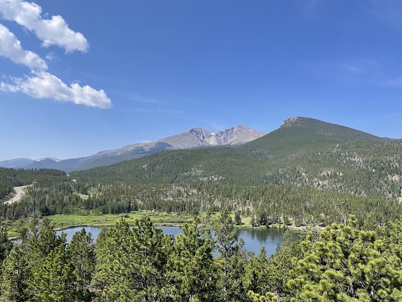
On the drive back toward Estes Park along Highway 7, Lily Lake offers a gentle, near-level 0.8-mile loop around a serene subalpine lake with a full-frontal view of the east face of Longs Peak, the park's only fourteener. The wide, mostly accessible gravel path makes it the easiest and most restorative walk of the three days — a fitting cool-down for legs that have climbed the Bear Lake chain and walked the alpine tundra. Benches along the shore, wildflower-thick meadows, and reliable trout-fishing make it a favorite for a slow final stroll. The Lily Lake area sits just outside the main fee gates, so no timed-entry permit is needed here — a relaxed, no-hassle finish before the long drive south.
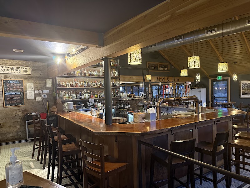
Named for two early Estes Park pioneers, Bird & Jim is one of the town's standout farm-to-table restaurants, serving elevated Colorado fare — elk, trout, bison, and seasonal vegetables — in a warm room with big windows toward the mountains on Elkhorn Avenue. It's the right place for a proper final meal before the drive back to Colorado Springs, a step up from the trailside picnics of the day. Reservations are wise in summer and on weekends. Fuel up well; the return drive is a little under three hours, mostly along the Front Range.