🥾 ActiveLong weekend · from Minneapolis, MN
Superior Hiking Trail 3-Day: Waterfalls, Bluffs & George Crosby Manitou
The Minnesota North Shore unfolds in three acts along Highway 61: Gooseberry Falls packs five named waterfalls into a single volcanic river corridor that meets Lake Superior at a cobblestone beach, while Tettegouche offers the state's tallest waterfall, a knife-edge basalt peninsula, and a summit panorama across the western basin of the world's largest freshwater lake. The circuit ends at George H. Crosby Manitou — the park that time and pavement forgot, a roadless wilderness of gorges, cascades, and backcountry campsites on the lakeshore that serious hikers consider the true payoff of the North Shore.
Day 1 — Gooseberry Falls, MNDay 2 — Tettegouche State Park, MNDay 3 — George H. Crosby Manitou & Grand Marais, MN
Day 1 — Gooseberry Falls, MN
Day 1 — Gooseberry Falls, MN
🚗 2 hr 30 min driving📍 6 stops
🌅
Morning
🚗
Drive
Minneapolis, MN → Gooseberry Falls State Park
2 hr 30 min
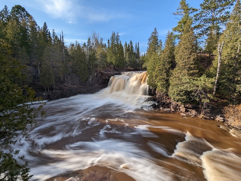
Gooseberry Falls — Five Falls Circuit
★ Reviews →The Gooseberry River drops through five named waterfalls before reaching Lake Superior — a concentration of cascades in a half-mile stretch that makes Gooseberry Falls State Park the most-visited park on the North Shore. Upper Falls (25 feet), Middle Falls (60 feet combined in two drops), Lower Falls (30 feet), and the more remote Fifth Falls (reached by a 2-mile round trip) all flow over 1.1-billion-year-old basalt bedrock formed during the Midcontinent Rift. The falls run at their most powerful in May during snowmelt, when the river runs dark with boreal tannins. The cobble beach below the lower falls is one of the finest Lake Superior stone beaches on the shore.
~1 hr📍 See location
🍽️
Lunch
🍽️ Lunch~1 hr
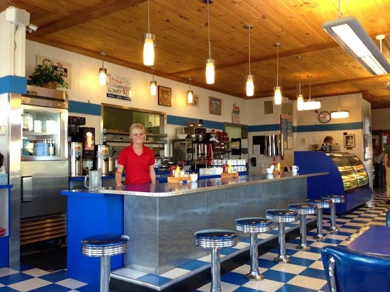
Betty's Pies — Two Harbors
The North Shore's most famous bakery and the mandatory fuel stop for hikers heading north — fresh-baked pies in flavors including Lake Superior blueberry, sour cream raisin, and five-layer chocolate. Operating since 1956 on Highway 61. The walleye sandwich serves as the savory option.
2 options · tap to switch
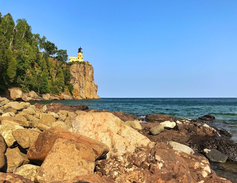
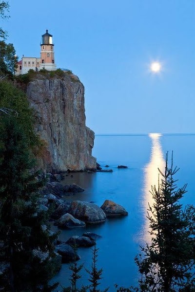
Split Rock Lighthouse
★ Reviews →The 1910 lighthouse on a 130-foot diabase cliff is the premier historic site on the North Shore — built after the Mataafa Storm of 1905 destroyed 29 ships in Lake Superior in a single week. The fog signal building, the keeper's dwellings, and the light tower are all restored and open for tours operated by the Minnesota Historical Society. The annual Edmund Fitzgerald memorial light on November 10 has been lit every year since the 1975 sinking of the 729-foot freighter with all 29 crew. The bluff view south down the North Shore toward Duluth is the most-photographed image in Minnesota.
~1.5 hrs📍 See location
☀️
Afternoon
Split Rock Lighthouse State Park — Gitchi-Gami Trail
★ Reviews →The Gitchi-Gami State Trail runs 86 miles along the Lake Superior shore from Two Harbors to Grand Marais — the most dramatic long-distance trail in Minnesota. The Split Rock segment follows the cobble beach between the lighthouse and the Beaver River, passing through birch forest and across basalt headlands. The trail offers both casual walkers and serious cyclists the same Lake Superior views without the highway traffic of Highway 61. Segments are paved for cycling, with natural-surface connections through the state park.
~1.5 hrs📍 See location
🌙
Evening
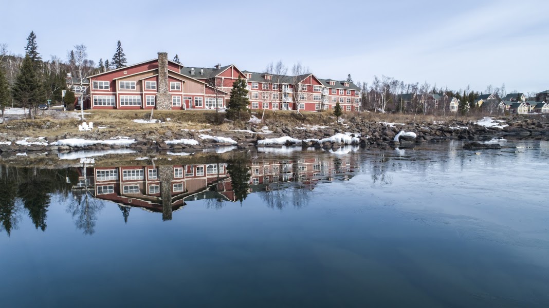
Cove Point Lodge Dining Room
★ Reviews →The dining room at Cove Point Lodge near Beaver Bay is the pre-eminent dinner option between Duluth and Tettegouche — Lake Superior walleye, wild rice, and broasted chicken in a log-and-stone dining room above the private lake. The sunset views west across Lake Superior from the lodge deck are exceptional.
🛏️
Cove Point Lodge
Classic North Shore resort on a private Lake Superior cove between Two Harbors and Tettegouche — individual cabin units and a main lodge building on a private cobble beach. The most immersive North Shore lodging experience at the midpoint of the three-day itinerary. Hiking trails from the property connect to the Gitchi-Gami trail network.
Day 2 — Tettegouche State Park, MN
Day 2 — Tettegouche State Park, MN
🚗 20 min driving📍 7 stops
🌅
Morning
🚗
Drive
Cove Point Lodge → Tettegouche State Park
20 min
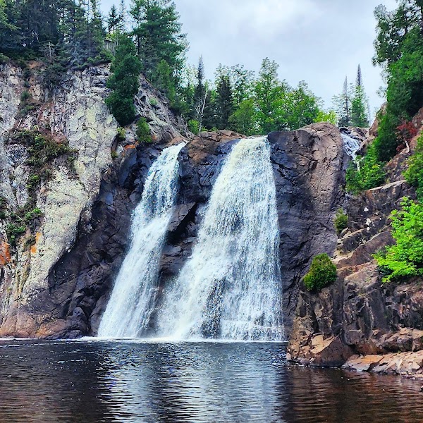
Tettegouche — High Falls of the Baptism River
★ Reviews →The Baptism River descends 60 feet over a basalt ledge in a narrow gorge at the back of Tettegouche State Park — the highest waterfall in Minnesota with both its banks within state borders. The falls are reached via a 1.5-mile trail from the visitor center that crosses the river gorge on a suspension bridge. At peak flow the falls fill the gorge with spray. The trail continues to the Upper Falls and the ridgeline above the river valley for additional elevation gain. The Baptism River gorge exposes 1.1-billion-year-old basalt in sheer walls 40 feet high.
~1.5 hrs📍 See location
🍽️
Lunch
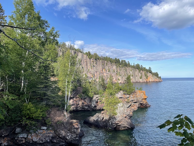
Shovel Point — Tettegouche
★ Reviews →The Shovel Point trail at Tettegouche is a 1.8-mile circuit on a basalt peninsula projecting into Lake Superior — the sides drop 70 feet directly to the lake. The trail winds through jack pine and birch growing from cracks in the basalt. The views from the peninsula's tip encompass open Lake Superior in three directions. The trail connects to the Palisade Valley trail, extending the hike to 5 miles with views of the 350-foot Palisade Head cliff to the north.
~1.5 hrs📍 See location
🍽️ Lunch~1 hr
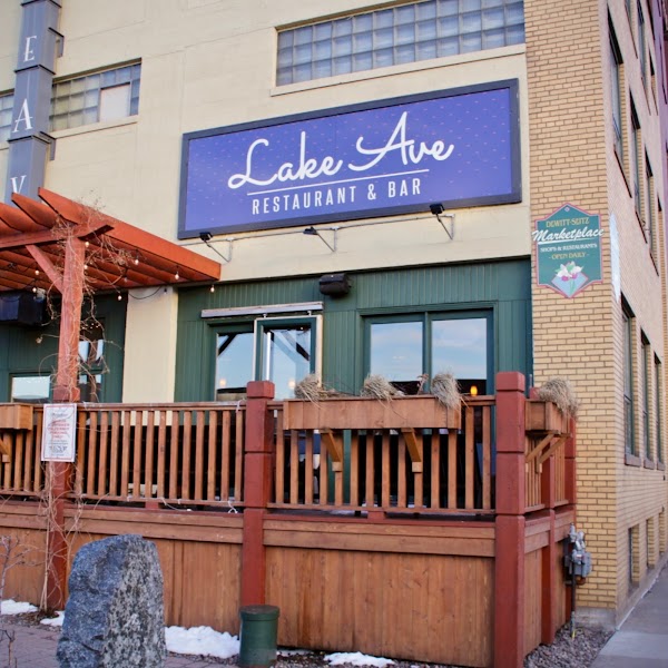
Lakeview Castle Restaurant
The stone-castle diner on Highway 61 between Beaver Bay and Silver Bay is a North Shore landmark — walleye, burgers, and homemade pies served in a quirky stone building that has confused and delighted drivers on Highway 61 for decades.
2 options · tap to switch
☀️
Afternoon
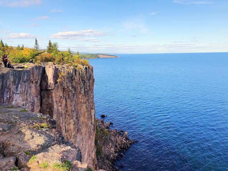
Palisade Head
★ Reviews →Palisade Head is a 350-foot rhyolite cliff rising directly from Lake Superior 15 miles northeast of Tettegouche — the most dramatic cliff face on the Minnesota shore. The road to the summit is narrow and the parking area tiny. The view from the top encompasses Shovel Point to the south, open Lake Superior to the east, and the Sawtooth Mountains rising inland to the north. Palisade Head is a technical rock climbing destination with multi-pitch routes ascending the full 350-foot wall. The cliff is one of only two rhyolite formations on the Minnesota North Shore.
~1.5 hrs📍 See location
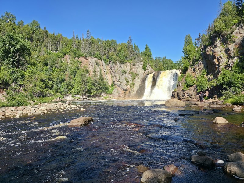
Mt. Baldy — Tettegouche
★ Reviews →The Mt. Baldy summit trail at Tettegouche climbs 500 feet above Lake Superior through birch-maple forest to an open rocky summit with 360-degree views — the broadest panorama available from any trail in the park. From the summit the entire arc of Lake Superior's western basin is visible, from the Duluth harbor to the Apostle Islands on clear days. The Superior Hiking Trail passes the summit on its route between Tettegouche and George H. Crosby Manitou.
~2 hrs📍 See location
🌙
Evening
🍽️ Dinner~6 hrs
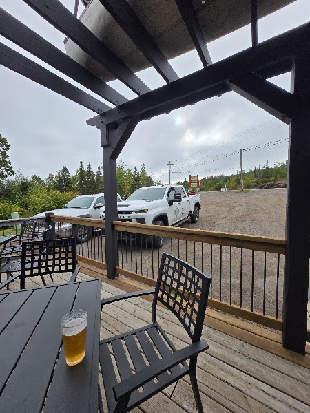
Silver Bay Lakeside Café
The most convenient dinner option near Tettegouche — in Silver Bay, a compact town built in 1954 to house workers at the Reserve Mining Company taconite plant. Basic American fare and a beer selection after a full day of North Shore hiking.
2 options · tap to switch
🛏️
Caribou Highlands Lodge — Lutsen
Resort accommodations at Lutsen Mountains, midway between Tettegouche and Grand Marais — condo units and lodge rooms with mountain views. The Lutsen Mountains ski area is directly adjacent. The Superior Hiking Trail passes through the Lutsen area with direct trailhead access. The most complete resort facility on the North Shore for overnight hikers.
Day 3 — George H. Crosby Manitou State Park, MN
Day 3 — George H. Crosby Manitou State Park, MN
🚗 4 hr 10 min driving📍 6 stops
🌅
Morning
🚗
Drive
Lutsen, MN → George H. Crosby Manitou State Park
30 min
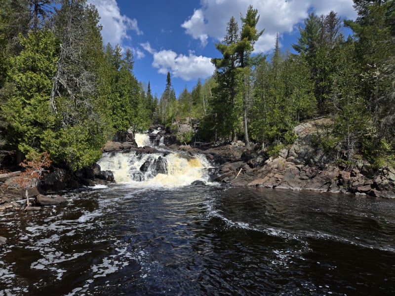
George H. Crosby Manitou — Manitou River Gorge
★ Reviews →George H. Crosby Manitou State Park is the most remote and rugged state park on the Minnesota North Shore — there are no vehicle-accessible amenities, only hiking trails and primitive backpacking campsites on the Lake Superior shore and in the Manitou River gorge. The Manitou River cuts a dramatic gorge through volcanic rock as it descends to Lake Superior. The Middle River cascades, the river mouth on the lake, and the 8 miles of backcountry trail make this the park for experienced hikers who want to leave the Highway 61 tourist corridor. The park was donated to the state by George H. Crosby Jr. in 1967 with the explicit condition that it remain undeveloped and accessible only on foot.
~2 hrs📍 See location
🍽️
Lunch
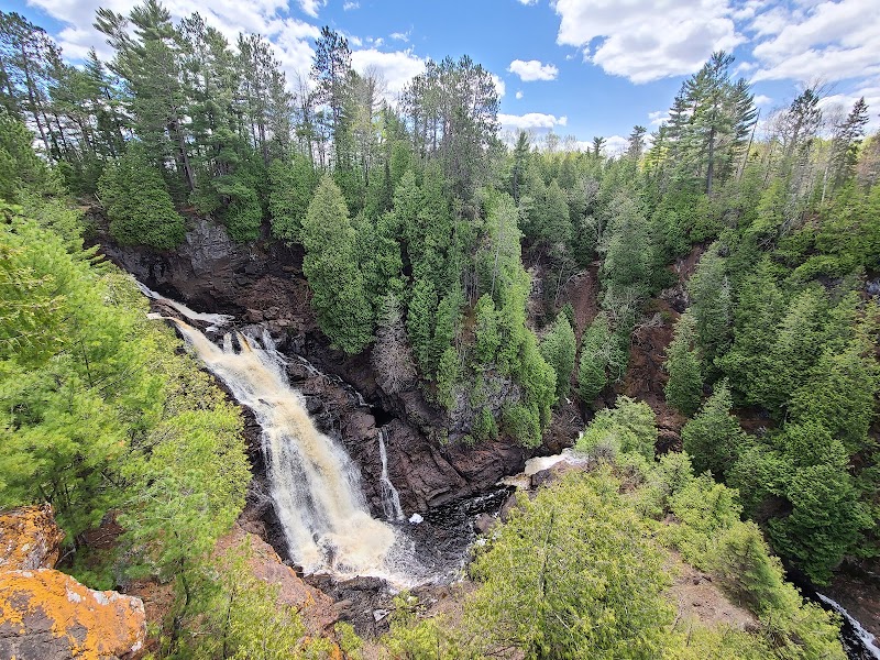
Manitou River Waterfall Loop
★ Reviews →The 9-mile loop trail in Crosby Manitou follows the Manitou River from its Lake Superior mouth upstream through the gorge, climbing past four distinct waterfalls — including the dramatic Upper Falls where the river drops 30 feet into a plunge pool — before returning through old-growth boreal forest on the ridge above the gorge. The trail requires stream crossings in spring and early summer. Moose, black bears, and timber wolves are regularly seen in the Manitou watershed. The primitive campsites on the Lake Superior shore require a permit and are among the most remote camping experiences available within a half-day of Duluth. Note: The full 9-mile Manitou River Waterfall Loop takes 4–5 hours for most hikers at a North Shore pace. Start this trail by 8 AM to have time for Grand Marais in the afternoon and the 220-minute return drive. If you prefer a shorter option, the 4-mile out-and-back to the lower falls reaches the most dramatic scenery in half the time.
~4.5 hrs📍 See location
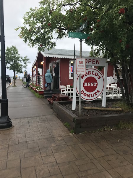
Grand Marais — World's Best Donuts
★ Reviews →The legendary Grand Marais donut shop operating since 1969 — cake donuts in rotating flavors including blueberry, maple, and potato. The line forms before 8am on summer weekends and the shop sells out by noon. A required stop for anyone completing the North Shore circuit.
~1 hr📍 See location
☀️
Afternoon
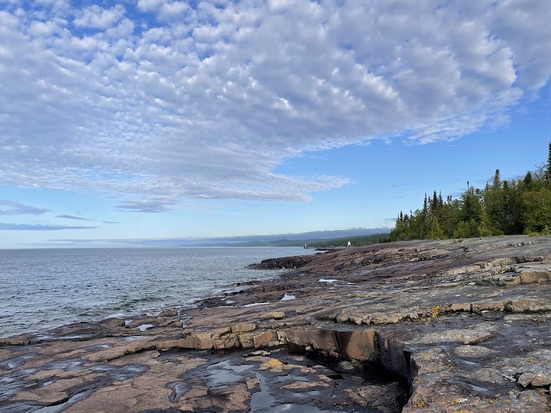
Grand Marais Harbor & Artist's Point
★ Reviews →Artist's Point is a rocky breakwater at the mouth of Grand Marais harbor — a finger of basalt extending into Lake Superior where painters, photographers, and visitors have gathered since the 19th-century art colony settled here. The lighthouse on the outer point dates to 1922. The harbor view from Artist's Point encompasses the Sawtooth Mountain ridgeline rising inland, the town's modest skyline, and the open lake stretching to the horizon. The combination of mountain backdrop and Great Lake foreground makes Grand Marais the most scenically complete small town in Minnesota.
~1 hr📍 See location
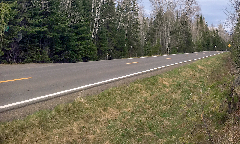
Gunflint Trail Corridor — Overview
★ Reviews →The Gunflint Trail begins at the edge of Grand Marais and runs 57 miles northwest through the Boundary Waters Canoe Area Wilderness watershed — one of the most celebrated wilderness corridors in North America. The trail gives access to the BWCA entry points, the boreal forest ecosystem, and some of the most remote lakes in the contiguous United States accessible by road. Even the first 10 miles of the Gunflint provide views of beaver ponds, boreal forest, and the Sawtooth Mountain foothills.
~1.5 hrs📍 See location
🌙
Evening
🍽️ Dinner~1 hr
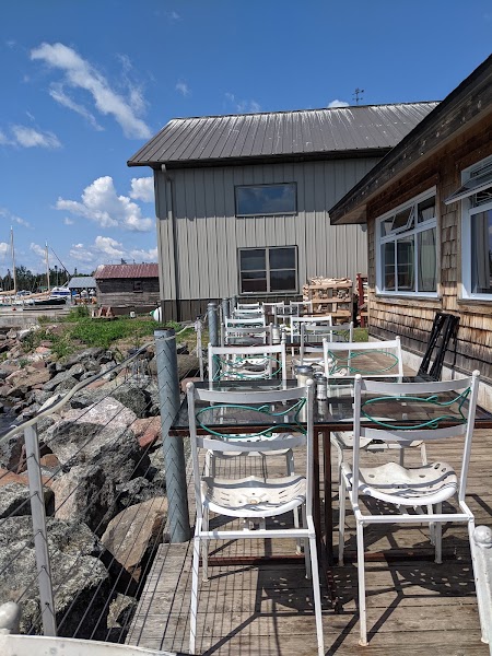
Angry Trout Café — Grand Marais
The most celebrated restaurant on the Minnesota North Shore — Lake Superior trout, whitefish, and smoked fish from a dock-side position on Grand Marais harbor. The menu emphasizes sustainably caught and locally sourced North Shore seafood. Outdoor seating on the harbor dock with lighthouse views. The post-hike dinner of choice for North Shore regulars.
2 options · tap to switch
🚗
Drive
Grand Marais, MN → Minneapolis, MN
3 hr 40 min
← All Minneapolis trips
More getaways from Minneapolis
Taylors Falls: Glacial Potholes, Basalt Climbing & the St. Croix Dalles — Day trip🥾North Shore Waterfalls: Gooseberry Falls, Split Rock & Tettegouche — Weekend🥾Bluff Country 3-Day: Root River Biking, Niagara Cave & Whitewater Trails — Long weekend🥾Stillwater: Minnesota's Birthplace & the Antique Capital of the Midwest — Day trip🏛️Stillwater & the St. Croix Valley: Antiques, Potholes & a River Bluff — Weekend🏛️Great River Road: Red Wing, Winona & La Crosse Bluff Towns — Long weekend🏛️Stillwater Slow Day: Antiques, Lowell Inn & Sunset on the St. Croix — Day trip🌿Stillwater Weekend: River Town, Sculpture Park & the St. Croix — Weekend🌿
© 2026 theweekendgetaways.com · All itineraries are original content. Terms
Plan your own escapeExplore more trips →