← The Weekend Getaways
🥾 ActiveLong weekend · from Nashville, TN

Cumberland Plateau Waterfall Circuit

Three days of the best waterfall hiking in Tennessee, tracing the eastern escarpment of the Cumberland Plateau from the state's tallest falls to its most dramatic gorge to a final cascade of four successive waterfalls on the Falling Water River. Day one delivers the iconic Fall Creek Falls at 256 feet and the Cane Creek waterfall complex. Day two pushes into the wild heart of Savage Gulf, where the Stone Door — a 150-foot rock opening worn through a sandstone fin — is the gateway to one of the East's most remote wilderness gorges. Day three descends to Burgess Falls State Park near Cookeville, where the Falling Water River drops over four successive waterfalls to a dramatic 130-foot finale in a shaded canyon — a fitting capstone to three days on the plateau.

Day 1 — Fall Creek Falls State ParkDay 2 — Savage Gulf — Stone DoorDay 3 — Burgess Falls State Park
Day 1Fall Creek Falls State Park, TN

Day 1Fall Creek Falls State Park, TN

🚗 2 hr driving📍 5 stops
🌅
Morning
🚗
Drive
Nashville, TNFall Creek Falls State Park
2 hr8:00 AM10:00 AM
Fall Creek Falls — Main Falls Overlook & Cable Trail
4.9
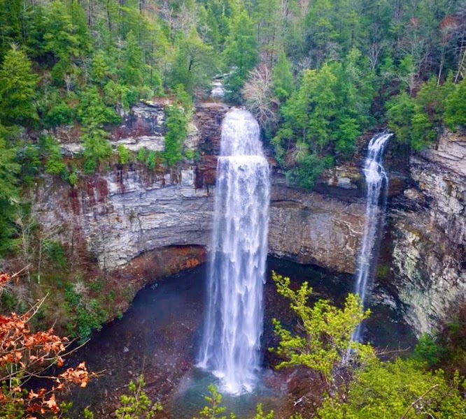
At 256 feet, Fall Creek Falls is the tallest waterfall east of the Rocky Mountains — a single free-fall plunge over a sandstone caprock ledge into a mist-shrouded plunge pool. The overlook at the rim offers the postcard view, but descending the Cable Trail to the gorge floor delivers the full sensory experience: the thunder of the falling water, the permanent mist, and the scale of the sandstone amphitheater become unmistakable up close. The cable-assisted section is short but legitimately steep — use the fixed cables and wear grippy shoes.
🍽️
Lunch
Cane Creek Cascades & Cane Creek Falls
4.8
Cane Creek Cascades (45 feet, broad sandstone fan) and Cane Creek Falls (85 feet, deep gorge plunge) form one of the finest secondary waterfall pairs in the eastern United States, reachable via a 2-mile round trip from the Cane Creek picnic area. The shaded gorge trail between them passes through stands of old-growth hemlock and rhododendron.
🍽️ Lunch12:00 PM
Fall Creek Falls State Park Inn Restaurant
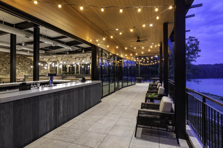
The park inn restaurant provides a casual, convenient midday break with standard American fare — burgers, sandwiches, soups — in a comfortable setting overlooking Lake Rockwell.
3.9$restaurant📍 Maps →
2 options · tap to switch
☀️
Afternoon
Suspension Bridge & Gorge Overlook Trail
4.8
The swinging suspension bridge over the Fall Creek gorge — hanging 60 feet above the canyon floor — connects the main falls trail system to the western rim overlooks. The Gorge Overlook Trail follows the rim through sandstone outcroppings to views of the gorge below that grow progressively wilder and more remote as you walk farther from the main trailhead.
🌙
Evening
🛏️
Fall Creek Falls State Park Inn
The Fall Creek Falls State Park Inn offers lodge rooms, chalets, and camping within the park. Booking the inn puts you at the trailhead for tomorrow's early departure to Savage Gulf. Alternatively, the small town of Spencer (15 minutes north) has basic chain motel options.
Day 2Savage Gulf State Natural Area, TN

Day 2Savage Gulf State Natural Area, TN

🚗 1 hr 30 min driving📍 4 stops
🌅
Morning
🚗
Drive
Fall Creek Falls State ParkStone Door Trailhead, Savage Gulf
45 min8:00 AM8:45 AM
Stone Door — Savage Gulf
4.9
The Great Stone Door is a 150-foot-tall natural opening worn through a sandstone fin at the rim of the Big Creek gorge — for centuries a passage route used by Native peoples to descend from the plateau to the rivers below, and now the most distinctive landmark in Savage Gulf's 15,000-acre wilderness. The 0.5-mile trail from the ranger station to the Stone Door overlook is the most dramatic short walk on the plateau, arriving abruptly at an opening that frames the full depth of the gorge below. Savage Gulf proper — the confluence of three wild gorges carved 800 feet into the plateau — begins here, with old-growth hemlock forest, wildflower-rich hollows, and genuinely remote backcountry beyond.
🍽️
Lunch
Collins West Rim Trail
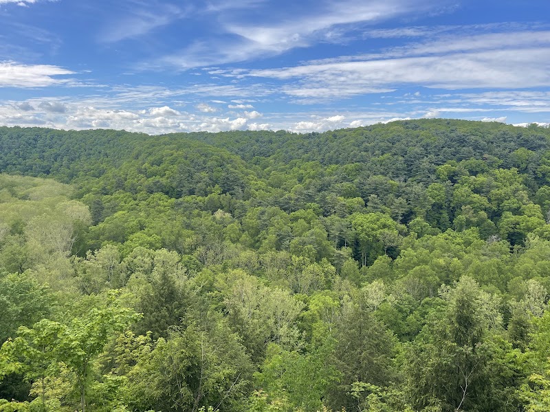
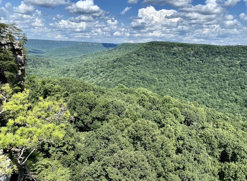
The Laurel Trail runs west from the Stone Door trailhead along the Collins River gorge rim, offering repeated cliff-edge views 600 feet down to the river below through gaps in the forest. The Collins West Rim overlook, approximately 2.5 miles from the trailhead, is the finest single viewpoint in the park — a bare sandstone ledge from which the entire gorge system spreads in an unbroken panorama of forested canyon walls and the silver thread of the river far below. Pack lunch and eat on the rimrock.
☀️
Afternoon
📍
Big Creek Rim Trail
The Big Creek Rim Trail continues east from the Stone Door along the opposite rim, with the Big Creek gorge visible below through the sandstone outcroppings. The afternoon light is ideal for the return leg — the canyon walls glow amber and the hemlock-shaded hollows deepen into shadow in a way that captures the plateau's atmospheric grandeur. Return via the connector trail back to the ranger station parking lot.
🌙
Evening
🚗
Drive
Savage GulfCookeville, TN
45 min5:00 PM5:45 PM
🛏️
Cookeville hotel (Hampton Inn or similar)
Cookeville, the commercial hub of Putnam County on the upper plateau, offers a full range of chain hotels convenient to I-40 and to tomorrow's Burgess Falls State Park (15 minutes south). The Hampton Inn and Holiday Inn Express are the most reliable options.
Day 3Burgess Falls State Park, TN

Day 3Burgess Falls State Park, TN

🚗 1 hr 45 min driving📍 3 stops
🌅
Morning
🚗
Drive
Cookeville, TNBurgess Falls State Park
15 min8:00 AM8:15 AM
Burgess Falls — Four Waterfall Cascade
4.8
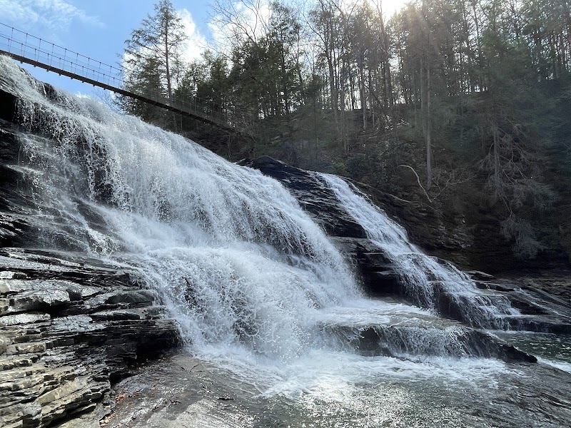
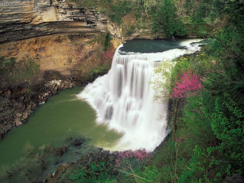
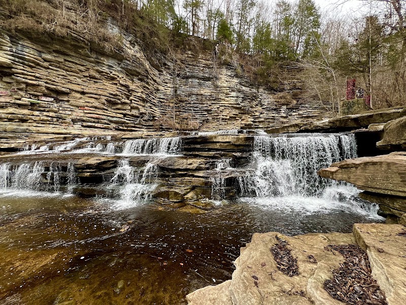
Burgess Falls State Park presents a uniquely dramatic hiking experience: the Falling Water River drops over four successive waterfalls in a single 1.5-mile canyon walk, each waterfall larger than the last, culminating in the 130-foot Burgess Falls plunging into a shaded limestone canyon. The first three falls — Upper Burgess (30 feet), Middle Burgess (70 feet), and Lower Burgess (136 feet in the final dramatic drop) — are visible from a series of overlook platforms along the trail, with the path descending progressively closer to the river between each set. The final overlook of the main Burgess Falls is one of the finest waterfall viewpoints in Tennessee — the water free-falls in a powerful single curtain into a deep plunge pool enclosed by 200-foot canyon walls, creating a natural amphitheater of sound and spray. The trail is rated moderate, approximately 3 miles round trip.
🍽️
Lunch
Continue at Burgess Falls Overlook Picnic Area
4.8
Use the afternoon to explore a different side of Burgess Falls — Four Waterfall Cascade — there's more to discover beyond the morning highlights.
☀️
Afternoon
Riverside Trail — Falling Water River
4.6
The short Riverside Trail follows the Falling Water River downstream from the park's upper area through streamside forest to the reservoir overlook, offering a quieter and less crowded alternative to the main falls trail for afternoon legs that have already covered significant mileage over three days. The river's clear water and the streamside sycamores and river birches make this a pleasant, low-key finale before the drive home.
🌙
Evening
🚗
Drive
Burgess Falls State ParkNashville, TN
1 hr 30 min5:00 PM6:30 PM
Plan your own escapeExplore more trips →