← The Weekend Getaways
🥾 ActiveLong weekend · from Nashville, TN

Big South Fork — Coal Ghosts, Twin Arches & Old-Growth Forest

The Big South Fork National River and Recreation Area straddles the Tennessee-Kentucky border in a landscape of dramatic sandstone gorges, natural arches, and the extraordinary remnants of early twentieth-century coal mining — one of the most undervisited and genuinely wild places in the eastern United States. Day one explores the Blue Heron Coal Mining Community, a ghost town mining settlement frozen in time since it closed in 1962, with its eerie interpretive ghost structures and the massive O&W Railroad bridge. Day two tackles the Twin Arches — the largest natural arches east of the Mississippi River, with the South Arch standing 70 feet high and spanning 135 feet — plus Yahoo Falls, Kentucky's tallest waterfall at 113 feet. Day three visits Pickett State Park's ancient stone arches, old-growth forest, and primeval lake before the return to Nashville.

Day 1 — Blue Heron, Big South Fork NRRADay 2 — Twin Arches & Yahoo FallsDay 3 — Pickett State Park
Day 1Big South Fork NRRA — Blue Heron, TN/KY
Day 1Big South Fork NRRA — Blue Heron, TN/KY
🚗 3 hr 20 min driving📍 6 stops
🌅
Morning
🚗
Drive
Nashville, TNBlue Heron, Big South Fork NRRA
3 hr8:00 AM11:00 AM
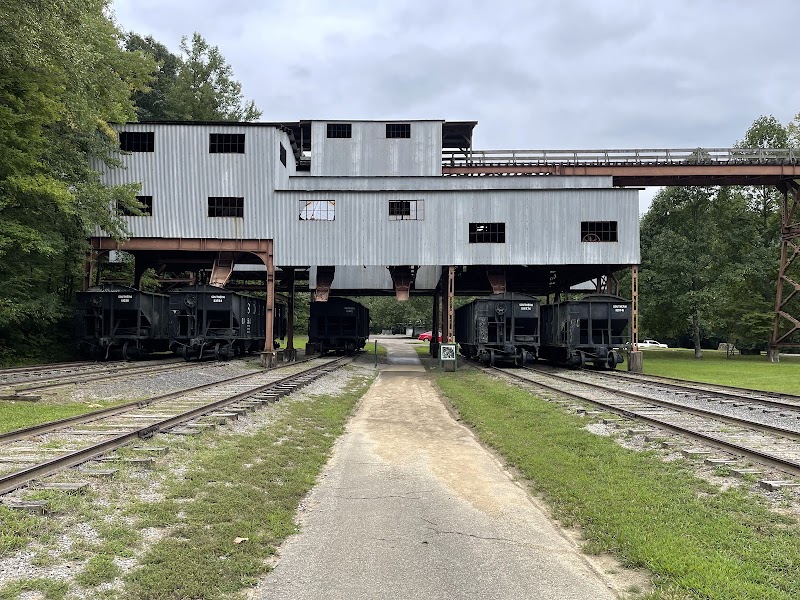
Blue Heron Coal Mining Community
4.7
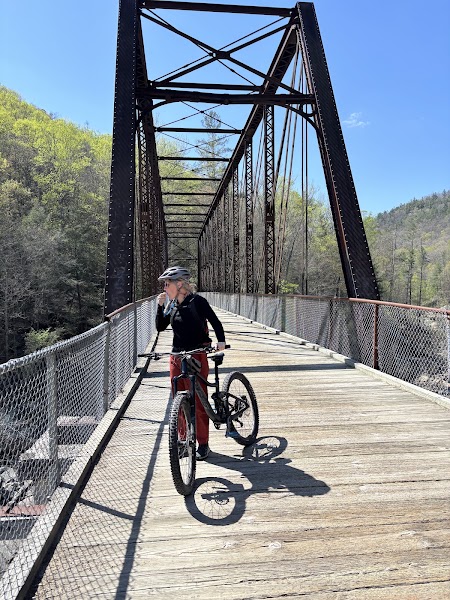
Blue Heron Mine No. 18 operated from 1937 to 1962 as part of the Stearns Coal and Lumber Company's operations in the Big South Fork gorge, employing hundreds of miners in a self-contained company town accessible only by the Kentucky and Tennessee Railway (known locally as the 'Old Wobbly' or O&W Railroad) along the floor of the Big South Fork canyon. When the mine closed in 1962, the community was abandoned and the structures were demolished — but the National Park Service has reconstructed a series of 'ghost structures': steel-framed building outlines in the original footprints of the tipple, the church, the school, the commissary, and the individual miners' homes, each containing recorded audio testimony from former residents describing life in the hollow. The effect is haunting and deeply moving — voices from the past describing a vanished world in a canyon that time has largely reclaimed. The massive O&W Railroad trestle bridge crossing the Big South Fork below the community is one of the most dramatic pieces of railroad infrastructure in the region.
🍽️
Lunch
Big South Fork River Trail
4.8
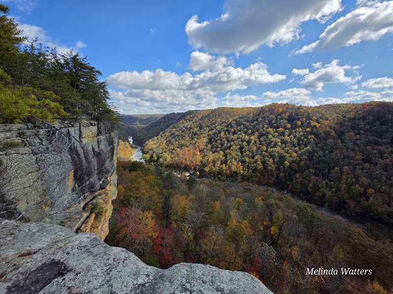
The river trail below Blue Heron follows the Big South Fork upstream along the canyon floor through stands of hemlock and river birch, past Class III and IV rapids that attract whitewater paddlers from across the region. The canyon walls here rise 300-400 feet on both sides, creating a dramatic enclosed landscape of sculpted sandstone and dense riparian forest. The trail is level and well-maintained along the canyon floor, making it an accessible afternoon walk despite the remote setting. Kingfishers, herons, and otters are regularly seen along the river.
Pack a picnic — Blue Heron overlook
4.8
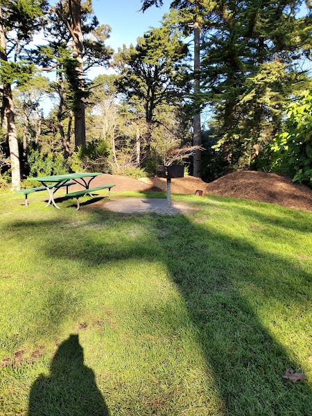
There are no restaurants in or near Blue Heron — pack a substantial lunch from Oneida (the nearest town, 20 minutes south) or from Nashville. The picnic tables at the Blue Heron overlook above the trestle bridge offer one of the most dramatic lunch settings anywhere in Tennessee.
1:00 PM📍 See location
☀️
Afternoon
O&W Railroad Bridge & Canyon Overlook
4.7
The Kentucky and Tennessee Railway bridge at Blue Heron is a massive steel trestle structure crossing the Big South Fork gorge — a remnant of the railroad infrastructure that connected the mining communities of the plateau to markets in Stearns and beyond. The overlook platform above the bridge and the footpath along the canyon rim offer different perspectives on the gorge's depth and the scale of the engineering required to operate a coal mine in this remote hollow.
🌙
Evening
🚗
Drive
Blue Heron, Big South ForkOneida, TN
20 min5:00 PM5:20 PM
🍽️
Scott's Diner — Oneida, TN
Oneida's workhorse diner — open late, unpretentious, honest Southern cooking. After a long drive and afternoon hike in Big South Fork, this is where you eat before heading to the motel.
🛏️
Oneida Motel or Best Western, Oneida
Oneida is the commercial hub of Scott County and the most convenient base for Big South Fork explorations. Lodging options are basic — the Best Western is the most reliable chain option — but the town has gas, grocery stores, and several diners for evening meals. The Big South Fork's Bandy Creek Campground (20 minutes west in the park) offers camping for those who prefer to be inside the park.
Day 2Twin Arches & Yahoo Falls, Big South Fork
Day 2Twin Arches & Yahoo Falls, Big South Fork
🚗 1 hr 40 min driving📍 5 stops
🌅
Morning
🚗
Drive
Oneida, TNTwin Arches Trailhead, Big South Fork
35 min8:00 AM8:35 AM
Twin Arches Trail
Twin Arches Trail
4.9
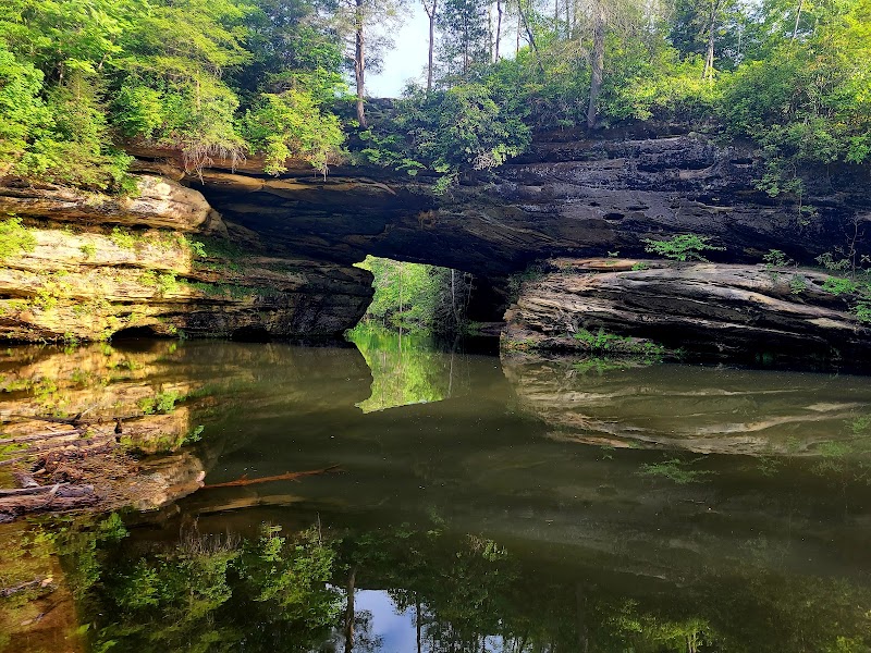
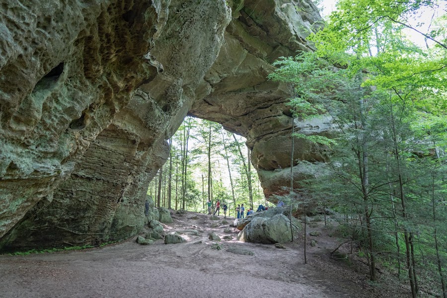
The Twin Arches are the largest natural arches east of the Mississippi River — a distinction backed by measurement. The North Arch stands 62 feet high with a 103-foot span; the South Arch stands 70 feet high with a 135-foot span. Both arches are formed from Lee Formation sandstone, the same resistant caprock that creates the Big South Fork's dramatic cliffs, and both span hollows on the plateau plateau. The 3.4-mile Twin Arches Loop descends from the plateau rim into a shadowed hollow and arrives at the arches from below, so their full height is experienced from underneath — an approach that makes the scale immediately visceral. Massive fallen caprock boulders litter the floor beneath each arch, remnants of previous roof collapses that gradually enlarged the spans over thousands of years. The trail between the two arches passes through a forest of old-growth white oak and hemlock that has likely never been logged.
🍽️
Lunch
🚗
Drive
Twin Arches TrailheadYahoo Falls Trailhead, KY
25 min9:35 AM10:00 AM
Yahoo Falls
Yahoo Falls
4.7
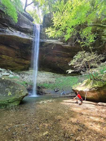
Yahoo Falls is Kentucky's tallest waterfall, dropping 113 feet in a free-fall curtain over a massive sandstone overhang that creates a walkable cave-like amphitheater behind the falls — a 'rockshelter' hollowed by millennia of water and wind erosion. The trail from the Yahoo Arch Recreation Area descends 0.7 miles through a gorge to the falls base, where you can walk behind the curtain on dry ground beneath the overhanging lip. The surrounding rockshelter has evidence of prehistoric habitation spanning thousands of years. Yahoo Arch, a modest natural arch on the plateau above the falls, is visible from the rim trail on the return.
☀️
Afternoon
Yahoo Arch & Gorge Rim Loop
4.8
The Yahoo Arch and Gorge Rim Loop above the falls is a 2.5-mile circuit along the plateau edge that passes Yahoo Arch (a smaller but well-proportioned natural arch) and follows the gorge rim with views down into the Yahoo Creek canyon below. The afternoon light illuminates the canyon walls in warm tones that make this one of the most photogenic times to hike the rim loop.
🌙
Evening
🚗
Drive
Yahoo Falls, KYOneida or Jamestown, TN
40 min5:00 PM5:40 PM
🍽️
Oneida Downtown Diner (or motel restaurant)
Oneida is a small working town with a handful of local diners and fast-casual spots near the Best Western. Ask the motel front desk for tonight's recommendation — options are limited but reliable.
🛏️
Oneida Best Western or Jamestown motel
Return to Oneida for a second night, or continue south to Jamestown (30 minutes) which is slightly closer to tomorrow's Pickett State Park and has several motel options along US-127.
Day 3Pickett State Park, TN

Day 3Pickett State Park, TN

🚗 2 hr 40 min driving📍 4 stops
🌅
Morning
🚗
Drive
Oneida / Jamestown, TNPickett State Park
30 min8:00 AM8:30 AM
Pickett State Park — Natural Arches Trail
4.8
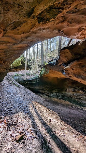
Pickett State Rustic Park — one of Tennessee's smallest and most remote state parks — protects 11,752 acres of the Cumberland Plateau's most ancient and ecologically significant landscape: old-growth sandstone forest that has never been logged, a network of natural rock arches and overhangs, crystal-clear spring-fed streams, and Pickett Lake, a 15-acre impoundment set in a forested hollow. The Natural Arches Trail is the park's signature hike, a 4-mile loop through sandstone formations that include a series of rock bridges, overhanging shelters, and arch-like formations worn by water and frost through the resistant Lee Formation sandstone. The forest here — white oak, chestnut oak, hemlock, sourwood — has the character of genuinely old woodland, with massive overstory trees and a richly developed understory absent from younger second-growth forest elsewhere on the plateau.
🍽️
Lunch
Continue at Pickett Lake Picnic Area
4.8
Use the afternoon to explore a different trail, cool off at a swimming hole, or find a scenic spot to watch the sunset.
9:30 AM📍 See location
☀️
Afternoon
Continue at Hazard Cave & Indian Rockhouse
4.8
Use the afternoon to explore a different trail, cool off at a swimming hole, or find a scenic spot to watch the sunset.
🌙
Evening
🍽️
Jamestown Town Square — Dinner before the Drive
Stop in Jamestown (15 minutes from Pickett State Park) for dinner before the 2-hour return to Nashville. The town has several casual spots — a meal here makes the evening drive more comfortable.
🚗
Drive
Pickett State ParkNashville, TN
2 hr 10 min6:00 PM8:10 PM
Plan your own escapeExplore more trips →