🥾 ActiveLong weekend · from Portland, OR
Beacon Rock, Wahkeena Canyon & Opal Creek Wilderness
A three-day immersion in the Pacific Northwest's two great basalt canyon systems — the Columbia River Gorge's Washington side on day one, the Gorge's Oregon waterfall corridor on day two, and Opal Creek Wilderness's ancient forest and turquoise swimming holes on day three.
Day 1 — Beacon Rock State Park, WADay 2 — Wahkeena Falls & Multnomah Falls CorridorDay 3 — Opal Creek Wilderness
Day 1 — Beacon Rock State Park, WA
Day 1 — Beacon Rock State Park, WA
🚗 1 hr 20 min driving📍 5 stops
🌅
Morning
🚗
Drive
Portland, OR → Beacon Rock State Park
35 min
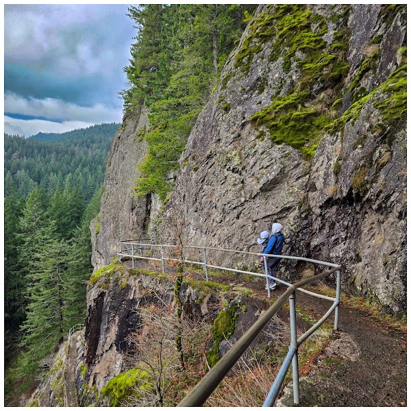
Beacon Rock Summit Trail
★ Reviews →A 1.6-mile round-trip switchback trail bolted to the face of an 848-foot volcanic plug rising from the Columbia River — the second-largest monolith in North America after Gibraltar. The trail was built by Henry Biddle between 1915 and 1918 using hand-drilled rock and iron handholds; 52 switchbacks and 23 wooden bridges ascend the sheer south face. The summit view looks directly into the gorge both east and west.
~1 hr📍 See location
🍽️
Lunch
🚗
Drive
Beacon Rock State Park → Bonneville Dam
10 min
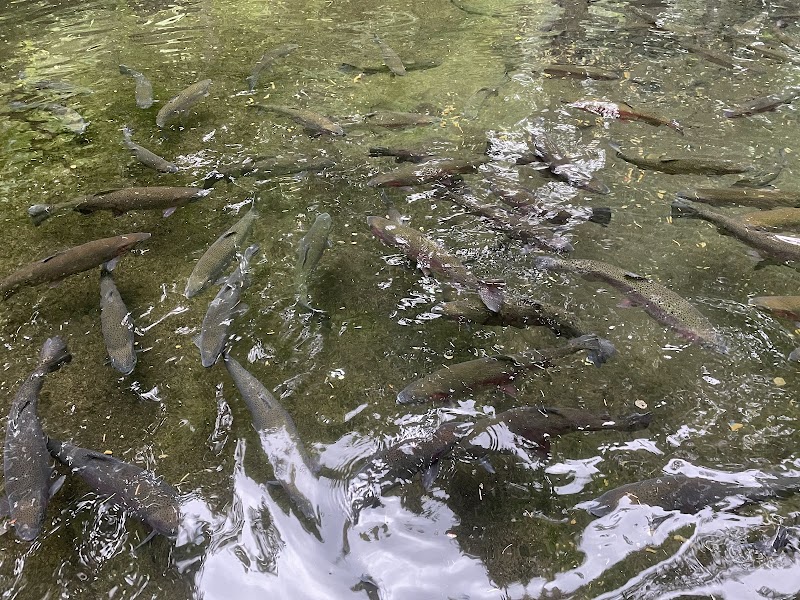
Bonneville Dam Fish Ladder & Visitor Center
★ Reviews →The 1938 New Deal dam that transformed the Columbia River — the fish ladder observation windows allow underwater viewing of chinook, coho, and steelhead salmon migrating upstream during the fall runs (September–November is peak). The Bradford Island Visitor Center documents the dam's construction during the Depression and the river's transformation from wild salmon highway to managed hydroelectric system.
~1.5 hrs📍 See location
☀️
Afternoon
🚗
Drive
Bonneville Dam → Augspurger Mountain Trailhead
15 min
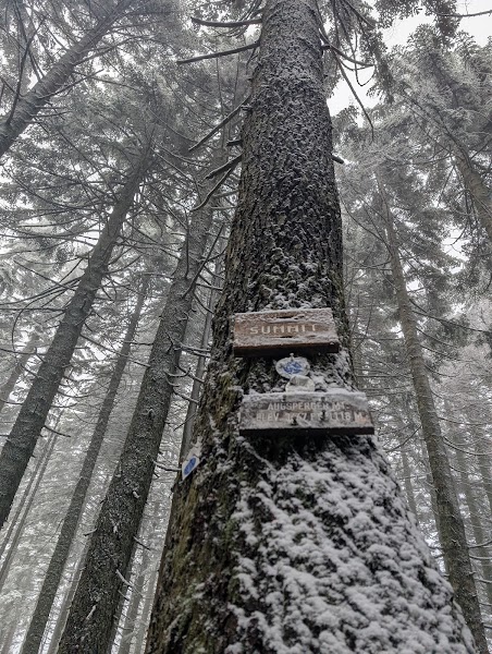
Augspurger Mountain Trail
★ Reviews →A 9-mile round-trip on the Washington bank of the Columbia Gorge climbing 3,100 feet through old-growth forest to open ridgeline meadows at 3,600 feet — the summit views encompass the full breadth of the Gorge from Mt. Hood south to Mt. Adams north, with the Columbia River visible as a silver thread far below. Less trafficked than the other Gorge summits, the trail passes through a diverse mix of oak savanna, Douglas fir, and subalpine meadow on its ascent.
~6 hrs📍 See location
🌙
Evening
🚗
Drive
Augspurger Mountain Trailhead → Walking Man Brewing
20 min
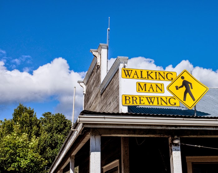
Walking Man Brewing
★ Reviews →Stevenson's post-hike institution since 2000, in a converted downtown building on the Washington side — house-brewed ales, reliable pub food, and the outdoor seating that catches the evening light on the Columbia. The Homo Erectus IPA is the flagship; the seasonal rotation draws from Cascade hops grown 30 miles north.
~1 hr📍 See location
🛏️
Skamania Lodge or Comfort Inn Stevenson
Skamania Lodge has full resort amenities with gorge views; Comfort Inn Stevenson is the practical option at half the price.
Day 2 — Wahkeena Falls & Multnomah Falls Corridor
Day 2 — Wahkeena Falls & Multnomah Falls Corridor
🚗 50 min driving📍 5 stops
🌅
Morning
🚗
Drive
Stevenson, WA → Wahkeena Falls Trailhead
10 min
Cross the Bridge of the Gods and head west on the Historic Columbia River Highway.
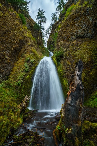
Wahkeena Falls Trail
★ Reviews →The 5-mile Wahkeena–Multnomah loop begins at the 242-foot tiered cascade of Wahkeena Falls and climbs through old-growth forest to Vista Point before descending past Fairy Falls — a 20-foot veil fall over a moss-covered grotto — to Multnomah Falls from above. The upper trail is quiet even when the base of Multnomah is crowded; the forest between the falls is among the finest old-growth Douglas fir corridor in the Gorge.
~1 hr📍 See location
🍽️
Lunch
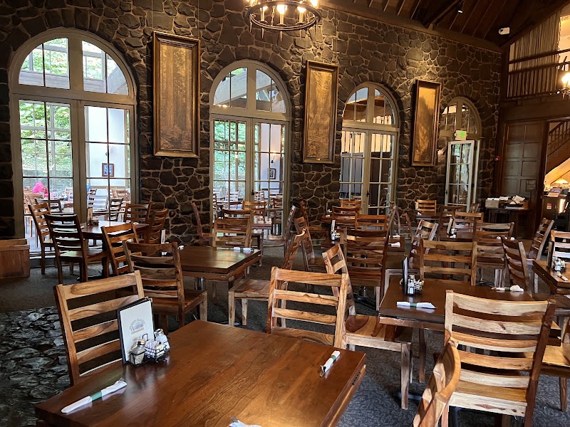
Multnomah Falls Lodge Restaurant
★ Reviews →The 1925 National Historic Landmark lodge at the base of the 620-foot falls — the Gorge Burger and the salmon chowder are the lunch anchors. The terrace tables face the lower falls directly; arrive before noon to avoid the afternoon rush on the most-visited natural site in Oregon.
~1 hr📍 See location
☀️
Afternoon
🚗
Drive
Multnomah Falls → Angel's Rest Trailhead
15 min
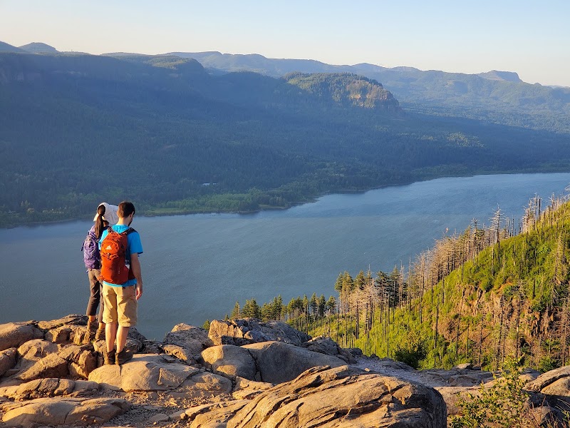
Angel's Rest
★ Reviews →A 4.6-mile round-trip climb to a basalt promontory 1,600 feet above the Columbia — the open rock ledge at the summit overhangs a 1,000-foot drop with unobstructed views east toward Crown Point and west into the Portland Basin. The trail is steep but never technical; the summit is windswept and dramatic in all weather.
~3 hrs📍 See location
🌙
Evening
🚗
Drive
Angel's Rest Trailhead → Cascade Locks, OR
25 min
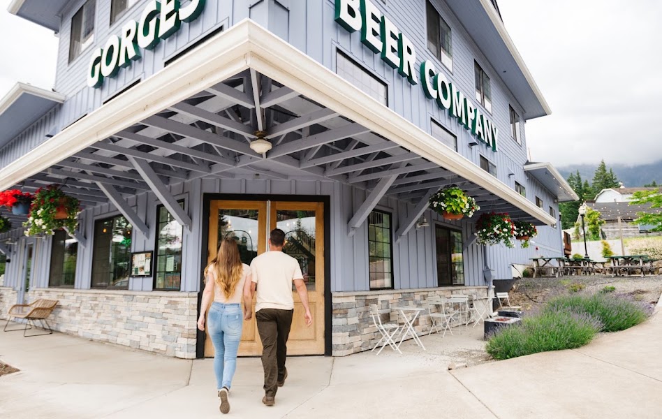
Gorges Beer Co. — Cascade Locks
★ Reviews →A brewpub in the small town at the Gorge's western gateway, with a patio above the Columbia and views of the Bridge of the Gods directly overhead. The house beers run to Northwest classics — pale ales, an IPA, and a seasonal saison. The fish and chips are properly done.
~1 hr📍 See location
🛏️
Hood River, OR Hotels
30 minutes east and a full town's worth of dining and accommodation options for the Opal Creek day.
Day 3 — Opal Creek Wilderness
Day 3 — Opal Creek Wilderness
🚗 3 hr 30 min driving📍 4 stops
🌅
Morning
🚗
Drive
Hood River, OR → Opal Creek Trailhead
1 hr 30 min
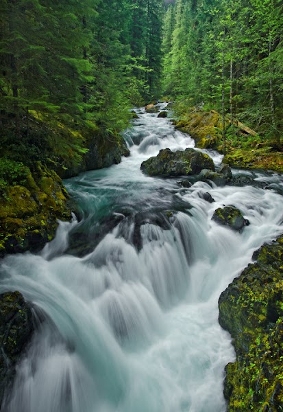
Opal Creek Trail to Opal Pool
★ Reviews →The 5.5-mile round-trip to Opal Pool follows the Little North Santiam River through one of the last unlogged old-growth watersheds in the Oregon Cascades — Douglas fir and western red cedar 500 years old, the river running clear over polished bedrock, and Opal Pool itself glowing turquoise from mineral seeps. The trail is flat and well-maintained; the swimming hole at Opal Pool is the destination.
~3 hrs📍 See location
🍽️
Lunch
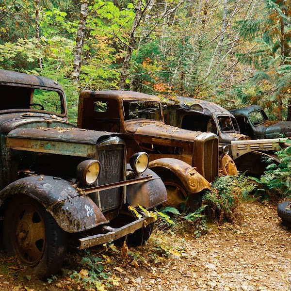
Jawbone Flats Historic Mining Settlement
★ Reviews →A 1930s gold mining camp at the confluence of Battle Ax Creek and Opal Creek, preserved in place — corrugated rooflines, wood-frame cook shacks, and the company store all intact in the old-growth setting. Day visitors walk through on the way to Opal Pool; the Friends of Opal Creek organization maintains the site as a conservation education facility.
~45 min📍 See location
☀️
Afternoon
🚗
Drive
Opal Creek Trailhead → Bagby Hot Springs
45 min
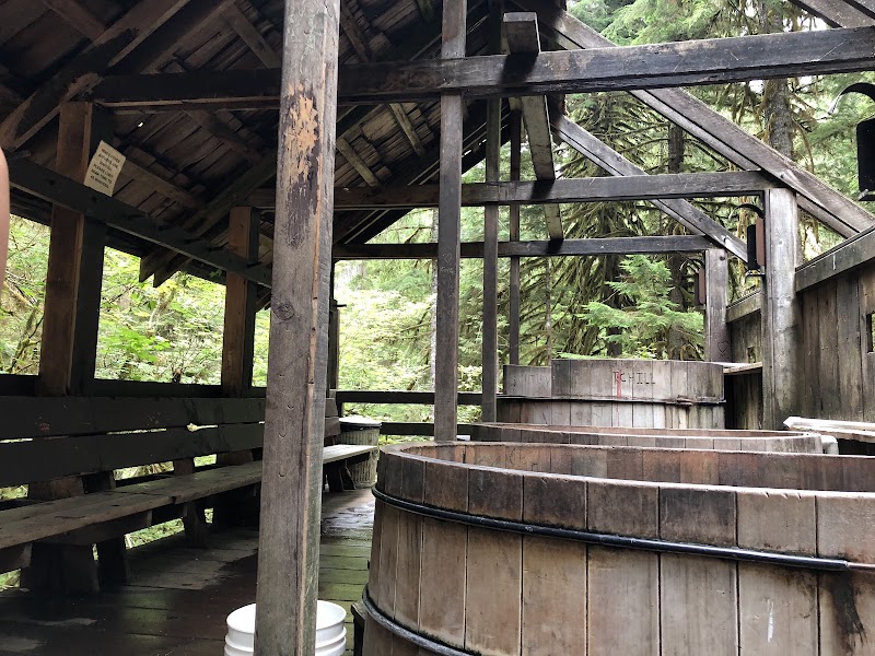
Bagby Hot Springs
★ Reviews →A 3-mile round-trip trail through old-growth forest leads to a collection of hand-hewn cedar soaking tubs filled with 136°F water from a natural hot spring — the tubs, carved in the 1900s and maintained by volunteers, sit in a grove of massive old-growth timber above Nohorn Creek. The hike is flat; the soaking is the entire point. Arrive early to secure a private tub.
~1.5 hrs📍 See location
🌙
Evening
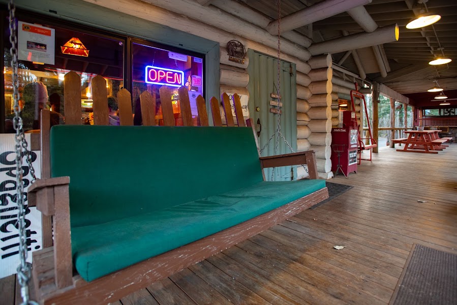
Barlow Trail Roadhouse
★ Reviews →A roadhouse in the town of Sandy at the base of Mt. Hood, named for the original Barlow Road — the 1846 toll road over the Cascades that served as the Oregon Trail's final mountain crossing. The kitchen serves honest Pacific Northwest comfort food: burgers, wild salmon, and house-smoked meats in a wood-paneled room that has been feeding timber workers, climbers, and Portlanders heading home from the mountain since the 1940s.
~1.5 hrs📍 See location
🚗
Drive
Bagby Hot Springs → Portland, OR
1 hr 15 min
← All Portland trips
More getaways from Portland
Silver Falls: The Trail of Ten Falls — Day trip🥾Timberline & Ramona Falls: Mount Hood's West Side — Weekend🥾Coast Range to Pacific: Tillamook Head & Cape Lookout — Long weekend🥾McMinnville: Wine Country & Aviation History — Day trip🏛️Willamette Valley Wine Country & Oregon City — Weekend🏛️Willamette Valley: Wine, History & the Oregon Trail — Long weekend🏛️Dundee Hills Pinot Country — Day trip🌿Manzanita & Nehalem Bay Wine Country — Weekend🌿
© 2026 theweekendgetaways.com · All itineraries are original content. Terms
Plan your own escapeExplore more trips →