← The Weekend Getaways
🥾 ActiveWeekend · from Sacramento, CA

Sutter Buttes & the Pacific Flyway — The World's Smallest Mountain Range & the Winter Wetlands

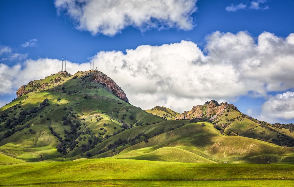
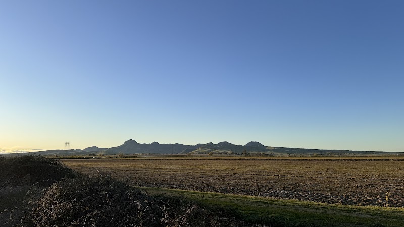
Rising abruptly from the dead-flat floor of the Sacramento Valley, the Sutter Buttes are often called the world's smallest mountain range — a compact ring of volcanic peaks that erupted a million and a half years ago and now stand alone above the rice fields, utterly unlike anything around them. Because the entire range is privately owned, the only way in is on a guided hike, which makes day one a rare and memorable ascent into a landscape few Californians ever see. Day two drops to the valley floor and the great wetlands of the Pacific Flyway, where the Sacramento National Wildlife Refuge auto-tour and the Gray Lodge marshes host hundreds of thousands of wintering geese, ducks, and swans in one of the continent's most staggering wildlife spectacles. Between them lies a night in Yuba City or Colusa, farm-country towns at the edge of the rice belt. It is a two-day trip about a valley most people only drive past.

Day 1 — Guided hike into the Sutter ButtesDay 2 — The Sacramento NWR auto-tour & the Gray Lodge wetlands
Day 1Sutter Buttes, CA

Day 1Sutter Buttes, CA

🚗 1 hr 35 min driving📍 4 stops
🌅
Morning
🚗
Drive
Sacramento, CASutter Buttes Guided Hike Meeting Point, Sutter
1 hr 15 min8:00 AM9:15 AM
Guided Hike into the Sutter Buttes
4.4
The Sutter Buttes are entirely private land, so the only legitimate way into the range is on a docent-led hike arranged in advance through the Middle Mountain Foundation or a licensed guide — book well ahead, as trips fill and run seasonally. The reward is extraordinary: a walk up through oak-studded ravines and volcanic outcrops into the ring of peaks at the valley's center, with your guide interpreting the geology of the ancient eruption, the Maidu heritage of the range, and the ranching families who still work the land. Trips vary from moderate rambles to strenuous summit climbs of the interior peaks, so choose to match your party's fitness. From the high ground the entire Sacramento Valley spreads out flat in every direction, the Sierra and Coast Range walls hazy on the horizon. It is a genuinely rare experience, on ground almost no one gets to stand on. Confirm your reservation, bring sturdy boots, sun protection, and all your own water.
🍽️
Lunch
📍
Trail Lunch on the Buttes
Guided hikes into the Buttes typically break for lunch somewhere high on the range, so a packed meal is part of the day — there are no services inside the private land. Eat with the whole valley below you, the rice fields stretching to the horizon and the peaks of the interior rising close at hand, a lunch spot as singular as the hike itself. Your guide will point out landmarks and wildlife as you rest. Pack light, high-energy food, carry out every scrap, and be sure you have enough water for the full outing.
10:15 AM📍 See location
☀️
Afternoon
Sutter Buttes Scenic Loop Drive & Sutter Farm Country
4.1
After the hike, circle the range on the public levee and farm roads that ring the Buttes, the only way to appreciate the mountains from the outside without trespassing. The loop through Sutter, West Butte, and the surrounding orchards and rice fields gives constantly shifting profiles of the peaks rising from the plain, especially handsome in low afternoon light. Fruit stands and small farms line the route in season, selling peaches, walnuts, and olives from the fertile valley soil. It is a relaxed, scenic wind-down after a demanding morning, and a good chance to photograph the range from every angle. Drop into the little town of Sutter for a cold drink before heading to your night's lodging.
🌙
Evening
🚗
Drive
Sutter, CAYuba City, CA
20 min5:00 PM5:20 PM
🛏️
Yuba City hotel (Hampton Inn or similar)
Yuba City is the commercial center of the twin-city region on the Feather River and offers the fullest range of chain hotels within easy reach of the Buttes and the refuges — the Hampton Inn, Hampton, and Holiday Inn Express are the reliable picks. It sits roughly midway between the morning's hike and tomorrow's wetlands, making it a practical base, and its diverse restaurant scene (the area has a large Punjabi community and excellent Indian food) makes for a memorable dinner. Colusa, closer to the Sacramento NWR, is a smaller alternative with a historic riverfront hotel if you prefer to be right by tomorrow's first stop. Stock up on breakfast and gas before an early start to the wetlands.
Day 2Sacramento NWR & Gray Lodge, CA

Day 2Sacramento NWR & Gray Lodge, CA

🚗 1 hr 45 min driving📍 3 stops
🌅
Morning
🚗
Drive
Yuba City, CASacramento National Wildlife Refuge
30 min8:00 AM8:30 AM
Sacramento National Wildlife Refuge Auto-Tour
4.8
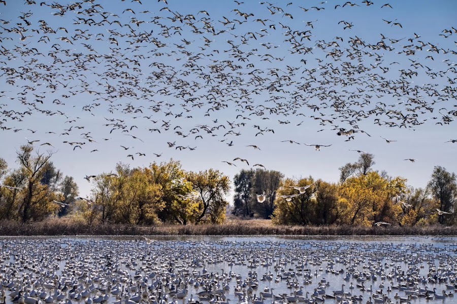
The Sacramento National Wildlife Refuge is one of the crown jewels of the Pacific Flyway, and its six-mile auto-tour route is the classic way to experience it — a slow drive through managed marshes, ponds, and grasslands from which you watch, without disturbing, the wildlife feet away. In winter the refuge explodes with hundreds of thousands of snow geese, Ross's geese, pintails, and tundra swans, rising in vast clattering clouds off the water in a spectacle few other places in North America can match. Two short walking trails and observation platforms let you stretch your legs and set up a scope or camera. Start early, when the birds are most active and the light is soft; the visitor center has current sighting boards and a spotting scope. Even outside the peak winter months the refuge holds herons, egrets, raptors, and resident waterfowl. Keep windows down, engines quiet, and move slowly.
🍽️
Lunch
🍽️ Lunch9:30 AM
Colusa Riverfront Lunch
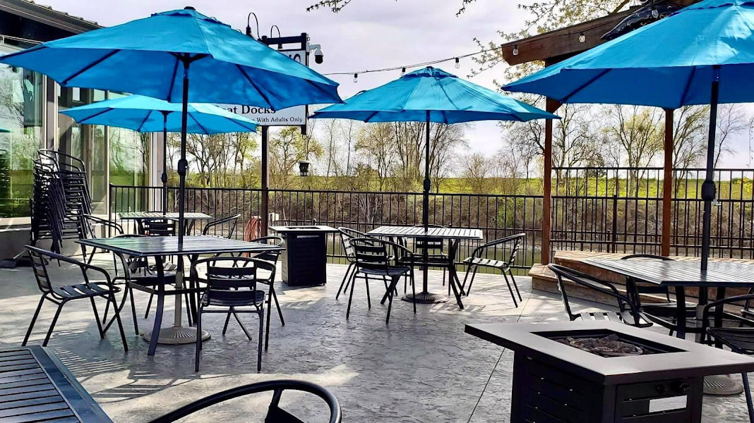
The old river town of Colusa, on the banks of the Sacramento River near the refuge, makes a pleasant midday break with a handful of local restaurants and cafes in its historic brick downtown. Expect straightforward, hearty California and Mexican fare in a genuine farm-town setting, a short walk from the leafy riverfront and the 1861 county courthouse. It is an unhurried lunch between the two wetland stops, with easy parking and small-town prices. Stroll the levee-top river walk afterward if the birds have you in the mood for more water.
4.7$$bar📍 Maps →
2 options · tap to switch
☀️
Afternoon
Gray Lodge Wildlife Area
4.6
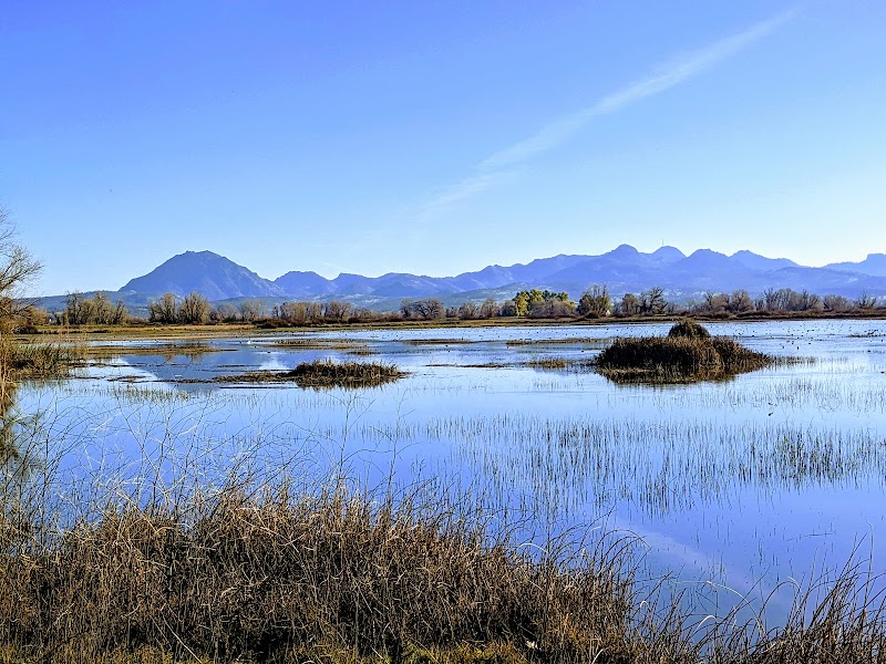
Gray Lodge Wildlife Area, tucked against the western flank of the Sutter Buttes, is the second great wetland of the flyway and a wonderful place to end the trip on foot. A three-mile auto-loop and several miles of walking trails and viewing platforms thread the seasonal marshes, where in winter the sky fills with snow geese and the ponds teem with wintering ducks, herons, and shorebirds against the backdrop of the Buttes you climbed the day before. The walking here is flat and easy, and the closer, quieter viewing rewards patience with foxes, deer, and hawks alongside the waterfowl. It ties the two days together, the wetlands framed by the very range that opened the trip. Bring binoculars, dress for the cold marsh wind in winter, and allow time before the drive home.
🌙
Evening
🚗
Drive
Gray Lodge Wildlife Area, CASacramento, CA
1 hr 15 min5:00 PM6:15 PM
Plan your own escapeExplore more trips →