← The Weekend Getaways
🥾 ActiveWeekend · from Salt Lake City, UT

Moab: Delicate Arch, Dead Horse Point, and Canyonlands' Island in the Sky

Moab sits at the confluence of the Colorado and Green rivers in the canyon country of southeastern Utah, surrounded by two national parks and a landscape of Navajo sandstone and Entrada sandstone that has been eroding into arches, fins, towers, and canyons for 150 million years. The 3.5-hour drive from Salt Lake City is long but rewards disproportionately: Arches National Park contains the world's highest concentration of natural arches — over 2,000 documented — while Canyonlands' Island in the Sky mesa rises 2,000 feet above the canyon junction on a thin neck of land that gives the impression of floating. This two-day circuit covers the iconic Delicate Arch hike, Dead Horse Point's dramatic horseshoe overlook, and the Grand View Point panorama at the mesa's southern edge.

Day 1 — Moab & Arches National Park, UTDay 2 — Canyonlands & Dead Horse Point, UT
Day 1Moab & Arches National Park, UT

Day 1Moab & Arches National Park, UT

🚗 3 hr 30 min driving📍 5 stops
🌅
Morning
🚗
Drive
Salt Lake City, UTArches National Park Visitor Center, Moab
3 hr 30 min8:00 AM11:30 AM
Arches National Park — Balanced Rock & Windows Section
4.8
Arches National Park's 76,679 acres contain more than 2,000 natural stone arches — the highest concentration in the world — formed in the Entrada and Navajo sandstone of the Colorado Plateau over the past 300 million years through the dissolution of salt anticlines that destabilized overlying rock layers. Balanced Rock (128 feet tall, 3,577-ton capstone on a narrowing pedestal) and the Windows Section — Turret Arch (105 ft tall), North Window (51 ft wide, 48 ft tall), and South Window (105 ft span) — are accessible within 30 minutes of the park entrance on paved trails.
🍽️
Lunch
🍽️ Lunch12:30 PM
Moab Diner
Moab Diner
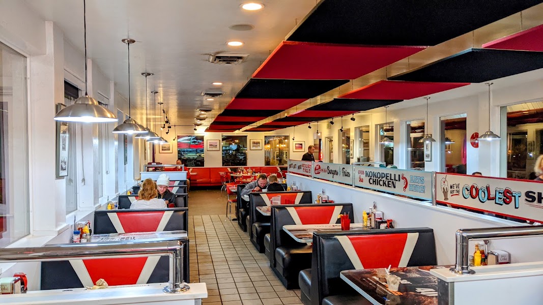
A Moab institution since 1989, the Moab Diner serves no-nonsense American diner food at canyon-country prices: breakfast burritos, green chile cheeseburgers, pie, and milkshakes in a dining room decorated with gear and maps.
4.5$American diner📍 Maps →
4 options · tap to switch
☀️
Afternoon
📍
Delicate Arch Trail
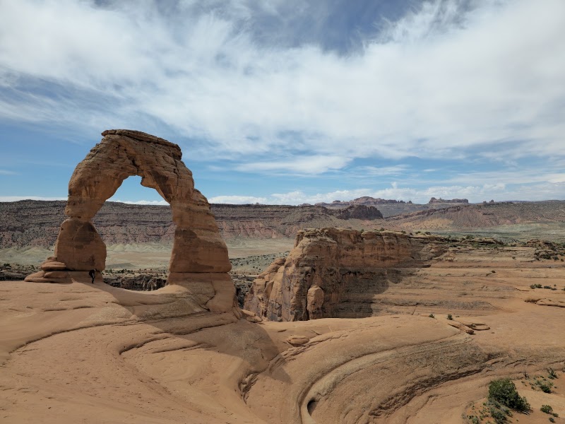
The 3-mile round-trip trail from the Wolfe Ranch trailhead climbs 480 feet over slickrock to Delicate Arch — at 65 feet tall, the largest freestanding arch in Arches National Park and the most photographed natural stone formation in the world, appearing on the Utah license plate, the 2001 US Olympic commemorative quarter, and millions of photographs taken from the bowl-shaped amphitheater at the arch's feet. The final approach across open slickrock rounds a stone fin and reveals the arch framing the La Sal Mountains in a moment of sudden visual drama that rewards the modest physical effort of the hike. Late afternoon light turns the arch from orange to deep red.
🌙
Evening
🍽️ Dinner5:00 PM
Desert Bistro — Moab
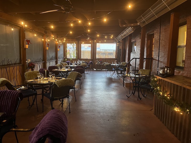
Moab's finest dinner restaurant operates in a Victorian house on 100 West Street with a seasonal menu built around local and regional ingredients: Colorado lamb, canyon-country game, Utah fish, and vegetables from the Moab-area farms that survive in the high desert with irrigation from the Colorado River. The wine list emphasizes the Canyonlands wine region (Colorado's Grand Valley AVA, 90 miles north) and the service matches the ambition of the kitchen.
4.7$$$American restaurant📍 Maps →
3 options · tap to switch
🛏️
Moab Springs Ranch
A riverside property on the Colorado River just north of Moab with cottonwood-shaded casitas and direct Colorado River access — one of the more distinctive lodging experiences in Utah canyon country, combining the comfort of resort amenities with the immediate wildness of the canyon river environment.
Day 2Canyonlands & Dead Horse Point, UT
Day 2Canyonlands & Dead Horse Point, UT

🚗 4 hr 5 min driving📍 7 stops
🌅
Morning
📍
Moab Lunch Detour — Pack In or Stop in Moab
Canyonlands Island in the Sky has zero food services — pack lunch in Moab before the 35-minute drive to the park entrance, or plan a 35-minute Moab detour between Canyonlands and Dead Horse Point. The drive between the two parks actually passes back through the Moab area, making a lunch stop practical.
🚗
Drive
Moab, UTCanyonlands National Park — Island in the Sky
35 min9:00 AM9:35 AM
Mesa Arch — Canyonlands Island in the Sky
4.9
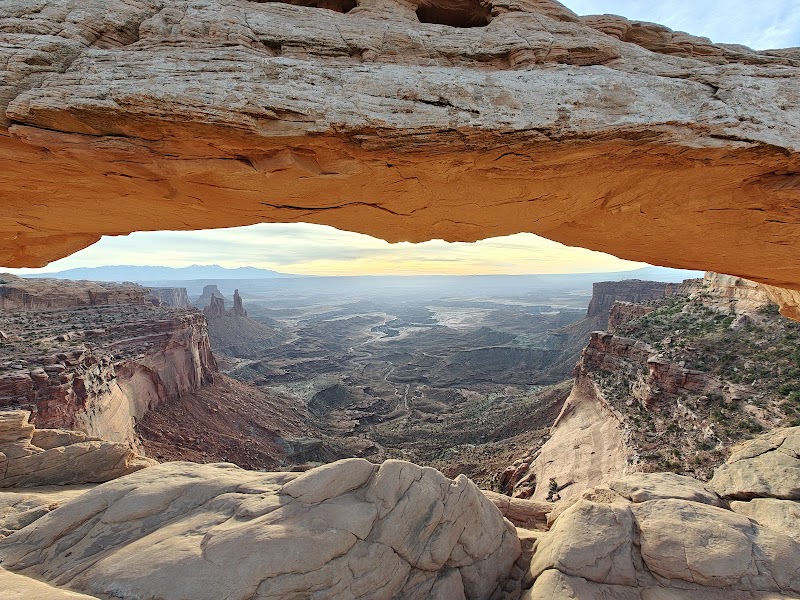
A 0.5-mile round-trip walk from the Island in the Sky main road leads to Mesa Arch, a sandstone arch at the canyon edge whose underside frames the Buck Canyon and the La Sal Mountains in one of the most photographed sunrise compositions in the American West. The arch sits at the very edge of the Island in the Sky mesa rim, 2,000 feet above the canyon floor, and the morning light catches the underside of the stone in a reflected golden glow that lasts approximately 20 minutes after sunrise. Arriving at sunrise requires a 5 AM departure from Moab.
Grand View Point — Island in the Sky
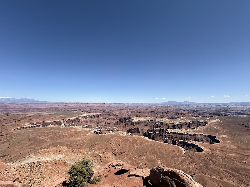
The southern end of the Island in the Sky mesa is the Grand View Point overlook, where a 360-degree panorama takes in the junction of the Green and Colorado rivers 2,000 feet below, the Needles district to the south, the Maze district to the southwest, and the Henry Mountains and Abajo Mountains on the distant horizons. The 1.8-mile round-trip Grand View Point trail follows the mesa rim through piñon-juniper forest to the promontory.
🍽️
Lunch
Upheaval Dome — Island in the Sky
4.7
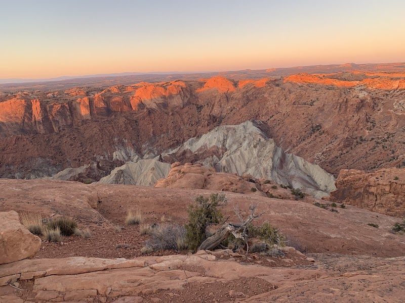
A 1.8-mile round-trip trail from the Upheaval Dome parking area reaches two overlooks above a 3-mile-wide circular depression in the Island in the Sky mesa whose origin is scientifically debated: either a collapsed salt dome or, more likely, a meteor impact crater that punched through the overlying rock layers when the Cretaceous sea covered the region. The white-and-purple banded rock exposed in the crater walls is dramatically unlike the surrounding red Navajo sandstone.
Dead Horse Point State Park
4.8
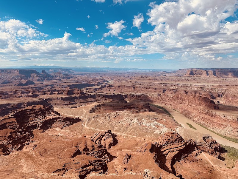
The 14-mile drive from the Island in the Sky entrance to Dead Horse Point follows the mesa's backbone before ending at a narrow neck where the peninsula's "deadhorse" shape — a 5,000-acre plateau connected to the mainland by a 30-yard-wide neck — creates an overlook of the Colorado River's gooseneck 2,000 feet below. The park takes its name from the mustangs that were corralled on the point by cowboys in the late 1800s; some animals apparently died of thirst with the Colorado River visible 2,000 feet below. The view inspired the oil refinery sequence at the end of the film Thelma and Louise.
☀️
Afternoon
Colorado Riverway Scenic Drive — Moab
4.8
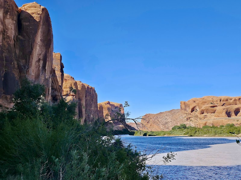
The Utah 128 scenic byway follows the Colorado River upstream from Moab for 44 miles through Canyon Rims country — red canyon walls, cottonwood bottomlands, and the Castle Valley with its Fischer Towers rock formations rising 900 feet from the valley floor. The afternoon drive from Canyonlands back to Moab via the river road provides a quieter finale to the canyon country circuit before the long drive home.
🌙
Evening
🍽️ Dinner5:00 PM
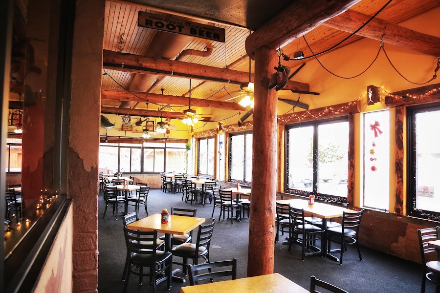
Moab Brewery — Return Dinner
Colorado Plateau craft beers — Derrick Dunkel Dark Ale, Dead Horse Amber, Rocket Bike Lager — alongside wood-fired pizza and burgers before the 3.5-hour return drive to Salt Lake City.
4.1$$Brewpub📍 Maps →
3 options · tap to switch
🚗
Drive
Moab, UTSalt Lake City, UT
3 hr 30 min6:00 PM9:30 PM
Plan your own escapeExplore more trips →