🥾 ActiveWeekend · from San Diego, CA
Mountain High: Cuyamaca Peaks & Sunrise Highway at 6,000 Feet
Two days in the Peninsular Ranges east of San Diego take you from the granite summit of Stonewall Peak and the alpine waters of Lake Cuyamaca on Day 1 to the cloud-level meadows and Pacific Crest Trail corridors of Mount Laguna on Day 2 — where Sunrise Highway crests at 6,000 feet and opens onto sweeping views eastward over the Salton Sea and the Colorado Desert, one of the most dramatic landscape transitions in California accessible by paved road.
Day 1 — Cuyamaca Rancho State Park, CADay 2 — Mount Laguna, CA
Day 1 — Cuyamaca Rancho State Park, CA
Day 1 — Cuyamaca Rancho State Park, CA
🚗 1 hr 15 min driving📍 5 stops
🌅
Morning
🚗
Drive
San Diego, CA → Cuyamaca Rancho State Park — Stonewall Peak Trailhead
1 hr
Stonewall Peak Trail
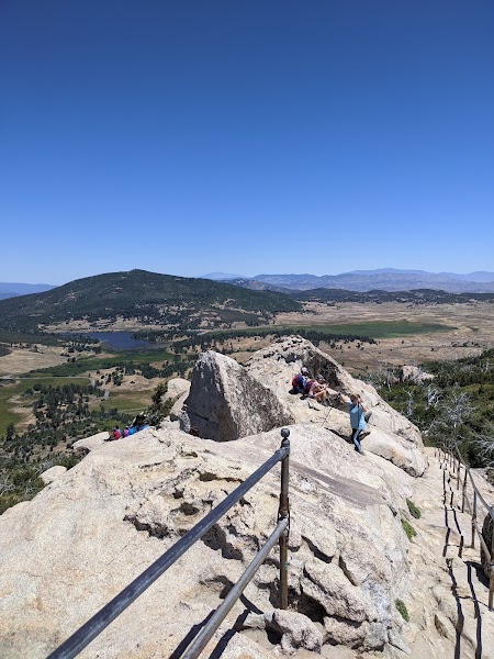
★ Reviews →The Stonewall Peak Trail (4 miles round trip, 980 feet gain) is the most rewarding summit hike in Cuyamaca Rancho State Park — a sustained climb through chaparral and Jeffrey pine forest that emerges at a bare granite summit at 5,730 feet with iron handrails assisting the final exposed rock scramble. The 360-degree view from the top encompasses the Pacific Ocean to the west, Baja California to the south, the Borrego Badlands and Salton Sea to the east, and the Cuyamaca peaks to the north. Morning starts are critical in summer; the exposed south-facing slopes can become uncomfortably hot by midday.
~3.5 hrs📍 See location
🍽️
Lunch
Green Valley Falls & Swimming Holes
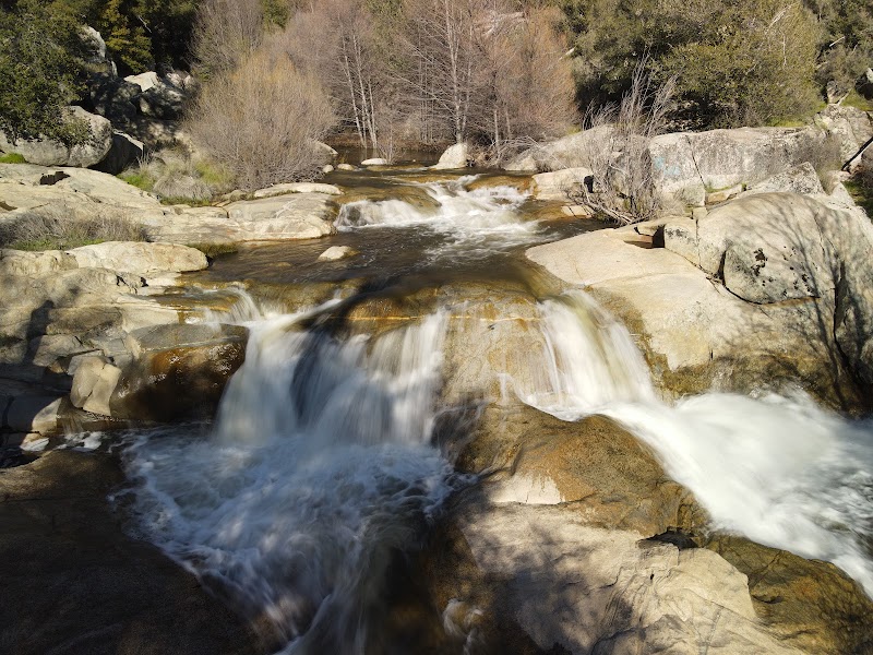
★ Reviews →Green Valley Falls, reached by an easy 1-mile walk from the Green Valley Campground along the Sweetwater River, cascades over a series of granite slabs into natural pools deep enough for swimming from spring through early fall. The shaded canyon riparian corridor provides a 10-15 degree temperature drop compared to the exposed peaks, and the pools are a perfect midday recovery spot after the Stonewall Peak climb. The falls themselves drop about 20 feet in a series of steps over smoothed granite.
~45 min📍 See location
🍽️ Lunch~1 hr
Julian Grille
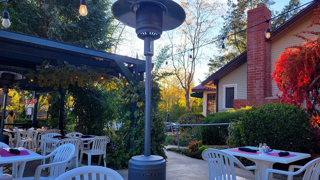
The Julian Grille is a reliable full-service restaurant in Julian's historic downtown, serving hearty American comfort food — steaks, pasta, and seasonal specials — in a Western-themed dining room that has been a mountain community gathering place for decades. A 15-minute drive from Green Valley Falls, it provides a proper sit-down lunch before the Lake Cuyamaca afternoon.
3 options · tap to switch
☀️
Afternoon
🚗
Drive
Julian, CA → Lake Cuyamaca
15 min
📍
Lake Cuyamaca Kayak Rental
★ Reviews →Lake Cuyamaca at 4,600 feet elevation is the highest recreational lake in San Diego County and one of the most tranquil paddling destinations in Southern California. The 110-acre reservoir is surrounded on all sides by Jeffrey pine and California black oak forest, and the boat rental concession provides kayaks, pedal boats, and rowboats for hourly use. The lake is stocked year-round with rainbow trout, largemouth bass, and catfish — fishing licenses are available at the concession — and paddling across the glassy surface with the Cuyamaca peaks reflected below is a remarkable contrast to the summit hiking of the morning.
~1.5 hrs📍 See location
🌙
Evening
🛏️
Orchard Hill Country Inn — Julian
Orchard Hill Country Inn on the hilltop above Julian provides the finest overnight in the mountain community — craftsman-style cottages with fireplaces, 4 hilltop acres with mountain views, and a full hot breakfast that powers an active Day 2 start on Mount Laguna.
Day 2 — Mount Laguna, CA
Day 2 — Mount Laguna, CA
🚗 1 hr 30 min driving📍 4 stops
🌅
Morning
🚗
Drive
Julian, CA → Mount Laguna — Sunrise Highway
35 min
Sunrise Highway — Desert View Pullout
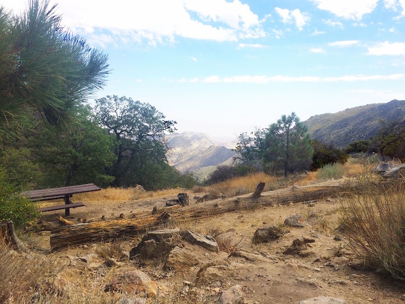
★ Reviews →Sunrise Highway (County Route S-1) is one of California's great scenic drives — a 25-mile route that climbs from the desert floor through chaparral into the cool conifer forests of the Laguna Mountains, reaching elevations of 6,000 feet at its crest near Mount Laguna village. At the Desert View Picnic Area near the summit, the land falls away sharply on the east side of the ridge, revealing the Colorado Desert spreading to the horizon — the Salton Sea glinting 5,000 feet below, the Chocolate Mountains beyond, and on exceptionally clear days the Arizona ranges in the distance. The view represents one of the most abrupt ecological and topographic transitions on the Pacific Coast: in less than 10 miles of driving, you cross from alpine conifer forest to low Sonoran Desert.
~1.5 hrs📍 See location
🍽️
Lunch
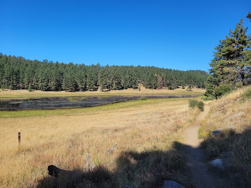
Big Laguna Trail — Laguna Meadow
★ Reviews →The Big Laguna Trail loops through the Laguna Meadow system at the summit of the Laguna Mountains — a series of connected meadows and seasonal vernal pools set among Jeffrey pines and white firs at 5,500-6,000 feet elevation. The meadows are at their most dramatic in late spring and early summer when wildflowers bloom in the damp grass margins of the pools, and in autumn when the mountain maples turn gold along the creek margins. The full Big Laguna Trail loop covers approximately 6 miles with minimal elevation change, making it an accessible all-ability hike with outstanding birdlife — mountain bluebirds, Steller's jays, and flocks of mountain chickadees work the meadow edges throughout the day.
🥪No food available here — pack a trail lunch.
~1 hr📍 See location
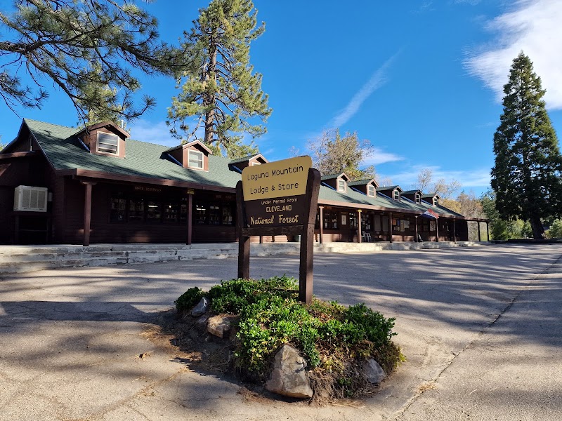
Laguna Mountain Lodge Store
★ Reviews →The Laguna Mountain Lodge store and visitor center serves as the community hub for the small Mount Laguna village, offering basic café items, snacks, sandwiches, and cold drinks for hikers taking a midday break. The store also carries trail maps, PCT guidebooks, and basic hiking supplies. The picnic tables outside, shaded by ponderosa pines, are one of the best simple lunching spots in the Laguna Mountains.
~1.5 hrs📍 See location
☀️
Afternoon
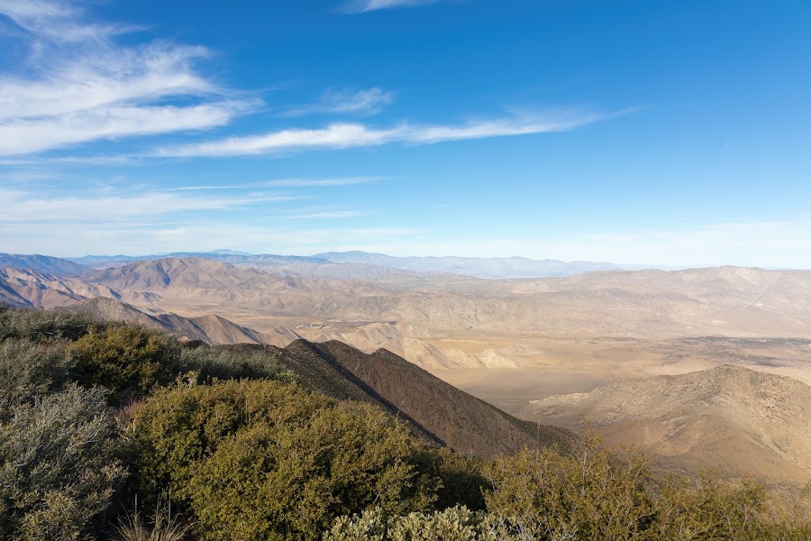
Pacific Crest Trail — Mount Laguna Section
★ Reviews →The Pacific Crest Trail passes through Mount Laguna on its way from the Mexican border (75 miles south) toward Canada, and the section through the Laguna Mountains is among the most scenically varied on the entire Southern California PCT — alternating between dense Jeffrey pine forest, open meadows with east-facing desert views, and exposed granite ridge walks. The PCT trailhead at Mount Laguna is mile marker 43 from the southern terminus at Campo, and northbound hikers typically reach it on their third or fourth day of the thru-hike. Day hikers can walk any section; the 3-mile stretch south toward Horse Heaven trailhead through the meadow corridor is particularly rewarding.
~2.5 hrs📍 See location
🌙
Evening
🚗
Drive
Mount Laguna, CA → San Diego, CA
55 min
← All San Diego trips
More getaways from San Diego
Anza-Borrego in a Day: Badlands, Slot Canyons & Palm Oasis — Day trip🥾Anza-Borrego Two Days: Slot Canyons, Palm Groves & Desert Solitude — Weekend🥾Three Ecosystems in Three Days: Desert, Mountains & Ancient Forest — Long weekend🥾Temecula in a Day: Adobes, Vines & Valley Gold — Day trip🏛️Temecula Weekend: Wines, Luiseño Heritage & Ecological Reserves — Weekend🏛️Missions, Battlefields & Wine: Three Days Through San Diego's Cultural Heart — Long weekend🏛️North Coast Day: Flower Fields, Surf Breaks & Coastal Strolling — Day trip🌿North Coast Weekend: Flower Fields, Ranchero History & Coastal Strolling — Weekend🌿
© 2026 theweekendgetaways.com · All itineraries are original content. Terms
Plan your own escapeExplore more trips →