← The Weekend Getaways
🥾 ActiveWeekend · from Tucson, AZ

Aravaipa Canyon Wilderness — Wading the Desert Narrows

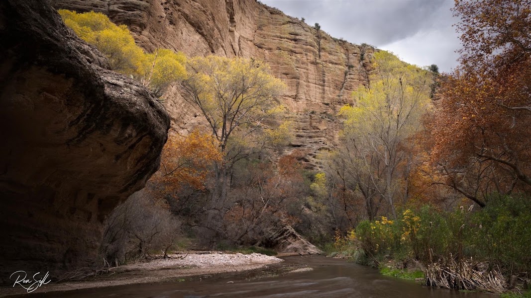
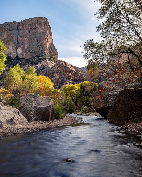
Two hours north of Tucson, hidden in the folds between the Galiuro and Santa Teresa mountains, Aravaipa Creek runs year-round through an eleven-mile slot of tawny canyon walls — one of the rarest things in Arizona, a perennial desert stream you hike by walking straight up its bed. Aravaipa is a designated wilderness with a strict daily quota, and a permit reserved in advance is required to enter; this is not a spur-of-the-moment stop but a planned pilgrimage into one of the state's most pristine riparian corridors, home to bighorn sheep, coatimundi, and one of the healthiest native-fish populations in the Southwest. Day one is spent wading upstream through the cottonwood-and-sycamore narrows, criss-crossing the ankle-to-knee-deep creek beneath 1,000-foot walls. Day two explores the remote ranch country of the Klondyke area and the piñon foothills of the Galiuro Wilderness before the long drive home. Nights are spent in the wide-open Aravaipa/Klondyke backcountry or in the farming town of Safford to the east.

Day 1 — Wading the perennial Aravaipa Creek narrows (permit required)Day 2 — The Klondyke area & the Galiuro foothills
Day 1Aravaipa Canyon Wilderness (West Entrance), AZ
Day 1Aravaipa Canyon Wilderness (West Entrance), AZ
🚗 4 hr 30 min driving📍 5 stops
🌅
Morning
🚗
Drive
Tucson, AZAravaipa Canyon West Trailhead
2 hr8:00 AM10:00 AM
Aravaipa Canyon West Trailhead & Permit Check-In
4.8
The west trailhead, reached via Aravaipa Road east of Mammoth, is the gateway to the wilderness and the point at which your reserved permit truly matters. Entry to Aravaipa Canyon is strictly limited — the Bureau of Land Management caps day and overnight use through an advance online reservation system, and rangers do check; without a permit in hand you cannot legally enter, so book weeks ahead, especially for weekends and the mild spring and fall seasons. There are no services here: a small parking area, a registration kiosk, and a pit toilet mark the boundary between the road and true wilderness. Sign in, check the weather one last time (flash floods are the real hazard), and prepare to get your feet wet — the trail is the creek.
🍽️
Lunch
Wading the Aravaipa Creek Narrows
4.6
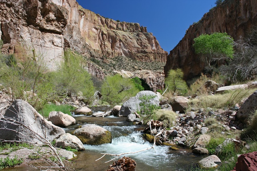
There is no maintained trail through Aravaipa — the route is the stream itself, and hiking means wading and criss-crossing the perennial creek dozens of times as it braids between sandbars beneath towering canyon walls. The water is usually ankle to knee deep and pleasantly cool, running clear over gravel through a green tunnel of Fremont cottonwood, Arizona sycamore, and velvet ash that shelters desert bighorn, coatimundi, and abundant birdlife. Progress is slow and deliberate — expect one to one-and-a-half miles per hour over slick cobbles — so pick a turnaround time rather than a distance and savor the side canyons, such as Hell Hole and Horse Camp, that open off the main stem. Wear sturdy shoes you don't mind soaking, bring trekking poles for balance, and never enter or stay in the canyon if storms threaten upstream.
Streamside Picnic in the Canyon
4.8
There are no shops, water sources you'd want to drink untreated, or facilities of any kind inside the wilderness, so everything you eat must be carried in — and carried out. A gravel bar in the shade of the cottonwoods, with the creek murmuring past, is as fine a lunch spot as Arizona offers. Pack a full picnic, plenty of water, and a trash bag; leave no trace in this fragile riparian corridor.
12:00 PM📍 See location
☀️
Afternoon
Side Canyons & the Return Wade
4.8
The afternoon is for the unhurried return downstream, when the low sun sets the canyon walls glowing amber and the cottonwoods shimmer overhead. Aravaipa's side canyons are among its greatest rewards — short detours up Hell Hole Canyon or into the boulder-choked mouths of the tributaries reveal hanging gardens, dry falls, and pockets of stillness away from the main stream. Watch the water for native fish, which thrive here in one of the last strongholds of Arizona's original desert-stream ecosystem. Time the walk out to reach the trailhead with daylight to spare; the creek crossings are far harder to read after dark, and there is no cell service to call for help.
🌙
Evening
🚗
Drive
Aravaipa Canyon West TrailheadSafford, AZ
2 hr 30 min5:00 PM7:30 PM
🛏️
Safford lodging (Klondyke backcountry alternative)
The nearest town with a full range of hotels is Safford, in the Gila Valley about an hour and a quarter east, offering reliable chain motels, restaurants, and fuel — the sensible base for a comfortable night and a strong launch point for day two around Klondyke. Those wanting to stay close to the wild eastern side of Aravaipa can instead camp or reserve a spot in the remote Klondyke area itself, where a BLM campground and a scattering of primitive sites sit near the east trailhead — utterly quiet, dark-sky country, but with no services, so arrive fully provisioned. Book any Aravaipa-area lodging or camping well ahead; options are few and fill fast.
Day 2Klondyke & the Galiuro Foothills, AZ
Day 2Klondyke & the Galiuro Foothills, AZ

🚗 3 hr 45 min driving📍 4 stops
🌅
Morning
🚗
Drive
Safford, AZKlondyke & Aravaipa East Area
1 hr 15 min8:00 AM9:15 AM
Klondyke & the Aravaipa East Trailhead
4.8
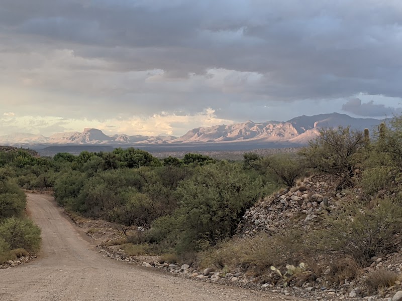
Klondyke is barely a place at all — a ghostly ranching outpost with a shuttered historic store and a scatter of homesteads at the end of a long dirt road, named by miners returning from the Yukon gold rush. It is the eastern gateway to Aravaipa Canyon and a window into the hard, isolated life of the Aravaipa Valley's settlers. From here a short exploration up the east trailhead lets you sample the canyon's quieter upper end (a permit is still required to enter the wilderness itself), while the drive in crosses classic high-desert grassland grazed by cattle and pronghorn. The remoteness is the point: fuel up, air up your tires, and treat the graded dirt roads with respect, especially after rain.
🍽️
Lunch
Galiuro Foothills — Turkey Creek Area
Rising west of Klondyke, the Galiuro Mountains form one of the least-visited wilderness ranges in Arizona — a rugged double spine of volcanic ridges cloaked in piñon, juniper, and manzanita, with almost no roads and few trails. From the foothills near Turkey Creek you can strike out on faint paths into the range's edge for big, empty views back over the Aravaipa Valley and up toward the high Galiuro crest, where Powers Garden and the infamous 1918 Power's Cabin shootout site lie deep in the backcountry. Even a short foray delivers the essential Galiuro experience: absolute solitude, tangled desert forest, and the sense of standing at the far margin of the settled Southwest. Carry all your water and a good map; this is genuinely remote country.
Tailgate Picnic in the Aravaipa Valley
4.6
With no restaurants anywhere near Klondyke, lunch is again what you carry — a tailgate picnic under a lone mesquite in the grassland, with the Galiuros on one side and the Santa Teresas on the other and not a building in sight. Bring shade if you can; the valley is exposed and hot outside the winter months. Pack out everything and top off your water for the drive back east.
11:15 AM📍 See location
☀️
Afternoon
Roper Lake State Park & Dankworth Pond
4.6
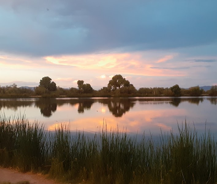
On the return leg toward Safford, Roper Lake State Park makes a restorative final stop after two rugged days. The park's small lake sits beneath the towering 10,720-foot backdrop of Mount Graham, with an easy shoreline trail, birdable marsh, and — the great luxury here — a natural stone hot-spring tub fed by geothermal water, perfect for soaking trail-weary legs. The adjacent Dankworth Pond unit adds a short interpretive loop past a reconstructed prehistoric village. It is a gentle, water-cooled contrast to the dry Galiuro country and a fitting place to rinse off before the long drive back to Tucson.
🌙
Evening
🚗
Drive
Safford, AZTucson, AZ
2 hr 30 min5:00 PM7:30 PM
Plan your own escapeExplore more trips →