Mount Graham & the Pinaleños — The Sky Island of the Gila Valley
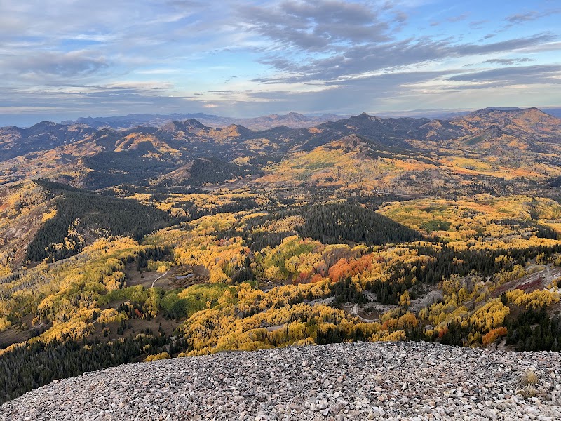
Two and a half hours east of Tucson, the Pinaleño Mountains vault more than 6,000 vertical feet out of the Gila Valley desert to the 10,720-foot summit of Mount Graham — the greatest vertical relief of any range in Arizona and a true sky island, whose slopes stack five distinct life zones from Sonoran desert to spruce-fir forest in a single climb. Day one is the ascent itself, up the winding Swift Trail past changing forests to alpine meadows and long views over the San Simon and Gila valleys. Day two lingers in the cool high country around Riggs Flat Lake, a spring-fed reservoir tucked at 8,600 feet among the pines, with lakeshore and forest trails. Day three descends to the valley floor to walk the Gila River corridor and the birdable Cluff Ponds before the long drive home. Note that the upper Swift Trail is gated and closed by snow from roughly mid-November to mid-April, so this is a late-spring-through-fall journey; the town of Safford anchors the nights.
Day 1 — The Swift Trail up Mount GrahamDay 2 — Riggs Flat Lake & the high-country trailsDay 3 — The Gila River & the Cluff Ponds
Day 1 — Mount Graham / Pinaleño Mountains, AZ
Day 1 — Mount Graham / Pinaleño Mountains, AZ
🚗 3 hr 30 min driving📍 5 stops
🌅
Morning
🚗
Drive
Tucson, AZ → Swift Trail Junction, Safford, AZ
2 hr 30 min8:00 AM → 10:30 AM
The Swift Trail (Highway 366) Ascent
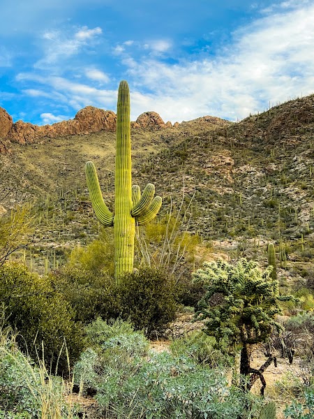
The Swift Trail, State Route 366, is one of Arizona's great mountain roads — a narrow, winding climb that rises more than 6,000 feet from the desert floor near Safford to the spruce-fir crest of Mount Graham, crossing five life zones and the equivalent of a drive from Mexico to Canada in under 35 miles. The lower switchbacks wind up through saguaro and grassland into oak and juniper, then pine, then cool aspen and fir as the temperature drops twenty degrees or more. Numerous overlooks frame vast views over the Gila and Sulphur Springs valleys and the ranges beyond. The upper section becomes gravel and is gated shut by snow from roughly mid-November to mid-April — check that it's open before you go — so time this for late spring through fall. Drive slowly; the road is steep, exposed, and shared with cyclists and wildlife.
Partway up the Swift Trail, the Arcadia National Recreation Trail offers the first real hike of the trip, climbing from the Arcadia Campground area through a cool transition forest of Douglas fir, ponderosa pine, and Gambel oak. The full trail runs about 5.5 miles one way to Shannon Campground with substantial elevation gain, but even an out-and-back sampling of its lower reaches rewards with shade, birdsong, and window views out over the desert far below — a striking contrast to the valley heat you left an hour earlier. Nearby, the short Wet Canyon area shelters one of the range's rare running streams. This is a fine leg-stretcher on the way up, gaining altitude gently before the higher-country hiking to come.
There is no food service anywhere on Mount Graham, so a packed lunch is essential — and the shaded picnic tables at Arcadia Campground, set among tall firs at around 6,700 feet, make a cool, fragrant spot to eat after the morning climb. The air here is crisp even when the valley bakes. Stock up on food, water, and fuel in Safford before starting up the mountain; carry out all trash to protect the forest.
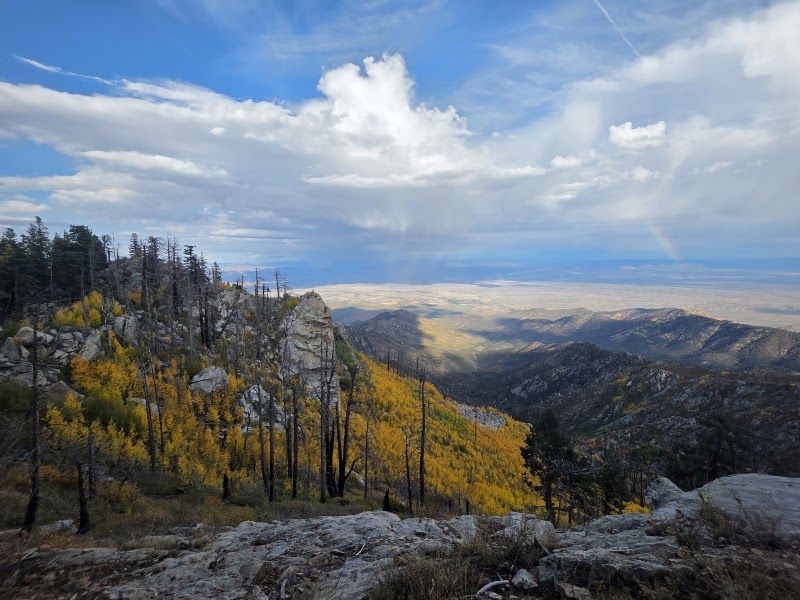
Continuing up the Swift Trail, a spur road and trail lead toward Heliograph Peak at 10,022 feet, crowned by a historic fire lookout named for the sun-flashing signal stations the Army used here in the Apache Wars. The road to the tower is often gated, making the final stretch a walk of a mile or so that climbs through spruce and fir to one of the widest panoramas in southeastern Arizona — the Gila Valley, the distant Chiricahuas and Galiuros, and the White Mountains ranged across the horizon. Even a stop at the high pullouts along the crest delivers alpine air, wildflower meadows in summer, and the surreal experience of standing in a northern forest while the desert shimmers thousands of feet below. Watch the sky, as afternoon storms build quickly at this altitude.
Safford, the seat of Graham County in the Gila Valley below the mountain, is the natural base for all three nights — a friendly farming and college town with a full range of chain hotels, restaurants, fuel, and groceries, and the last real services before the long climb up the Swift Trail. After a day of altitude, the valley's warmth and easy dining are welcome. For a memorable alternative, the nearby Roper Lake State Park has a natural hot-spring soaking tub and a handful of cabins beneath the towering backdrop of Mount Graham itself. Provision here each morning; there is nothing to buy on the mountain.
Day 2 — Riggs Flat Lake & the Pinaleño High Country, AZ
Day 2 — Riggs Flat Lake & the Pinaleño High Country, AZ
🚗 2 hr 30 min driving📍 5 stops
🌅
Morning
🚗
Drive
Safford, AZ → Riggs Flat Lake, Mount Graham
1 hr 15 min8:00 AM → 9:15 AM
Riggs Flat Lake
★ 4.6
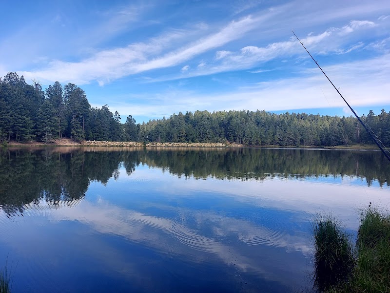
Near the far end of the Swift Trail's gravel upper section, Riggs Flat Lake is the jewel of the high Pinaleños — an 11-acre spring-fed reservoir tucked at about 8,600 feet among tall spruce, fir, and aspen, its still water mirroring the surrounding forest. It is a startling sight in a desert state: cool, pine-scented, and often twenty degrees cooler than the valley floor. A shoreline trail circles the lake for an easy, beautiful walk, and the water is stocked with trout for anglers. The drive out along the crest is itself a highlight, threading old-growth forest with occasional windows onto the ranges below. Because reaching the lake requires the full gravel drive, confirm the upper Swift Trail is open and passable before setting out; it is closed by snow much of the year.
The high crest of the Pinaleños is laced with quiet forest trails through the spruce-fir zone, and the loops and connectors around Grant Hill, Clark Peak, and the Columbine area make for superb, cool midday hiking far above the desert. These paths wind through dense old-growth conifer, past aspen groves that blaze gold in October, and across small meadows carpeted with summer wildflowers, with the occasional overlook opening onto the vast valleys below. The forest here shelters the endangered Mount Graham red squirrel, found nowhere else on Earth, along with black bear and wild turkey. Distances and difficulty are flexible — pick a loop to match the group's energy — and the altitude near 9,000 feet makes even gentle grades feel earned. Carry layers; the high country can turn cold and stormy quickly.
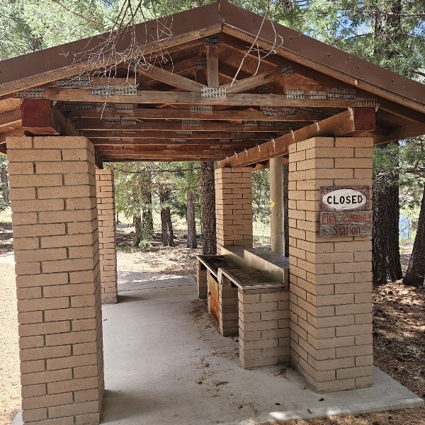
The picnic and day-use area at Riggs Flat Lake is one of the finest lunch spots in southern Arizona — tables set among the firs at the water's edge, with the lake glinting and the forest silent but for the wind and birdsong. Pack in everything, as there are no services anywhere on the mountain, and bring warm layers; even summer days are cool at this altitude. Pack out all trash to protect this fragile high-country lake and its wildlife.
Columbine & the Mount Graham International Observatory Vista
★ 4.5
Near the end of the Swift Trail, the small forest settlement of Columbine sits high on the crest amid meadows and conifer, close to the Mount Graham International Observatory, whose telescopes exploit the range's dark skies and stable mountain air from the summit ridge (the observatory itself is accessible only by guided tour arranged in advance through Eastern Arizona College). Even without touring the domes, the crest around Columbine offers cool afternoon strolls through wildflower meadows and stands of old-growth Engelmann spruce, with the sense of standing on an alpine island marooned in a desert sea. It is a peaceful, otherworldly way to spend the last high-country hours before descending the long road back to the valley.
A second night in Safford lets you unwind after the descent, with the valley's restaurants — Mexican, American, and a couple of local favorites — an easy end to a day at altitude. If you haven't yet, an evening soak in the geothermal hot-spring tub at nearby Roper Lake State Park, beneath the very mountain you spent the day on, is the perfect way to loosen tired legs under a brilliant dark sky. Rest up and provision for tomorrow's gentler valley-floor exploring before the drive home.
Day 3 — Gila River & the Cluff Ponds, Safford, AZ
Day 3 — Gila River & the Cluff Ponds, Safford, AZ
🚗 2 hr 50 min driving📍 4 stops
🌅
Morning
🚗
Drive
Safford, AZ → Cluff Ponds / Gila River Corridor
20 min8:00 AM → 8:20 AM
Cluff Ponds Wildlife Area
★ 3.8
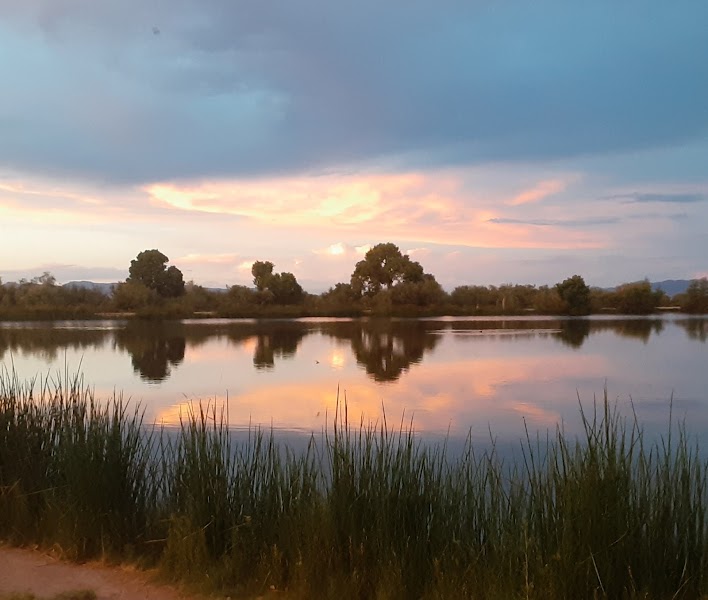
The Cluff Ponds, a cluster of small former agricultural reservoirs on the outskirts of Safford, have become one of the Gila Valley's best birding and easy-walking spots — a green, water-fringed oasis at the foot of Mount Graham. Flat trails and levees loop between the ponds through willow and mesquite, and the water draws herons, egrets, ducks, and a steady parade of migrants that make this a favorite of local birders. Anglers fish the stocked ponds, and the setting — still water reflecting the great bulk of the mountain you climbed yesterday — makes a gentle, restorative start to the final day. It is an easy, mostly shaded amble ideal for legs tired from two days at altitude.
Gila River Corridor & Gila Box Riparian National Conservation Area
★ 4.7
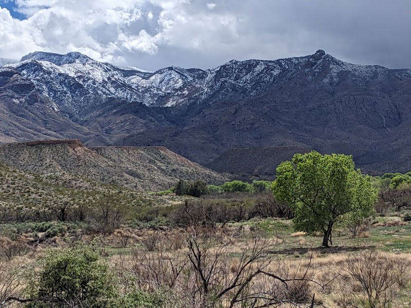
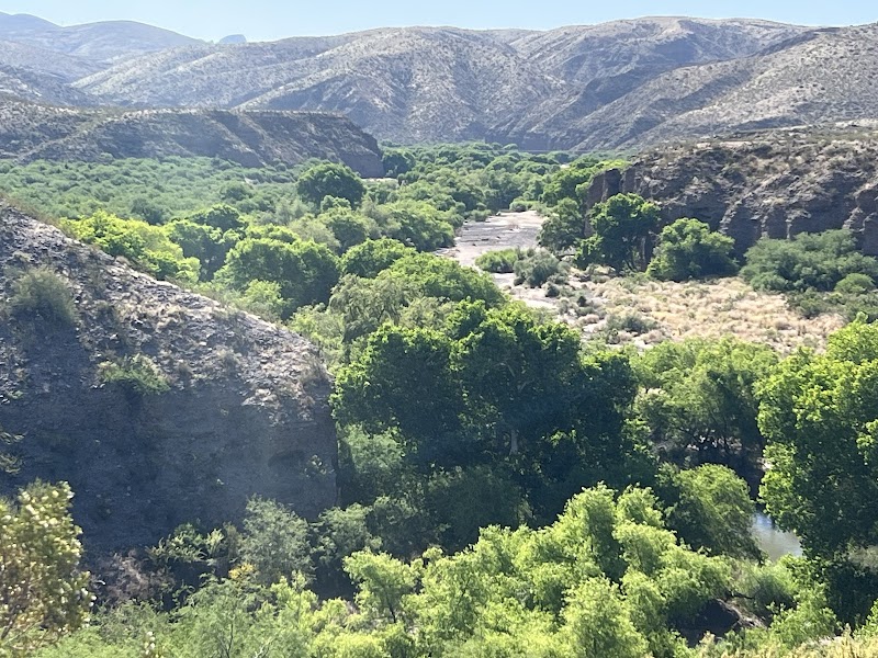
Northeast of Safford, the Gila River carves the Gila Box Riparian National Conservation Area, a lush ribbon of cottonwood-willow forest and towering canyon walls that shelters beaver, javelina, and more than a hundred species of nesting and migrating birds — one of only two riparian national conservation areas in the country. Easy access points such as Owl Creek and the Bonita Creek confluence offer streamside walks beneath big cottonwoods, with the river running clear over gravel bars and the desert cliffs rising above. It is a striking counterpoint to the alpine forest of the past two days: the same water that greens the valley, seen at the bottom of its journey. Watch for flash floods in the side canyons during monsoon season, and carry water for the exposed stretches.
Back in town, downtown Safford offers the trip's final sit-down meal before the long drive west — a handful of well-loved Mexican restaurants, a brewpub, and casual American spots along Main Street, several in restored early-twentieth-century buildings. After three days of packed picnics on the mountain, a hearty plate of Sonoran enchiladas or a burger and a cold drink is a fitting reward. Fill the tank and grab water for the road; it's a two-and-a-half-hour run back to Tucson from here.
A last easy stop before the drive home, Roper Lake State Park sits just south of Safford beneath the full 10,720-foot rise of Mount Graham — the mountain that has anchored the whole trip, now seen in one grand sweep. The park's small lake has a flat, birdable shoreline loop, a swimming beach, and a natural stone hot-spring tub for one final soak of tired legs. The nearby Dankworth Pond unit adds a short interpretive trail past a reconstructed prehistoric Indian village. It is a serene, water-cooled place to close the weekend and take a last long look at the Pinaleños before pointing the car back toward Tucson.