🥾 ActiveLong weekend · from Knoxville, TN
Cherohala & Tellico — Skyway Balds, River Falls & Indian Boundary
Three days in the southern Cherokee National Forest, ninety minutes south of Knoxville, where the Cherohala Skyway climbs to mile-high balds and the Tellico and Bald rivers tumble through some of the finest waterfall country in Tennessee. Day one drives the Cherohala Skyway's high ridgeline to sweeping overlooks and stops at the roadside spectacle of Bald River Falls. Day two explores Tellico Plains and follows the Tellico River road upstream past cascades to the hidden Coker Creek Falls. Day three traces the historic Unicoi Turnpike, an ancient Cherokee trading path, and finishes with a paddle and swim at tranquil Indian Boundary Lake before the return to Knoxville. The mountain town of Tellico Plains anchors all three nights.
Day 1 — The Cherohala Skyway & Bald River FallsDay 2 — Tellico Plains, the Tellico River & Coker Creek FallsDay 3 — The Unicoi Turnpike & Indian Boundary Lake
Day 1 — Cherohala Skyway & Bald River Falls, TN
Day 1 — Cherohala Skyway & Bald River Falls, TN
🚗 2 hr 5 min driving📍 5 stops
🌅
Morning
🚗
Drive
Knoxville, TN → Tellico Plains, TN
1 hr 30 min8:00 AM → 9:30 AM
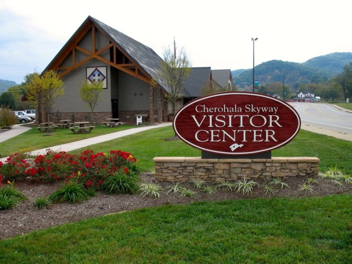
Cherohala Skyway Visitor Center, Tellico Plains
★ 4.8Tellico Plains is the western gateway to the Cherohala Skyway and the base for all three days of this trip. The Skyway visitor center and the adjacent Charles Hall Museum offer orientation to the southern Cherokee National Forest, current road and weather conditions for the high country, and trail and river information. The Skyway climbs above 5,000 feet and weather at the top can differ sharply from the valley, so check conditions before setting out. Pick up a forest map and confirm the status of the river and falls stops; fill the tank here, as fuel and services thin out quickly once you leave town for the mountains.
9:30 AM📍 See location
🍽️
Lunch
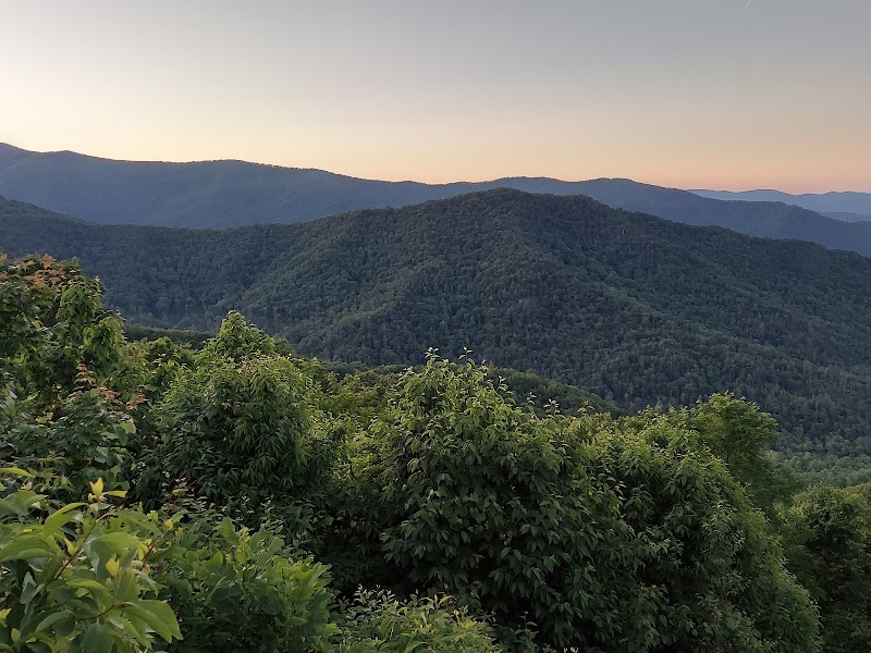
Cherohala Skyway — Ridgeline Overlooks
★ 4.8The Cherohala Skyway is one of the great scenic drives of the Southern Appalachians, a 43-mile National Scenic Byway that climbs from Tellico Plains over mile-high ridgelines to Robbinsville, North Carolina. The Tennessee half rises steadily through hardwood forest to a string of high overlooks — Turkey Creek, Brushy Ridge, and the pull-offs near the state line — where the view opens across ridge after ridge of unbroken national forest. Short trails from the crest lead onto grassy balds and high meadows like Hooper Bald and Huckleberry Knob, worth a leg-stretch for the panoramas. The road is smooth and well graded but the elevation is real; watch for fog and, in the shoulder seasons, patches of ice near the top.
10:30 AM📍 See location
🍽️ Lunch11:30 AM
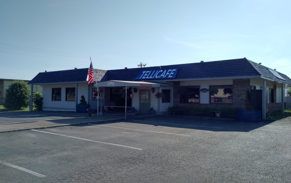
Tellico Plains Lunch Stop
Back down in Tellico Plains, the small downtown has a cluster of cafes, grills, and a brewery serving hearty mountain-town fare — burgers, barbecue, trout, and pie — that hits the spot between the Skyway drive and the afternoon at the falls. It is a relaxed, unpretentious place to eat and the main food stop of the day, since there are no restaurants along the river road to the falls. Grab water and trail snacks here for the afternoon. For those who would rather stay in the forest, packing a picnic to eat streamside near Bald River Falls is an easy alternative.
2 options · tap to switch
☀️
Afternoon
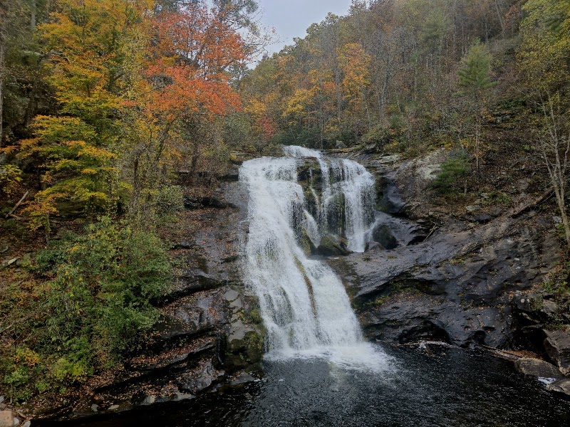
Bald River Falls
★ 4.9Bald River Falls is one of the most spectacular roadside waterfalls in Tennessee — a powerful 90-foot cascade that thunders down a broad rock face directly beside the Forest Service road, viewable from a bridge that crosses at its very base. The volume is impressive in any season and torrential after rain, sending spray across the bridge. For more than the drive-up view, the Bald River Trail climbs alongside the gorge above the falls, following the tumbling river past smaller cascades and deep pools through a lush forest of hemlock and rhododendron. The riverside setting on the Tellico River road makes it easy to combine the falls with a wade or a shaded picnic on a hot afternoon before returning to town.
12:30 PM📍 See location
🌙
Evening
🚗
Drive
Bald River Falls → Tellico Plains, TN
35 min5:00 PM → 5:35 PM
🛏️
Tellico Plains Overnight
Tellico Plains is the base for all three nights, a friendly mountain town at the foot of the Skyway with a range of lodging suited to an outdoors trip. Options include cozy cabins and cottages along the Tellico River, a couple of small inns and motels in and around town, and riverfront campgrounds for those with gear. Staying put here for all three nights keeps you close to the Skyway, the river road, and Indian Boundary, and lets you enjoy the town's restaurants and brewery in the evenings. Book cabins early in fall foliage season, when the Skyway draws crowds.
Day 2 — Tellico River & Coker Creek Falls, TN
Day 2 — Tellico River & Coker Creek Falls, TN
🚗 50 min driving📍 4 stops
🌅
Morning
🚗
Drive
Tellico Plains, TN → Tellico River Road
20 min8:00 AM → 8:20 AM
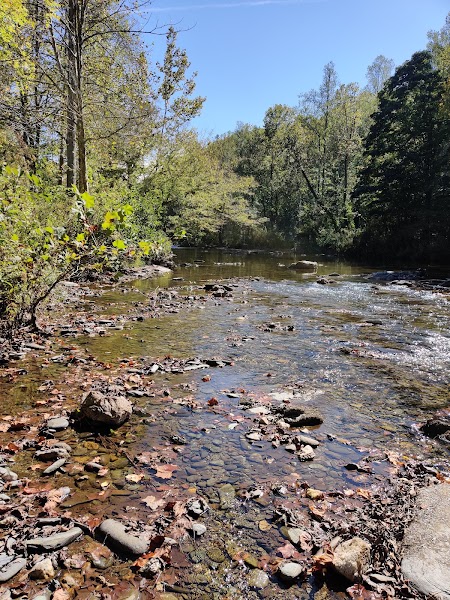
Tellico River Road & Cascades
★ 4.8The Tellico River Road follows the river deep into the Cherokee National Forest, a beautiful drive shadowing clear, boulder-strewn water the whole way. The morning is for exploring its string of pull-offs: swimming holes and gravel bars, roadside cascades, and the trout water that draws anglers from across the region — the Tellico is one of Tennessee's most storied stocked trout streams. Short trails drop to the river's edge at several points, and side roads lead to smaller falls and the North River area. It is an easy, unstructured morning of wading, casting, rock-hopping, and river photography in one of the prettiest forest corridors in East Tennessee, all within a short drive of last night's base.
8:20 AM📍 See location
🍽️
Lunch
🍽️ Lunch9:20 AM
Tellico Plains Midday Refuel
Swing back through Tellico Plains for lunch before the afternoon push to Coker Creek. The town's downtown grills, cafe, and brewery serve the hearty mountain fare — smoked meats, trout, burgers, and cobbler — that suits a day of river wading and hiking. It is the last dependable food, groceries, and fuel before the more remote Coker Creek area to the south, so top off and grab trail snacks and water here. For those who would rather not backtrack, a packed picnic eaten at a Tellico River pull-off keeps the morning by the water going.
2 options · tap to switch
☀️
Afternoon
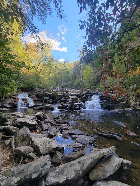
Coker Creek Falls
★ 4.8South of Tellico Plains, Coker Creek tumbles through a wooded gorge in a series of cascades and waterfalls, the largest dropping in a long, staircase rush over mossy ledges. The Coker Creek Falls trail follows the creek downstream from the trailhead, a moderate walk with several viewpoints of the successive cascades and pools; the full route continues on toward the Unicoi Turnpike and Coker Creek's old gold-mining country. The area has a rich history — this was the site of one of the earliest gold rushes in the Southeast in the 1820s and 1830s, on land that was then Cherokee. The shaded creek and its cascades make a cool, satisfying centerpiece to the day before the drive back to town.
12:00 PM📍 See location
🌙
Evening
🚗
Drive
Coker Creek Falls → Tellico Plains, TN
30 min5:00 PM → 5:30 PM
🛏️
Tellico Plains Overnight
A second night in Tellico Plains at the same cabin, inn, or riverside campground keeps the base simple and central. Spend the evening at one of the town's restaurants or the brewery, and if you stayed in a river cabin, the sound of the Tellico is a fitting close to a day on the water. Staying put again means an easy morning start for tomorrow's Unicoi Turnpike and Indian Boundary Lake before the return to Knoxville.
Day 3 — Unicoi Turnpike & Indian Boundary Lake, TN
Day 3 — Unicoi Turnpike & Indian Boundary Lake, TN
🚗 2 hr 5 min driving📍 3 stops
🌅
Morning
🚗
Drive
Tellico Plains, TN → Unicoi Turnpike Trail / Coker Creek
25 min8:00 AM → 8:25 AM
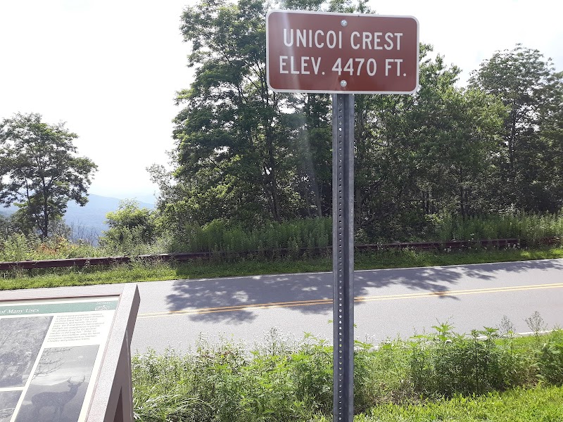
Unicoi Turnpike Trail
The Unicoi Turnpike is one of the oldest travel routes in the eastern United States — an ancient Cherokee trading path that became a colonial-era turnpike linking the Overhill Cherokee towns to the Carolinas, and later part of the tragic route of the Cherokee Removal on the Trail of Tears. A designated National Millennium Trail and Trail of Tears segment near Coker Creek preserves a walkable stretch of the historic road through the forest, with interpretive markers explaining its Native, trading, gold-rush, and Removal history. The hiking is moderate and deeply atmospheric, threading the same gaps and ridges that footsore travelers crossed for centuries. It is a quieter, more reflective morning than the waterfalls, layering the region's human story onto its mountain scenery.
8:25 AM📍 See location
🍽️
Lunch
🍽️ Lunch9:25 AM
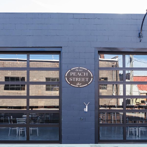
Tellico Plains Lunch
Return to Tellico Plains for a final town lunch before the last stop at Indian Boundary Lake. The downtown cafes, grills, and brewery offer the familiar hearty mountain fare, and it is the last convenient food and fuel before the drive to the lake and back to Knoxville. A relaxed sit-down meal here suits the more leisurely final day and lets you fuel up for the paddle and swim ahead. For those heading straight to the lake, packing a picnic to eat at Indian Boundary's shaded lakeside tables is an easy alternative.
2 options · tap to switch
☀️
Afternoon
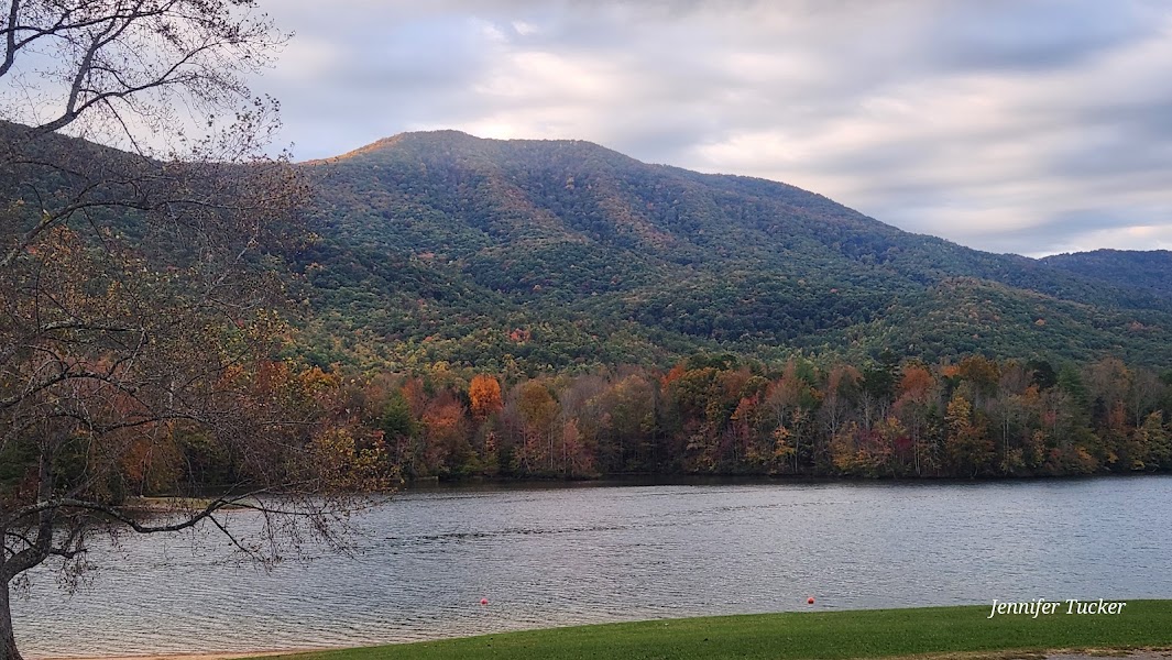
Indian Boundary Lake
★ 4.9Indian Boundary Lake is a serene 96-acre mountain lake in the Cherokee National Forest, ringed by forested ridges and named for the historic boundary line of the Cherokee lands. Gas motors are prohibited, keeping the water calm and quiet — ideal for a lazy paddle by kayak or canoe, with the graceful profile of Fodderstack Mountain reflected in the surface. A flat, easy trail circles the entire lake, a gentle two-and-a-half-mile loop through pine and hardwood with constant water views, and a sandy swimming beach offers a cool finish to three days in the mountains. It is the perfect low-key capstone before the drive home — a paddle, a swim, and a stroll before pointing the car back toward Knoxville.
12:00 PM📍 See location
🌙
Evening
🚗
Drive
Indian Boundary Lake → Knoxville, TN
1 hr 40 min5:00 PM → 6:40 PM
Plan your own escapeExplore more trips →