🥾 ActiveDay trip · from Las Vegas, NV
Red Rock & the Keystone Thrust: Calico Hills to Mount Charleston
Spend a day exploring one of the geological wonders of the American Southwest, hiking through the brilliant red Aztec sandstone formations of Red Rock Canyon where ancient Jurassic dunes were lithified 180 million years ago and stained crimson by descending iron oxide. Then ascend 30 miles of vertical relief into the Spring Mountains sky island, trading desert creosote for ponderosa pine and bristlecone, and climbing to the subalpine world of Mount Charleston at 8,700 feet — a landscape more reminiscent of the Sierra Nevada than the Mojave Desert below.
Day 1 — Red Rock Canyon & Spring Mountains, NV
Day 1 — Red Rock Canyon & Spring Mountains, NV
Day 1 — Red Rock Canyon & Spring Mountains, NV
🚗 2 hr driving📍 7 stops
🌅
Morning
🚗
Drive
Las Vegas, NV → Red Rock Canyon National Conservation Area
35 min
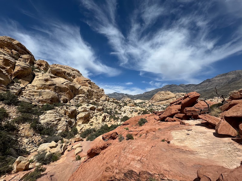
Calico Hills — Calico Tanks Trail
★ Reviews →The Calico Tanks Trail is a 2.5-mile round-trip hike through the most photogenic terrain in Red Rock Canyon, winding up through brilliant red and cream-colored Aztec sandstone formations that represent ancient Jurassic sand dunes lithified approximately 180 million years ago. The iron oxide staining that gives the Calico Hills their striking crimson hue seeped downward from iron-rich sediments above during diagenesis, infusing the sandstone with hematite and creating the dramatic bands of red, orange, and white visible throughout. The trail climbs to a natural water tank — a pothole depression in the rock that collects and holds rainwater runoff, making it a critical water source for bighorn sheep, ravens, and coyotes in this arid environment. From the high point above the tanks, panoramic views extend across the Las Vegas Valley skyline, the Spring Mountains rising to the west, and the great tilted slabs of the Keystone Thrust escarpment defining the horizon — a striking juxtaposition of urban sprawl against some of the most dramatic desert geology in North America.
~2 hrs📍 See location
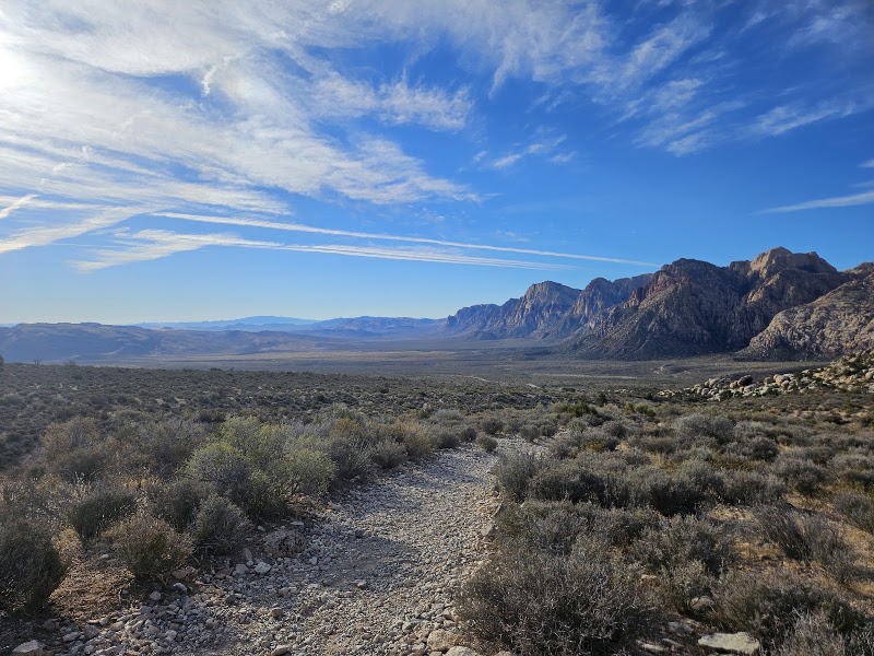
Keystone Thrust Trail
★ Reviews →The Keystone Thrust Trail is a 2.9-mile loop that traverses one of the most dramatic and accessible examples of thrust fault geology in the entire American West. The Keystone Thrust Fault is the visible boundary where ancient Paleozoic limestone — approximately 340 million years old and originally deposited in a shallow sea — was pushed eastward over much younger Aztec sandstone (roughly 180 million years old) during the Sevier Orogeny, a period of intense crustal compression that occurred approximately 65 million years ago. The result is a geological paradox visible with the naked eye: older gray limestone sitting directly on top of younger red sandstone, an inversion of the normal stratigraphic order that puzzled and fascinated early geologists and was once used as a classic argument against uniformitarian principles before thrust faulting was understood. Along the trail, hikers can touch the fault contact itself, a knife-edge boundary between two radically different rock types separated by 160 million years of missing time. The hike offers sweeping views of the escarpment from below, where the fault trace runs in a dramatic diagonal line across the canyon walls.
~1.5 hrs📍 See location
🍽️
Lunch
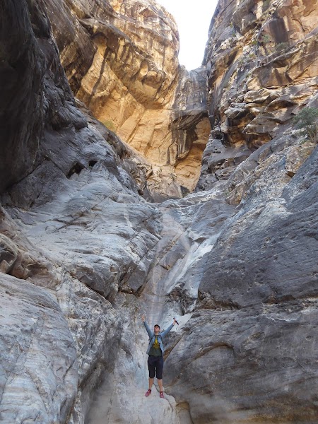
Ice Box Canyon
★ Reviews →Ice Box Canyon earns its name from the perpetually shaded microclimate created by its towering sandstone walls, which block direct sunlight for most of the day and keep temperatures noticeably cooler than the surrounding desert — often 10–15°F lower in summer. The 2.6-mile round-trip trail is the most adventurous hike in the Red Rock Canyon day-use area, requiring scrambling over polished boulders and squeezing through narrow passages in the canyon's inner gorge. In winter and early spring, a seasonal waterfall drops into a pool at the canyon's end, fed by snowmelt from the Spring Mountains above. The canyon walls, stained dark with desert varnish (a biological crust of manganese and iron oxides deposited by microorganisms over thousands of years), close in to just a few meters in places. In spring, the canyon floor bursts with wildflowers — desert paintbrush, sacred datura, and globe mallow — taking advantage of the moisture retained in the shaded rock alcoves. The contrast between this cool, damp inner canyon and the blazing open desert just a few hundred meters away is one of the most striking microclimatic transitions in the Mojave.
~2 hrs📍 See location
🍽️ Lunch~1 hr
🍽️
Lunch near Red Rock Canyon
Refuel after a morning of hiking with lunch near the canyon. The Summerlin area just east of Red Rock Canyon offers a range of casual dining options, or pack a lunch to eat at one of the conservation area's picnic sites near the visitor center.
Restaurant
3 options · tap to switch
☀️
Afternoon
🚗
Drive
Red Rock Canyon National Conservation Area → Mount Charleston — Kyle Canyon Road
35 min
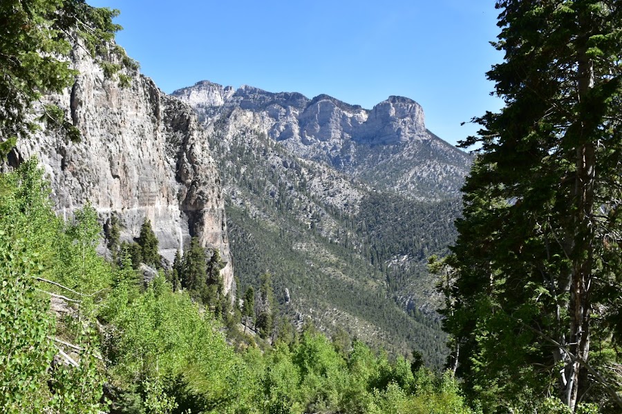
Cathedral Rock Trail
★ Reviews →The Cathedral Rock Trail is a 5.2-mile round-trip hike gaining 1,600 feet through the Kyle Canyon drainage of the Spring Mountains, climbing from Jurassic limestone foothills through dense ponderosa pine and white fir forest to a rocky summit at 8,700 feet where the first bristlecone pines begin to appear. The Spring Mountains constitute a sky island — a biologically isolated highland rising dramatically from the Mojave Desert floor — and support an ecosystem far more typical of the Pacific Northwest or the Sierra Nevada than of the surrounding desert. Species found here include Palmer's chipmunk and the Mount Charleston blue butterfly, both endemic to this single mountain range. From the Cathedral Rock summit, views extend across the full width of the Spring Mountains crest toward Charleston Peak at 11,918 feet to the west, and east across the basin-and-range topography of the Las Vegas Valley to the Lake Mead highlands and the Colorado River Plateau beyond. The contrast between the subalpine summit and the desert floor 8,000 feet below, visible simultaneously from the top, is one of the most dramatic elevation transitions accessible by day hike in the American Southwest.
~4.5 hrs📍 See location
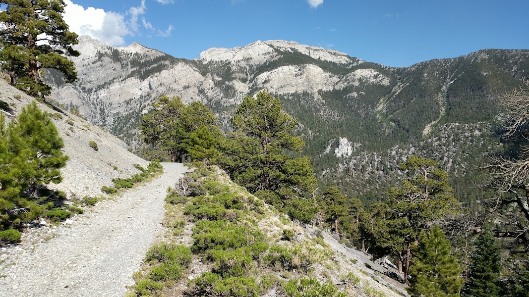
Charleston Peak Trailhead — Bristlecone Trail
★ Reviews →From the upper trailhead area above Kyle Canyon, the Bristlecone Trail leads into one of the most ancient forests accessible in the continental United States. The Great Basin bristlecone pine (Pinus longaeva) is the longest-lived individual organism on Earth, with specimens in the Spring Mountains known to be more than 3,000 years old. These trees persist on wind-scoured dolomite ridges above 9,000 feet where shallow soils, extreme cold, and persistent drought keep competing species at bay. Their gnarled, orange-barked forms, twisted by centuries of prevailing westerly winds, are striking in their sculptural beauty. Hikers continuing toward Fletcher Peak (11,492 feet) traverse open subalpine terrain with views north to the Sheep Range and south across Nevada's Great Basin desert, a landscape of extraordinary horizontal sweep that makes the verticality of the Spring Mountains all the more remarkable.
~2.5 hrs📍 See location
🌙
Evening
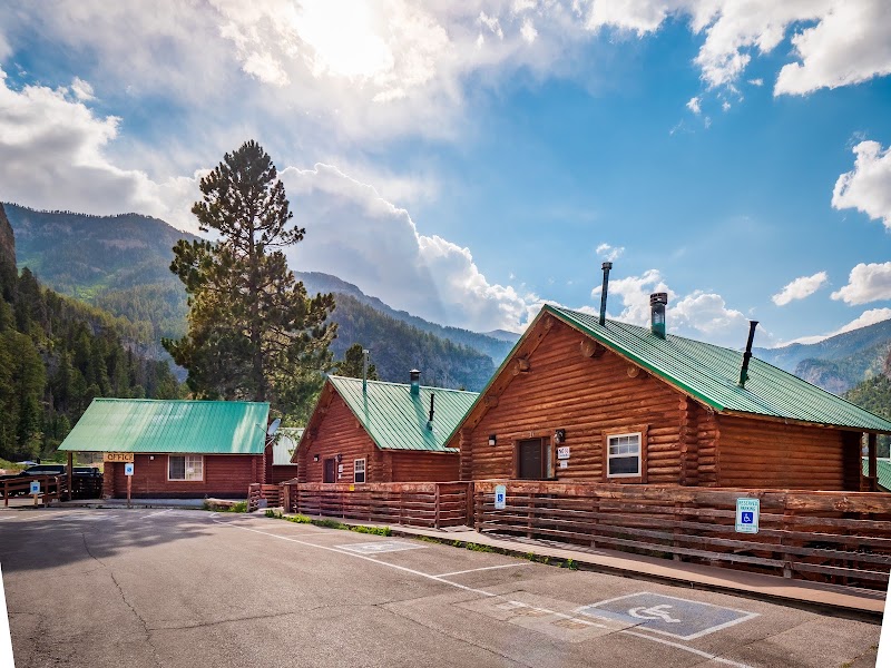
Mount Charleston Lodge
★ Reviews →Mount Charleston Lodge sits at 7,700 feet elevation in Kyle Canyon, a historic log structure built in the 1930s that serves as the social center of the Spring Mountains community. The lodge's outdoor terrace and interior dining room look out directly onto the towering Kyle Canyon limestone cliffs, which glow amber in the late afternoon sun. It's an ideal place for a post-hike drink or light snack before the descent back to Las Vegas, with cold craft beers, cocktails, and mountain comfort food in a setting that feels improbably remote given the 50-minute drive from the Strip.
~45 min📍 See location
🚗
Drive
Mount Charleston → Las Vegas, NV
50 min
← All Las Vegas trips
More getaways from Las Vegas
Black Canyon Kayak & the Emerald Cave: Lake Mead's Water Adventure — Day trip🥾Red Rock to the Bristlecones: Canyon Hikes & Alpine Summit — Weekend🥾Three Canyons: Red Rock, Snow Canyon & Zion's Angels Landing — Long weekend🥾Dam, Ghost Town & Fire: A Mojave History Circuit — Day trip🏛️Boulder to Fire: Hoover Dam, Lake Mead & Valley of Fire — Weekend🏛️Desert Crossroads: Petroglyphs, Pioneer History & Zion's Red Walls — Long weekend🏛️Boulder City: Hoover Dam Heritage & Lake Mead Sunset Cruise — Day trip🌿Fire & the Lost City: Valley of Fire & Ancestral Puebloan History — Weekend🌿
© 2026 theweekendgetaways.com · All itineraries are original content. Terms
Plan your own escapeExplore more trips →