← The Weekend Getaways
🥾 ActiveLong weekend · from Las Vegas, NV

Three Canyons: Red Rock, Snow Canyon & Zion's Angels Landing

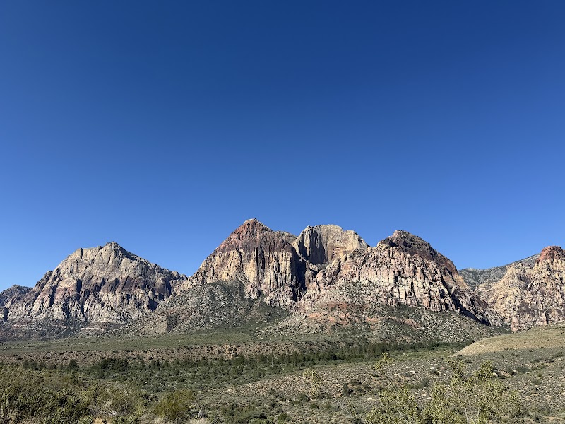
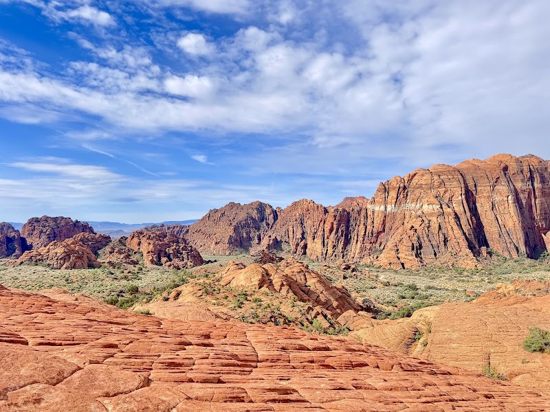
This three-day active circuit traces a progressive canyon journey northward from the Mojave Desert, opening at Red Rock Canyon's ancient Aztec sandstone escarpment before moving into the dramatic lava-and-sandstone contrasts of Snow Canyon State Park in Utah's Dixie region, and culminating at Zion National Park where the soaring Navajo Sandstone walls of Angels Landing crown the entire adventure. Each day builds on the last in both elevation, geological scale, and hiking intensity, making this a true canyon-country progression rather than a series of disconnected stops. The circuit returns to Las Vegas on Day 3 via the scenic Zion–Mount Carmel Highway corridor, completing a loop through three of the American Southwest's most visually distinct canyon systems.

Day 1 — Red Rock Canyon, NVDay 2 — St. George & Snow Canyon, UTDay 3 — Zion National Park, UT
Day 1Red Rock Canyon, NV

Day 1Red Rock Canyon, NV

🚗 35 min driving📍 8 stops
🌅
Morning
🚗
Drive
Las Vegas, NVRed Rock Canyon Visitor Center
35 min8:00 AM8:35 AM
Calico Hills & Calico Tanks Trail
4.9
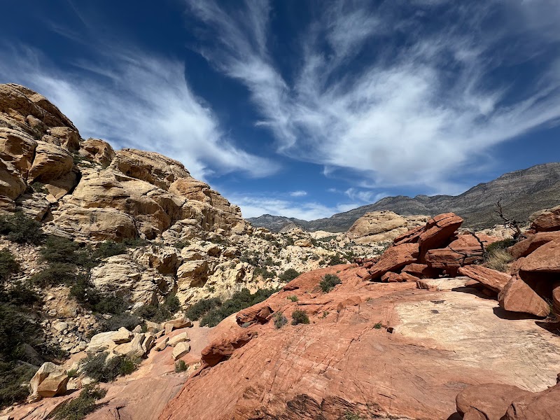
The Calico Tanks Trail is a 2.5-mile round-trip scramble up the flaming orange-red Calico Hills to a hidden natural water tank carved into Aztec sandstone at the summit ridge. The Aztec sandstone here formed roughly 180 million years ago during the Jurassic period when massive inland sand dunes — comparable in scale to the modern Sahara — were buried, lithified, and then uplifted by tectonic forces that tilted the once-horizontal strata to dramatic angles. The cross-bedded layers within the sandstone preserve the windward and leeward faces of individual ancient dune slipfaces, giving the rock its characteristic swirling striped texture. From the tank at the trail's high point, the entire Las Vegas Valley opens to the east, with the Strip's glittering towers rising incongruously from the flat desert basin behind the canyon's red escarpment — a juxtaposition that underscores just how abruptly the Spring Mountains rise from the valley floor.
Keystone Thrust Trail
4.9
The Keystone Thrust Trail is a 2.9-mile loop that traverses one of the most spectacular and legible examples of thrust fault geology visible anywhere in the world without a geology degree. Approximately 65 million years ago, immense compressional forces caused a sheet of older Paleozoic limestone — some 600 million years old — to be pushed eastward over the much younger (180-million-year-old) Aztec sandstone below it, producing what geologists call the Keystone Thrust Fault. The contact line between the grey limestone and the red sandstone is visible as a sharp color boundary across the canyon walls above the trail, an ancient collision preserved in stone. Walking the loop, hikers cross that boundary and can literally place one foot on Jurassic-era sandstone and the other on rock three times older — an experience that makes abstract deep time suddenly visceral.
🍽️
Lunch
Ice Box Canyon
Ice Box Canyon
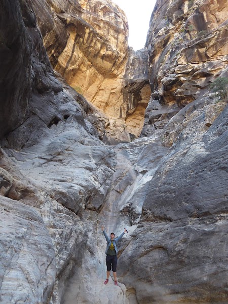
Ice Box Canyon earns its name from the persistent cool air that pools in the depths of this shaded slot canyon cut into the Spring Mountains escarpment at Red Rock Canyon. The 2.6-mile round-trip trail crosses the canyon wash multiple times, requiring light scrambling over boulders polished smooth by seasonal flash floods, before arriving at a seasonal waterfall that plunges from the upper canyon walls into a sheltered pool. In winter and spring the falls can be impressive; by late summer they may reduce to a seep — but the canyon's microclimate remains noticeably cooler than the surrounding desert regardless of season, sometimes 10–15°F below ambient temperatures. The canyon walls close in to just 20–30 feet apart in places, the Aztec sandstone overhead striped with iron oxide bands of orange, tan, and buff, and desert varnish — a thin coating of manganese and iron oxide deposited by microorganisms over millennia — darkening the high walls to a rich mahogany sheen.
🍽️ Lunch11:35 AM
🍽️
Lunch near Red Rock — Summerlin Area
Pack a lunch in advance or drive 10 minutes east into Summerlin for a quick midday meal before continuing the afternoon drive loop.
$Restaurant📍 Maps →
3 options · tap to switch
☀️
Afternoon
Red Rock Canyon Scenic Drive
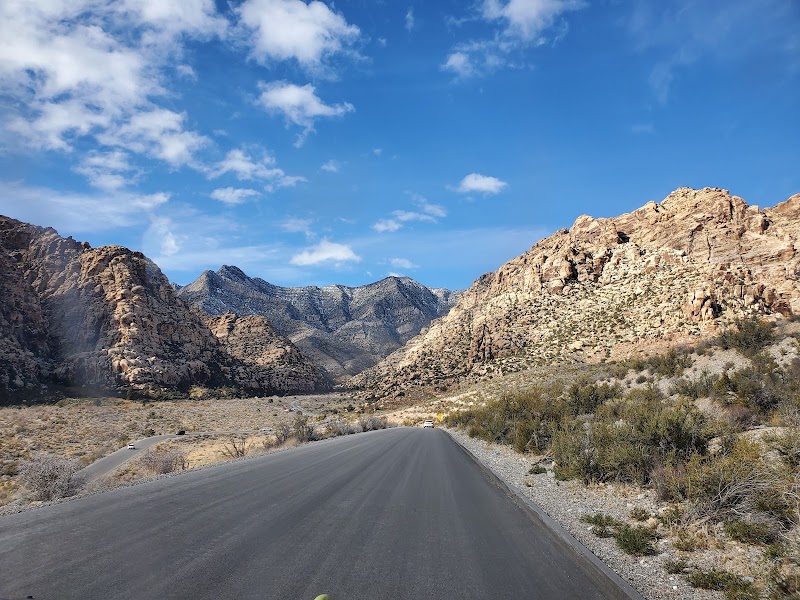
The 13-mile one-way paved scenic loop through Red Rock Canyon National Conservation Area is among the finest short drives in the American Southwest, threading between the cream-colored White Rock Hills and the fiery Calico Hills before sweeping past Willow Springs — a natural seep that sustained Indigenous Paiute populations for thousands of years and produced the canyon's richest concentration of rock art petroglyphs. The drive transitions visually from the pink-and-tan Aztec sandstone dominating the canyon's west face into the subtle blending of the Mojave Desert's painted terrain as the loop curves back east, with pullouts at Calico Hills giving close-range views of the sandstone's swirling iron-oxide banding. Late afternoon light turns the escarpment from orange to deep crimson, making the post-lunch window the single best time for the loop.
Pine Creek Canyon Trail
4.9
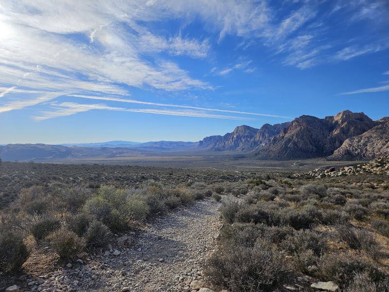
The Pine Creek Canyon Trail descends 6.4 miles round-trip from the scenic drive into one of Red Rock Canyon's most dramatic and botanically rich canyon floors, passing the ruins of a 1920s homestead — its stone fireplace still standing among the desert willows and oak trees — before reaching the canyon bottom where seasonal Pine Creek flows beneath towering canyon walls. The trail crosses the creek multiple times depending on water levels, each crossing offering a different angle on the Keystone Thrust escarpment from below: looking up, hikers can trace the same fault contact line that is viewed laterally from the Keystone Thrust Trail, now rendered as a sweeping geological horizon overhead with grey limestone overhanging red sandstone in a 500-foot wall. The creek bottom supports a rare riparian corridor of cottonwoods, scrub oak, and manzanita that stands in vivid contrast to the surrounding Mojave scrub, and the canyon walls shelter one of the area's highest concentrations of bighorn sheep.
🌙
Evening
🍽️ Dinner5:00 PM
🍽️
Dinner in Summerlin
Summerlin's Downtown Summerlin open-air mall and surrounding streets offer casual to mid-range dining options within 10 minutes of the Red Rock Canyon entrance.
$Restaurant📍 Maps →
3 options · tap to switch
🛏️
Lodging — Red Rock Canyon / Summerlin Area
The Red Rock Casino Resort & Spa in Summerlin is the closest full-service resort to Red Rock Canyon, positioned at the western edge of Las Vegas with unobstructed views of the canyon's sandstone escarpment from its pool deck and many west-facing rooms. For a slightly more resort-campus feel, the JW Marriott Las Vegas Resort & Spa is a 10-minute drive deeper into Summerlin with lush landscaped grounds, multiple pools, and a spa — a good base before the early northbound drive to Snow Canyon on Day 2.
Day 2St. George & Snow Canyon, UT

Day 2St. George & Snow Canyon, UT

🚗 1 hr 55 min driving📍 8 stops
🌅
Morning
🚗
Drive
Las Vegas / SummerlinSnow Canyon State Park, UT
1 hr 55 min8:00 AM9:55 AM
Snow Canyon State Park — Petrified Sand Dunes & Entrada Sandstone
4.9
Snow Canyon State Park occupies a 7,000-acre pocket of geologic drama in the Santa Clara River Valley just northwest of St. George, where two radically different geological epochs collide in a single landscape. The canyon walls are formed from Entrada sandstone approximately 180 million years old — the same Jurassic dune field that produces the red sandstone at Red Rock Canyon — here displaying brilliant bands of red, cream, and buff in sweeping cross-bedded formations that preserve the ancient dune slipfaces in stunning clarity. But cutting across and pooling at the base of these ancient walls is something far younger and far darker: black basaltic lava flows erupted from nearby cinder cones between 10,000 and 27,000 years ago, still rough-surfaced and barely weathered, their angular black aa texture contrasting sharply with the smooth salmon-colored sandstone. The park's petrified sand dunes — outcrops of Navajo sandstone exposed near the north entrance — add a third visual layer, their wave-like frozen forms eroded into sculpted ridges that preserve the original dune geometry in lithified stone.
Jenny's Canyon Slot Canyon
4.8
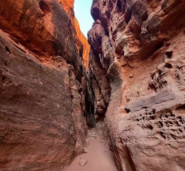
Jenny's Canyon is Snow Canyon's most intimate geological experience — a 0.4-mile round-trip walk that ends inside a narrow Entrada sandstone slot canyon where the walls narrow to arm-width at the deepest point, the smooth orange-pink rock curving overhead in organic arcs sculpted by centuries of intermittent water flow through the soft sandstone. Unlike the grand scale of the main canyon walls, Jenny's Canyon reveals the micro-scale of erosion at work: every curve of the narrows corresponds to a subtle shift in rock hardness or a change in the direction of ancient water flow, the walls etched with parallel horizontal lines recording the varying water levels of past flash floods. The light inside the narrows filters from a slot of blue sky overhead, painting the interior walls in reflected orange warmth that intensifies at midday.
🍽️
Lunch
Lava Tubes Trail
Lava Tubes Trail
4.6
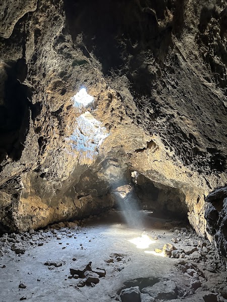
The Lava Tubes Trail in Snow Canyon is a 1.4-mile round-trip hike to one of the park's most unusual geological features: a series of hollow tubes formed during volcanic eruptions when the outer surface of a flowing lava stream cooled and solidified into a hardened shell while molten rock continued to flow through the interior. When the eruption ceased and the interior lava drained away, it left behind hollow tunnels — in Snow Canyon's case, some reaching 6 feet in diameter — that visitors can crawl into and explore. The tubes formed from the same lava flows visible throughout the park, erupted from cinder cones less than 27,000 years ago, and represent one of the most approachable examples of active volcanic landscape in the region. The trail surface is rough basalt that requires careful footing, and the tube interiors stay noticeably cooler than outside — a welcome respite in summer months.
🍽️ Lunch12:55 PM
Xetava Gardens Café
Xetava Gardens Café
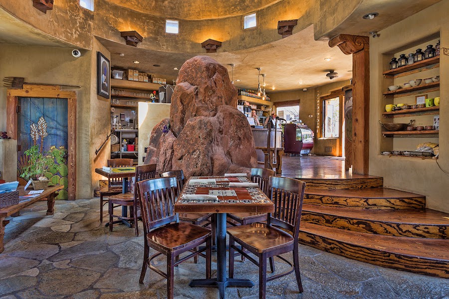
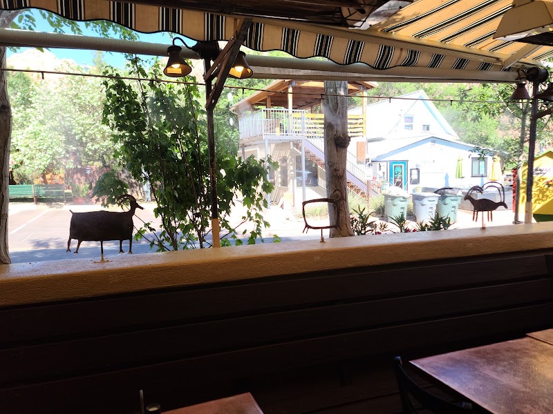
Xetava Gardens Café sits directly adjacent to Snow Canyon State Park's main entrance in Ivins, offering a shaded garden patio and a menu of fresh, locally-influenced dishes — a rare quality dining option in this otherwise rural landscape.
4.6$$restaurant📍 Maps →
3 options · tap to switch
☀️
Afternoon
📍
Red Cliffs National Conservation Area — Babylon Trail
A short but scenic trail through red sandstone formations just north of St. George — desert wildflowers in spring, ancient petroglyphs, and dramatic canyon views without the Snow Canyon crowds. Connects the morning's canyon work with the afternoon's St. George historic walk.
St. George Historic Area Evening Walk
4.7
St. George's compact historic core along Main Street and Tabernacle Street preserves some of the finest pioneer-era architecture in the American West, anchored by the 1877 St. George Utah Temple — the first LDS temple completed after the pioneers reached Utah — and the adjacent 1875 Tabernacle, both constructed from locally quarried white sandstone. A pre-dinner stroll through the historic blocks reveals the orderly grid laid out by Brigham Young himself during his winter visits, with brick and sandstone commercial buildings from the 1870s–1890s now housing restaurants, galleries, and boutiques.
🌙
Evening
🍽️ Dinner5:00 PM
🍽️
Dinner in St. George
St. George offers a growing restaurant scene anchored in its compact historic downtown, with options ranging from upscale New American to casual Utah comfort food within easy walking distance of most lodging.
$$Restaurant📍 Maps →
3 options · tap to switch
🛏️
Lodging — St. George, UT
The Inn on the Cliff in St. George is a boutique hotel perched on the volcanic black lava cliffs above the city, offering panoramic views of the red rock valley, Pine Valley Mountains, and the illuminated city below from its cliff-edge pool and terrace — one of the most dramatically situated hotels in Utah. For a more accessible option with reliable amenities, the Courtyard by Marriott St. George is centrally located near the historic district and is a straightforward base for the early drive to Zion on Day 3.
Day 3Zion National Park, UT

Day 3Zion National Park, UT

🚗 3 hr 20 min driving📍 6 stops
🌅
Morning
🚗
Drive
St. George, UTZion National Park
45 min8:00 AM8:45 AM
📍
West Rim Trail — Lava Point Overlook
The West Rim Trail to Lava Point Overlook is Zion's most rewarding less-crowded alternative to Angels Landing — a strenuous but uncrowded route that climbs through a series of switchbacks above the canyon floor onto the broad West Rim plateau at over 7,800 feet elevation, where panoramic views stretch across the entire Zion Canyon system, the Kolob Terrace, and on clear days as far as the Pine Valley Mountains to the west. Unlike the permit-constrained chains section of Angels Landing, the West Rim Trail requires no lottery permit beyond normal park entry, yet delivers an equally dramatic perspective on Zion's soaring Navajo Sandstone walls from above. The trail passes through a transition from canyon desert to high-elevation ponderosa pine and white fir forest — a dramatic ecological shift in a short vertical distance — before reaching the volcanic basalt cap of Lava Point, the remnant of an ancient lava flow that once pooled on the canyon rim.
🍽️
Lunch
📍
Kolob Canyons — Taylor Creek Trail
The Taylor Creek Trail in Zion's little-visited Kolob Canyons section — a separate unit of the park accessible directly off I-15, about 40 minutes from the main canyon — is a 5.4-mile round-trip that follows Middle Fork Taylor Creek through a canyon of deep red Navajo sandstone to the Double Arch Alcove, a soaring 150-foot concave alcove carved by seeping groundwater. The Kolob Canyons section receives a fraction of the main canyon's visitation despite containing some of Zion's most dramatic scenery: the canyon walls here are narrower and more intimate than the main valley, the red sandstone older and more intensely colored, and the riparian corridor along the creek lined with boxelder, Gambel oak, and occasional wild grape. Reaching the Double Arch Alcove — where a natural arch sits within a broader alcove frame — rewards the modest effort with a scene of complete quiet impossible to find in the main canyon on a busy day.
🍽️ Lunch10:45 AM
Zion Lodge Red Rock Grill — Lunch
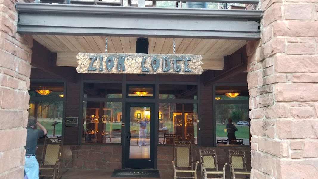
The Red Rock Grill at Zion Lodge is the only full-service restaurant inside Zion Canyon, situated in a National Historic Landmark building at the canyon's midpoint with views of the Court of the Patriarchs sandstone towers. Reservations are strongly recommended in peak season.
3.7$$american restaurant📍 Maps →
3 options · tap to switch
☀️
Afternoon
📍
Canyon Overlook Trail
The Canyon Overlook Trail is one of the most efficient hikes in the national park system for the views it delivers relative to effort — a 1-mile round trip from the east portal of the Zion–Mount Carmel Tunnel to a broad sandstone promontory overlooking lower Zion Canyon, Pine Creek Canyon, and the Great Arch of Zion in a single sweeping panorama. The trail threads through a narrow hanging canyon of sculpted Navajo Sandstone with potholes, cryptobiotic soil crusts, and the occasional California condor riding thermals overhead before emerging at the exposed overlook platform. At 163 feet of elevation gain over a half mile, it asks little physically while delivering one of Zion's signature aerial perspectives — ideal as a cool-down finale to a full day of canyon immersion before the drive back south.
Canyon Junction Bridge & Pa'rus Trail
4.8
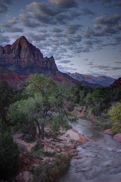
The Pa'rus Trail is Zion's 1.7-mile paved riverside walk connecting the South Campground to Canyon Junction, following the Virgin River through cottonwood groves and open meadows at the canyon's widest southern section. It is the only Zion trail open to bicycles and leashed pets, and functions as a perfect cool-down route before departure — flat, shaded by mature cottonwoods, and offering unobstructed views of the Watchman and West Temple sandstone towers that form Zion's southern gateway. The Canyon Junction Bridge at the trail's north end is a classic photography spot with the canyon walls framing the Virgin River in both directions.
🌙
Evening
🍽️ Dinner5:00 PM
Early Dinner in Springdale
Springdale's main street is lined with casual to mid-range restaurants catering to Zion visitors — aim for an early dinner around 5 PM to beat the crowds and allow time for the 2.5-hour drive back to Las Vegas.
4.7$restaurant📍 Maps →
3 options · tap to switch
🚗
Drive
Zion National ParkLas Vegas, NV
2 hr 35 min6:00 PM8:35 PM
Plan your own escapeExplore more trips →