← The Weekend Getaways
🏛️ CulturalLong weekend · from Las Vegas, NV

Desert Crossroads: Petroglyphs, Pioneer History & Zion's Red Walls

Trace 2,000 years of human presence across the Colorado Plateau, beginning with Ancestral Puebloan petroglyphs etched into the blazing Aztec sandstone of Valley of Fire — one of the most concentrated rock art sites in the American Southwest. Continue north into Utah's Dixie, where Mormon pioneers under Brigham Young's directive carved an agricultural civilization out of the red desert at St. George, leaving behind the first completed temple in Utah Territory and a network of historic sandstone buildings still standing along tree-lined streets. The circuit culminates in Zion Canyon, where the Virgin River spent millions of years slicing a 2,000-foot-deep gorge through Navajo Sandstone, creating walls so sheer and vivid that settlers believed they had found a terrestrial version of the heavenly city — a landscape that continues to inspire awe and quiet reverence in every visitor who enters it.

Day 1 — Valley of Fire State Park, NVDay 2 — St. George & Snow Canyon, UTDay 3 — Zion National Park, UT
Day 1Valley of Fire State Park, NV

Day 1Valley of Fire State Park, NV

🚗 1 hr driving📍 8 stops
🌅
Morning
🚗
Drive
Las Vegas, NVValley of Fire State Park
1 hr8:00 AM9:00 AM
Atlatl Rock & Petroglyph Canyon
4.8
Atlatl Rock is the crown jewel of Valley of Fire's rock art heritage, a towering sandstone outcrop climbed by a permanent metal staircase that delivers visitors face-to-face with one of the most remarkable petroglyph panels in the American Southwest. The imagery was pecked into the dark desert varnish — a coating of manganese and iron oxide deposited over millennia by microorganisms — by people of the Virgin Ancestral Puebloan cultural tradition, who occupied southern Nevada and the adjacent Virgin River drainage from approximately 300 BC to 1150 AD. The panels depict atlatl spear-throwers (the weapon technology that preceded the bow and arrow by thousands of years), human figures in elaborate headdresses, bighorn sheep, snakes, spirals, and geometric symbols whose precise meanings remain a subject of scholarly discussion. The atlatl itself — a hooked throwing board that dramatically extends the effective range of a hand-thrown dart — is rendered with enough anatomical accuracy that archaeologists use these images to reconstruct the tool's mechanics. Nearby Petroglyph Canyon extends the experience along a shaded wash where additional panels appear at eye level, including depictions of celestial objects that may mark solstice alignments. Walking among these images is a direct encounter with a continuous human tradition of place-making and cosmological expression that predates the Roman Empire.
Elephant Rock
Elephant Rock
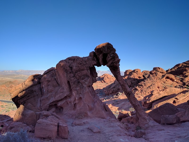
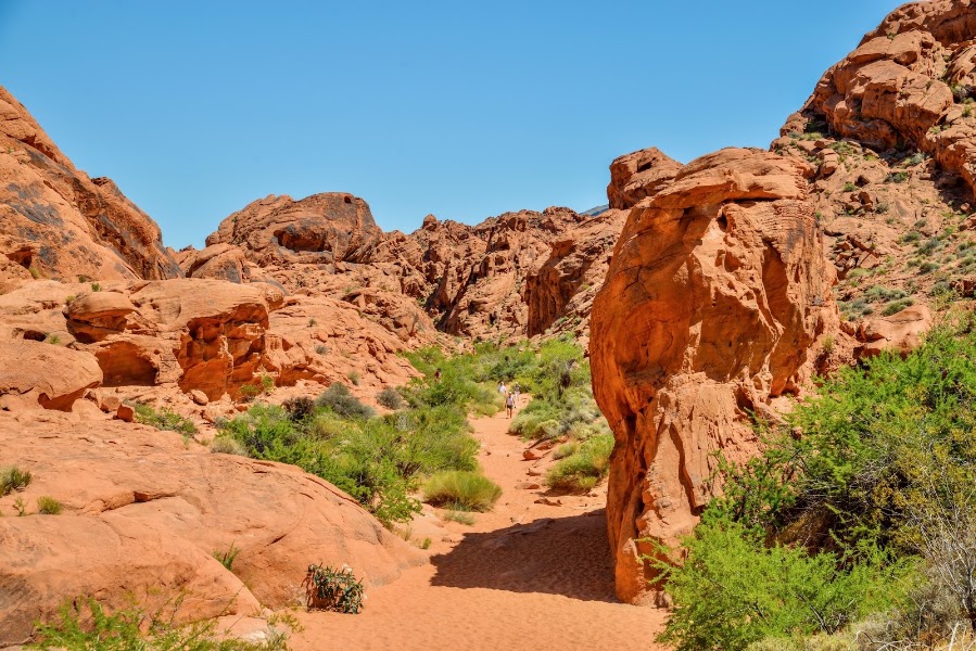
Elephant Rock stands just inside the park's eastern entrance as an immediate introduction to the geological forces that shaped Valley of Fire — a massive sandstone formation whose head, drooping trunk, and broad body bear an uncanny resemblance to an African elephant in profile. The formation is carved from Aztec Sandstone, the same deep-red rock that dominates the entire park, which was deposited roughly 150–180 million years ago during the Jurassic period when this part of the Mojave was an enormous erg — a sea of wind-blown sand dunes stretching across a landscape that looked nothing like today's Nevada. Over tens of millions of years, compaction and silica cementation turned the dunes to rock, and subsequent uplift exposed the sandstone to differential weathering: softer layers erode more quickly while harder, more cemented zones resist, creating the wild sculptural variety of fins, domes, arches, and freestanding forms visible throughout the park. Elephant Rock is accessible from a short interpretive trail and requires no hiking fitness to reach, making it an ideal first stop that frames the geological story visitors will encounter throughout the day.
🍽️
Lunch
Fire Wave Trail
Fire Wave Trail
4.7
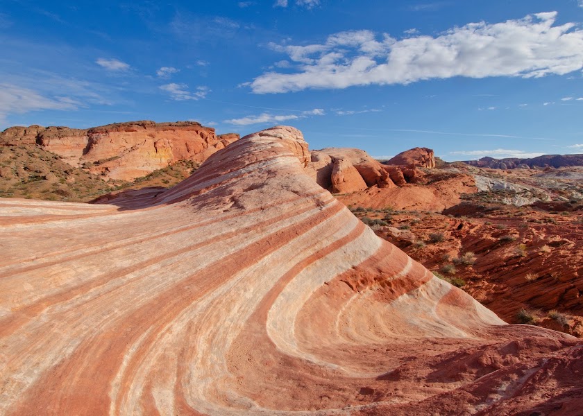
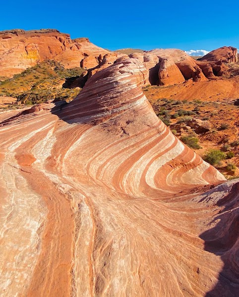
The Fire Wave Trail covers 1.5 miles round-trip across open slickrock to one of the most photogenic geological features in the Mojave Desert — a series of undulating sandstone formations banded in parallel stripes of deep crimson, burnt orange, cream, and white that flow across the rock like a frozen wave. The banding reflects subtle differences in mineral content and cementation within the original Jurassic sand dune deposits: iron-rich zones oxidized to red, while adjacent calcium-carbonate-cemented zones bleached to white or cream. Erosion by wind and the rare but powerful flash floods that sweep through the park have sculpted these differently-hardened layers into the smooth, curving forms visible today, rounding the harder surfaces while cutting channels through the softer ones. The trail traverses a broad basin of open sandstone with minimal shade — proper desert footwear, sun protection, and at least two liters of water are essential — and the wave formation itself rewards extended contemplation, as the patterns shift in character with changing light conditions throughout the day.
Valley of Fire Picnic Lunch
4.8
Valley of Fire State Park has several developed picnic areas with covered ramadas, tables, and grills set among the red rock formations — the Atlatl Rock picnic area and the campground area near the visitor center are the most convenient. There is no restaurant inside the park, so the most practical and cost-effective midday strategy is to bring a packed lunch from Las Vegas before departure, picking up supplies at a grocery or deli on the way out of the city. The town of Overton, 15 miles north of the park on NV-169, has a small grocery store if supplies are needed.
12:00 PM📍 See location
☀️
Afternoon
White Domes Loop
White Domes Loop
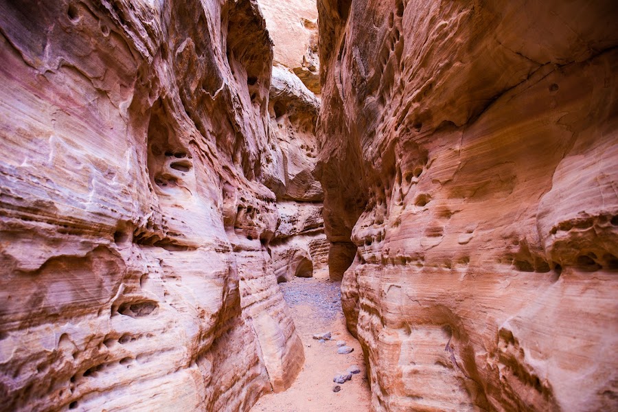
The White Domes Loop at the northern end of Valley of Fire is widely considered the park's most varied and rewarding short hike, packing canyon narrows, geological diversity, and a piece of Hollywood history into 1.1 miles of relatively easy walking. The trail descends through a narrow slot canyon — walls close enough to touch on both sides — where cream-colored Aztec Sandstone contrasts sharply with the iron-red rock encountered elsewhere in the park, the pale coloration the result of bleaching by groundwater that flushed away the iron oxides. Partway through the loop, hikers pass the crumbling adobe and timber ruins of a set built for a 1966 western film, an evocative reminder that the otherworldly landscape has attracted filmmakers for decades. The remainder of the loop winds through deeply eroded domes, honeycombed rock faces, and narrow fins, providing a concentrated lesson in the variety of forms that differential weathering produces in sedimentary rock.
Mouse's Tank Trail
Mouse's Tank Trail
4.8
Mouse's Tank Trail follows a sandy-floored canyon 0.75 miles (one-way) to a natural sandstone depression — known as a tinaja or tank — that collects and holds rainwater long after storms have passed, making it a critical water source in one of the most arid environments in North America. The trail is named after a Southern Paiute fugitive known as Little Mouse, who reportedly used this hidden water source as a refuge in the 1890s. But the canyon's human story begins far earlier: the walls are lined with one of the densest concentrations of petroglyphs in all of Nevada, created by multiple cultures across at least 2,000 years. Basketmaker-period images (from before 500 AD) appear alongside Virgin Ancestral Puebloan depictions (300 BC–1150 AD) and later Southern Paiute imagery, creating a layered visual record of repeated human use of this water-bearing corridor. Bighorn sheep, human figures, geometric patterns, and abstract designs cover the shaded canyon walls at eye level throughout the walk, making this the most immersive rock art experience in the park.
🌙
Evening
🍽️ Dinner5:00 PM
🍽️
Dinner in Overton, NV
Overton, the nearest town to Valley of Fire, is a small agricultural community in the Moapa Valley 15 miles north of the park. Dining options are limited but functional — the town has a small number of casual restaurants and a local pizza shop. The Valley of Fire Lodge, located just outside the park's western entrance on NV-169, also serves basic meals. For travelers who prefer more options, the drive back toward Las Vegas on I-15 passes through the Las Vegas metropolitan fringe where a full range of dining is available.
$American restaurant📍 Maps →
3 options · tap to switch
🛏️
Valley of Fire Lodge or Overton, NV Lodging
The Valley of Fire Lodge sits at the western entrance of the park on NV-169, offering the most convenient overnight option for travelers who want to maximize early morning access to the park before day-trippers arrive — the lodge is a small property with basic rooms and a restaurant, placing guests directly in the red rock landscape. The alternative is staying in Overton, 15 miles north, where the Best Western Overton provides comfortable chain-hotel accommodations in a quiet agricultural town on the Virgin River floodplain. Both options position travelers well for a morning departure toward St. George, Utah on Day 1.
Day 2St. George & Snow Canyon, UT

Day 2St. George & Snow Canyon, UT

🚗 1 hr 40 min driving📍 8 stops
🌅
Morning
🚗
Drive
Valley of Fire / Overton, NVSt. George, UT
1 hr 40 min8:00 AM9:40 AM
Snow Canyon State Park — Entrada Sandstone & Lava Flows
4.9
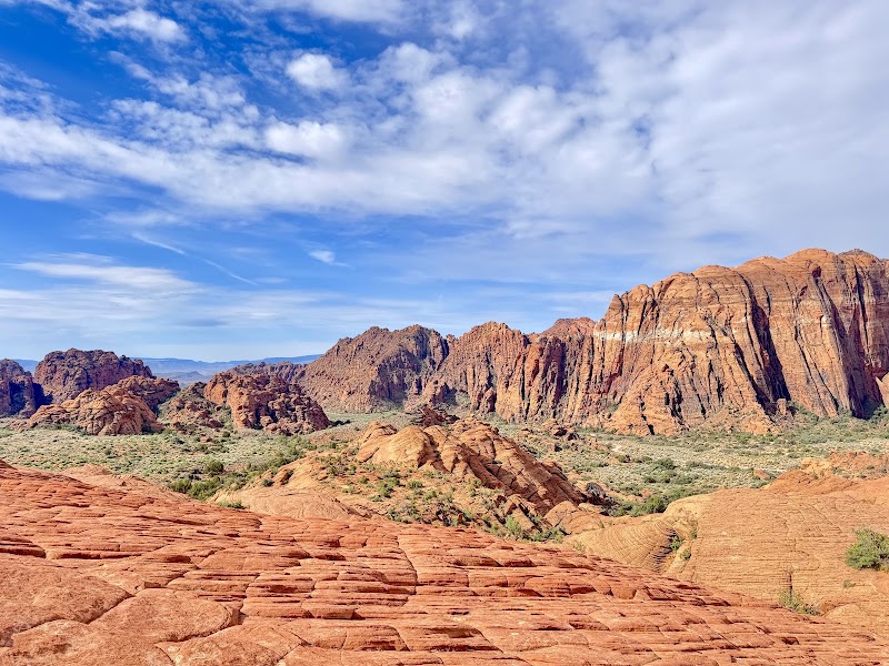
Snow Canyon State Park encompasses 7,000 acres of the Santa Clara River valley just northwest of St. George, and its defining geological drama is the collision of two vastly different eras of Earth history within a single landscape. The canyon walls are composed of Entrada Sandstone — the same Jurassic-period formation found across the Colorado Plateau, deposited roughly 180 million years ago as an enormous sand dune field and subsequently lithified into the characteristic red, cream, and orange layered rock visible in the canyon's sheer faces, which rise between 50 and 750 feet above the canyon floor. Draped across these ancient walls and pooled on the valley floor are sheets and mounds of jet-black basaltic lava, the product of volcanism that occurred only 10,000 to 27,000 years ago — geologically yesterday — when a series of cinder cones erupted along the Hurricane Fault and sent flows coursing through the existing sandstone canyon. The visual contrast between the red stone and black lava is extraordinary and geologically instructive. Short trails access petrified sand dunes, where wind ripples frozen in Navajo Sandstone have been exposed by erosion, and lava tubes — underground tunnels left by cooling lava flows — can be explored with a flashlight.
Pioneer Joshua Tree Grove & Fremont Petroglyphs, Snow Canyon
4.7
Near the lava flow overlook area of Snow Canyon, a series of petroglyph panels left by people of the Fremont culture — a distinct archaeological tradition that occupied the eastern Great Basin and Colorado Plateau between approximately 600 and 1250 AD — depicts bighorn sheep in profile with characteristic compact bodies and recurved horns, alongside geometric designs and anthropomorphic figures. The Fremont culture was contemporaneous with but distinct from the Ancestral Puebloans to the south, and their rock art style differs subtly in the elongated, trapezoidal body forms used for human figures. The same area hosts a grove of Joshua trees (Yucca jaegeriana) that marks one of the northernmost expressions of Mojave Desert plant communities, the distinctive branching yucca trees thriving here at the ecological transition zone between the Mojave and the Great Basin. Mormon pioneers who settled the region in the 1860s named these trees after the biblical Joshua, believing their upraised branches resembled the prophet pointing the way to the promised land — a naming story that perfectly encapsulates the layered cultural history of this corner of the American Southwest.
🍽️
Lunch
St. George Historic District Walk
4.7
St. George is the oldest continuously occupied pioneer settlement in Utah, founded in 1861 under direct instruction from Brigham Young, who identified the warm Dixie climate of the Virgin River basin as suitable for growing cotton — earning the region the nickname 'Utah's Dixie.' The compact historic district contains an exceptional concentration of 19th-century pioneer architecture built from locally quarried red sandstone and volcanic black rock. The St. George Utah Temple, completed in 1877, was the first temple finished in Utah Territory and remains a working religious building of the Church of Jesus Christ of Latter-day Saints; its white-painted sandstone walls and square tower are visible from across the city. Brigham Young's Winter Home, a modest frame house completed in 1873 where Young retreated during cold Salt Lake winters, is preserved and operated as a historic site with guided tours explaining the domestic life and administrative decisions of Utah Territory's most powerful figure. The red sandstone Tabernacle, completed in 1876 after ten years of construction by pioneer craftsmen who had no professional training, is considered one of the finest examples of pioneer religious architecture in the American West, featuring a vaulted ceiling constructed without nails from locally harvested lumber.
🍽️ Lunch12:40 PM
Painted Pony Restaurant
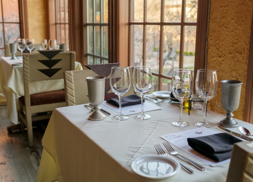
Painted Pony is St. George's most celebrated fine-casual restaurant, occupying an elegant space in Ancestor Square in the heart of the historic district. The menu emphasizes creative American cuisine with regional Southwest influences — grilled meats, fresh salads, and house-made desserts — in an atmosphere that feels genuinely upscale for a small Utah city. The restaurant's location in the historic core makes it a natural midday stop after the walking tour of pioneer-era landmarks.
4.6$$fine dining restaurant📍 Maps →
3 options · tap to switch
☀️
Afternoon
Tuacahn Amphitheatre
4.8
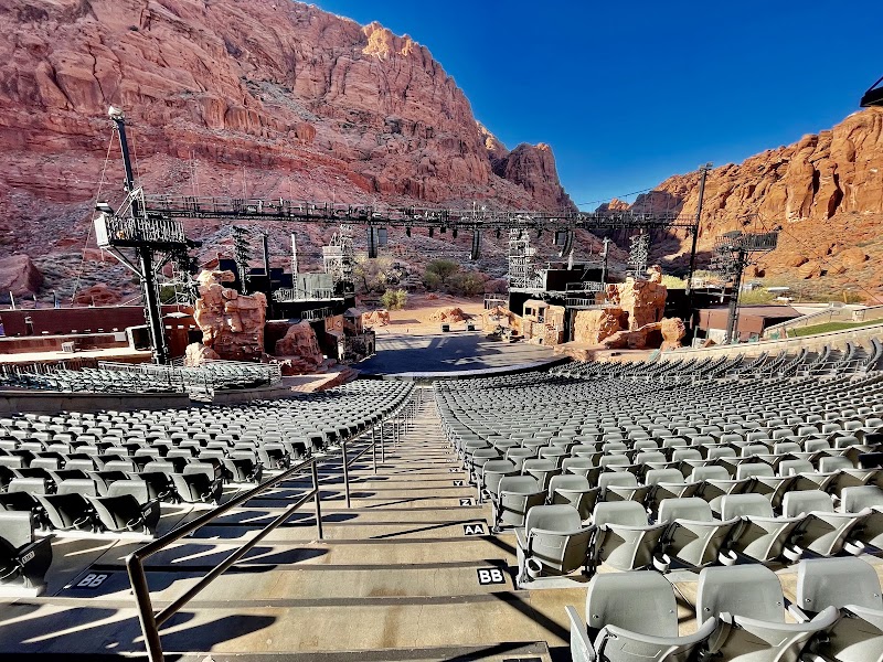
Tuacahn Amphitheatre is one of the most dramatically situated outdoor performance venues in the United States — a 2,000-seat open-air theater built directly into a red sandstone canyon in Ivins, Utah, just outside Snow Canyon State Park. The name 'Tuacahn' is derived from the Paiute language and translates roughly as 'canyon of the gods,' a description that becomes immediately self-evident when visitors see the 1,500-foot canyon walls rising behind the stage. The amphitheater opened in 1995 and has since become a regional cultural institution, hosting Broadway-caliber musical productions — past seasons have included The Little Mermaid, Newsies, Hamilton, and other major titles — in a setting where the natural stone backdrop becomes an integral part of the theatrical experience. The facility was designed by architect Thomas Greene to nestle into the canyon with minimal visual intrusion, and the effect of watching professional theater with stars overhead and sandstone cliffs glowing in the stage lights is genuinely memorable. Matinee performances are available during the summer and fall season; even a visit without a performance to see the venue and its canyon setting is worthwhile as an afternoon excursion from St. George.
Rosenbruch Wildlife Museum
4.5
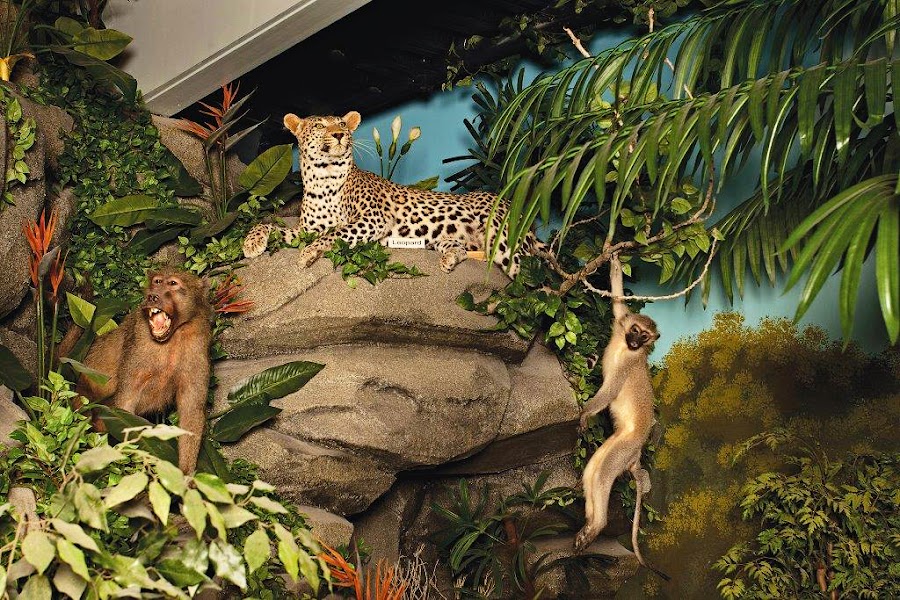
The Rosenbruch Wildlife Museum in St. George is one of the largest and most technically sophisticated natural history display museums in the American Southwest, housing approximately 300 life-size mounted animals in 27,000 square feet of gallery space. The exhibits are organized by continent and biome, with each diorama meticulously recreating the habitat of the featured species — African savanna, Alaskan tundra, Southeast Asian rainforest, North American mountain meadow — using hand-crafted artificial vegetation, painted backdrops, and lighting designed to simulate natural conditions. The collection was assembled over decades by Jim and Jerene Rosenbruch and donated to the city of St. George, representing a significant private investment in public natural history education. The museum occupies a position in the cultural landscape of southern Utah somewhat analogous to the Natural History Museum of Utah in Salt Lake City, but with a more intimate and family-accessible presentation. The quality of the taxidermy and the detail of the habitat recreations make this a genuinely impressive stop for travelers interested in wildlife biology or natural history, and the air-conditioned galleries provide a welcome respite from the afternoon desert heat.
🌙
Evening
🍽️ Dinner5:00 PM
Benja Thai & Sushi
Benja Thai & Sushi
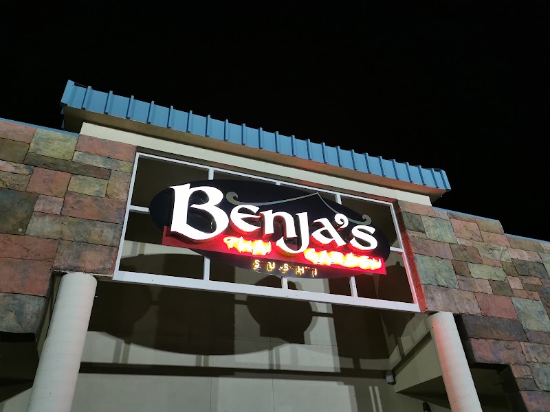
Benja Thai & Sushi is a longtime St. George favorite for dinner, offering an extensive menu of Thai curries, noodle dishes, and Japanese sushi rolls in a relaxed, well-appointed dining room. The restaurant is particularly popular with locals and visiting families, and the consistently well-executed dishes make it a reliable choice after a full day of canyon exploration.
4.4$$thai restaurant📍 Maps →
3 options · tap to switch
🛏️
Inn on the Cliff, St. George
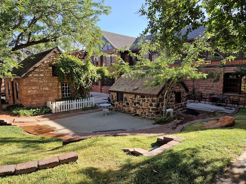
The Inn on the Cliff is St. George's most distinctive boutique accommodation, perched on a basalt lava bench above the city with panoramic views across the red rock valley toward the Nevada mountains. The property features rooms with private balconies facing west for sunset views, a pool terrace overlooking the volcanic cliffs, and a rooftop restaurant that has earned a strong regional reputation. The hotel's position on the lava bench — the same geological formation that runs through Snow Canyon — gives it a dramatic setting that keeps the landscape central to the experience even after a day of exploration. An alternative for travelers preferring chain reliability is the Courtyard by Marriott St. George in the historic core, within walking distance of the Tabernacle, Ancestor Square, and the city's best restaurants.
Day 3Zion National Park, UT

Day 3Zion National Park, UT

🚗 3 hr 20 min driving📍 7 stops
🌅
Morning
🚗
Drive
St. George, UTZion National Park
45 min8:00 AM8:45 AM
Zion Human History Museum
4.5
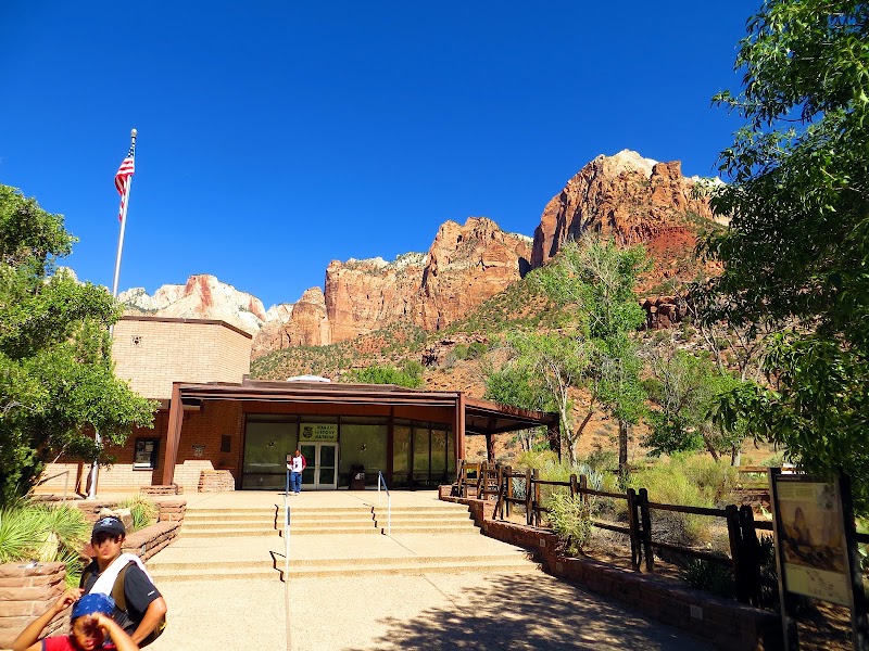
The Zion Human History Museum, located just inside the south entrance on the canyon floor, provides the essential cultural framework for understanding the human story layered into Zion Canyon's geological spectacle. Exhibits begin with the Archaic period hunter-gatherers who moved through the canyon beginning around 6000 BC, followed by the Virgin Ancestral Puebloans who established semi-permanent farming settlements on the canyon floor and benches between approximately 500 and 1200 AD, cultivating maize, beans, and squash in the narrow, sun-drenched bottomlands along the Virgin River. The Southern Paiute arrived after the Ancestral Puebloans departed and maintained a deep relationship with the canyon they called 'Mukuntuweap' — meaning straight canyon — until the mid-19th century. Mormon pioneers entered the canyon in the 1860s, naming the main canyon 'Zion' (a Hebrew word for sanctuary or sacred place) and establishing farms that remained productive for decades. The museum covers the 1909 designation as a national monument under Taft, the 1919 establishment as Utah's first national park, and the construction of the Zion-Mt. Carmel Highway and tunnel in 1930, which transformed access to the park. The building itself was constructed by the Civilian Conservation Corps in the 1930s as part of the New Deal's investment in national park infrastructure.
Canyon Junction Bridge Viewpoint
4.8
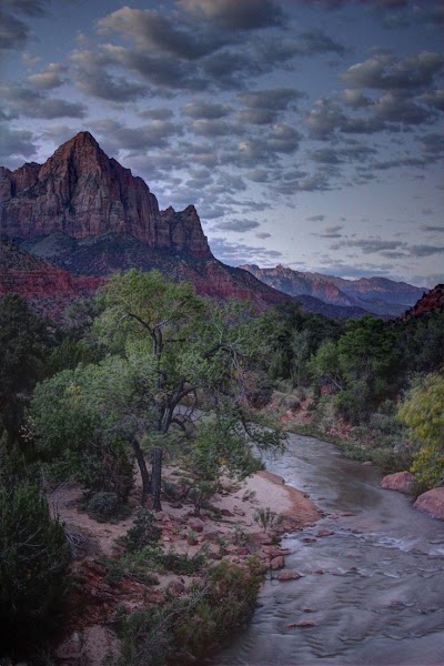
The Canyon Junction Bridge spans the Virgin River at the point where the North Fork joins the main canyon, and the pedestrian walkway across it provides what many visitors consider the definitive orientation view of Zion Canyon. Looking upstream from the bridge, the canyon walls rise in spectacular tiers: the Navajo Sandstone cliffs — iron-stained in bands of pink, orange, white, and red depending on oxidation state — ascend to the summit of Angels Landing, visible at 1,488 feet above the canyon floor as a narrow fin of rock with a sheer east face. Further up-canyon, the Great White Throne dominates the skyline with 2,350 feet of nearly vertical Navajo Sandstone — one of the largest monolithic rock faces in North America — its upper reaches bleached nearly white by groundwater percolating through the stone and flushing away iron pigments. The Virgin River runs clear and green over a cobbled bed at the base of the bridge, and in the right season, yellow cottonwoods frame the view in a burst of color that photographs beautifully but barely does the scale justice.
🍽️
Lunch
Pa'rus Trail
Pa'rus Trail
4.8
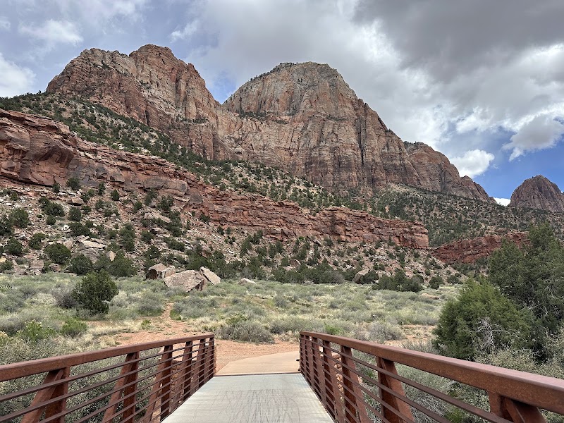
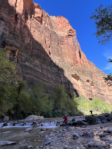
The Pa'rus Trail — the name means 'bubbling, tumbling water' in the Southern Paiute language — is a 1.7-mile paved, ADA-accessible path that follows the Virgin River from the visitor center north to Canyon Junction, offering ground-level immersion in the canyon ecosystem without requiring significant hiking fitness. The trail crosses the river six times on wooden footbridges, placing walkers directly above the rushing water and within the narrow riparian corridor of Fremont cottonwood, Gambel oak, boxelder, and red willow that lines the riverbanks — a lush green ribbon winding between canyon walls of bare stone. From this low elevation, the vertical relief of the surrounding canyon is particularly striking: walls that appear merely tall from above seem genuinely immense from the riverbed level, and the geological layering of the Navajo Sandstone — each stratum representing a different phase of ancient dune deposition — is clearly legible in the cliff faces. The trail is open to bicycles and leashed dogs in addition to pedestrians, and its gentle grade makes it accessible to travelers of all ages and abilities while still delivering the full emotional impact of Zion Canyon.
🍽️ Lunch11:45 AM
Zion Canyon Brew Pub
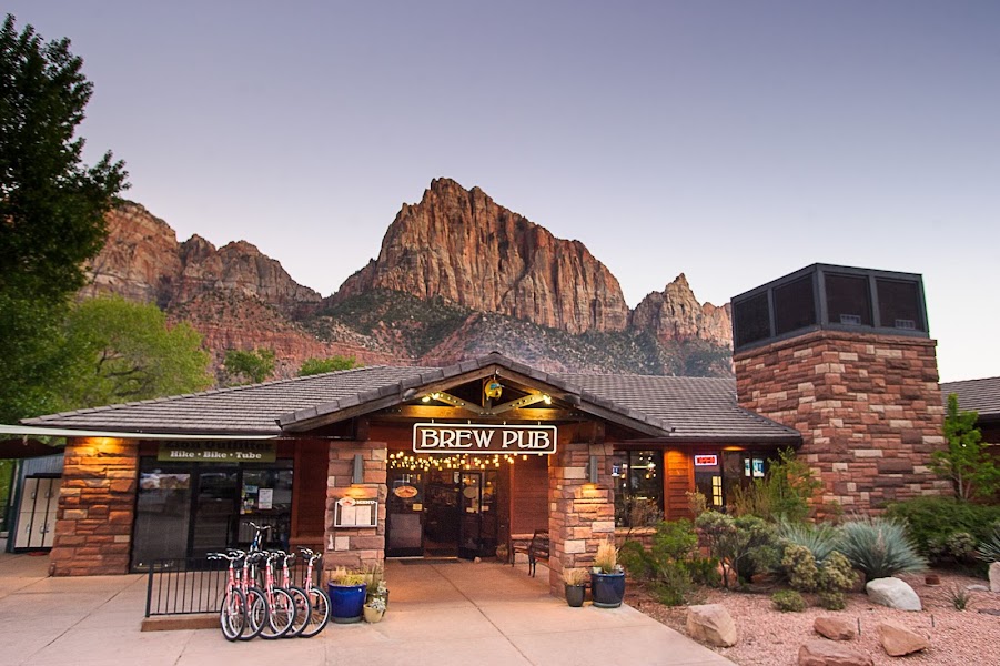
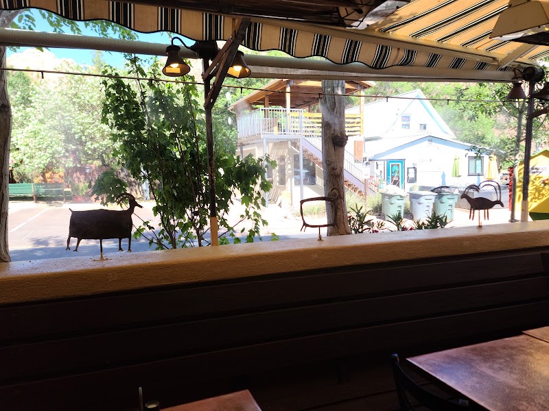
The Zion Canyon Brew Pub in Springdale is the town's most popular casual lunch destination, serving a rotating selection of house-brewed beers alongside a menu of burgers, sandwiches, salads, and pub fare in a lively, comfortable setting. Springdale's main street has exceptional views of the Zion Canyon rim from outdoor seating areas, making lunch here a scenic pause between morning and afternoon activities.
4.3$American restaurant📍 Maps →
3 options · tap to switch
☀️
Afternoon
Court of the Patriarchs Viewpoint
4.8
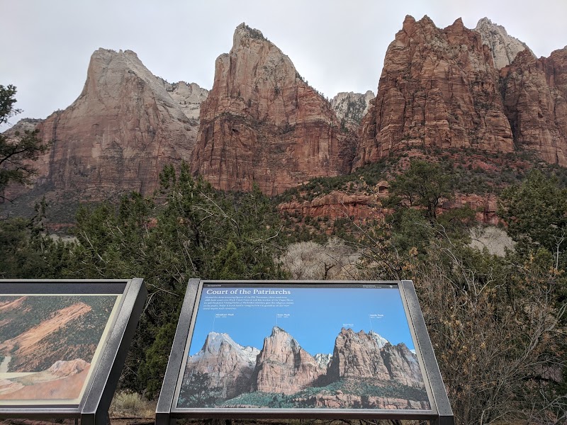
The Court of the Patriarchs viewpoint, accessible by a short walk from shuttle stop 4, looks directly at three massive sandstone monoliths that rise 3,600 to 4,000 feet in elevation on the west wall of Zion Canyon. Methodist minister Frederick Vining Fisher named the three peaks Abraham, Isaac, and Jacob in 1916 during an exploratory visit to the canyon, drawing on the patriarchal figures of the Hebrew Bible — names that resonated deeply with the Mormon community that had settled the canyon and named it after the heavenly city of Zion. A fourth formation visible slightly behind and to the right was later named Mount Moroni after the angel central to Latter-day Saint scripture. The naming history reflects the profound religious significance this canyon held for 19th-century settlers — Zion was not metaphor for them but a genuine conviction that this place of towering red walls and clear water carried divine meaning. The geological reality is equally impressive: these formations are sections of the west canyon wall where erosion has isolated individual spurs and fins, the Navajo Sandstone showing its full 2,200-foot thickness in faces streaked with desert varnish and decorated with seeping springs.
Zion Canyon Visitor Center & Shuttle Ride
4.3
The Zion Canyon Shuttle system — mandatory for private vehicles above Canyon Junction from spring through fall — is itself one of the most thoughtful visitor management systems in the national park network, replacing the traffic that once choked the canyon floor with a quiet, frequent bus service that stops at nine locations between the visitor center and the Temple of Sinawava at the end of the canyon road. Riding the full length of the canyon on the shuttle is a compelling way to experience the sequential revelation of Zion's major features: the weeping sandstone walls at Weeping Rock, the broad grassy benches at the Grotto picnic area, the narrow canyon framing at Big Bend, and the final terminus at the Temple of Sinawava where the canyon narrows to a slot and the Narrows hike begins. The visitor center itself, designed by GWSM Architects and opened in 2000, is a landmark of sustainable building design — a LEED-certified structure that uses passive solar heating, natural ventilation, and photovoltaic power — as well as the starting point for ranger programs that contextualize the park's geology, ecology, and human history.
🌙
Evening
🍽️ Dinner5:00 PM
Early Dinner in Springdale before Return
Springdale's small but well-developed restaurant strip caters to national park visitors with a range of options from casual counter service to sit-down dining. An early dinner before the return drive to Las Vegas allows travelers to avoid the late-afternoon rush at park exit and settles the meal well before the 155-minute highway drive home.
4.7$restaurant📍 Maps →
3 options · tap to switch
🚗
Drive
Zion National ParkLas Vegas, NV
2 hr 35 min6:00 PM8:35 PM
Return drive via I-15 South through the Virgin River Gorge
Plan your own escapeExplore more trips →