🌿 RelaxedWeekend · from Las Vegas, NV
Fire & the Lost City: Valley of Fire & Ancestral Puebloan History
Spend two unhurried days in the Mojave's most dramatic landscape, wandering the fiery red sandstone formations and petroglyph-etched canyons of Valley of Fire State Park at a pace that lets the geology sink in. The second day shifts from the ancient rocks to the ancient people who lived among them, with a morning at Nevada's finest archaeological museum beside the shores that now cover the ruins of a thriving Ancestral Puebloan salt-trading colony.
Day 1 — Valley of Fire State Park, NVDay 2 — Overton & Lost City Museum, NV
Day 1 — Valley of Fire State Park, NV
Day 1 — Valley of Fire State Park, NV
🚗 1 hr driving📍 9 stops
🌅
Morning
🚗
Drive
Las Vegas, NV → Valley of Fire State Park
1 hr
Via I-15 N and NV-169 east through the Moapa Valley
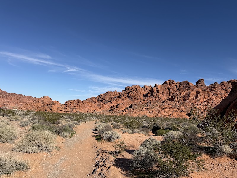
Valley of Fire Visitor Center
★ Reviews →The Valley of Fire Visitor Center is the ideal first stop for understanding the extraordinary landscape you are about to enter. Interpretive displays explain how the park's signature Aztec sandstone — brilliant shades of red, orange, and pink — originated as massive Jurassic sand dunes approximately 150 million years ago, later buried, compressed, and cemented by iron oxide and silica before erosion stripped away the overlying rock to reveal the formations visible today. The center covers the cultural history of the region in depth, documenting Southern Paiute use of the valley for centuries before European contact and the earlier presence of the Virgin Ancestral Puebloan people, who left petroglyphs across the park's canyon walls between roughly 300 BC and AD 1150. Rangers can orient you to the park's film history as well — the surreal red landscape has stood in for alien worlds and dystopian deserts in productions including Star Trek Generations (1994), Total Recall (1990), and Transformers: Revenge of the Fallen, among others.
~1.5 hrs📍 See location
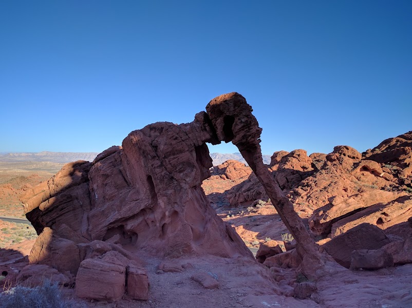
Elephant Rock
★ Reviews →Just steps from the parking area near the park's east entrance, Elephant Rock is a freestanding sandstone arch whose profile bears an uncanny resemblance to an elephant complete with a thick curved trunk drooping toward the ground and a broad domed head above. The formation is composed of the same Aztec sandstone that dominates the park — iron oxide gives it a deep brick-red color — and its distinctive shape was produced by differential weathering, in which softer layers of rock erode more quickly than the harder cap rock above, gradually sculpting the organic, rounded forms that define Valley of Fire's character. Elephant Rock is one of the most frequently photographed formations in Nevada, in part because it requires almost no effort to view and rewards visitors regardless of time of day.
~45 min📍 See location
🍽️
Lunch
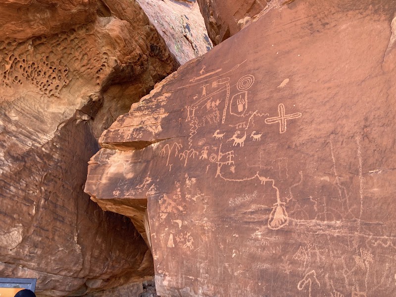
Atlatl Rock
★ Reviews →Atlatl Rock is one of the most significant petroglyph sites in the Mojave Desert, its central panel accessible via a metal staircase bolted to the sandstone face. The focal image is a human figure clearly depicted holding an atlatl — a wooden spear-throwing device that preceded the bow and arrow by thousands of years — surrounded by a dense gallery of bighorn sheep, human figures in ceremonial postures, geometric patterns, and abstract symbols representing multiple cultural periods from the Archaic through the Virgin Ancestral Puebloan era, roughly 300 BC to AD 1150. The panel's variety of styles and subjects suggests that this face of rock served as a gathering point across generations, with different groups adding to the visual record over more than a millennium. Atlatl Rock is named for this single standout image but the full panel rewards slow examination; binoculars help with the upper registers.
~45 min📍 See location
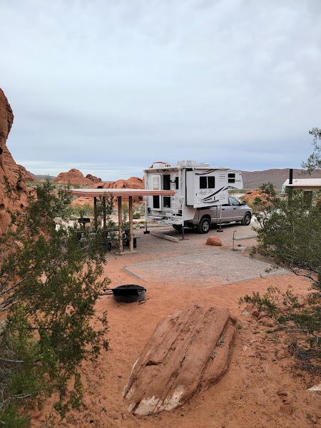
Picnic Lunch — Atlatl Rock Picnic Area
★ Reviews →The shaded picnic area adjacent to Atlatl Rock offers tables tucked against the sandstone in a natural alcove, one of the most atmospheric lunch spots in any Nevada state park. There are no food vendors inside Valley of Fire, so provisions must be brought from Las Vegas or from a grocery or gas station in Overton before entering the park. The shade here is genuine — the canyon walls block direct sun through much of the midday — making this a comfortable rest before the afternoon trails.
~1.5 hrs📍 See location
☀️
Afternoon
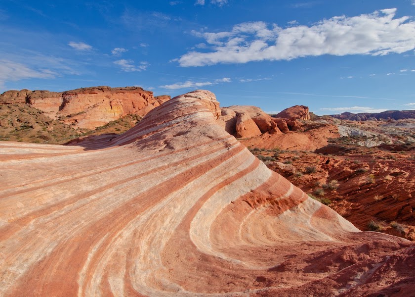
Fire Wave Trail
★ Reviews →The Fire Wave Trail is a 1.5-mile round trip across open sandstone leading to one of Valley of Fire's most visually striking formations — a broad expanse of undulating rock banded in parallel stripes of deep red and creamy white. The wave pattern is created by differential hardness within the Aztec sandstone: layers with higher iron oxide content are harder and resist erosion longer, while softer, paler layers between them are worn down more quickly by millennia of wind and flash flooding. The result is a surface of flowing ridges and troughs that photographically resembles the great sandstone wave formations of southern Utah. The trail begins as a marked dirt path and transitions to open-rock navigation across the sandstone surface; small cairns guide the way but the terrain is low-gradient and manageable at a leisurely pace.
~1 hr📍 See location
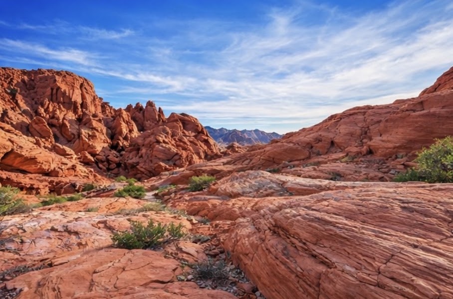
Rainbow Vista Overlook
★ Reviews →Rainbow Vista is a broad roadside pullout that delivers one of the widest unobstructed panoramas in Valley of Fire, scanning across an open basin of chromatic sandstone in every direction. The color range is what distinguishes this view from others in the park: iron oxides in the Aztec sandstone produce deep reds, burnt oranges, and warm yellows, while manganese creates purple and lavender hues in certain formations, and calcium carbonate-cemented zones appear cream or white. On clear days the southern horizon reveals the blue-grey shimmer of Lake Mead, the reservoir's open water forming a striking visual contrast against the arid desert foreground. The late-afternoon light angle — particularly in the two hours before sunset — is when the color variation is most vivid.
~30 min📍 See location
🌙
Evening
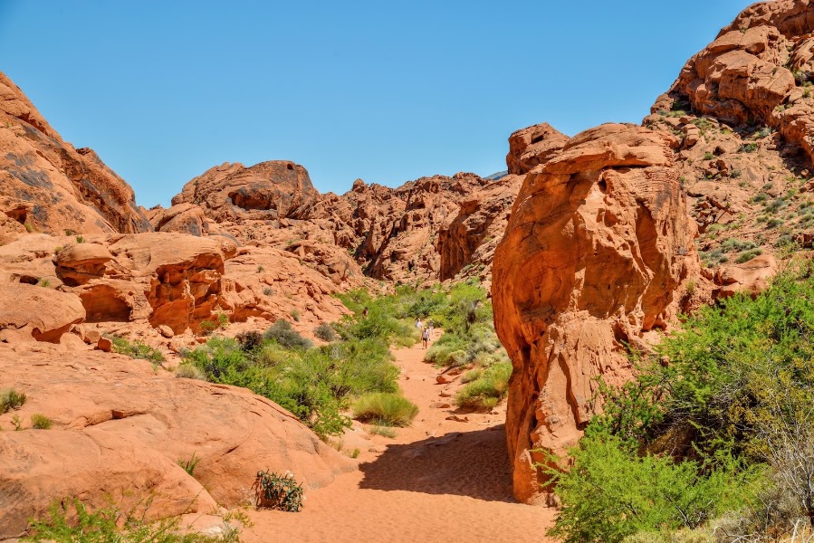
Mouse's Tank Trail (Sunset Walk)
★ Reviews →Mouse's Tank Trail follows a 0.75-mile canyon wash named for a Paiute man called Mouse who is said to have hidden in this remote canyon from authorities in the 1890s. The trail's true draw is one of the densest concentrations of petroglyphs in the Mojave — the canyon walls flanking the sandy wash bear hundreds of incised images of bighorn sheep, human figures, spirals, sunbursts, and abstract geometric forms, accumulated by different groups over thousands of years. At the far end of the canyon is the natural sandstone basin — the 'tank' — that collects and holds rainwater, making it a reliable water source that drew both wildlife and people to this spot for millennia. In the late afternoon, the canyon walls trap and amplify the sunset light, turning the red sandstone nearly luminous and making the petroglyphs unusually legible against the warm background.
~1 hr📍 See location
🍽️ Dinner~1 hr
🍽️
Dinner in Overton, NV
Overton is a small agricultural town of about 3,000 people in the Moapa Valley, and dining options are limited but unpretentious. Inside Track Sports Bar & Grill is the most reliable local option, serving burgers, sandwiches, and pub fare in a casual setting with friendly locals.
Restaurant
3 options · tap to switch
🛏️
Valley of Fire Lodge or Overton Motel
The Valley of Fire Lodge sits at the park's west entrance, offering basic but well-positioned rooms that allow an early start back into the park before day-trippers arrive. For those who prefer a wider range of services, the town of Overton 15 miles north on NV-169 has several budget motels including the Overton Motel, providing easy access to gas, grocery, and the Lost City Museum the following morning.
Day 2 — Overton & Lost City Museum, NV
Day 2 — Overton & Lost City Museum, NV
🚗 1 hr 20 min driving📍 7 stops
🌅
Morning
🚗
Drive
Valley of Fire / Overton → Lost City Museum of Archaeology
15 min
Short drive north on NV-169 into Overton
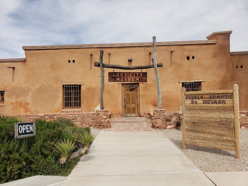
Lost City Museum of Archaeology
★ Reviews →The Lost City Museum is one of the finest small archaeological museums in the American West, built in 1935 specifically to preserve artifacts excavated from Pueblo Grande de Nevada — a sprawling Ancestral Puebloan settlement known as 'the Lost City' — before the rising waters of Lake Mead submerged much of the site in 1938. The settlement was occupied continuously from roughly 300 BC to AD 1150 by the Virgin Branch of the Ancestral Puebloan people, who exploited locally abundant salt deposits along the Muddy River to establish a trading network extending across the Colorado Plateau. At its peak the community included hundreds of pit houses and above-ground pueblo structures spread across several miles of river valley. The Bureau of Reclamation funded emergency excavations in the mid-1930s as the Hoover Dam project progressed, and the museum was constructed to house the recovered materials: painted and plain-ware pottery in a remarkable range of styles, coiled and twined basketry, turquoise jewelry and ornaments, shell beads traded from the Gulf of California, and a full range of agricultural tools including manos, metates, and digging sticks. On the museum grounds, a reconstructed pueblo village built on original foundations using period-accurate adobe construction gives tangible scale to what was once a substantial desert town.
~1.5 hrs📍 See location
Lost City Reconstructed Pueblo
★ Reviews →On the museum grounds, the Bureau of Reclamation constructed a series of adobe pueblo rooms on original foundations excavated in the 1930s, using period-accurate materials and construction methods documented during the archaeological work. The outdoor exhibit provides a tangible sense of the scale and layout of a pueblo village from the Ancestral Puebloan period — the low-ceilinged rooms, the communal layout, the thick earthen walls that insulate against desert heat — in a way that no indoor display can replicate. Interpretive signs throughout explain construction techniques, room functions, and the daily life of the people who occupied this river-valley community for more than a millennium.
~1.5 hrs📍 See location
🍽️
Lunch
Overton Beach — Lake Mead Overlook
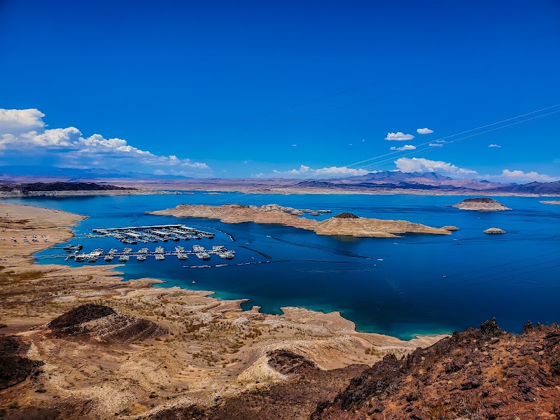
★ Reviews →The Overton Arm is the northernmost and most remote reach of Lake Mead, a finger of reservoir water extending into the Moapa Valley where the Muddy River once flowed. During the prolonged drought of the 2000s and 2010s, dramatically dropping lake levels exposed broad shelves of pale calcium carbonate — the 'bathtub ring' visible on canyon walls throughout the lake — and at the lowest points revealed the partially submerged remains of pioneer settlements that had been underwater since 1938. Overton Beach, once a developed marina, became stranded far from the retreating waterline during those drought years. The area provides a quiet, uncrowded vantage point on a part of Lake Mead most visitors never see, the alkaline flats and desert mountains framing the blue water in a landscape of unusual austerity.
~30 min📍 See location
🍽️ Lunch~1 hr
🍽️
Lunch in Overton, NV
Overton's dining scene is small but friendly, with a handful of local spots serving straightforward American food along the main highway through town.
Restaurant
3 options · tap to switch
☀️
Afternoon
📍
St. Thomas Ghost Town (Lake Mead)
★ Reviews →St. Thomas was a Mormon pioneer settlement founded in 1865 at the confluence of the Muddy and Virgin Rivers, growing into a prosperous waypoint on the Arrowhead Highway connecting Salt Lake City to Los Angeles. The town had a post office, school, stores, and approximately five hundred residents when the Bureau of Reclamation announced that the rising waters behind Hoover Dam would permanently submerge the site. The last resident, Hugh Lord, famously rowed a boat out of his flooded home in June 1938. The rising lake covered the town completely within months, and St. Thomas remained invisible beneath the reservoir for decades. Beginning in the early 2000s, sustained drought conditions dropped Lake Mead's surface by more than 130 feet, gradually exposing the ghost town: concrete foundations, cistern walls, the outlines of streets, and sections of masonry emerged from the lake bed and have remained accessible at low water levels ever since. The walk from the trailhead to the main townsite covers roughly 1.5 miles of sandy lake bed each way, and the eeriness of walking across what was recently a lake floor — finding old building foundations and the occasional artifact — is unlike any other experience in the region.
~1 hr📍 See location
Valley of Fire — White Domes Area
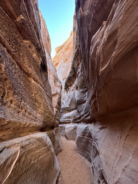
★ Reviews →The White Domes are a cluster of towering sandstone formations at the far western end of Valley of Fire, where cream-and-white calcium carbonate-cemented rock contrasts sharply with the deep red Aztec sandstone surrounding it. The 1.1-mile White Domes Loop passes through a short narrows slot canyon section and circles the formations in a relatively easy circuit. Afternoon revisiting allows for photography in lower light angles that bring out the color contrast between the white domes and the red canyon walls far more dramatically than midday sun.
~2.5 hrs📍 See location
🌙
Evening
Redstone Dune Trail — Sunset Walk
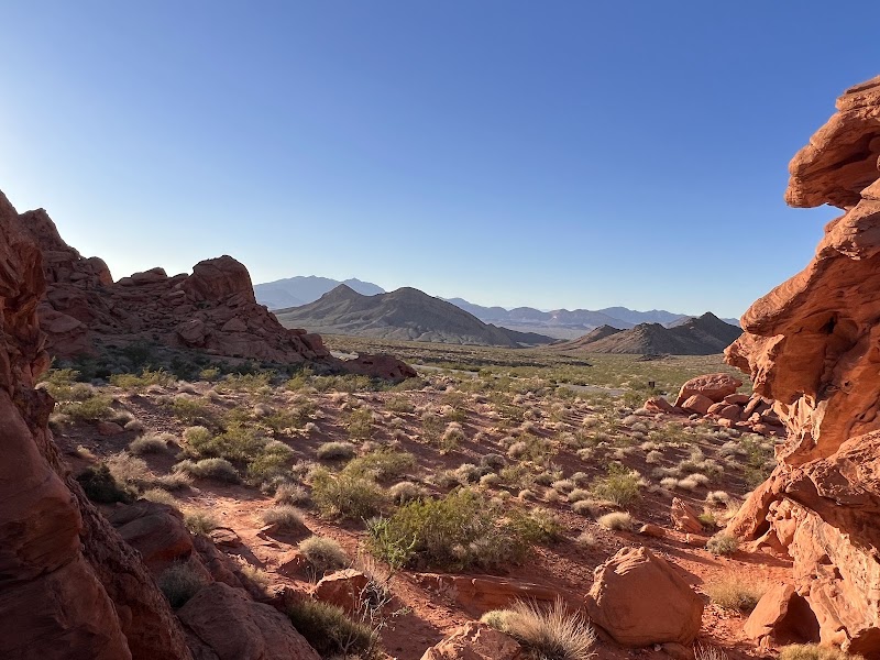
★ Reviews →The Redstone Dune Trail is a short, easy walk of under a mile leading to a cluster of brilliantly red Aztec sandstone dunes near the park's southern entrance. In the final thirty minutes before sunset the dunes absorb the low golden light and appear to glow from within, the color intensifying to a deep crimson before fading quickly at dusk. It is a calm, unhurried way to close two days in the valley.
~2.5 hrs📍 See location
🚗
Drive
Valley of Fire / Overton → Las Vegas, NV
1 hr 5 min
Return via NV-169 west and I-15 S; 60–75 minutes depending on traffic
← All Las Vegas trips
More getaways from Las Vegas
Red Rock & the Keystone Thrust: Calico Hills to Mount Charleston — Day trip🥾Red Rock to the Bristlecones: Canyon Hikes & Alpine Summit — Weekend🥾Three Canyons: Red Rock, Snow Canyon & Zion's Angels Landing — Long weekend🥾Dam, Ghost Town & Fire: A Mojave History Circuit — Day trip🏛️Boulder to Fire: Hoover Dam, Lake Mead & Valley of Fire — Weekend🏛️Desert Crossroads: Petroglyphs, Pioneer History & Zion's Red Walls — Long weekend🏛️Boulder City: Hoover Dam Heritage & Lake Mead Sunset Cruise — Day trip🌿Red Rock Towns: St. George Pioneer History & Springdale's Canyon Views — Weekend🌿
© 2026 theweekendgetaways.com · All itineraries are original content. Terms
Plan your own escapeExplore more trips →