🥾 ActiveDay trip · from Philadelphia, PA
Delaware Water Gap: Waterfalls, Summit Views & River Swimming
The Delaware Water Gap National Recreation Area preserves 70,000 acres of river gorge, ridge forest, and glacially carved landscape along the Pennsylvania-New Jersey border just 90 minutes from Philadelphia. Two spectacular waterfalls cascade through narrow rock chutes in Dingmans Ferry, the Red Dot Trail ascends to panoramic views of the Delaware River's hairpin bend through the Kittatinny Ridge, and the river beaches at Smithfield offer swimming in clean, cold mountain water by early afternoon.
Day 1 — Delaware Water Gap, PA
Day 1 — Delaware Water Gap, PA
Day 1 — Delaware Water Gap, PA
🚗 3 hr driving📍 6 stops
🌅
Morning
🚗
Drive
Philadelphia, PA → Dingmans Falls, Pike County, PA
1 hr 30 min
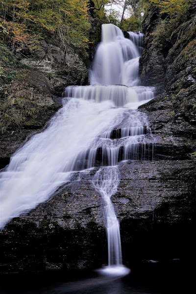
Dingmans Falls
★ Reviews →Dingmans Creek delivers two of the finest waterfalls in the mid-Atlantic states within a single easy walk. Silverthread Falls arrives first — a narrow column of water dropping 80 feet through a rock chute barely wider than the stream itself, the water barely touching the sides as it falls in an unbroken curtain into the pool below. A quarter mile further, Dingmans Falls plunges 130 feet, making it the second highest waterfall in Pennsylvania. The 1-mile boardwalk connecting them threads through old-growth hemlock forest over wetland and mossy rock, requiring no technical hiking ability and remaining accessible even after rain. The light through the hemlock canopy at mid-morning turns the gorge walls a deep green, and the mist from the lower falls drifts back across the boardwalk on still days.
~1.5 hrs📍 See location
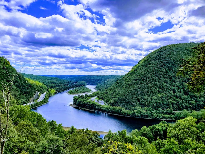
Mount Tammany — Red Dot Trail
★ Reviews →The Red Dot Trail climbs 1,527 feet in 2.2 miles from the I-80 parking area to the summit of Mount Tammany on the New Jersey side of the Delaware Water Gap, making it one of the steepest sustained ascents in the mid-Atlantic states. The trail follows the spine of the Kittatinny Ridge through open rock faces with river views that widen progressively as the forest thins toward the summit. The view from the top is one of the finest in the region: the Delaware River bends through the gap between the Pennsylvania Blue Mountain and the New Jersey Kittatinnies in a tight horseshoe bend visible in its entirety from the exposed granite ledges at the peak. The 4.4-mile round trip is strenuous and well-marked; the descent via the Blue Dot Trail through the gorge returns hikers to the same parking area. Plan 3 to 4 hours for the full loop.
~4 hrs📍 See location
🍽️
Lunch
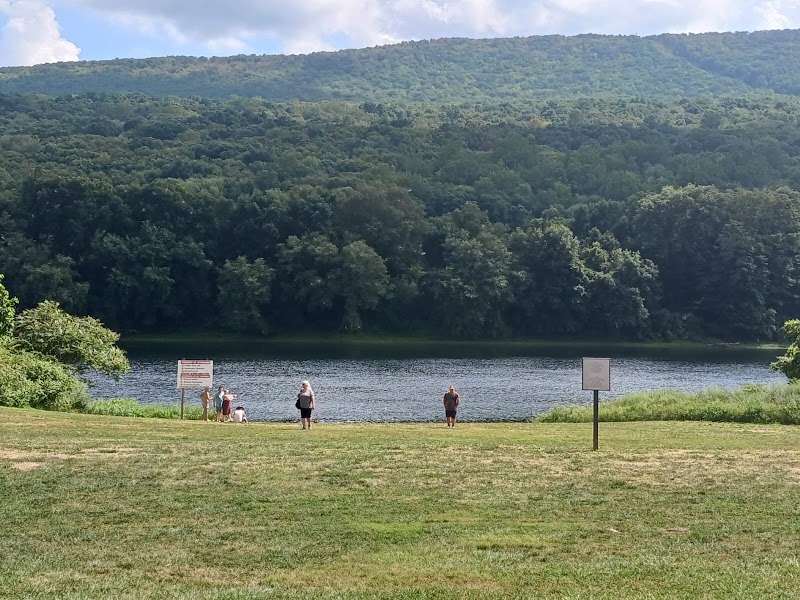
Smithfield Beach
★ Reviews →Smithfield Beach is the National Park Service's primary river-access swimming area on the Delaware, where the river runs wide and gentle over a sandy bottom with lifeguards posted in season. After the Mount Tammany climb the cold water is a significant reward — the Delaware runs considerably cooler here than any lake beach, fed by springs and mountain tributaries from the Kittatinnies. The flat gravel beach is large enough to spread out, and the NPS maintains changing facilities and restrooms. A camp store a short drive away at Dingmans stocks sandwiches, snacks, and cold drinks for those who didn't pack lunch.
~1.5 hrs📍 See location
☀️
Afternoon
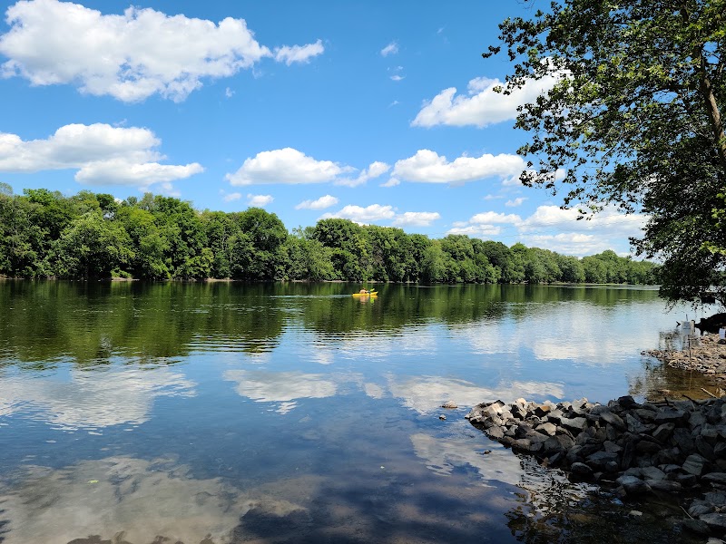
Delaware River Canoe & Kayak Launch
★ Reviews →The National Park Service maintains several put-in points for self-guided paddling on the flat-water Delaware through the recreation area. The 7-mile stretch from Smithfield Beach to Bushkill is Class I calm water with no technical features, running through a continuous corridor of NPS land where the forest comes to the bank on both sides and no development is visible from the river. Canoe and kayak rentals are available from outfitters including Kittatinny Canoes and Adventure Sports in nearby Marshalls Creek; guided trips are also available for those who have not paddled before. The river runs wide and steady through the afternoon, and the gorge walls above the water are visible in their full height from the middle of the channel.
~1 hr📍 See location
Bushkill Falls
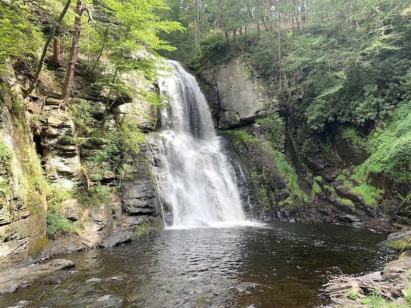
★ Reviews →Bushkill Falls has carried the title 'the Niagara of Pennsylvania' since the 19th century — a privately operated gorge system on Bushkill Creek where 8 separate waterfalls are linked by 2.5 miles of trails ranging from a 15-minute easy boardwalk loop to a 2-hour wilderness circuit through the full gorge. The Main Falls drops 100 feet in a narrow chute framed by sheer rock walls darkened with moisture and moss, and the viewing platforms at its base deliver the most dramatic close-range waterfall view in the Poconos. The private admission fee funds trail maintenance that has kept the paths in excellent condition for well over a century; the park also operates a small nature museum and picnic grounds near the entrance.
~1.5 hrs📍 See location
🌙
Evening
🍽️ Dinner~1 hr
Sycamore Grille
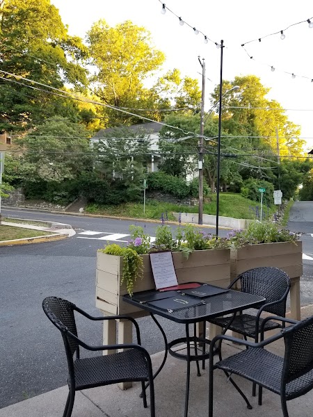
A longtime dinner anchor in Delaware Water Gap borough, the small Victorian river town on Route 611 at the southern end of the recreation area. The building dates to the resort era of the late 1800s when the Gap was a summer destination for Philadelphia and New York families; the menu covers American comfort cooking with a regional emphasis and a solid selection of draft beers. The outdoor seating in warm weather looks toward the mountain gap itself.
4 options · tap to switch
🚗
Drive
Delaware Water Gap, PA → Philadelphia, PA
1 hr 30 min
← All Philadelphia trips
More getaways from Philadelphia
Jim Thorpe: Whitewater, the Switchback Trail & Victorian Mountain Town — Day trip🥾Delaware Water Gap: Waterfalls, Ridge Hiking & Niagara of Pennsylvania — Weekend🥾Pocono Mountains Circuit: Waterfalls, Gorge Rafting & Hawk Migration — Long weekend🥾Steam Trains & Amish Farmlands: Lancaster County in a Day — Day trip🏛️Pennsylvania Dutch Country: Steam Trains, Plain Communities & Colonial Communes — Weekend🏛️Pennsylvania Dutch Country: Three Days Among Plain Communities, Colonial History & Artisan Traditions — Long weekend🏛️Brandywine Valley: Longwood Gardens, Wyeth & Delaware River Countryside — Day trip🌿Brandywine Valley Weekend: Du Pont Estates, Wyeth Country & Delaware River — Weekend🌿
© 2026 theweekendgetaways.com · All itineraries are original content. Terms
Plan your own escapeExplore more trips →