🥾 ActiveWeekend · from Philadelphia, PA
Delaware Water Gap: Waterfalls, Ridge Hiking & Niagara of Pennsylvania
Two days in the Delaware Water Gap National Recreation Area give enough time to hike the Appalachian Trail above a glacial lake, swim at a National Park beach, and experience the eight-waterfall cascade that earned Bushkill Falls its outsized nickname. The Water Gap's 70,000 acres are laced with 100 miles of trail and bounded by the cleanest large river in the northeastern United States — a river where you can see the bottom in ten feet of water.
Day 1 — Delaware Water Gap, PADay 2 — Bushkill & Kittatinny Ridge, PA
Day 1 — Delaware Water Gap, PA
Day 1 — Delaware Water Gap, PA
🚗 2 hr driving📍 7 stops
🌅
Morning
🚗
Drive
Philadelphia, PA → Dingmans Falls
1 hr 30 min
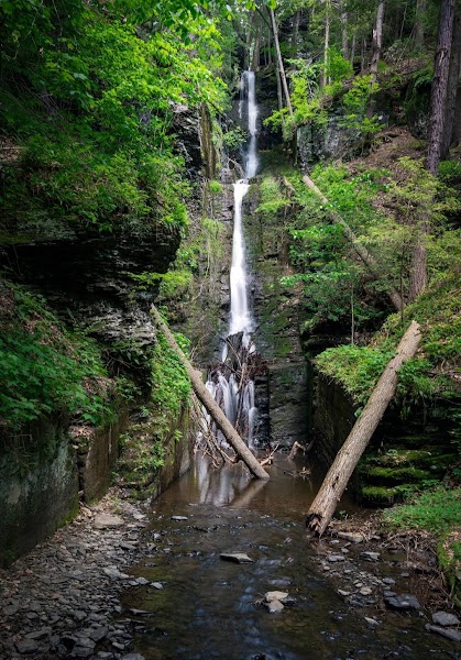
Dingmans Falls & Silverthread Falls
★ Reviews →A 1-mile boardwalk loop through a cathedral hemlock ravine leads to two of Pennsylvania's tallest waterfalls. Silverthread Falls drops 80 feet in a single translucent thread through a narrow basalt slot, its spray catching the light filtered through the old-growth canopy above. Dingmans Falls follows — 130 feet of wide cascade over layered ledge rock, the roar audible before the falls come into view. The hemlock grove along the boardwalk is one of the largest surviving old-growth hemlock stands in Pennsylvania, and the ravine runs 10 degrees cooler than the surrounding plateau through August.
~1.5 hrs📍 See location
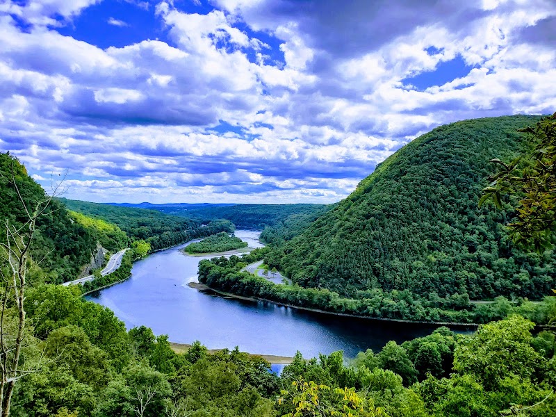
Mount Tammany Red Dot Trail
★ Reviews →The most dramatic short hike in the Water Gap — a 4.4-mile round trip ascending 1,527 feet via a series of switchbacks and a rocky scramble to the summit of Mount Tammany on the Pennsylvania side of the gap. From the summit ledge, the Delaware River bends directly below in a 1,200-foot-deep cleft between the Kittatinny Ridge to the north and Tammany's cliffs to the south — one of the definitive panoramic views in the Mid-Atlantic. The Red Dot Trail ascent is the more demanding route; fit hikers can make the summit in 90 minutes.
~1.5 hrs📍 See location
🍽️
Lunch
🚗
Drive
Mount Tammany → Smithfield Beach
10 min
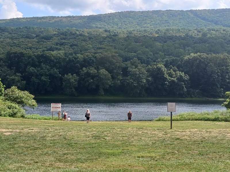
Smithfield Beach
★ Reviews →A National Park Service beach on the Delaware River — cold, clear water with a sandy bottom and lifeguards on duty in season, making it the best swim stop in the Water Gap after a strenuous morning on Mount Tammany. The river here is designated Wild and Scenic, and the water clarity is exceptional: you can see the bottom in ten feet. The NPS prohibits motorized boats above Tocks Island Dam, so the swimming area is free of wake and noise. The camp store at the adjacent picnic area sells sandwiches and snacks for a simple lunch in the shade of the riverside trees.
~1.5 hrs📍 See location
☀️
Afternoon
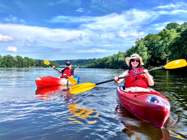
Delaware River Flatwater Kayak & Canoe
★ Reviews →A 7-mile Class I paddle from Smithfield Beach downstream toward Bushkill on the Wild and Scenic Delaware River — calm water with no motorized boats, forested banks running right to the waterline, and bald eagles and great blue herons visible from the river at regular intervals. Multiple outfitters operating from Smithfield Beach provide canoe and kayak rentals and shuttle service. The river is at its widest and most tranquil in this stretch, and the Kittatinny Ridge rising above the hemlock banks to the west gives the paddle an enclosed, remote character despite its proximity to the highway corridor.
~1.5 hrs📍 See location
🚗
Drive
Smithfield Beach → Delaware Water Gap Visitor Center
15 min
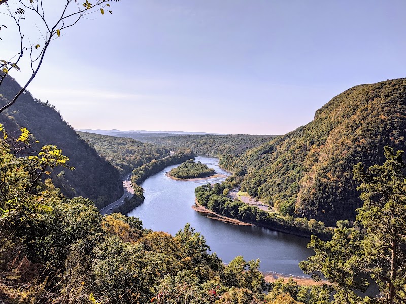
Delaware Water Gap National Recreation Area Visitor Center
★ Reviews →The NRA headquarters visitor center in the borough of Delaware Water Gap holds interpretive exhibits on the gap's glacial geology — the Delaware cut through the Kittatinny Ridge over millions of years as the ridge itself was slowly uplifted — and on the remarkable political battle of the 1970s, when grassroots opposition defeated the Army Corps of Engineers' proposed Tocks Island Dam that would have flooded 37 miles of river valley and displaced 80,000 residents. The defeat of Tocks Island was one of the first major environmental victories in American history, and it preserved the river corridor that exists today.
~2.5 hrs📍 See location
🌙
Evening
🚗
Drive
Delaware Water Gap Visitor Center → Delaware Water Gap Borough
5 min
🍽️ Dinner~1 hr

The Sycamore Grille
A well-regarded American grill in the small borough of Delaware Water Gap, serving hearty post-hike fare — burgers, steaks, and local trout — in a casual dining room frequented by hikers coming off the Appalachian Trail, which passes directly through the borough on its way across the ridge above.
4 options · tap to switch
🛏️
Water Gap Country Club Hotel or Stroudsburg Inn
Stay in the Delaware Water Gap borough or in Stroudsburg, 5 miles west — both have a range of options from historic inns to modern hotels on Route 611, all within easy reach of the next morning's Bushkill Falls.
Day 2 — Bushkill, PA
Day 2 — Bushkill, PA
🚗 2 hr 45 min driving📍 5 stops
🌅
Morning
🚗
Drive
Delaware Water Gap, PA → Bushkill Falls
20 min
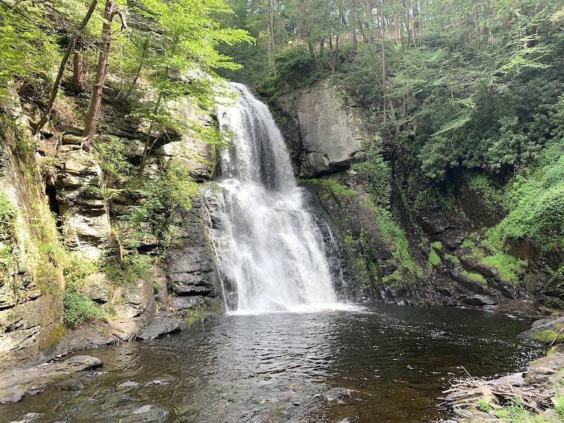
Bushkill Falls
★ Reviews →Eight waterfalls cascade through a narrow shale gorge carved by Bushkill Creek — the Main Falls drops 100 feet in a single, thunderous curtain of water, earning the attraction its longstanding nickname the Niagara of Pennsylvania. Upper Clift Falls and Bridal Veil Falls are accessible via the 2.5-mile red loop trail, which follows the gorge rim on a boardwalk-and-staircase system through hemlock and hardwood forest. A private family has operated Bushkill Falls as a nature attraction since 1904, maintaining the trails and bridges without the regulatory constraints of state park management. The gorge walls close in to twenty feet at the most dramatic viewpoints, and the mist from the main falls is felt before the falls themselves come into view around the final bend.
~1.5 hrs📍 See location
🚗
Drive
Bushkill Falls → Dunnfield Creek Trailhead
20 min
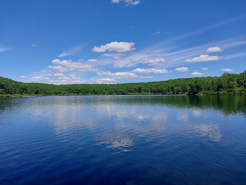
Appalachian Trail to Sunfish Pond
★ Reviews →From the Dunnfield Creek trailhead at the base of Mount Tammany, the Appalachian Trail climbs 3.5 miles through oak-hickory forest to Sunfish Pond — a 41-acre glacial lake formed 18,000 years ago when a retreating glacier left a depression in the Kittatinny Ridge that has held water ever since. Sunfish Pond is one of only seven remaining glacial lakes on the Kittatinny Ridge and a designated National Natural Landmark. The lake sits in a bowl of second-growth forest with no roads or structures visible from its shore; the water is clear to the bottom in the shallows. The Dunnfield Creek trail follows a cascading stream through a hemlock ravine for the first mile before ascending the ridge in earnest — a complete change of scenery within a single hike.
~2.5 hrs📍 See location
🍽️
Lunch
🚗
Drive
Dunnfield Creek Trailhead → Millbrook Village
25 min
📍
Millbrook Village
★ Reviews →The NPS-preserved 19th-century village on the New Jersey side of the Delaware River, originally settled in 1832 and preserved as a living history site depicting rural life in the Water Gap valley from the 1830s to around 1900. Original structures include a grist mill, blacksmith shop, church, and several farmhouses — all original to the site, not relocated reproductions. Costumed interpreters operate the mill and demonstrate period crafts on summer weekends. The village sits in a meadow framed by the Kittatinny Ridge and the Old Mine Road corridor, with picnic tables beside the millpond for lunch. There are no food vendors at Millbrook Village — pack a lunch from the night before and enjoy it at the picnic tables beside the millpond after the hike.
~1.5 hrs📍 See location
☀️
Afternoon
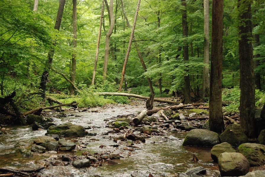
Pocono Environmental Education Center
★ Reviews →The 65-acre PEEC campus on the Delaware River offers guided nature walks, hawk-watching platforms, and interpretive programs on the Water Gap's ecosystems for visitors outside its residential school programs. The Kittatinny Ridge directly above is one of the most significant raptor migration corridors in the eastern United States: in September and October, tens of thousands of broad-winged hawks, sharp-shinned hawks, and Cooper's hawks funnel along the ridge as they travel south, and PEEC's elevated platforms provide unobstructed sightlines along the ridge. In summer the focus shifts to dragonfly and butterfly surveys and forest ecology walks. Note: PEEC primarily hosts residential school groups — call ahead to confirm visitor hours before arriving, as drop-in access is limited. The hawk-watching platform is accessible during fall migration without reservation.
~1.5 hrs📍 See location
🚗
Drive
PEEC → Old Mine Road
10 min
Old Mine Road Scenic Drive
★ Reviews →A 17-mile NPS scenic road running through the Delaware River valley along the New Jersey bank — the oldest continuously used road in the United States, built in the 1650s by Dutch copper miners who hauled ore from the Pahaquarry Copper Mines to Esopus on the Hudson River, more than 100 miles north. The road follows the river closely through a corridor of farmland, woodlot, and floodplain forest; the stone foundations of Dutch-era farmsteads and a colonial-era grist mill appear at intervals along the route. The NPS has preserved this section from development, and the drive through late afternoon light along the river is unhurried and genuinely historic.
~2.5 hrs📍 See location
🌙
Evening
🚗
Drive
Old Mine Road → Philadelphia, PA
1 hr 30 min
← All Philadelphia trips
More getaways from Philadelphia
Delaware Water Gap: Waterfalls, Summit Views & River Swimming — Day trip🥾Jim Thorpe & Hickory Run: Lehigh Gorge Trail, Whitewater & a Glacial Boulder Field — Weekend🥾Pocono Mountains Circuit: Waterfalls, Gorge Rafting & Hawk Migration — Long weekend🥾Steam Trains & Amish Farmlands: Lancaster County in a Day — Day trip🏛️Pennsylvania Dutch Country: Steam Trains, Plain Communities & Colonial Communes — Weekend🏛️Pennsylvania Dutch Country: Three Days Among Plain Communities, Colonial History & Artisan Traditions — Long weekend🏛️Brandywine Valley: Longwood Gardens, Wyeth & Delaware River Countryside — Day trip🌿Brandywine Valley Weekend: Du Pont Estates, Wyeth Country & Delaware River — Weekend🌿
© 2026 theweekendgetaways.com · All itineraries are original content. Terms
Plan your own escapeExplore more trips →