🥾 ActiveLong weekend · from San Francisco, CA
Año Nuevo Elephant Seals, Coastal Redwoods & Tomales Bay Paddling
Three days covering the full geographic sweep of the Bay Area's accessible wilderness: California's most spectacular elephant seal colony at Año Nuevo on the San Mateo coast, the ancient redwood forest of Samuel P. Taylor in West Marin, and the protected waters of Tomales Bay for kayaking. Each day has a distinct character — wildlife and sand in the south, forest in the middle, and open water and headlands for the return.
Day 1 — Año Nuevo State Reserve & San Mateo CoastDay 2 — Samuel P. Taylor State Park & West MarinDay 3 — Tomales Bay Kayaking & Marin Headlands Return
Day 1 — Año Nuevo State Reserve & San Mateo Coast
Day 1 — Año Nuevo State Reserve & San Mateo Coast
🚗 2 hr driving📍 5 stops
🌅
Morning
🚗
Drive
San Francisco, CA → Año Nuevo State Reserve
1 hr 15 min
Drive south on I-280 to CA-1 south through Half Moon Bay and Pescadero to the Año Nuevo parking area.
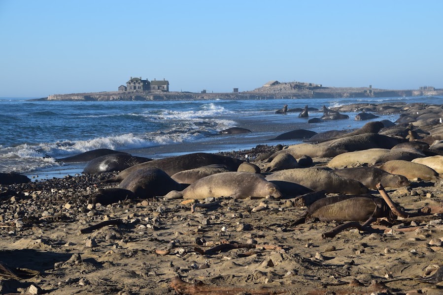
Año Nuevo State Reserve — Elephant Seal Colony
★ Reviews →California's most accessible northern elephant seal colony — 3,000 to 4,000 seals haul ashore annually, with bulls weighing up to 2,500 pounds competing for territory from December through March. Outside the breeding season, juvenile seals are year-round residents on the beach; the 3-mile round-trip trail through coastal scrub and dunes delivers consistent seal sightings in every season. The offshore Año Nuevo Island, visible from the trail, hosts the main bull colony and a historic lighthouse that operated from 1872 until automated in 1948. Guided tours are required December through March; self-guided trails are open the rest of the year.
~1.5 hrs📍 See location
🍽️
Lunch
🚗
Drive
Año Nuevo State Reserve → Duarte's Tavern — Pescadero
15 min
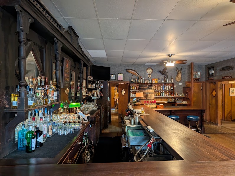
Duarte's Tavern — Pescadero
★ Reviews →A Pescadero institution since 1894, when Frank Duarte opened a saloon for the logging crews working the Santa Cruz Mountains. The fifth generation of the family still operates the restaurant, still serving the original artichoke soup recipe using locally-grown Pescadero artichokes, and the cream of green chile soup that has appeared in Gourmet, Sunset, and a James Beard Award nomination. The half-and-half soup (artichoke and green chile in one bowl) is the order.
~1 hr📍 See location
☀️
Afternoon
🚗
Drive
Pescadero → Pigeon Point Lighthouse State Historic Park
10 min
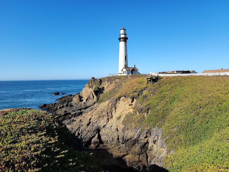
Pigeon Point Lighthouse & Tide Pools
★ Reviews →The second-tallest lighthouse in the United States at 115 feet, built in 1872 and still operating — the Fresnel lens on display inside weighs several tons and was hand-ground in France. The rocky point below the lighthouse has some of the most productive tide pools on the San Mateo coast, accessible at low tide: aggregating anemones, ochre sea stars, hermit crabs, and purple sea urchins in shallow pools. The adjacent hostel (in the original fog-signal building) is the only lighthouse overnight accommodation on the California coast.
~2 hrs📍 See location
🌙
Evening
🚗
Drive
Pigeon Point Lighthouse → Half Moon Bay
20 min
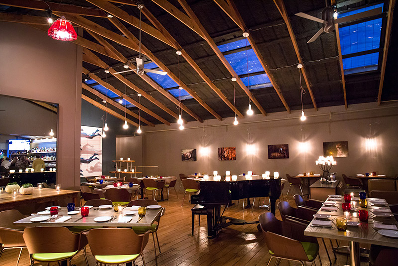
Pasta Moon — Half Moon Bay
★ Reviews →A Half Moon Bay Italian restaurant that has been the coastside's most reliable dinner destination since 1989 — house-made pasta, wood-fired dishes, and a Dungeness crab ravioli that reflects the local fishing fleet's catch. The kitchen sources from the surrounding San Mateo County farms; the wine list features small-production Santa Cruz Mountains and Santa Lucia Highlands producers. The dining room on Main Street is warm and unpretentious.
~1 hr📍 See location
🛏️
Ritz-Carlton Half Moon Bay or Zaballa House
The Ritz-Carlton Half Moon Bay sits on the bluffs above the ocean; the Zaballa House inn occupies the historic downtown.
Day 2 — Samuel P. Taylor State Park & West Marin
Day 2 — Samuel P. Taylor State Park & West Marin
🚗 2 hr 15 min driving📍 6 stops
🌅
Morning
🚗
Drive
Half Moon Bay, CA → Samuel P. Taylor State Park
1 hr 30 min
Drive north via US-101 through Marin to San Rafael, then west on Sir Francis Drake Boulevard through Fairfax to the park.
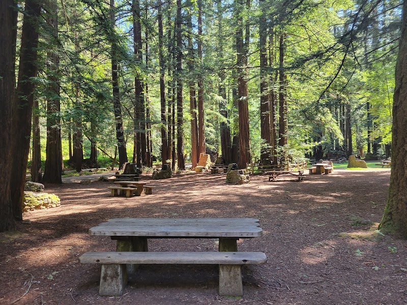
Samuel P. Taylor State Park — Redwood Grove Trail
★ Reviews →A 2,800-acre state park in the Lagunitas Creek watershed, with old-growth coast redwoods growing within 30 miles of San Francisco. The Redwood Grove Loop (1.3 miles, flat) passes through a genuine cathedral grove of 150-foot trees; the Irving Picnic Area beneath the redwoods has been in continuous use since 1875, when the park was a camping resort. An 1850s paper mill site in the redwoods of the San Geronimo Valley operated here from 1856 until 1905.
~2 hrs📍 See location
Barnabe Mountain Trail — Samuel P. Taylor SP
★ Reviews →A 6.5-mile loop from the Paper Mill Creek campground gains 1,200 feet to Barnabe Mountain's fire lookout, offering commanding views across Tomales Bay to the Point Reyes Peninsula and west to the Pacific. The return descent through mixed Douglas fir and bay laurel is some of the most pleasant trail running in Marin County.
~4.5 hrs📍 See location
🍽️
Lunch
🚗
Drive
Samuel P. Taylor State Park → West Marin School Lunch Cart — Point Reyes Station
20 min
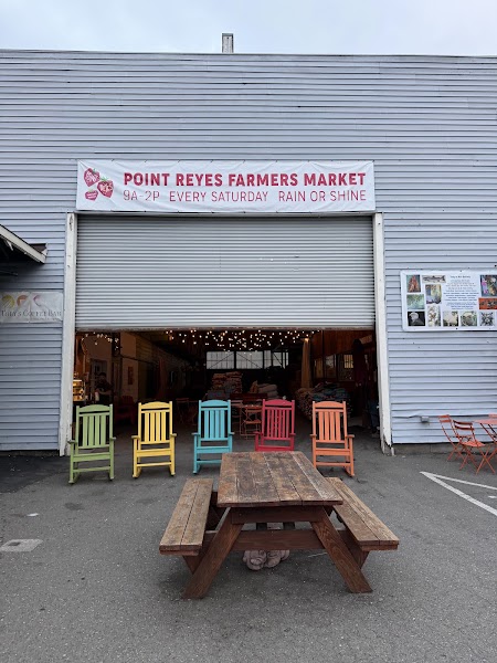
Point Reyes Station Farmers Market
★ Reviews →Point Reyes Station's agricultural character — working dairies, an oyster farm, and vegetable operations — concentrates on the main street in a collection of independent food businesses: the Bovine Bakery (morning buns and coffee since 1988), Osteria Stellina (Californian-Italian using West Marin ingredients), and the Cowgirl Creamery Sidekick shop where the Mt. Tam triple-cream and Red Hawk washed-rind cheeses are made. The most food-per-square-mile of any town in Marin County.
~1 hr📍 See location
☀️
Afternoon
🚗
Drive
Point Reyes Station → Tomales Bay State Park
15 min
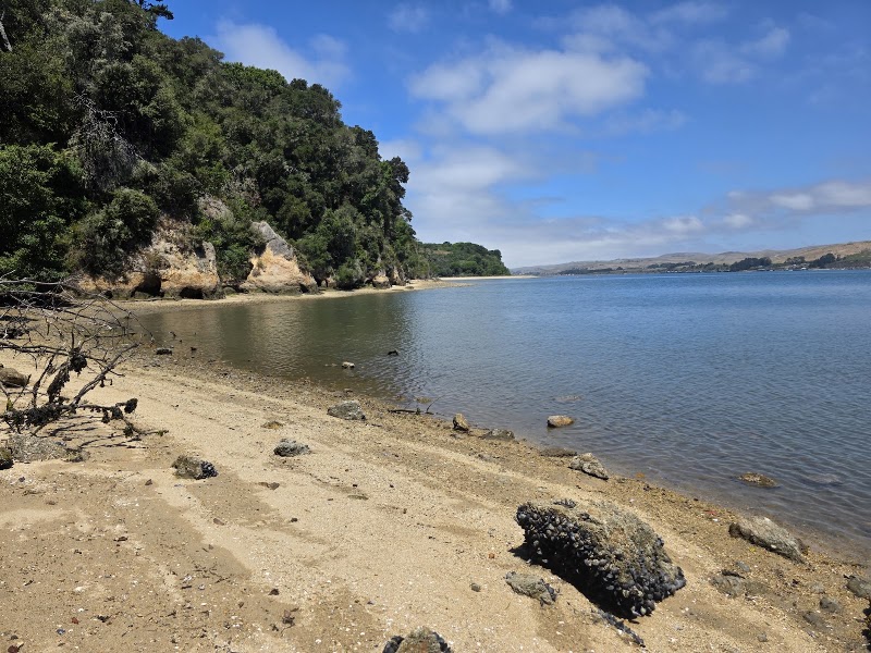
Tomales Bay State Park — Bishop Pine Trail
★ Reviews →The Bishop Pine Forest at Tomales Bay State Park is one of two places on earth where native stands of bishop pine grow — a fire-adapted conifer that requires the marine fog and sandy soils of the Point Reyes peninsula. The 2-mile Bishop Pine Trail through the grove connects to Heart's Desire Beach on the bay's inner shore, with calm, clear water and harbor seal sightings from the beach.
~2 hrs📍 See location
🌙
Evening
🚗
Drive
Tomales Bay State Park → Inverness
10 min
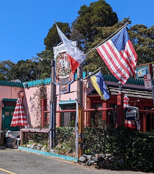
Vladimir's Czech Restaurant
★ Reviews →An Inverness institution since 1960 — a Czech restaurant in a converted Victorian house serving svíčková, schnitzel, and roast duck to the West Marin farming and fishing community. The owner Vladimir Nevl emigrated from Prague in 1948; the restaurant reflects his cooking as it stood when he arrived. The fireplace dining room has not been renovated since the 1960s.
~1 hr📍 See location
🛏️
Point Reyes Seashore Lodge
A 1988 building with garden rooms above Olema Creek, in Inverness or Point Reyes Station.
Day 3 — Tomales Bay Kayaking & Marin Headlands Return
Day 3 — Tomales Bay Kayaking & Marin Headlands Return
🚗 1 hr 35 min driving📍 4 stops
🌅
Morning
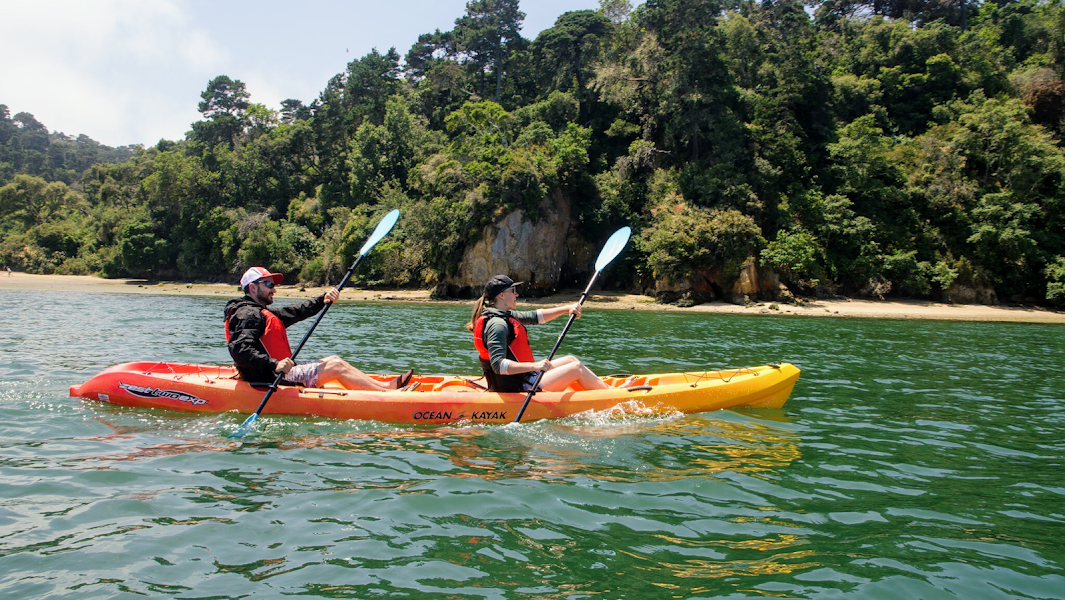
Tomales Bay Kayaking — Inverness Launch
★ Reviews →Launch from the Inverness public beach and paddle north toward the mouth of Tomales Bay — the bay is 15 miles long, 1 mile wide, and lies precisely on the San Andreas Fault. The sheltered water is calm enough for beginners; the seal haul-outs on the sandbars are visible from 100 yards on the water. The northern end of the bay, 5 miles from Inverness, has tide pools accessible only by boat at low tide.
~1 hr📍 See location
🍽️
Lunch
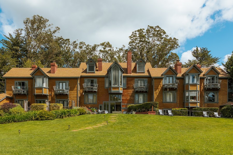
Sir and Star at the Olema Inn
★ Reviews →A celebrated farm-to-table restaurant in the 1876 Olema Inn, Sir and Star sources almost entirely from Marin farms and the Point Reyes seashore — the menu changes daily and might feature local halibut, West Marin beef, or foraged mushrooms from the hills above. One of the most destination-worthy dining rooms in the Bay Area.
☀️
Afternoon
🚗
Drive
Olema, CA → Marin Headlands — Tennessee Valley Trail
1 hr
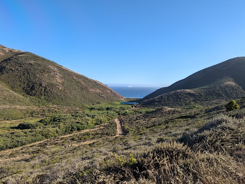
Tennessee Valley Trail — Marin Headlands
★ Reviews →The Tennessee Valley Trail (3.4 miles round-trip, nearly flat) follows Tennessee Creek through a coastal valley to a crescent beach and sea cave at the Pacific — the simplest route to the ocean floor of the Golden Gate National Recreation Area. Raptors hunt the valley grasslands; harbor seals rest on the sea stack offshore. The return drive via Rodeo Beach and Conzelman Road passes the coastal gun batteries and delivers the full Golden Gate panorama before re-entering the city.
~2 hrs📍 See location
🌙
Evening
🚗
Drive
Tennessee Valley Trail → Murray Circle — Fort Baker
15 min
🍽️ Dinner~1 hr
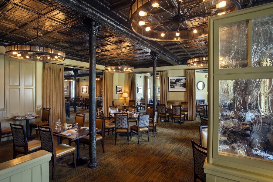
Murray Circle Restaurant
The restaurant inside the Cavallo Point Lodge at Fort Baker, a former Army post at the north end of the Golden Gate Bridge. The historic officers' quarters and contemporary lodge buildings sit 200 feet above the bay with direct views of the bridge from the dining room and terrace. The California-focused menu uses local and sustainable ingredients; the wine list emphasizes Napa and Sonoma producers.
4 options · tap to switch
🚗
Drive
Murray Circle Restaurant → San Francisco, CA
20 min
← All San Francisco trips
More getaways from San Francisco
Angel Island & Marin Ridgeline: Bay Views from the Water's Edge — Day trip🥾Mount Tamalpais Summit & Point Reyes Kayaking — Weekend🥾Tomales Point Tule Elk, Point Reyes & Steep Ravine — Long weekend🥾Sausalito Houseboats & Tiburon Waterfront — Day trip🏛️Sonoma Wine Country & the Bear Flag Republic — Weekend🏛️Napa Valley Culinary Capital, Sonoma Arts & Frank Lloyd Wright's Marin — Long weekend🏛️Stinson Beach & Bolinas Lagoon: Marin's Secret Coast — Day trip🌿Russian River Resort Town & the Bohemian Highway to Dillon Beach — Weekend🌿
© 2026 theweekendgetaways.com · All itineraries are original content. Terms
Plan your own escapeExplore more trips →