🥾 ActiveLong weekend · from San Francisco, CA
Tomales Point Tule Elk, Point Reyes & Steep Ravine
Point Reyes National Seashore is one of the most biologically diverse protected areas in the American West — 71,000 acres of wilderness extending 10 miles into the Pacific on a peninsula that moves 2 inches northwest every year on the Pacific Plate. Three days cover the seashore's north and south zones: the tule elk reserve at Tomales Point, the dramatic Drakes Beach and lighthouse cliffs, and the remote Limantour Estero. The return on Day 3 descends through the slot canyon of Steep Ravine on Mount Tamalpais, one of the most dramatic short hikes in the Bay Area.
Day 1 — Point Reyes Lighthouse & Chimney RockDay 2 — Bear Valley & Limantour EsteroDay 3 — Steep Ravine Trail & Muir Woods Return
Day 1 — Point Reyes Lighthouse & Chimney Rock
Day 1 — Point Reyes Lighthouse & Chimney Rock
🚗 2 hr 15 min driving📍 5 stops
🌅
Morning
🚗
Drive
San Francisco, CA → Point Reyes Lighthouse
1 hr 15 min
📍
Point Reyes Lighthouse — 308-Step Descent
★ Reviews →The lighthouse at the tip of the Point Reyes headlands sits at the base of a 308-step staircase descending 300 feet down the cliff face — the windiest spot on the California coast, averaging 47 mph, and one of the foggiest locations on the Pacific Coast. The lighthouse itself, built in 1870 and still operating, houses a first-order Fresnel lens that weighs 6,000 pounds and was hand-ground in France. Gray whales pass within a quarter-mile of the point during their December–April migration (18,000 animals making the longest mammal migration on earth, from Arctic feeding grounds to Baja lagoons and back). The staircase closes when winds exceed 40 mph.
~1.5 hrs📍 See location
🍽️
Lunch
🚗
Drive
Point Reyes Lighthouse → Chimney Rock Trailhead
10 min
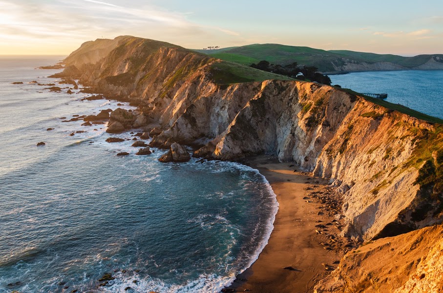
Chimney Rock Trail
★ Reviews →A 1.8-mile out-and-back to the dramatic headland at Point Reyes — one of the finest short hikes on the Northern California coast. The trail follows a windswept ridge above cliffs where elephant seals haul out in season, ending at sweeping views of the Gulf of the Farallones and the lighthouse below. In spring, wildflowers carpet the headland.
~2.5 hrs📍 See location
☀️
Afternoon
🚗
Drive
Chimney Rock Trailhead → Tomales Point Trailhead
30 min
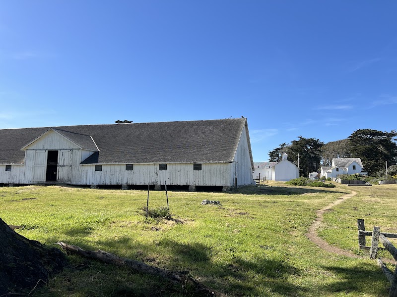
Tomales Point Trail — Pierce Ranch to the Tule Elk Reserve
★ Reviews →The 9.4-mile out-and-back Tomales Point Trail traverses the seashore's northernmost peninsula through the tule elk reserve — a herd of 500+ elk that roams free across the headlands, visible at close range year-round. The terrain is open coastal scrub with direct Pacific views; the point itself provides a horizon-spanning panorama from the Farallon Islands to Bodega Head. The elk bulls carry antlers up to 5 feet across during the rut (August–October); the cows and calves are present year-round at the reserve.
~45 min📍 See location
🌙
Evening
🚗
Drive
Tomales Point → Nick's Cove Cottages — Marshall
20 min
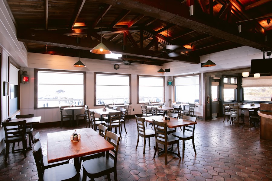
Nick's Cove Restaurant
★ Reviews →A restored 1930s oyster camp on Tomales Bay, with a dining room, bar, and 12 vintage cottages above the water. The menu focuses on Tomales Bay oysters, local fish, and Marin County produce; the bar serves the best gin and tonic in West Marin. The waterfront deck at sunset, watching egrets work the bay margins, is the most peaceful hour in Marin County.
~1 hr📍 See location
🛏️
Nick's Cove Cottages
12 restored 1930s waterfront cottages on Tomales Bay, each with a private deck above the water. The most atmospheric accommodation in West Marin.
Day 2 — Bear Valley & Limantour Estero
Day 2 — Bear Valley & Limantour Estero
🚗 1 hr 5 min driving📍 5 stops
🌅
Morning
🚗
Drive
Nick's Cove, Marshall → Bear Valley Visitor Center
15 min
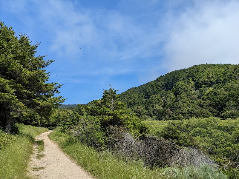
Bear Valley Trail to Arch Rock
★ Reviews →The 8.2-mile round-trip Bear Valley Trail is the main hiking artery of Point Reyes National Seashore, following Coast Miwok tribal territory through Douglas fir forest and coastal scrub to Arch Rock — a sea arch at the cliff edge where a stream meets the Pacific through a tunnel in the headland. The trail passes Divide Meadow (where the forest ends and the coastal bluffs begin) and the Kelham Beach junction; the final 0.5-mile descends to the ocean. The Coast Miwok people lived on this peninsula for 3,000 years; the visitor center has a reconstructed village with original 1960s ethnographic materials.
~5.5 hrs📍 See location
🍽️
Lunch
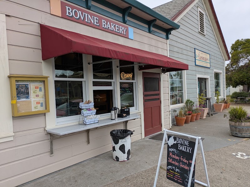
Bovine Bakery — Point Reyes Station
★ Reviews →The bakery that has defined morning in West Marin since 1988 — enormous morning buns, elephant ear pastries, sourdough loaves, and coffee from a 1920s storefront on Point Reyes Station's main street. The morning bun (croissant dough rolled in cinnamon sugar and orange zest) is the canonical order; the pecan sticky bun is equally serious. The bakery sells out by noon on weekends.
~30 min📍 See location
☀️
Afternoon
🚗
Drive
Point Reyes Station → Limantour Beach & Estero
30 min
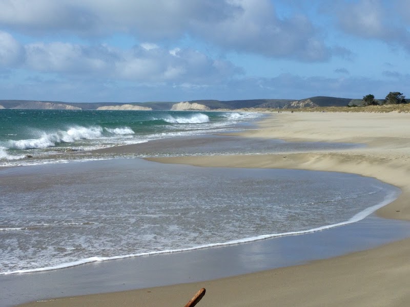
Limantour Beach & Limantour Spit Trail
★ Reviews →The 3-mile round-trip Limantour Spit Trail from the beach parking area traverses a narrow sand spit separating the Pacific from the 1,200-acre Drakes Estero — a pristine coastal estuary that supports 20,000 shorebirds in winter and harbor seals year-round on the interior beaches. The spit itself narrows to 50 yards at the estero mouth; at high tide the trail is walked between open water on both sides. The beach faces west and catches the afternoon sun even when the headlands are socked in fog.
~2 hrs📍 See location
🌙
Evening
🚗
Drive
Limantour Beach → Osteria Stellina — Point Reyes Station
20 min

Osteria Stellina
★ Reviews →A West Marin Italian restaurant sourcing exclusively from local farms and the surrounding sea — the pasta is made in house, the pizza dough uses local flour, and the menu changes daily based on what arrived from the Straus dairy, Marin Sun Farms, and the Hog Island oyster boat. Small, warm, and difficult to get a table on weekends.
~1 hr📍 See location
🛏️
Point Reyes Seashore Lodge
Garden rooms above Olema Creek in Point Reyes Station.
Day 3 — Steep Ravine Trail & Muir Woods Return
Day 3 — Steep Ravine Trail & Muir Woods Return
🚗 1 hr 40 min driving📍 4 stops
🌅
Morning
🚗
Drive
Point Reyes Station → Steep Ravine Trailhead — Mount Tamalpais
40 min
Drive south on Sir Francis Drake Boulevard, then east on Panoramic Highway to the Pantoll/Steep Ravine trailhead on the southern slopes of Mount Tamalpais.
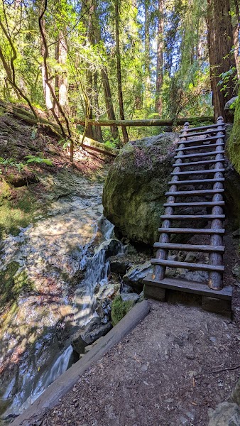
Steep Ravine Trail — Mount Tamalpais
★ Reviews →A 4.6-mile loop on the southern slopes of Mount Tamalpais descending through a narrow slot canyon on wooden ladders to Webb Creek, then along Redwood Creek through old-growth coast redwoods before returning to the Pantoll trailhead. The ladder descent — unique in the Golden Gate National Recreation Area — drops into a canyon so narrow and moss-covered it feels subterranean; the old-growth redwoods along the creek floor include specimens over 500 years old. One of the most dramatically varied short hikes in the Bay Area, covering three distinct ecosystems in under 5 miles.
~3 hrs📍 See location
🍽️
Lunch
🚗
Drive
Steep Ravine Trailhead → Muir Beach — Pelican Inn
15 min
Drive down the Panoramic Highway to Muir Beach.
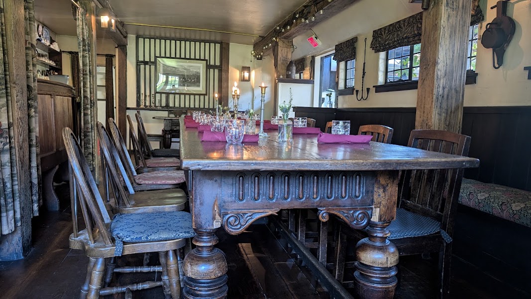
Pelican Inn — Muir Beach
★ Reviews →A Tudor-style English country inn and pub built in 1977 on the edge of Muir Beach, 50 yards from the Pacific — serving house-poured British ales, beef-and-Guinness pie, and a proper ploughman's lunch in a flagstone dining room with a fireplace. The inn has seven guest rooms above the pub; the property is convincingly English in a coastal California setting that makes the contrast memorable. Lunch on weekdays is walk-in; weekends require reservation.
~1 hr📍 See location
☀️
Afternoon
🚗
Drive
Muir Beach → Muir Woods National Monument
10 min
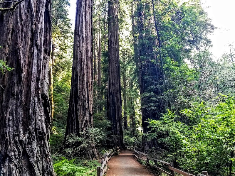
Muir Woods National Monument — Bootjack Trail Loop
★ Reviews →The less-traveled Bootjack Trail (4.2-mile loop) reaches Muir Woods from the Bootjack Trailhead on Pantoll Road rather than the main entrance — approaching from above through mixed woodland before descending into the old-growth redwood canyon. The old-growth core (Cathedral Grove) contains trees up to 1,200 years old and 258 feet tall, with trunk diameters above 12 feet. The canyon floor temperature stays 10–15°F cooler than the surrounding hillsides year-round.
~3 hrs📍 See location
🌙
Evening
🚗
Drive
Muir Woods National Monument → Mill Valley — Bungalow 44
15 min

Bungalow 44 — Mill Valley
★ Reviews →A Mill Valley restaurant serving California-American cuisine in a warm, wood-paneled bungalow space on Miller Avenue — rotisserie meats, seasonal vegetable sides, house-made charcuterie, and a well-curated Marin and Sonoma wine list. The kitchen handles the transition from hiking to dinner well, with generous portions and an unfussy approach to good ingredients. Mill Valley's downtown location means easy parking and a relaxed pace before the 20-minute drive back to San Francisco.
~15 min📍 See location
🚗
Drive
Mill Valley, CA → San Francisco, CA
20 min
← All San Francisco trips
More getaways from San Francisco
Angel Island & Marin Ridgeline: Bay Views from the Water's Edge — Day trip🥾Mount Tamalpais Summit & Point Reyes Kayaking — Weekend🥾Año Nuevo Elephant Seals, Coastal Redwoods & Tomales Bay Paddling — Long weekend🥾Sausalito Houseboats & Tiburon Waterfront — Day trip🏛️Sonoma Wine Country & the Bear Flag Republic — Weekend🏛️Napa Valley Culinary Capital, Sonoma Arts & Frank Lloyd Wright's Marin — Long weekend🏛️Stinson Beach & Bolinas Lagoon: Marin's Secret Coast — Day trip🌿Russian River Resort Town & the Bohemian Highway to Dillon Beach — Weekend🌿
© 2026 theweekendgetaways.com · All itineraries are original content. Terms
Plan your own escapeExplore more trips →