← The Weekend Getaways
🥾 ActiveLong weekend · from Las Vegas, NV

Desert Extremes: Red Rock, Death Valley Canyons & Telescope Peak

This three-day active circuit tests the full range of the American desert — warming up at Red Rock Canyon's Jurassic sandstone escarpment on Day 1 before descending into Death Valley on Day 2 to hike Mosaic Canyon's polished marble narrows and Golden Canyon's brilliant badlands amphitheater. Day 3 delivers perhaps the most extraordinary single summit in North America: Telescope Peak at 11,049 feet, rising directly above Badwater Basin at 282 feet below sea level — a vertical relief of over 11,300 feet visible in a single glance from the summit, with Mount Whitney's 14,505-foot silhouette hovering 90 miles northwest across the haze. The circuit closes via the alien tufa spires of Trona Pinnacles before the long desert highway home to Las Vegas.

Day 1 — Red Rock Canyon, NVDay 2 — Death Valley Canyon Hikes, CADay 3 — Telescope Peak & Trona Pinnacles
Day 1Red Rock Canyon, NV

Day 1Red Rock Canyon, NV

🚗 35 min driving📍 8 stops
🌅
Morning
🚗
Drive
Las Vegas, NVRed Rock Canyon
35 min8:00 AM8:35 AM
Calico Tanks Trail
Calico Tanks Trail
4.9
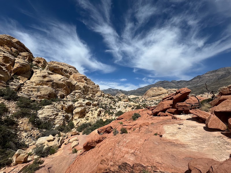
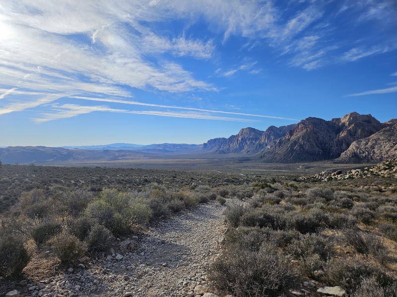
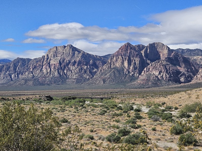
The Calico Tanks Trail serves as the warm-up hike for this multi-day desert circuit — a 2.5-mile round-trip scramble through Red Rock Canyon's vivid Calico Hills to a natural water tank carved into Aztec sandstone at the summit ridge. The Aztec sandstone here represents lithified Jurassic desert dunes approximately 180 million years old, the cross-bedded strata preserving the original windward and leeward dune faces in sweeping curved lines of orange, red, and buff. The trail itself requires moderate scrambling over rounded sandstone boulders near the top, a good activation exercise before the more demanding Death Valley hikes ahead. From the tank, the Las Vegas Strip's towers are visible to the east across the flat valley floor — a last glimpse of the city before departing west into increasingly remote desert terrain.
Keystone Thrust Trail
4.9
The Keystone Thrust Trail is a 2.9-mile loop traversing one of the world's most legible examples of thrust fault geology — the exposed contact line where Paleozoic limestone approximately 600 million years old was pushed eastward over the much younger 180-million-year-old Aztec sandstone beneath it during the Sevier orogeny about 65 million years ago. The color boundary between grey limestone and red sandstone is visible as a sharp diagonal line across the canyon walls, a geological suture recording a continental collision preserved in stone. On a circuit that will eventually reach Death Valley — itself a product of extensional Basin and Range tectonics — the Keystone Thrust provides an instructive early lesson in how compression and extension both sculpt this corner of the American West in radically different ways.
🍽️
Lunch
Ice Box Canyon
Ice Box Canyon
Ice Box Canyon is Red Rock Canyon's finest slot canyon scramble — a 2.6-mile round-trip that requires boulder-hopping and light scrambling up the wash as the Aztec sandstone walls close in overhead, funneling cool pooled air downward in a natural refrigeration effect that keeps the canyon floor noticeably cooler than the surrounding desert. A seasonal waterfall drops into a pool at the canyon's inner chamber, and desert varnish darkens the high walls to deep mahogany where microorganism colonies have slowly deposited manganese and iron oxide over millennia. This midday canyon scramble functions as the trip's technical warm-up — the arm strength and footwork required here at smaller scale directly translates to the boulder-field navigation needed in Death Valley's Mosaic and Natural Bridge canyons the following day.
🍽️ Lunch11:35 AM
🍽️
Lunch near Red Rock
Pack a lunch in advance for the trailhead, or drive 10 minutes east into Summerlin for a quick meal before the afternoon scenic drive and westbound departure toward Death Valley.
$Restaurant📍 Maps →
3 options · tap to switch
☀️
Afternoon
Red Rock Canyon Scenic Drive
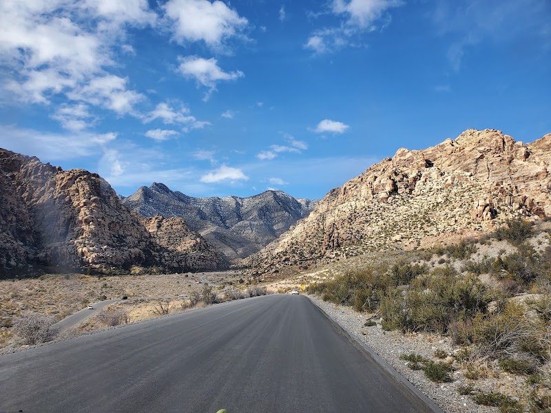
The 13-mile one-way scenic loop provides an efficient afternoon decompression after the morning hikes — windows down, the Calico Hills flashing past in sequences of orange and cream sandstone — before the drive west toward Death Valley. The loop's overlooks provide a final survey of the Spring Mountains escarpment, the Keystone Thrust color boundary visible as a horizontal gray-above-red line across the canyon's west wall. The loop exits near the visitor center, positioning drivers perfectly for the westbound departure along US-95 toward Beatty and the Death Valley corridor.
Turtlehead Peak (Optional)
4.9
For those with remaining energy, the Turtlehead Peak Trail is a 5-mile round-trip summit hike gaining 2,000 feet to the top of the White Rock Hills at 6,323 feet elevation — the highest readily accessible summit at Red Rock Canyon. The trail crosses the scenic drive and ascends steeply through the limestone layer above the Keystone Thrust, offering progressively expanding views of the Las Vegas Valley. This optional extension is best skipped if energy conservation is a priority before the strenuous Death Valley days ahead.
🌙
Evening
🍽️ Dinner5:00 PM
🍽️
Dinner in Pahrump, NV (En Route to Death Valley)
Pahrump, Nevada sits roughly midway between Las Vegas and the Death Valley entrance at Beatty, making it the logical dinner stop on the westbound drive. Dining options are limited to casino restaurants and chain fast food — stock up on water and snacks for the next two days in Death Valley as options inside the park are limited and expensive.
$Restaurant📍 Maps →
3 options · tap to switch
🛏️
Lodging — Death Valley (Stovepipe Wells or Furnace Creek)
Staying inside Death Valley National Park dramatically maximizes active time on Days 2 and 3 by eliminating long approach drives each morning. Stovepipe Wells Village Hotel is the closest lodging to Mosaic Canyon (the first morning hike), with a pool, basic motel-style rooms, and a saloon-style restaurant — it has the feel of a genuine desert outpost. The Ranch at Death Valley in Furnace Creek is a more comfortable full-service resort option with a spring-fed pool and multiple dining options, positioned 25 minutes closer to the Telescope Peak trailhead departure point.
Day 2Death Valley Canyon Hikes

Day 2Death Valley Canyon Hikes

🚗 15 min driving📍 8 stops
🌅
Morning
🚗
Drive
Stovepipe Wells Village HotelMosaic Canyon, Death Valley
15 min8:00 AM8:15 AM
Mosaic Canyon
Mosaic Canyon
4.7
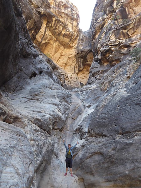
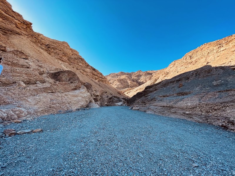
Mosaic Canyon is widely regarded as Death Valley's finest canyon hike — a 4-mile round-trip slot canyon trail ascending through a narrow gorge whose lower section features polished marble walls so smooth they reflect light like satin. The marble here began as carbonate sediment deposited in a shallow Proterozoic sea roughly 750 million years ago; over eons of burial and tectonic pressure, the limestone was metamorphosed into white marble. Subsequent fracturing and recementation created the canyon's signature 'mosaic' breccia — angular marble fragments embedded in a matrix of calcite cement, giving the lower walls the appearance of natural mosaic tilework in shades of grey, white, and rust. As the canyon ascends, the narrows open into broader passages floored with water-polished alluvial conglomerate, eventually reaching a dry waterfall that terminates the standard hiking route. The upper canyon walls, accessible by scrambling, display even more dramatic fold and fault structures in the layered marble — among the most accessible examples of ductile rock deformation visible anywhere in North America.
Mesquite Flat Sand Dunes
4.8
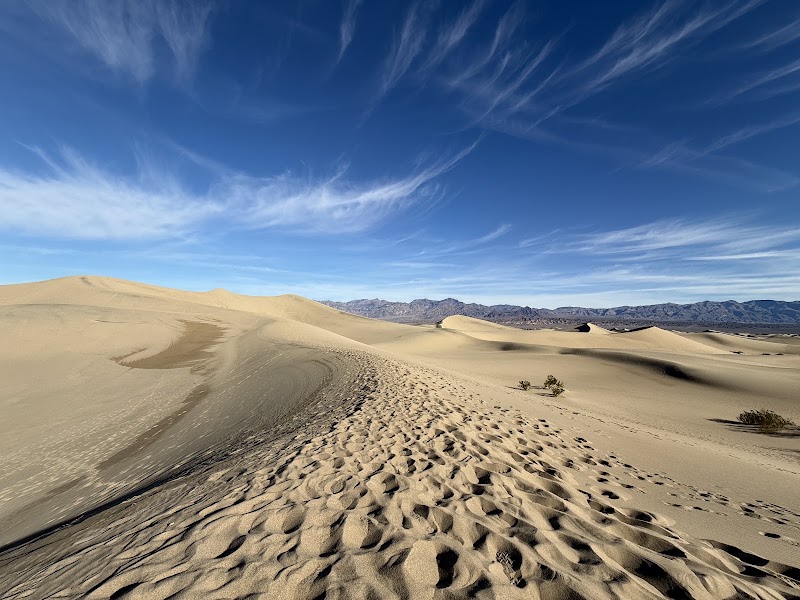
The Mesquite Flat Dunes are Death Valley's most accessible and dramatically beautiful dune field — a star dune system rising to 100 feet directly adjacent to Stovepipe Wells, their crests sculpted by the competing wind patterns that pour through Towne Pass and Daylight Pass from opposing directions. The dunes support a surprising microecosystem: mesquite trees send taproots up to 40 feet deep to reach groundwater, creating pedestaled hummocks called mesquite mounds as wind erodes the surrounding sand; kit fox, sidewinder rattlesnake, and kangaroo rat tracks cross the lower dune flanks at dawn. In the morning light the dune faces catch raking shadows that turn the slip faces from gold to deep ochre, and the barefoot sand walk from the parking area to the nearest high crest takes about 20 minutes — making this the trip's most effortless visual reward.
🍽️
Lunch
Golden Canyon Hike
Golden Canyon Hike
4.7
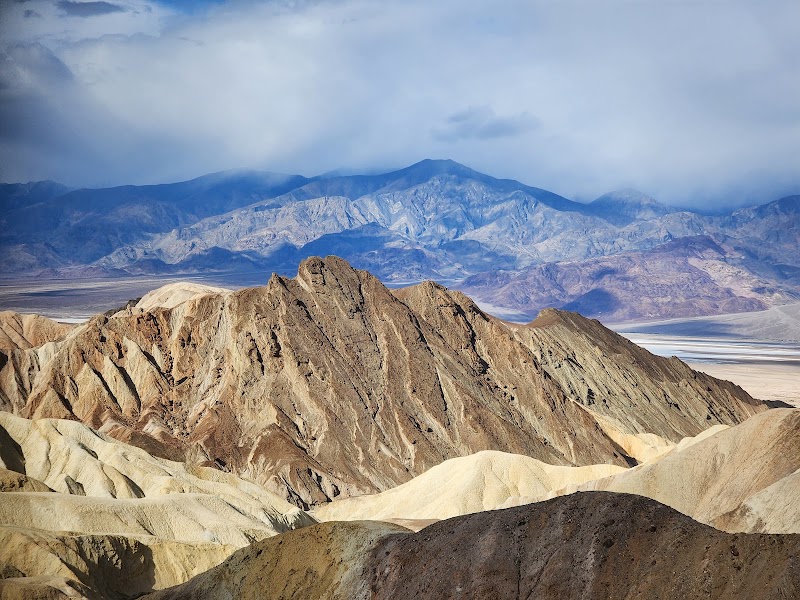
The Golden Canyon trail is a 3-mile round-trip hike through the most visually intense badlands in Death Valley, the canyon walls composed of ancient lakebed sediments — silts, clays, and mudstones deposited in a Pleistocene lake that filled the valley floor roughly 10,000–30,000 years ago — compressed into layers of brilliant golden-yellow to orange mudstone. The trail begins at the canyon mouth and ascends through progressively narrowing walls of golden rock streaked with iron oxide bands of rust and burgundy, ending at the Red Cathedral: a soaring amphitheater of red conglomerate and breccia whose dark walls are draped with long vertical streaks of black desert varnish, creating a cathedral-like effect of alternating color that has made the Red Cathedral one of Death Valley's most photographed geological formations. Interpretive signs along the lower trail explain the lake sediment sequence, making Golden Canyon one of the most geologically educational short hikes in the national park system.
🍽️ Lunch11:15 AM
Lunch at The Ranch at Death Valley
The Ranch at Death Valley in Furnace Creek is the most accessible full-service dining option in the park, with two restaurants including the 49er Café for casual sit-down meals. Expect higher prices than outside the park — Death Valley's remote logistics drive up all food and beverage costs.
$$buffet restaurant📍 Maps →
3 options · tap to switch
☀️
Afternoon
Natural Bridge Canyon
4.5
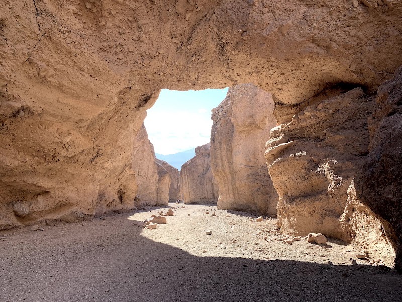
Natural Bridge Canyon is a 1.5-mile round-trip trail in Death Valley that leads to a 35-foot natural bridge of conglomerate rock spanning the canyon width — one of only a handful of natural bridges in the California desert. The bridge formed when differential erosion removed the softer material beneath a harder conglomerate cap, leaving the resistant rock spanning the gap as the canyon floor dropped away below it. The approach trail winds through a narrow canyon of polished alluvial fan deposits whose gravel layers preserve the compacted record of thousands of years of flash flood events, each gravel lens slightly different in color and grain size depending on the source rock eroded in that particular flood. Beyond the bridge, the canyon continues through progressively narrowing walls with a dry waterfall at its terminus.
Badwater Basin Sunset Walk
4.8
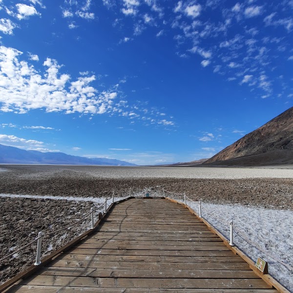
Badwater Basin at 282 feet below sea level is the lowest point in North America — a vast white salt flat extending five miles across the valley floor, its surface patterned in the hexagonal salt crystal formations that give the basin its otherworldly appearance. As the sun drops toward the Panamint Mountains to the west, these hexagonal salt polygons glow from white to gold to deep amber, the low raking light throwing shadows into every crystal edge and turning the entire basin into a luminous mosaic. The late afternoon walk out onto the salt flats is effortless — completely flat, firm surface — and the scale is disorienting: the Panamints rise over 11,000 feet immediately to the west, visible directly above, while the valley floor remains below sea level, a vertical relief that will be experienced in reverse during tomorrow's Telescope Peak summit.
🌙
Evening
🍽️ Dinner5:00 PM
Dinner at Death Valley Lodging Restaurant
Dinner options in Death Valley are limited to park concession restaurants — plan ahead and eat early, as kitchens close by 9 PM. The evening should be spent resting and preparing for the earliest possible departure for the Telescope Peak trailhead, where parking and road conditions may require a 6 AM start.
3.9$$restaurant📍 Maps →
3 options · tap to switch
🛏️
Lodging — The Inn at Death Valley
The Inn at Death Valley (formerly the Furnace Creek Inn) is the park's most historic and architecturally distinguished property — a 1927 Spanish Mission Revival resort elevated above the valley floor on the alluvial fan below the Funeral Mountains, with a spring-fed swimming pool maintained at a constant 87°F year-round, landscaped gardens sustained by the same natural spring, and views across the salt flats toward the Panamint Mountains. Its position above the valley floor makes it slightly cooler than Stovepipe Wells, and its proximity to the Furnace Creek Visitor Center positions guests ideally for the predawn departure toward the Mahogany Flat trailhead for Telescope Peak.
Day 3Telescope Peak & Return

Day 3Telescope Peak & Return

🚗 5 hr 40 min driving📍 3 stops
🌅
Morning
🚗
Drive
Death Valley InnTelescope Peak Trailhead (Mahogany Flat)
50 min8:00 AM8:50 AM
Telescope Peak Summit Trail
4.6
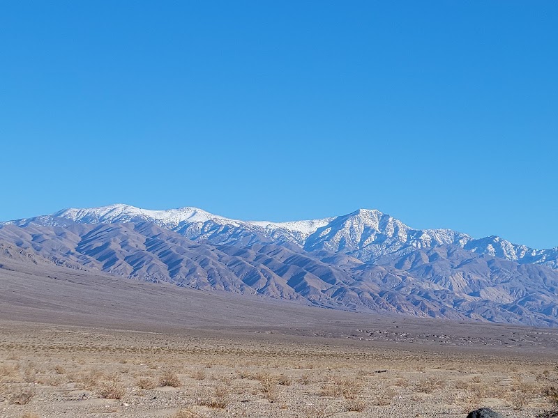
The Telescope Peak Trail is a 14-mile round-trip alpine route beginning at Mahogany Flat Campground at 8,133 feet elevation and ascending 2,916 vertical feet to the summit of Telescope Peak at 11,049 feet — the highest point in the Panamint Range and in Death Valley National Park. The trail begins in a pinyon-juniper woodland that transitions through a band of limber pine above 9,500 feet and ultimately into one of the Panamint Range's most remarkable ecological zones: ancient Great Basin bristlecone pine forest above 10,000 feet, the gnarled and twisted trees dating to 3,000–5,000 years old, their wind-sculpted trunks recording millennia of high-altitude survival at the edge of their range. The summit view is arguably the most dramatic vantage point in North America: directly below, the white salt pan of Badwater Basin at 282 feet below sea level is visible as a luminous oval on the valley floor, while Mount Whitney at 14,505 feet — the highest point in the contiguous United States — is visible 90 miles to the northwest on clear days. The vertical relief between Badwater Basin and Telescope Peak's summit, 11,331 feet spanning less than 15 horizontal miles, is one of the greatest elevation differentials visible from a single point in any national park. A high-clearance vehicle is required for the final miles of the Wildrose Road to Mahogany Flat; the road may be closed by snow November through April.
🍽️
Lunch
Mahogany Flat Campground — Rest & Packed Lunch
4.7
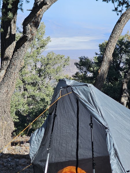
Mahogany Flat Campground at 8,133 feet serves as the post-summit recovery point — a primitive NPS campground with vault toilets but no water, set in pinyon-juniper woodland with picnic tables. Pack all food, water, and supplies from Death Valley before driving up, as nothing is available at the trailhead. Alternatively, descend to Stovepipe Wells Village after the hike for a simple meal before the drive to Trona.
9:50 AM📍 See location
🚗
Drive
Telescope Peak / Mahogany FlatTrona Pinnacles
1 hr 30 min10:50 AM12:20 PM
☀️
Afternoon
Trona Pinnacles
Trona Pinnacles
4.8
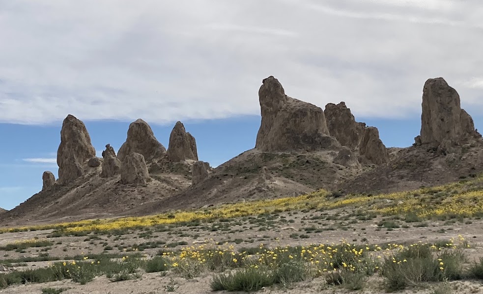
The Trona Pinnacles are 135 tufa spire formations rising 30 to 140 feet from the flat, bleached expanse of Searles Dry Lake east of the Sierra Nevada — one of the most surreal landscapes in California and among the most otherworldly geological features in North America. The pinnacles formed between 10,000 and 100,000 years ago when Searles Lake was a living body of water fed by glacial melt from the Sierra Nevada; calcium-rich spring water rising through the lake bed met the carbonate-rich lake water and precipitated calcium carbonate, slowly building the spires tower by tower as mineral-laden water continued to percolate upward. When the lake dried in the late Pleistocene, the towers were left standing on the exposed lake floor exactly as they grew, their porous tufa surfaces now colonized by desert lichens and the occasional burrowing owl. The Bureau of Land Management has designated the area a National Natural Landmark, and the pinnacles' alien appearance has made them a recurring film location: Planet of the Apes (2001), Star Trek V: The Final Frontier, and various television productions have all used the pinnacles as stand-ins for extraterrestrial or post-apocalyptic landscapes.
🌙
Evening
🚗
Drive
Trona PinnaclesLas Vegas, NV
3 hr 20 min5:00 PM8:20 PM
Plan your own escapeExplore more trips →