← The Weekend Getaways
🏛️ CulturalDay trip · from Las Vegas, NV

Death Valley in a Day: Badlands, Salt Flats & Volcanic Color

Drive two hours west of Las Vegas into the hottest place on Earth, where the Mojave gives way to a landscape of savage extremes: at Zabriskie Point, nine-million-year-old lakebed sediments have been eroded into a badlands of golden spires and purple ridgelines that seem to belong to another planet, while Badwater Basin — 282 feet below sea level, the lowest point in North America — spreads a blinding white hexagonal salt flat across the valley floor, the crystallized residue of a vast Pleistocene lake that evaporated ten thousand years ago. The day unfolds through Artist's Drive, a nine-mile volcanic corridor where iron, manganese, and chlorite minerals paint the hills in reds, greens, and purples, and every hour brings a different angle of light transforming an already otherworldly terrain into something approaching the sublime.

Day 1 — Death Valley National Park, CA
Day 1Death Valley National Park, CA

Day 1Death Valley National Park, CA

🚗 4 hr 10 min driving📍 5 stops
🌅
Morning
🚗
Drive
Las Vegas, NVZabriskie Point, Death Valley
2 hr8:00 AM10:00 AM
Zabriskie Point
Zabriskie Point
4.8
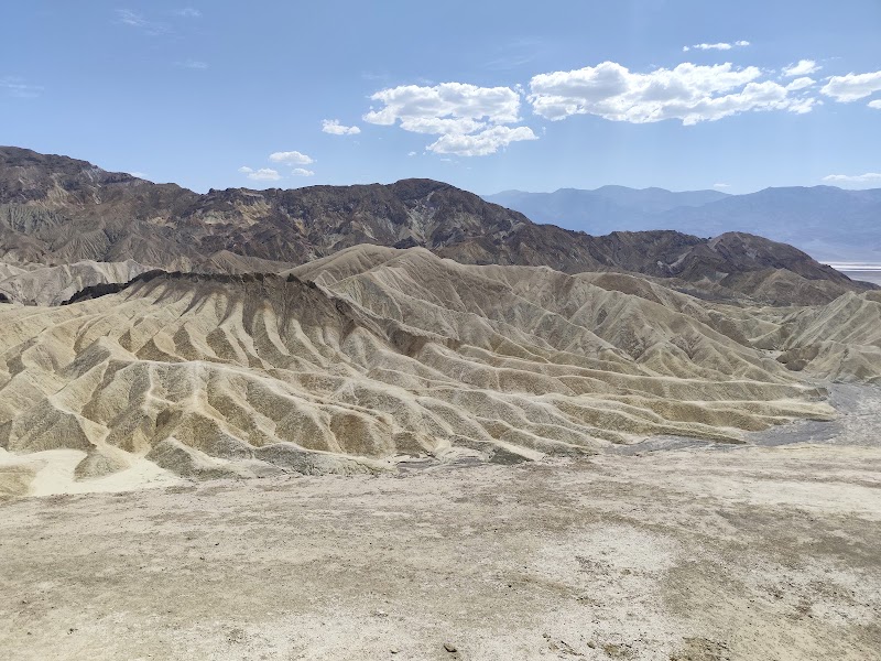
Zabriskie Point overlooks one of the most disorienting landscapes in North America: a vast badlands of rippled, multi-colored mudstone formed from the sediments of the ancient Furnace Creek Lake, a body of water that filled much of Death Valley approximately nine million years ago during the late Miocene epoch. As the lake evaporated over millions of years and the region's geology was compressed and then uplifted along fault lines, these fine-grained lakebed deposits were exposed to erosion by wind and the rare but intense flash floods that race through Death Valley's canyons. The result is a labyrinth of sharp ridges, pyramidal pinnacles, and wrinkled gullies in shades of gold, tan, rust, and pale lavender — the colors determined by the precise mix of volcanic ash, borates, and clay minerals in each sediment layer. The dominant feature is Manly Beacon, a solitary pinnacle rising roughly 200 feet above the badlands floor named after William Lewis Manly, one of the survivors of a harrowing 1849 crossing of the valley. At sunrise, when low-angle light rakes across the formations, the terrain glows with extraordinary intensity, making Zabriskie Point one of the most photographed morning viewpoints in the American Southwest. Italian filmmaker Michelangelo Antonioni used the location in his 1970 counterculture film 'Zabriskie Point,' cementing its place in visual culture.
Mesquite Flat Sand Dunes
4.8
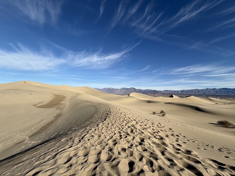
The Mesquite Flat Sand Dunes are the most accessible and visually iconic dune field in Death Valley, rising from the valley floor near Stovepipe Wells in a graceful star-dune system that reaches heights of roughly 100 feet. The dunes are formed by sand blown from the surrounding alluvial fans and converging winds that funnel through the valley from multiple directions — when these winds meet, the sand piles into the classic radial star pattern with three or more arms extending outward. The dunes are entirely composed of quartz and feldspar grains, giving them their warm honey color in morning and late afternoon light. In the early hours after dawn, before the desert heat rises and visitors arrive, the dune surface records a detailed diary of nocturnal animal life: the delicate parallel-line tracks of sidewinder rattlesnakes, the star-shaped impressions of darkling beetles, and the precise four-point prints of kit foxes hunting across the sand are often perfectly preserved until the first breeze of morning erases them. The absence of any vegetation on the dune crests — only mesquite shrubs survive at the dune bases, their roots tapping groundwater below — gives the formations a pristine sculptural quality that makes them exceptional for photography at any hour.
🍽️
Lunch
Badwater Basin
Badwater Basin
4.8
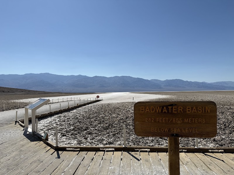
Badwater Basin sits 282 feet below sea level — the lowest point in North America and one of the lowest on Earth — at the heart of Death Valley along the base of the Black Mountains. The salt flat stretches approximately five miles wide and nearly 200 miles of total salt pan extends across the valley floor, making it the largest salt flat in the Western Hemisphere. The basin is the terminal endpoint of the entire Death Valley watershed: rainwater and snowmelt from surrounding mountains flow inward with no outlet, carrying dissolved minerals that accumulate as the water evaporates under extreme desert heat. The result is a thick crust of halite (sodium chloride) interlaced with other evaporite minerals including calcite, borax, and gypsum. The most striking surface feature is the intricate hexagonal pattern of salt polygons: as brine pools dry at the surface, the salt crust contracts and buckles upward along its edges, forming a mosaic of five- and six-sided cells that extends across the flat like a vast tiled floor. A survey marker on the Black Mountains cliff face across the basin reads 'Sea Level,' providing a striking visual reference for how far below the ocean's surface visitors are standing. The name 'Badwater' reportedly comes from a surveyor's mule that refused to drink from a small spring here, its water rendered unpalatable by dissolved salts. Temperatures on the basin floor routinely exceed 120°F in summer, and the ground surface itself can reach 200°F.
🍽️ Lunch1:00 PM
The Inn at Death Valley Dining Room
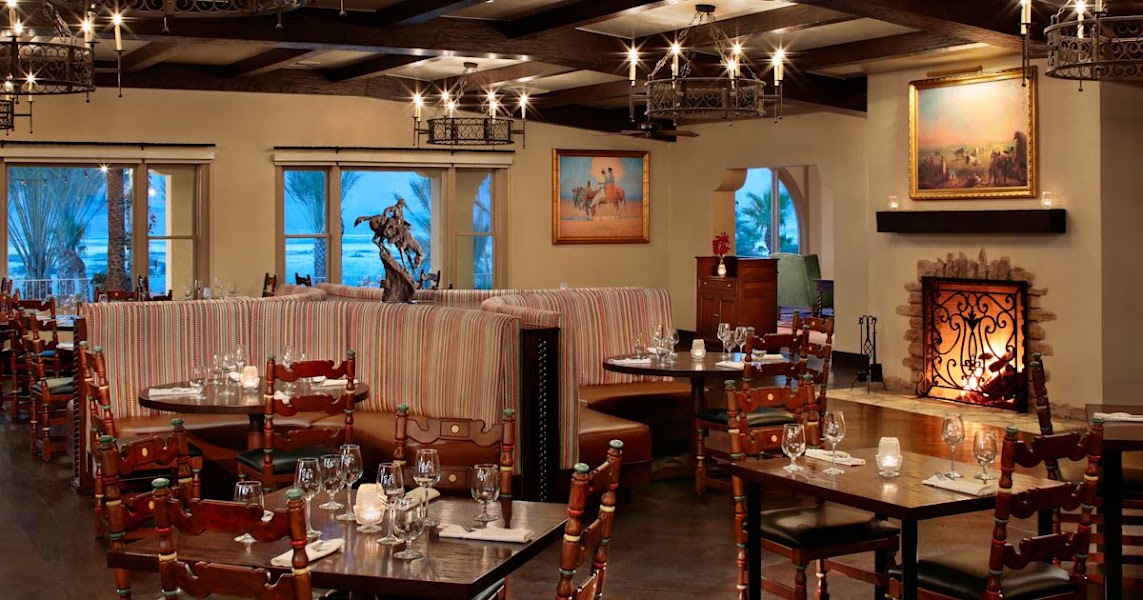
The dining room at The Inn at Death Valley — a 1920s Spanish Mission-style resort in Furnace Creek — offers table-service lunch in an oasis setting with palm trees and spring-fed pools directly outside. The menu features California-influenced American cuisine with an emphasis on seasonal ingredients, served in a cool, shaded interior that provides welcome respite from the valley heat. Reservations are recommended in peak season.
3.9$$restaurant📍 Maps →
3 options · tap to switch
☀️
Afternoon
🚗
Drive
Badwater BasinArtist's Drive
10 min2:00 PM2:10 PM
📍
Artist's Drive & Artist's Palette
Artist's Drive is a nine-mile one-way paved loop through the Black Mountains on the east side of Death Valley, accessible from Badwater Road and returning to it farther north — making it an effortless addition to any valley itinerary. The road winds through eroded volcanic hills that display one of the most improbable natural color palettes in the American landscape. The chromatic variety is entirely geological in origin: the hills are composed of ancient volcanic and sedimentary rocks whose minerals have been oxidized and altered under millions of years of heat and hydrothermal activity. Iron oxides produce the vivid reds, oranges, and yellows that dominate the palette; manganese oxides create blacks and purples; and the presence of chlorite — a green clay mineral — gives certain outcrops an unmistakable sage-green hue. Mica flecks in the rock catch the light and add a subtle iridescence. The colors are at their most saturated in the afternoon hours when direct sunlight hits the hillsides at low angles, transforming the drive into an experience that feels more like moving through a painting than a landscape. The road's terminus at the Artist's Palette pullout — the most concentrated and photographed section — offers a short interpretive loop on foot among the most vividly colored formations, where several colors can be seen in close proximity on a single hill face.
🌙
Evening
🚗
Drive
Death Valley National ParkLas Vegas, NV
2 hr5:00 PM7:00 PM
Plan your own escapeExplore more trips →