🏛️ CulturalWeekend · from Las Vegas, NV
Death Valley Depths: Badlands, Craters & a Gold Rush Ghost Town
Spend two days in the world's hottest, driest, and lowest national park — on Day 1 tracing the geological extremes from Zabriskie Point's eroded mudstone badlands to the salt hexagon fields of Badwater Basin at 282 feet below sea level, then winding through Artist's Drive's volcanic color show at dusk. Day 2 ventures north to the phreatomagmatic abyss of Ubehebe Crater before crossing into Nevada to explore Rhyolite, the gold rush boomtown that ballooned to 10,000 people by 1907 and stood nearly empty a decade later, its bottle house and bank ruins still improbably standing in the Amargosa Desert.
Day 1 — Death Valley National Park, CADay 2 — Ubehebe Crater, Rhyolite Ghost Town & Return
Day 1 — Death Valley National Park, CA
Day 1 — Death Valley National Park, CA
🚗 2 hr 40 min driving📍 8 stops
🌅
Morning
🚗
Drive
Las Vegas, NV → Zabriskie Point, Death Valley
2 hr
Zabriskie Point
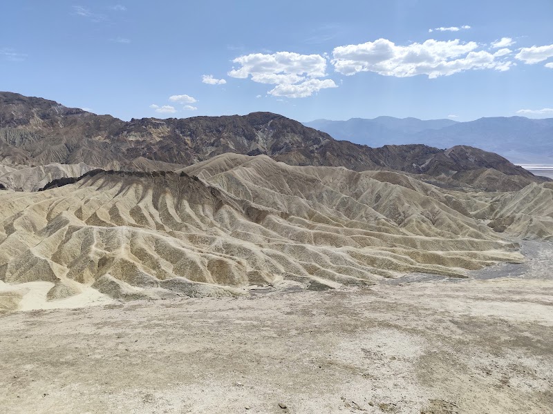
★ Reviews →Zabriskie Point is one of the most geologically explicit landscapes in North America — a panorama of eroded badlands whose striated spires, rounded knobs, and fluted gullies expose the sedimentary record of an ancient lake that occupied Death Valley approximately 9 million years ago during the Pliocene epoch. The Furnace Creek Formation deposits visible here are composed of fine-grained mudstone, siltstone, and volcanic ash layers that accumulated on the lakebed over millions of years, then were uplifted and tilted by regional faulting before erosion stripped them into the surreal badlands visible today. The dominant color palette — tawny gold, ochre, lavender, and burnt sienna — reflects the chemical composition of the sediments: iron oxides for the orange and red zones, chlorite for greenish tints, and manganese for dark surface coatings. Manly Beacon, the most prominent pinnacle rising from the badland field, is named for William Lewis Manly, who led a party of Death Valley '49ers out of the valley on foot in 1850 after their wagons became stranded. Early morning light transforms the entire formation into a warm amber incandescence, making sunrise the ideal time to visit and accounting for the loyal community of photographers who arrive well before dawn.
~1 hr📍 See location
Mesquite Flat Sand Dunes
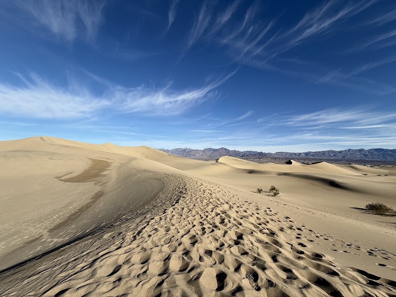
★ Reviews →The Mesquite Flat Sand Dunes are the most accessible and visually dramatic dune field in Death Valley, rising to a peak height of approximately 100 feet and spreading across several square miles of the valley floor near Stovepipe Wells. The dune system includes star dunes — the most complex dune morphology, characterized by radiating arms extending from a central peak — which form in locations where wind direction is variable and multidirectional, creating the intersecting slip faces that give star dunes their geometry. The dunes are composed of quartz, feldspar, and other silicate minerals derived from the valley's surrounding mountains and transported by prevailing westerly winds that funnel through the Cottonwood and Panamint ranges; when these winds meet the valley's crosscurrents, sand drops out of suspension and accumulates. Despite shifting on their surfaces seasonally, the dune field remains anchored in place by the consistent wind patterns that created it. Morning is the optimal time for the dunes: the low angle of light casts razor-edged shadows along every ripple and dune ridge, creating a topographic legibility that midday sun completely erases.
~45 min📍 See location
🍽️
Lunch
🚗
Drive
Mesquite Flat Sand Dunes → Badwater Basin
30 min
Badwater Basin
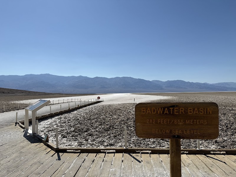
★ Reviews →Badwater Basin occupies the lowest point in North America at 282 feet below sea level, a figure marked by a small sign mounted high on the adjacent canyon wall that is itself at eye level with the surrounding desert when viewed from the highway. The basin floor is encrusted with a white salt flat stretching approximately 200 square miles — one of the largest salt flats in the world — composed primarily of sodium chloride, calcium carbonate, and borax deposited by the evaporation of ancient Lake Manly, which last filled the valley to a depth of 600 feet approximately 10,000–12,000 years ago during the Pleistocene. The hexagonal crystal patterns that tile the flat's surface are a direct product of salt's crystallographic properties: as the thin brine layer that floods the flat after rare rainstorms evaporates, sodium chloride molecules pack into a cubic lattice structure, and the growing crystals expand outward and buckle upward along their edges, forcing the surface into hexagonal tiles that mimic the geometry of a honeycomb. Telescope Peak, the highest point in the Panamint Range at 11,049 feet, is visible to the west on clear winter and spring days — offering one of the most dramatic elevation contrasts visible from a single standing position anywhere on Earth.
~45 min📍 See location
🍽️ Lunch~1 hr
The 49er Café at The Ranch at Death Valley
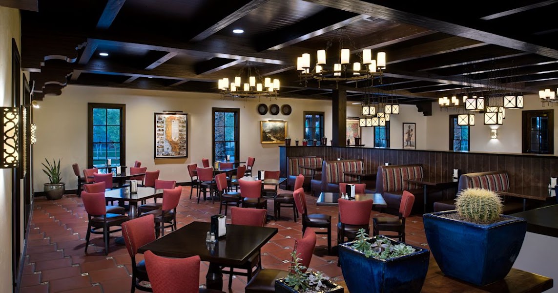
Located at The Ranch at Death Valley in the Furnace Creek resort complex — one of the only dining options in the central valley — the 49er Café serves casual American comfort food including burgers, sandwiches, salads, and breakfast items throughout the day. In a park where the nearest alternative is often an hour's drive away, its convenience is as valuable as its menu.
3 options · tap to switch
☀️
Afternoon
🚗
Drive
Badwater Basin → Artist's Drive
10 min
📍
Artist's Drive & Artist's Palette
★ Reviews →Artist's Drive is a 9-mile one-way loop road through volcanic hills that constitute one of the most mineralogically polychromatic landscapes in the American West. The hills are composed of the Artist Drive Formation — a sequence of volcanic ash, mudstone, and debris flow deposits spanning roughly 6–12 million years in age — whose constituent minerals have been chemically altered by hydrothermal fluids and surface weathering into a spectrum of pigments that the human eye can barely rationalize as natural. Iron oxides in their various hydration states produce the reds, oranges, and yellows; manganese oxides create the blacks and dark purples; mica flakes catch the light and produce a greenish shimmer; and chlorite-rich zones contribute a distinctive blue-green not found in most desert landscapes. The Artist's Palette viewpoint at the road's midpoint concentrates the most vivid color display into a single hillside, and the late afternoon angle of light — when the sun sits low over the Panamint Range and casts oblique rays across the formation — is the optimal time to see the colors at their most saturated and differentiated.
~1 hr📍 See location
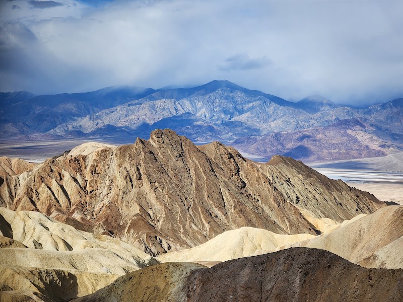
Golden Canyon Viewpoint
★ Reviews →A brief roadside stop offering a view into Golden Canyon's amphitheater of warm-hued badlands, where ancient Furnace Creek Formation mudstones — the same deposits exposed at Zabriskie Point — are compressed into walls of gleaming golden tan and amber. The canyon is accessible via trail for those with energy remaining in the afternoon, but the roadside viewpoint alone delivers the essential visual impression of these compressed lakebed sediments glowing in late light.
~30 min📍 See location
🌙
Evening
🍽️ Dinner~1 hr
🍽️
Dinner at The Inn at Death Valley or The Ranch at Death Valley
The two historic Furnace Creek properties — The Inn and The Ranch — between them offer the only full-service dinner options in the central valley. The Inn's dining room is the more refined choice, with a seasonal menu and views over the date palm oasis, while The Ranch's restaurant delivers a more casual atmosphere suitable for post-hike hunger.
American restaurant
3 options · tap to switch
🛏️
The Ranch at Death Valley or The Inn at Death Valley
Death Valley's two historic in-park lodging options are both operated by the concessionaire at Furnace Creek. The Inn at Death Valley, originally opened in 1927 and rebuilt and expanded through the mid-20th century, sits at approximately 190 feet below sea level but catches breezes off the Funeral Range and features a spring-fed, temperature-regulated pool, refined dining, and a Mission Revival aesthetic that has made it a desert institution for nearly a century. The Ranch at Death Valley, established in 1933 as the more accessible option, occupies the valley floor in a sprawling campus of motel-style rooms, a spring-fed pool, a general store, and casual dining — the base camp mentality to The Inn's resort sensibility. Both are within walking distance of each other in the Furnace Creek area, and both book far in advance for peak season visits from October through April.
Day 2 — Ubehebe Crater, Rhyolite & Return
Day 2 — Ubehebe Crater, Rhyolite & Return
🚗 4 hr 50 min driving📍 5 stops
🌅
Morning
🚗
Drive
Death Valley (Furnace Creek) → Ubehebe Crater
1 hr 30 min
Via Scotty's Castle Road through the Grapevine Mountains.
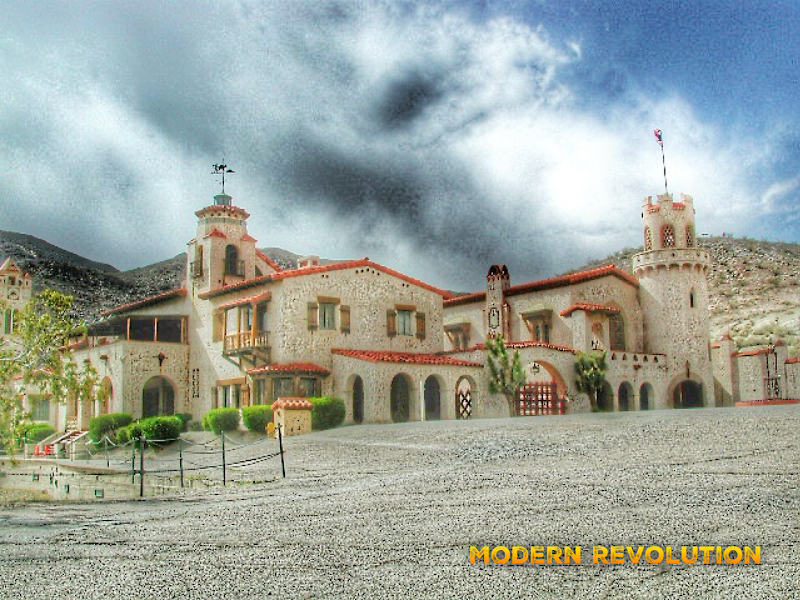
Scotty's Castle Road & Grapevine Area
★ Reviews →Scotty's Castle — officially Death Valley Ranch — is a lavish 1920s Spanish-Moorish villa built deep in the northern Death Valley desert by Chicago insurance millionaire Albert Mussey Johnson as a winter retreat, largely at the urging of his flamboyant friend Walter Scott, a former Buffalo Bill Wild West show performer who convinced Johnson that he owned a secret gold mine in the area. The resulting 'castle' features hand-painted ceilings, imported European tiles, a pipe organ, and a clock tower, and became famous as the eccentric desert folly of a partnership between a credulous investor and an incorrigible con man. Scott is buried on the grounds. The property suffered catastrophic damage in a rare 2015 flash flood that destroyed the access road and deposited tons of debris inside the buildings, and has been under National Park Service restoration since; call ahead for current access status. The drive north through the Grapevine Mountains passes through dramatic desert terrain where the alluvial fans of the Grapevine Range meet the valley floor in sweeping bajadas of pale gravel.
~1 hr📍 See location
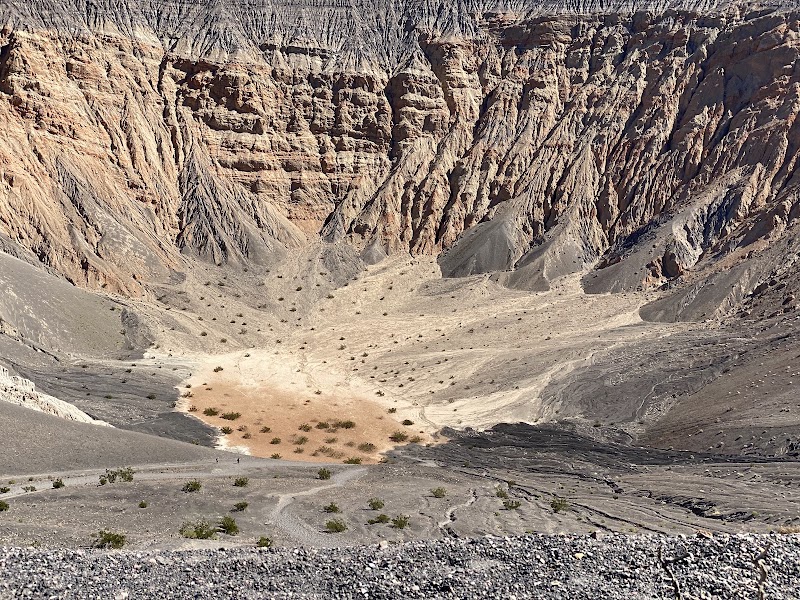
Ubehebe Crater
★ Reviews →Ubehebe Crater is a half-mile-wide, 500-foot-deep volcanic maar — a type of explosion crater formed not by erupting magma but by a phreatomagmatic event: superheated magma intruding into groundwater-saturated rock, flashing the water to steam in an explosive decompression that blasted out the overlying crust. Geologists have estimated this eruption occurred somewhere between 300 and 2,000 years ago, and possibly as recently as the 18th century — making Ubehebe geologically very young. The crater floor is blanketed in black basaltic cinders and surrounded by layered deposits of tephra (volcanic ash and ejecta) in bands of black, brown, and ochre that ring the crater walls like geological stratigraphy made visible. A 1.5-mile rim trail circles the crater, offering views into the main crater and several smaller satellite craters including Little Hebe — a perfectly proportioned miniature maar visible at the southwest end of the rim. The wind at the crater rim is frequently fierce, funneled by the depression's geometry; the contrast between the hot desert plateau and the cool, shadowed interior of the crater is striking. On clear days, the Cottonwood and Last Chance ranges are visible to the west across the northern Death Valley floor.
~1.5 hrs📍 See location
🍽️
Lunch
🚗
Drive
Ubehebe Crater → Beatty, NV (via Rhyolite Ghost Town)
1 hr 20 min
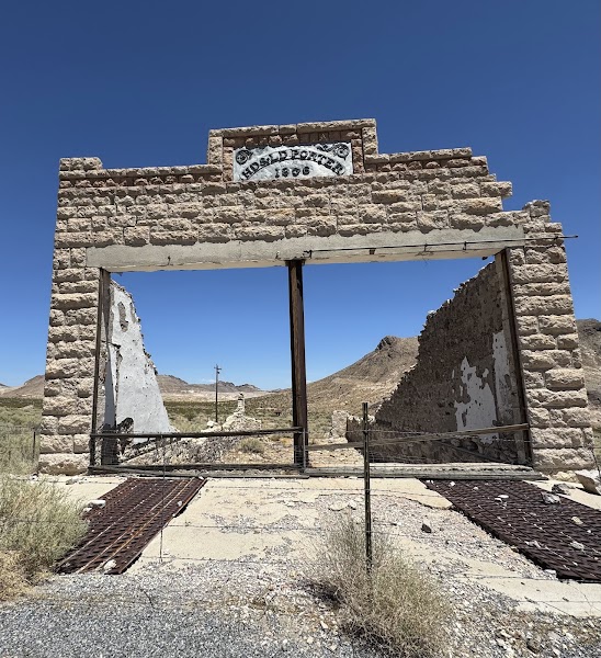
Rhyolite Ghost Town
★ Reviews →Rhyolite is one of the most dramatically preserved and historically documented ghost towns in the American West, a monument to the ferocity and brevity of a Nevada gold rush that compressed an entire boom-and-bust cycle into roughly fifteen years. Founded in 1905 following a gold strike by Shorty Harris and Ed Cross in the Bullfrog Hills, the town swelled to an estimated population of 10,000 by 1907–1908, constructing a three-story bank building, an opera house, a school, a railroad depot served by the Las Vegas & Tonopah Railroad, and a red-light district on its gridded streets. The 1907 financial panic and declining ore grades initiated a collapse that accelerated through 1910; by 1920, the population had fallen to 14 and the post office had closed. The ruins standing today include the skeletal steel and concrete frame of the Cook Bank — once the most imposing structure in southern Nevada — and the roofless adobe walls of the Las Vegas & Tonopah Railroad depot, whose arched windows frame views of the Amargosa Valley. Most celebrated is the Bottle House, constructed in 1906 by retired miner Tom Kelly from approximately 50,000 Adolphus Busch beer and whiskey bottles set in adobe mortar — one of only a handful of remaining bottle construction buildings in Nevada, and a testament to the resourcefulness of desert builders working with whatever materials the railroad could deliver.
~1 hr📍 See location
🍽️ Lunch~45 min
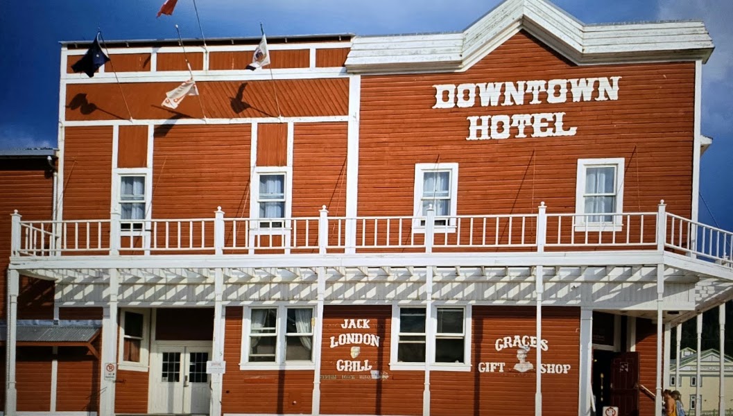
KC Bar & Casino or Sourdough Saloon
Beatty is the nearest resupply town outside Death Valley's eastern boundary, a no-frills Nevada desert crossroads with a handful of bars, diners, and small casinos offering cold beer and simple food. The KC Bar and Sourdough Saloon are both locally beloved for their unpretentious atmospheres and their function as a community gathering point for the small permanent population and the steady stream of Death Valley visitors passing through.
3 options · tap to switch
☀️
Afternoon
🚗
Drive
Beatty, NV → Amargosa Valley Scenic Pull-Off
30 min
Heading south on US-95 toward Las Vegas.
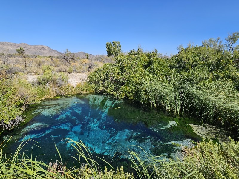
Amargosa Valley Scenic Pull-Off
★ Reviews →The Amargosa Valley stretches south from Beatty in a broad basin of alkali flats, dry lake beds, and creosote scrub framed by the Funeral Mountains to the west and the Spring Mountains on the eastern horizon — a classic expression of the Basin and Range Province, where the North American crust has been pulled apart over the last 30 million years into a series of alternating mountain fault blocks and down-dropped basins filled with sediment. A brief roadside stop somewhere along this stretch of US-95 offers a moment to absorb the sheer scale of the intermountain basin landscape before the drive back into Las Vegas, where the neon horizon eventually materializes out of the same geologic terrain.
~1 hr📍 See location
🌙
Evening
🚗
Drive
Amargosa Valley → Las Vegas, NV
1 hr 30 min
Return drive to Las Vegas via US-95 North. Total drive from Beatty to Las Vegas approximately 120 minutes.
← All Las Vegas trips
More getaways from Las Vegas
Red Rock & the Keystone Thrust: Calico Hills to Mount Charleston — Day trip🥾Red Rock to the Bristlecones: Canyon Hikes & Alpine Summit — Weekend🥾Three Canyons: Red Rock, Snow Canyon & Zion's Angels Landing — Long weekend🥾Dam, Ghost Town & Fire: A Mojave History Circuit — Day trip🏛️Boulder to Fire: Hoover Dam, Lake Mead & Valley of Fire — Weekend🏛️Desert Crossroads: Petroglyphs, Pioneer History & Zion's Red Walls — Long weekend🏛️Boulder City: Hoover Dam Heritage & Lake Mead Sunset Cruise — Day trip🌿Fire & the Lost City: Valley of Fire & Ancestral Puebloan History — Weekend🌿
© 2026 theweekendgetaways.com · All itineraries are original content. Terms
Plan your own escapeExplore more trips →