← The Weekend Getaways
🥾 ActiveLong weekend · from Las Vegas, NV

Death Valley Immersion: Geology, Ghost Towns & Desert Waterfalls

Three days in Death Valley National Park — the hottest, driest, and lowest national park in the United States — yield an immersion in extremes that is as intellectually fascinating as it is visually overwhelming, beginning with the eroded badlands of Zabriskie Point and the lowest point on the continent at Badwater Basin on Day 1. Day 2 moves north through the volcanic landscape of Ubehebe Crater and the grounds of Scotty's Castle, the eccentric Moorish villa whose story of frontier mythology and Gilded Age wealth is one of the most compelling in the American West, then returns through the narrow marble slot of Mosaic Canyon and past the gold rush ruins of Rhyolite Ghost Town. The circuit closes on Day 3 with Death Valley's most unlikely secret — a perennial waterfall hidden in a lush riparian canyon — before crossing into the Mojave Desert to stand among the Trona Pinnacles, a forest of tufa spires rising from a dry lake bed that looks like another planet and has been used as one in five decades of science fiction filmmaking.

Day 1 — Death Valley: Badlands & Salt FlatsDay 2 — Ubehebe Crater & Scotty's Castle AreaDay 3 — Darwin Falls & Trona Pinnacles
Day 1Death Valley National Park, CA

Day 1Death Valley National Park, CA

🚗 2 hr driving📍 8 stops
🌅
Morning
🚗
Drive
Las Vegas, NVZabriskie Point, Death Valley National Park
2 hr8:00 AM10:00 AM
Zabriskie Point
Zabriskie Point
4.8
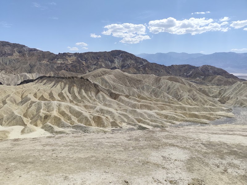
Zabriskie Point is the single most celebrated viewpoint in Death Valley and one of the most geologically arresting landscapes in North America — a panorama of deeply eroded badlands composed of lake bed sediments laid down between 3 and 9 million years ago, when Death Valley held a series of freshwater and saline lakes that repeatedly filled and evaporated as the climate changed. The pale yellow, cream, brown, and gray formations visible from the paved overlook are primarily composed of consolidated lake bed muds, volcanic ash layers, and evaporite minerals deposited during this Pliocene lake phase, subsequently uplifted by the same basin-and-range faulting that created the valley and then deeply dissected by erosion. The point is named for Christian Brevoort Zabriskie, who managed Pacific Coast Borax Company operations in Death Valley in the early 20th century, and it achieved international cultural recognition when Michelangelo Antonioni filmed scenes here for his 1970 film Zabriskie Point. The viewpoint is most dramatic at sunrise, when low-angle light illuminates the canyon floors in shadow while the ridgelines glow gold, but the late morning light of an early arrival from Las Vegas still provides excellent viewing conditions for the maze of eroded spires, fins, and canyons stretching toward the valley floor.
Twenty Mule Team Canyon
4.7
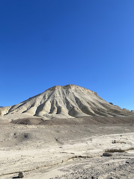
Twenty Mule Team Canyon is a 2.7-mile one-way unpaved loop road that winds through a landscape of eroded bentonite badlands — gray, cream, and tan formations of consolidated volcanic ash and lake sediments weathered into an intricate maze of ridges and gullies that look entirely unlike the red sandstone scenery of Utah or Arizona. The canyon takes its name from the remarkable commercial operation that defined Death Valley's 19th-century history: between 1883 and 1889, teams of 18 mules and 2 horses hauled enormous wooden wagons loaded with 10 tons of refined borax each trip across 165 miles of desert from the valley floor to the railroad at Mojave, California. The operation, organized by the Pacific Coast Borax Company, became one of the most iconic images of western commerce — the twenty-mule team logo is still used by 20 Mule Team Borax products today. The canyon road passes through the same pale formation deposits from which the borax was once extracted, the bentonite clay swelling dramatically when wet (the road closes after rain) and fracturing into irregular polygonal plates as it dries, creating an alien surface texture unlike anything else in the park.
🍽️
Lunch
Badwater Basin
Badwater Basin
4.8
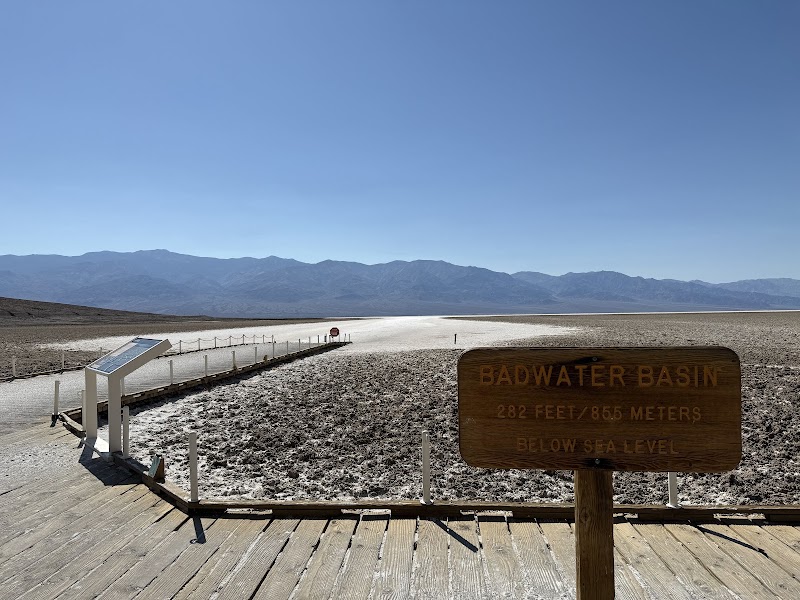
Badwater Basin is the lowest point in North America at 282 feet below sea level, a distinction marked by a small sign high on the canyon wall above the parking area while visitors stand on the valley floor far below. The basin is covered by a vast salt flat — approximately 200 square miles — left by the evaporation of a lake (Lake Manly) that filled Death Valley to a depth of 300 feet during the last ice age, roughly 10,000 to 12,000 years ago, when increased precipitation supported large pluvial lakes across the Great Basin. As that lake evaporated, it concentrated all of its dissolved minerals — primarily sodium chloride, calcium carbonate, calcium sulfate, and borax — into the crystalline salt crust visible today. Walking a short distance out onto the flat reveals the hexagonal salt crystal patterns that develop as the crust contracts during dry periods: the edges of each hexagon pushed upward by desiccation stress to form low ridges, creating a geometric mosaic that extends to the horizon in all directions. A small brine pool at the base of the alluvial fan near the boardwalk contains halophilic microorganisms and the Badwater snail (Assiminea infima), a species found nowhere else on Earth, adapting to the concentrated salinity of one of the most hostile environments on the planet.
🍽️ Lunch1:00 PM
The Ranch at Death Valley
The Ranch at Death Valley (formerly Furnace Creek Ranch) is the main service hub in the park, offering the most accessible lunch option in the central valley at the 19th Hole café and the Last Kind Words Saloon. The campus includes a golf course, general store, gas station, and the Borax Museum — a collection of mining equipment, wagons, and artifacts from the borax extraction era housed in an outdoor compound. Lunch here provides an air-conditioned respite and the opportunity to resupply water for the afternoon.
4$$American restaurant📍 Maps →
3 options · tap to switch
☀️
Afternoon
📍
Artist's Drive & Artist's Palette
Artist's Drive is a 9-mile one-way scenic road that winds through the Black Mountains on the east side of Death Valley, culminating at Artist's Palette — a hillside exposing a kaleidoscope of volcanic deposits in green, yellow, red, pink, brown, purple, and black. The multicolored effect is produced by the oxidation of different metalite minerals in decomposing volcanic material: iron oxides produce reds, pinks, and yellows; manganese oxides contribute purples and blacks; chlorite creates greens; and the combination of manganese and iron yields shades ranging from orange to brown. The underlying material is hydrothermally altered volcanic tuff — ancient ash deposits that were chemically transformed when hot, mineral-rich fluids percolated through them after deposition. The afternoon light tends to bring out the most vivid color contrasts, particularly on overcast days when diffuse illumination reduces glare. The surrounding Black Mountain terrain visible from the road shows additional geological complexity — fault scarps, alluvial fan deposits, and bajada surfaces — that contextualizes the artist's palette colors within the broader story of Death Valley's tectonic and volcanic history.
Devil's Golf Course
Devil's Golf Course
4.7
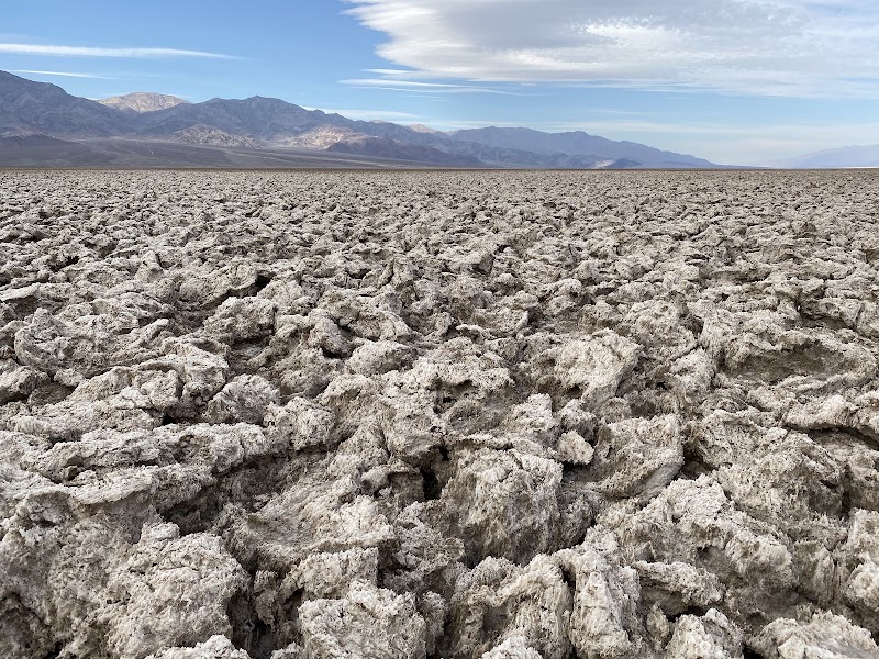
Devil's Golf Course is a vast expanse of jagged crystallized salt formations covering the valley floor just south of the main road near Badwater, named in the 1930s Death Valley park brochures with the observation that 'only the devil could play golf' on such rough terrain. The rock salt was deposited as the last major episode of Lake Manly evaporated roughly 2,000 years ago, leaving a thick salt layer that has since been sculpted by dissolution and recrystallization into formations up to two feet high with razor-sharp ridges, pinnacles, and holes — the surface is simultaneously delicate and brutally hard, crunching underfoot if walked upon and capable of slicing skin with unexpected efficiency. On hot days, visitors can hear the salt cracking and popping as it expands in the heat, a faint clicking and snapping that adds an auditory dimension to the already surreal landscape. The formations are most dramatically lit in late afternoon when the low sun creates strong shadows across the rough surface, accentuating the three-dimensional complexity of the crystalline texture.
🌙
Evening
🍽️ Dinner5:00 PM
The Inn at Death Valley Restaurant
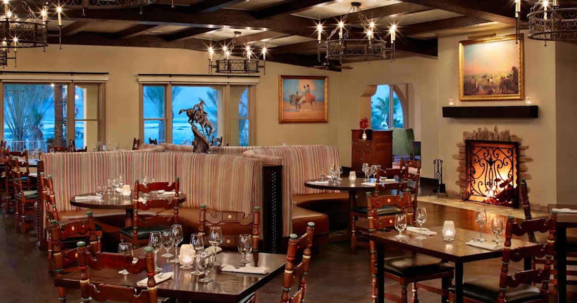
The dining room at The Inn at Death Valley (formerly The Inn at Furnace Creek) is the finest restaurant in the park, serving California-inspired cuisine in the elegant Spanish Mission-style dining room of the 1927 resort. The menu features seasonal ingredients with preparations that feel genuinely sophisticated for such a remote location, and the spring-fed pool terrace adjacent to the restaurant offers pre-dinner cocktails with views toward the Panamint Mountains at sunset.
3.9$$restaurant📍 Maps →
3 options · tap to switch
🛏️
The Inn at Death Valley
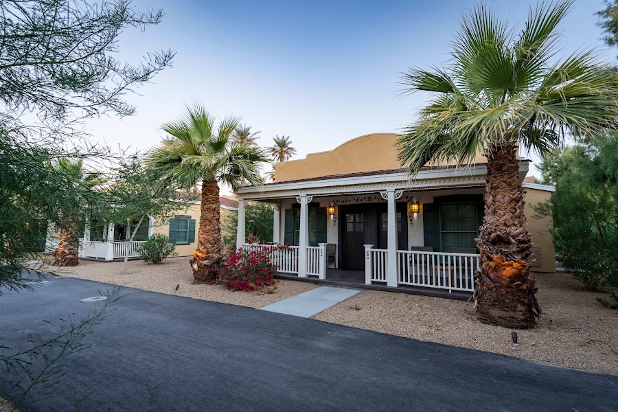
The Inn at Death Valley is the most historically significant and atmospheric accommodation in the national park — a 1927 Spanish Mission-style resort built by the Pacific Coast Borax Company at an elevation of approximately 2,000 feet on the alluvial fan of the Black Mountains above the Furnace Creek valley floor. The borax company developed the resort to attract tourists after the mining era ended, recognizing that Death Valley's extreme landscape could be marketed as a destination rather than simply an obstacle to extraction. The property features thick adobe walls, red tile roofs, arched walkways, and a spring-fed swimming pool that runs year-round from the same Furnace Creek freshwater spring that supported the valley's prehistoric and historic human populations. Rooms feature period-appropriate décor and panoramic valley views, and the elevation provides a few degrees of relief from the valley floor's legendary heat. The resort underwent significant renovation and reopening as The Inn at Death Valley in 2018, restoring its historic character while updating facilities.
Day 2Scotty's Castle Area & Ubehebe Crater
Day 2Scotty's Castle Area & Ubehebe Crater
🚗 2 hr 30 min driving📍 8 stops
🌅
Morning
🚗
Drive
The Inn at Death ValleyUbehebe Crater
1 hr 30 min8:00 AM9:30 AM
Via Scotty's Castle Road (North Highway) through the valley
Ubehebe Crater
Ubehebe Crater
4.8
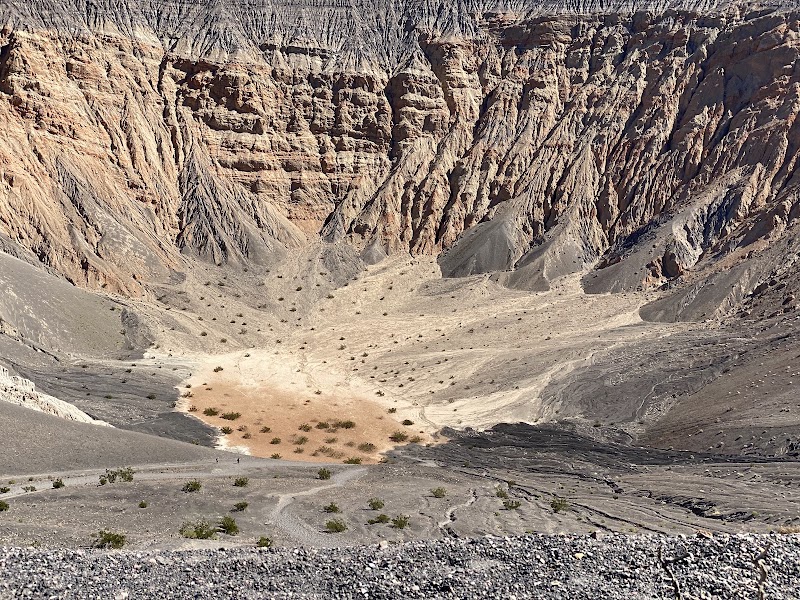
Ubehebe Crater is one of the most dramatic volcanic features accessible by paved road in the American Southwest — a half-mile-wide maar crater plunging 500 feet deep in the north end of Death Valley National Park, its interior walls striped in concentric bands of black basalt, orange cinder, and cream-colored lake sediment exposed by the explosion. The crater was formed by a phreatomagmatic eruption — a violent steam explosion produced when rising basaltic magma encountered groundwater or a shallow lake — sometime between 300 and 2,000 years ago (the dating range reflects the difficulty of precisely dating recent volcanic events in arid environments). The explosion ejected enormous quantities of black basalt cinders that mantle the surrounding landscape in a dark, angular gravel layer up to 150 feet deep near the crater rim, visible as the dark surface extending in all directions from the parking area. A trail around the rim (approximately 1.5 miles) passes the smaller adjacent Little Hebe Crater and offers views into the main crater's striated walls, while a steep trail descends 500 feet to the crater floor — a serious climb in desert heat but rewarding for the geological cross-section it reveals. The Paiute name 'Ubehebe' is generally translated as 'big basket in the rock' or 'coyote's basket,' reflecting the Indigenous communities' long familiarity with this conspicuous volcanic feature.
Scotty's Castle Historical Site (Exterior & Grounds)
4.3
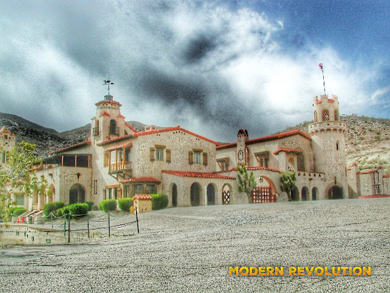
Scotty's Castle is the most improbable and charming anachronism in the national park system — a Spanish-Moorish villa of red tile roofs, arched loggias, wrought-iron grillwork, and a 185-foot clock tower constructed between 1922 and 1931 in one of the most remote corners of the Mojave Desert. The story behind its construction is one of the great frontier myths of the American West: Walter 'Death Valley Scotty' Scott was a former Buffalo Bill Wild West Show performer who convinced wealthy Chicago insurance magnate Albert Johnson to invest in a supposedly lucrative secret gold mine in Death Valley. Johnson visited in 1906 to inspect his investment, discovered there was no mine, but — captivated by both the landscape and Scotty's irresistible personality — continued funding the friendship anyway, eventually building the castle as his personal desert retreat while Scotty lived there as a permanent resident and entertained visitors with increasingly elaborate tales of his fictional gold mine. Johnson, the actual owner, allowed Scotty to take all the credit, and the relationship between the eastern millionaire and the western showman became one of the great improbable friendships of the era. Interior tours (including a renowned living history program) have been suspended since a 2015 flash flood washed out the access road and inundated the basement; restoration continues, but the exterior, grounds, and outbuildings remain accessible and richly evocative of the castle's peculiar history.
🍽️
Lunch
🚗
Drive
Ubehebe Crater / Scotty's CastleStovepipe Wells Village
1 hr11:30 AM12:30 PM
South via North Highway back through the central valley
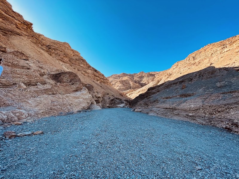
Mosaic Canyon
Mosaic Canyon
4.7
Mosaic Canyon, accessed by a 2-mile dirt road from Stovepipe Wells, is a slot canyon of exceptional geological interest whose polished walls expose some of the oldest accessible rock in Death Valley. The 4-mile round-trip hike begins in a narrow defile where flood-polished floors and walls of white Noonday Dolomite have been smoothed to a mirror finish by millennia of flash floods, the pale marble gleaming in contrast to the banded mosaic breccia that gives the canyon its name — a rock composed of angular fragments of older stone cemented in a matrix of finer-grained material, the result of tectonic forces that shattered the existing rock and healed it with mineral cement deposited by hydrothermal fluids. The Noonday Dolomite is approximately 750 million years old — Neoproterozoic in age, formed when the region lay beneath a shallow tropical sea long before the existence of complex animal life — making these some of the oldest rocks that can be touched by visitors anywhere in the park. Further up-canyon the narrows open into broader bowls with increasingly dramatic walls, and the hike continues past several dry waterfalls (easily scrambled around) to reach the upper canyon where wider views of the Panamint Range open to the west.
🍽️ Lunch1:30 PM
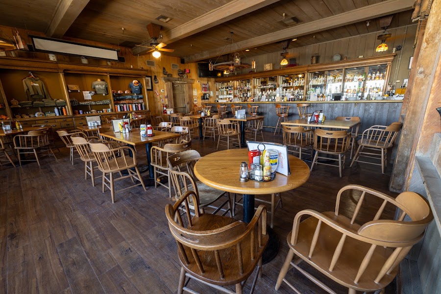
Stovepipe Wells Village Lunch
Stovepipe Wells Village is the most rustic of Death Valley's three in-park service areas, with a small general store, a saloon, a gas station, and a basic café serving burgers, sandwiches, and hot meals. The village sits at the edge of the Mesquite Flat Sand Dunes and across the road from a campground, and the casual atmosphere reflects its position as the working-class alternative to the more polished Furnace Creek resort complex.
4.1$bar📍 Maps →
3 options · tap to switch
☀️
Afternoon
Mesquite Flat Sand Dunes
4.8
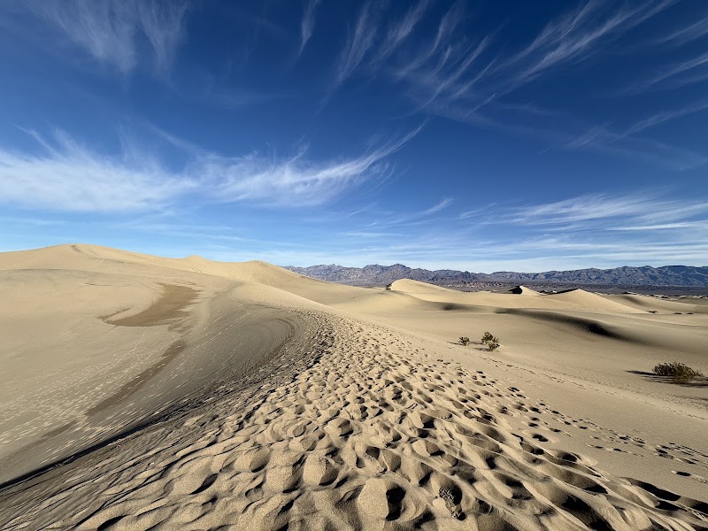
The Mesquite Flat Sand Dunes are the most accessible dune field in Death Valley — rising to 100 feet in height and covering several square miles directly adjacent to Stovepipe Wells — and the afternoon golden hour transforms them into something genuinely magical, with long shadows thrown across rippled sand faces and the warm orange-pink light of the low sun catching every grain. The dunes are formed from sand carried into the valley by alluvial fans from surrounding mountain ranges, accumulated where prevailing winds from multiple directions converge and lose their transport energy in a zone of competing air masses. A vigorous population of mesquite trees (for which the dunes are named) grows at the dune base, their roots reaching down 30–50 feet to the water table, and tracks of sidewinder rattlesnakes, kit foxes, and kangaroo rats across the morning sand provide evidence of the nocturnal animal community that inhabits this apparently barren environment. Visiting in the afternoon as opposed to mid-morning provides dramatically better photography conditions and slightly lower temperatures than the midday peak.
Rhyolite Ghost Town
Rhyolite Ghost Town
4.5
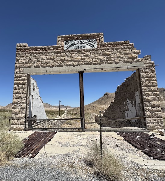
Rhyolite, located just outside the national park boundary near Beatty, Nevada, is the most substantial ghost town in the Death Valley region and one of the most evocative in the American West — a once-booming gold rush city of 10,000 people (1905–1911) reduced to roofless concrete shells and the still-standing wooden Cook Bank building. The town erupted from the desert after prospectors August Franklin and Ed Cross discovered gold-bearing quartz in 1904, triggering a speculative frenzy that brought the Las Vegas & Tonopah Railroad into town by 1907, funded 50 saloons, three newspapers, an opera house, a school, and the remarkable Bottle House — a residence built by miner Tom Kelly entirely from 50,000 glass beer and whisky bottles set in adobe mortar, which still stands nearly intact. The gold veins proved shallow and the 1907 financial panic accelerated the collapse; by 1911 the population had nearly vanished, and by 1920 only 14 people remained. What makes Rhyolite particularly haunting is the quality of its ruins — the three-story Cook Bank building, designed by a San Francisco architect, still stands to its second floor with Classical Revival details visible in the crumbling facade, and the railroad depot (restored) and train platform survive beside rusting track beds.
🌙
Evening
🍽️ Dinner5:00 PM
🍽️
Dinner at Stovepipe Wells or Furnace Creek
After the Rhyolite detour, returning to Stovepipe Wells for dinner at the Toll Road Restaurant provides the most convenient option, with the saloon atmosphere and basic American menu suiting the rustic character of a day spent in volcanic craters and ghost towns. Alternatively, the Ranch at Death Valley's Last Kind Words Saloon offers a slightly more varied menu 25 minutes further south at Furnace Creek.
$American restaurant📍 Maps →
3 options · tap to switch
🛏️
Stovepipe Wells Village Hotel
Stovepipe Wells Village Hotel is the most characterful of Death Valley's in-park accommodations — a low-slung desert motel complex at the edge of the Mesquite Flat Sand Dunes that offers the most direct immersion in the park's working landscape. The property reopened after significant renovation and now features updated rooms, a swimming pool, and the Badwater Saloon, which serves as both bar and gathering point for campers, hikers, and road-trippers sharing the particular camaraderie of people who have chosen to spend the night in the most extreme desert in North America. The hotel's position at the base of the dunes means guests can walk directly from their rooms onto the sand field for a sunset or pre-dawn dune walk — an experience of extraordinary quiet and visual drama available to no other accommodation guests in the park. Evening ranger programs are occasionally offered at the adjacent campground amphitheater, covering geology, astronomy (the skies above Stovepipe Wells are exceptionally dark), or natural history.
Day 3Darwin Falls & Trona Pinnacles

Day 3Darwin Falls & Trona Pinnacles

🚗 6 hr 30 min driving📍 5 stops
🌅
Morning
🚗
Drive
Stovepipe Wells Village HotelDarwin Falls Trailhead
1 hr8:00 AM9:00 AM
Via CA-190 West through the park toward Darwin Junction
Darwin Falls
Darwin Falls
4.6
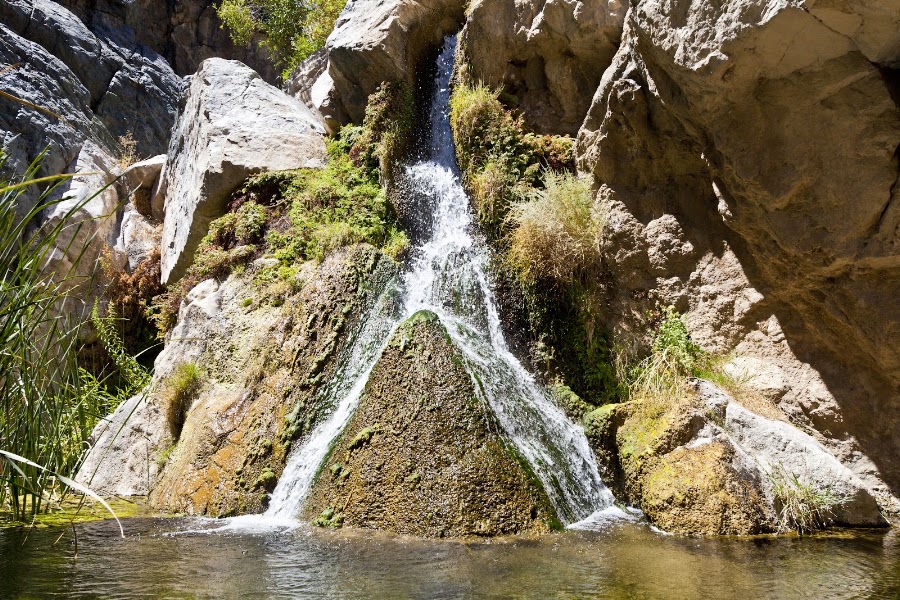
Darwin Falls is one of the most startling discoveries in Death Valley National Park — a perennial 35-foot waterfall hidden at the end of a 2-mile round-trip canyon hike in a landscape where average annual precipitation measures less than 2 inches. The water source is a permanent spring in Darwin Canyon, fed by groundwater percolating through the volcanic and metamorphic rock of the Argus Range, emerging reliably year-round and flowing south through the canyon to cascade over a ledge of dark volcanic basalt into a small clear pool. The canyon walls conceal the waterfall's existence completely until the last moment of the hike, making the revelation of rushing water, mist, and greenery all the more dramatic against the surrounding desert context. The riparian corridor along the approach trail is lush with Fremont cottonwood, Goodding's willow, cattail, and watercress — plants that cannot exist without the consistent moisture provided by the spring — and the sound of water increases gradually as hikers follow the trail upstream, crossing the stream several times on stepping stones. The pool at the base of the falls supports a healthy population of water-striders, dragonflies, and tree frogs, and the canyon walls above are streaked with colorful mineral deposits — rust reds, ochres, and pale greens — where groundwater seeps from the rock face. The contrast between this lush hidden oasis and the hyper-arid valley visible from the canyon entrance makes Darwin Falls one of the most memorable short hikes in the American Southwest.
🍽️
Lunch
🚗
Drive
Darwin Falls TrailheadTrona Pinnacles
1 hr 30 min10:00 AM11:30 AM
Via CA-190 East to US-395 South to Trona Pinnacles Road
Trona Pinnacles
Trona Pinnacles
4.8
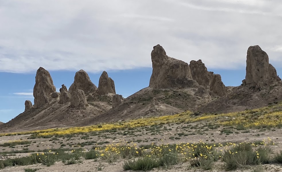
The Trona Pinnacles are among the most extraordinary geological formations in the Mojave Desert — 135 tufa spire formations rising up to 140 feet from the hard, cracked surface of the Searles Lake dry bed, their white and cream carbonate towers standing in dense clusters against the bare sky like the ruins of an alien city. Tufa forms when calcium-rich spring water bubbles up through carbonate-rich lake water, the chemical reaction precipitating calcium carbonate at the spring vent and building up layer by layer into rounded spires. The Searles Lake formations accumulated over a period from roughly 10,000 to 100,000 years ago when Searles Lake was a substantial body of water connected to the larger Pleistocene lake chain that linked Mono Lake, Owens Lake, China Lake, and ultimately Death Valley during ice age wet periods. As the climate dried and the lake level dropped, the tufa structures were exposed to air and stopped growing, their formation preserved in the dry alkaline conditions that prevent dissolution. The site has been used as a filming location to represent otherworldly terrain in Star Trek V: The Final Frontier (1989), Battlestar Galactica, Planet of the Apes (2001), and several other science fiction productions — a testament to the formations' genuinely extraterrestrial appearance. The BLM manages the site, which is accessible via a maintained gravel road, and an interpretive trail loops through the densest pinnacle cluster.
🍽️ Lunch12:30 PM
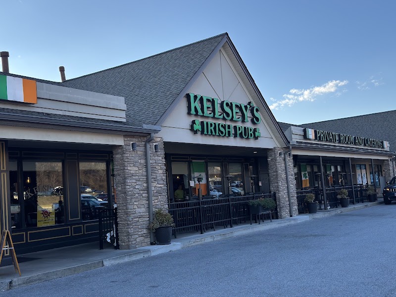
Kelsey's Restaurant
Kelsey's Restaurant
Ridgecrest, the nearest town to the Trona Pinnacles on US-395, offers a full range of casual dining options after the remote desert morning. Kelsey's Restaurant is a Ridgecrest institution with a broad American diner menu and generous portions. The town serves as a practical resupply and meal stop before the long highway drive back to Las Vegas.
4.4$irish pub📍 Maps →
3 options · tap to switch
☀️
Afternoon
🚗
Drive
Ridgecrest, CALas Vegas, NV
3 hr1:30 PM4:30 PM
Via US-395 North to US-95 North through Amargosa Valley
Amargosa Valley / Pahrump Pull-off (US-95 Corridor)
4.3
The drive north on US-95 from the Amargosa Valley through Pahrump traverses one of the clearest expressions of Basin and Range geology in the American West — the highway runs along the axis of a classic graben (down-dropped block between parallel normal faults), flanked to the east by the Spring Mountain Range and to the west by the Funeral Mountains and the Nevada-California border ranges. Pull-offs along this stretch reveal the characteristic basin-and-range landscape in panoramic form: flat alkali playas in the basin center, alluvial fans fanning out from mountain fronts, and the clean geometric fault scarps at the range bases marking where the land dropped along fault planes during the extensional tectonics that have been stretching the Great Basin eastward at roughly 1–2 centimeters per year for the past 15–20 million years. The Amargosa Desert visible to the southwest is the drainage basin for a hydrologically closed system — the Amargosa River flows north and then south in a great loop through the Mojave before terminating in Death Valley's salt pan — a hydrological isolation that has produced unique endemic species including the Amargosa pupfish.
🌙
Evening
🍽️
Isabella's Restaurant — Ridgecrest
Ridgecrest's most reliable sit-down dinner stop before the final 2-hour drive to Las Vegas — casual American fare, burgers and steaks, friendly service. Fuel up here rather than fast food on the highway.
🚗
Drive
Amargosa Valley / Pahrump, NVLas Vegas, NV
1 hr6:30 PM7:30 PM
Complete return to Las Vegas via US-95 North / NV-160
Plan your own escapeExplore more trips →