🏛️ CulturalWeekend · from Philadelphia, PA
Two Decisive Battlefields: Gettysburg & Antietam
The Civil War's bloodiest chapters unfolded on two adjacent landscapes that together produced more than 30,000 casualties in less than three months of 1862 and 1863. Gettysburg's rolling Pennsylvania hills hosted the war's turning point, where Pickett's Charge broke against Union lines on Cemetery Ridge and Robert E. Lee retreated south forever. The following morning, drive through the Blue Ridge's South Mountain gap to Antietam Creek in Maryland, where September 17, 1862 became the bloodiest single day in American military history — 22,726 casualties in less than twelve hours across the Cornfield, the Sunken Road, and Burnside Bridge.
Day 1 — Gettysburg, PADay 2 — Antietam, MD
Day 1 — Gettysburg, PA
Day 1 — Gettysburg, PA
🚗 2 hr driving📍 7 stops
🌅
Morning
🚗
Drive
Philadelphia, PA → Gettysburg, PA
2 hr
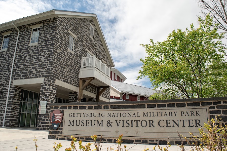
Gettysburg NMP Visitor Center & Museum
★ Reviews →The National Military Park's visitor center houses 19 galleries and 11,000 artifacts tracing the three-day battle of July 1-3, 1863 from strategic context through tactical engagement to national aftermath. The collection's centerpiece is the Gettysburg Cyclorama — a 377-foot circular canvas painted in 1884 by French artist Paul Philippoteaux depicting the July 3 cannonade and Pickett's Charge with a three-dimensional terrain foreground that creates a remarkable illusion of standing in the middle of the battle. The museum uses original weapons, uniforms, letters, and diaries to bring individual soldiers into focus amid the larger strategic narrative. Spending 90 minutes here before driving the battlefield makes the landscape immediately legible.
~1.5 hrs📍 See location
🍽️
Lunch
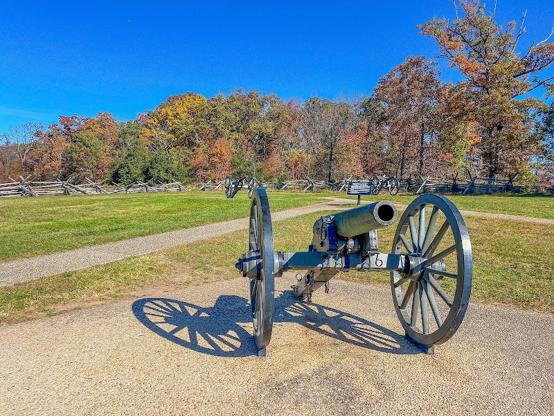
Battlefield Self-Drive Audio Tour — Little Round Top, Devil's Den & the Wheatfield
★ Reviews →The southern end of the Gettysburg battlefield contains the most dramatic terrain of the three-day engagement. Little Round Top was the rocky eminence that Colonel Joshua Lawrence Chamberlain's 20th Maine Infantry held with a bayonet charge on July 2 when they ran out of ammunition — its loss would have allowed Confederate forces to enfilade the entire Union line. Devil's Den, the jumbled boulder field below, sheltered Confederate sharpshooters whose fire made the ground between the two positions among the most lethal on the battlefield. The Wheatfield changed hands six separate times over two hours as both armies fed reinforcements into a killing zone roughly the size of twelve city blocks. A self-guided audio tour available through the NPS or commercial apps provides narration at each stop.
~1 hr📍 See location
🍽️ Lunch~1 hr
🍽️
Lunch on Lincoln Square, Gettysburg
Lincoln Square at the center of Gettysburg borough has several solid lunch options within walking distance. The square itself — where Lincoln passed through en route to deliver his November 19, 1863 address at the Soldiers' National Cemetery — is an attractive 19th-century commercial district with a mix of independent restaurants, taverns, and cafes. Gettysburg Eddie's, the Pub & Restaurant at the Gettysburg Hotel (which dates to 1797), and several other options cluster within a block or two.
diner
4 options · tap to switch
☀️
Afternoon
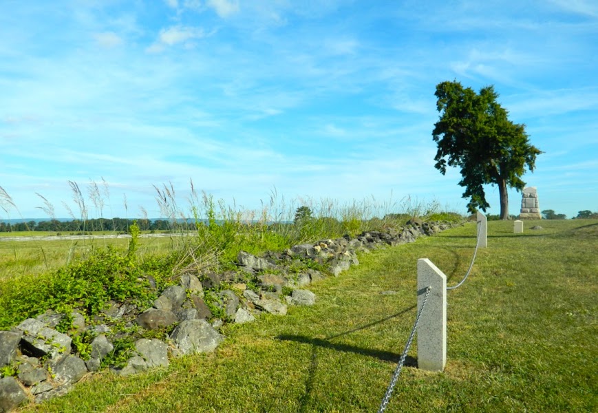
Cemetery Ridge & the Angle — High Water Mark of the Confederacy
★ Reviews →On July 3, 1863, approximately 12,500 Confederate soldiers under General George Pickett advanced three-quarters of a mile across open ground toward the Union center on Cemetery Ridge — under artillery fire for most of the approach, then under concentrated rifle fire as they neared the Federal line. The objective was a low stone wall on the ridge called the Angle, where a small section of Pickett's men briefly broke through before being repulsed. That breach — the farthest Confederate advance in the entire war — is marked as the High Water Mark of the Confederacy. The landscape today looks nearly identical to 1863: the same open fields, the same stone wall, the same ridge. Standing at the Angle and looking west across the ground the Confederate infantry crossed is one of the most affecting experiences in American battlefield touring.
~45 min📍 See location
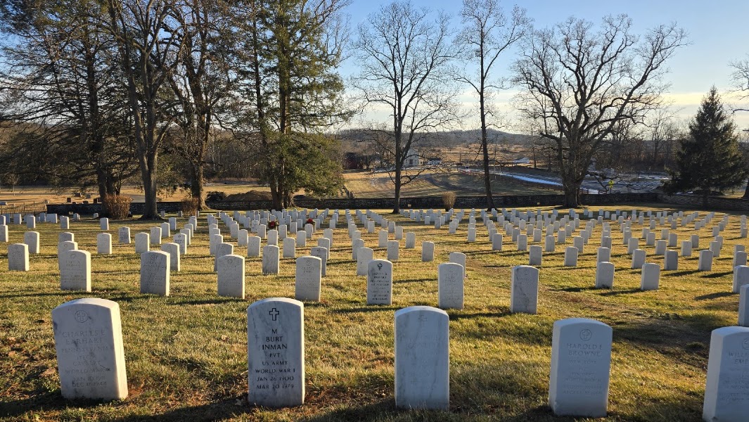
Soldiers' National Cemetery & David Wills House
★ Reviews →Soldiers' National Cemetery holds 3,512 Union dead arranged in semicircular rows by state — a formal geometric landscape that contrasts sharply with the raw ground of the battlefield it overlooks. Lincoln stood on the platform here on November 19, 1863 and delivered the 272-word Gettysburg Address after the cemetery's two-hour formal dedication. The David Wills House on Lincoln Square, where Lincoln stayed the night before the ceremony and where he is believed to have completed the final draft of the Address, is now a small museum with period furnishings and a thorough account of the November 19 ceremony and its long aftermath.
~1 hr📍 See location
🌙
Evening
🍽️ Dinner~1 hr
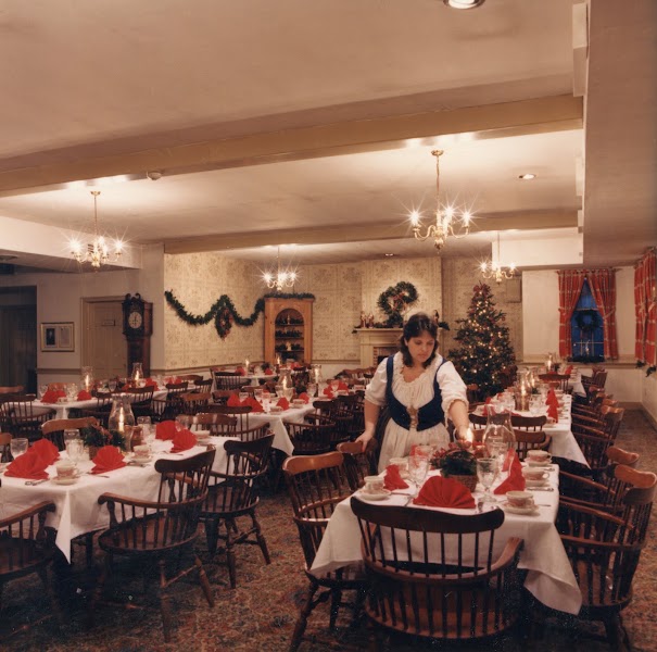
Dobbin House Tavern, Gettysburg
Built in 1776 — making it the oldest surviving structure in Gettysburg — the Dobbin House Tavern was used as a station on the Underground Railroad during the antebellum period, with a hidden room above the fireplace where escaped enslaved people sheltered before continuing north. It is now a well-regarded dinner restaurant serving colonial-era American cuisine in a setting of exposed stone walls, low-beam ceilings, and candlelight. The historical weight of the building and its location a short walk from the battlefield make it an appropriate and atmospheric close to a day spent on the ground where the war turned.
4 options · tap to switch
🛏️
Gettysburg Lodging
Gettysburg has a range of lodging that reflects both the scale of its tourism and the depth of its history. The Gettysburg Hotel on Lincoln Square has operated since 1797 and offers the most central location and historic atmosphere. The Herr Tavern & Publick House on Chambersburg Street — where Confederate forces were headquartered before the battle began — is a smaller inn with a strong period character. Several modern chain hotels cluster along US-30 for travelers who prefer predictable comfort and easy parking. Staying in the borough, within walking distance of Lincoln Square, is worth the premium for the experience of the town at night when the day visitors have left.
Day 2 — Antietam National Battlefield, MD
Day 2 — Antietam National Battlefield, MD
🚗 4 hr 20 min driving📍 6 stops
🌅
Morning
🚗
Drive
Gettysburg, PA → Antietam National Battlefield, Sharpsburg, MD
1 hr 20 min
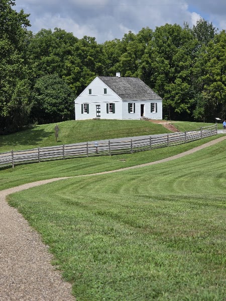
Antietam NMP Visitor Center
★ Reviews →The Antietam visitor center orients the battlefield through the park film 'Antietam Visit,' a battlefield relief map showing the three phases of the September 17, 1862 fighting — morning along the northern cornfields, midday at the Sunken Road, afternoon at Burnside Bridge — and a photographic exhibition anchored by Alexander Gardner's photographs taken two days after the battle. Gardner's images of Confederate dead in the Cornfield and along the Hagerstown Pike were published in New York newspapers and displayed at Mathew Brady's Manhattan gallery in October 1862, giving Northern civilians their first direct view of battlefield dead. The shock they produced in the public and in the Lincoln administration accelerated the decision to issue the Emancipation Proclamation five days later.
~1 hr📍 See location
🍽️
Lunch
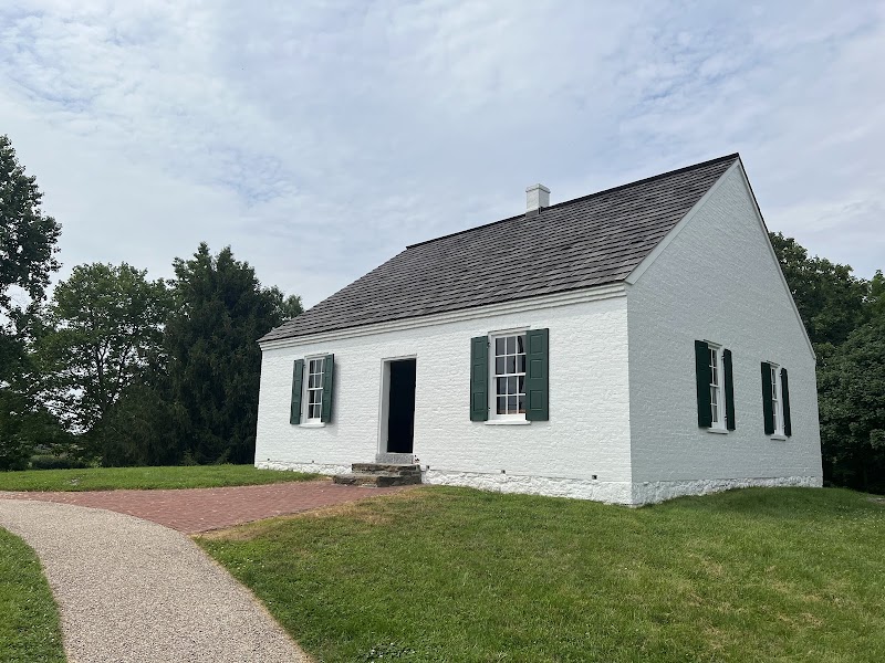
Battlefield Drive — the Cornfield & Dunker Church
★ Reviews →The northern sector of the Antietam battlefield encompasses the ground where the battle opened at dawn on September 17, 1862. The Cornfield — a 30-acre field of ripe corn belonging to farmer David Miller — changed hands fifteen times between 6 and 9 AM as Union and Confederate forces attacked and counterattacked in what General Joseph Hooker described as the most deadly ground he had ever seen. Stonewall Jackson's corps lost nearly 40% of its men in those 90 minutes. The Dunker Church, a small whitewashed meetinghouse of the pacifist German Baptist Brethren congregation, sat at the northern end of the field and was the objective of the morning's Union attack — an irony not lost on the congregation, who had built their church a mile from the nearest town specifically to avoid the moral contamination of the world.
~1.5 hrs📍 See location
🍽️ Lunch~1 hr
🍽️
Lunch in Sharpsburg or Hagerstown
Sharpsburg itself is a very small village with limited dining; Hagerstown, 12 miles north on US-65, offers a fuller range of options. The Canal Square area of Hagerstown has several restaurants within walking distance of each other. Alternatively, the Old South Mountain Inn on US-40 Alternate, roughly 10 miles northeast of Sharpsburg on the route back toward Frederick, is a historic inn dating to 1732 that serves lunch and dinner in a stone-walled colonial building along the historic National Road.
American restaurant
4 options · tap to switch
☀️
Afternoon
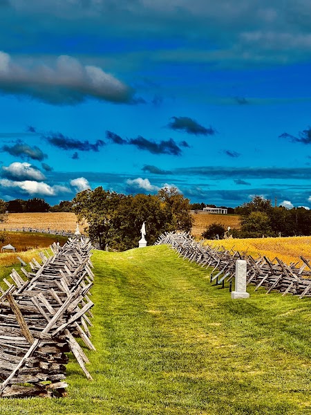
Bloody Lane — Sunken Road
★ Reviews →In the center of the battlefield, a farm lane worn by decades of wagon traffic had eroded several feet below the surrounding fields — creating a natural rifle pit that Confederate troops used to hold off repeated frontal assaults for three and a half hours on the morning of September 17. The Irish Brigade, led by General Thomas Meagher, charged the position six times under fire that reduced its ranks by 60%. When a miscommunication finally caused the Confederate defenders to abandon the road, Union troops poured over the berm and looked down on a lane filled with Confederate dead so densely packed that witnesses reported being able to walk its length stepping only on bodies. The road's depression is still visible; an observation tower at the northern end of the lane provides a view of the full position.
~45 min📍 See location
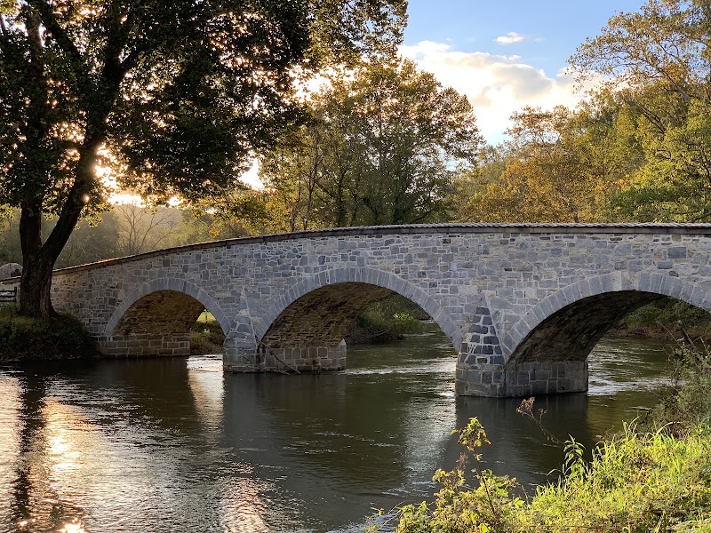
Burnside Bridge
★ Reviews →A four-arched stone bridge spanning Antietam Creek at the southern end of the battlefield, Burnside Bridge was the objective of Union General Ambrose Burnside's IX Corps — approximately 12,500 men — for the entire afternoon of the battle. Fewer than 500 Confederate sharpshooters of the 2nd and 20th Georgia Infantry, positioned on the bluff above the bridge's western end, held the creek crossing for three hours by firing down onto the narrow bridge approach. The delay proved fatal to the Union's afternoon offensive: when Burnside's men finally crossed and pushed the Confederate right flank to the breaking point, a fresh Confederate division under A.P. Hill arrived from Harpers Ferry just in time to stabilize the line and end the battle. The bridge is one of the most visually striking and tactically legible sites on any Civil War battlefield.
~1 hr📍 See location
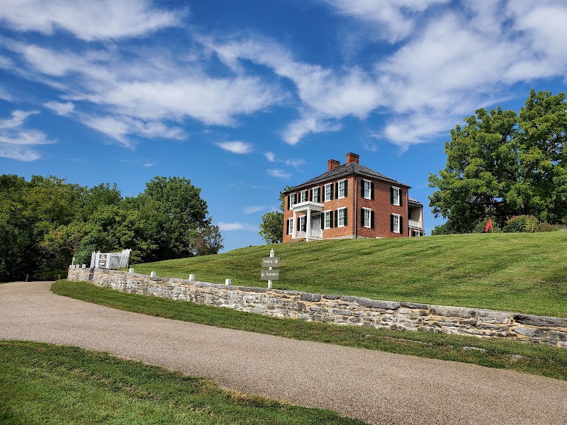
Pry House Field Hospital Museum
★ Reviews →The Philip Pry farmhouse on the eastern edge of the battlefield served as General George McClellan's headquarters during the battle and as a Union field hospital in the days that followed. The museum now focuses on Civil War medicine — the surgical techniques that earned Civil War surgeons the grim nickname 'butchers,' the role of chloroform and ether in making battlefield surgery survivable, and the pioneering work of Clara Barton, who brought supplies directly to the battlefield on September 17 and whose subsequent advocacy led to the American Red Cross. Documents and photographs related to Barton's work are displayed alongside the medical implements and hospital equipment used in the Pry House rooms.
~1.5 hrs📍 See location
🌙
Evening
🚗
Drive
Sharpsburg, MD → Philadelphia, PA
3 hr
← All Philadelphia trips
More getaways from Philadelphia
Delaware Water Gap: Waterfalls, Summit Views & River Swimming — Day trip🥾Delaware Water Gap: Waterfalls, Ridge Hiking & Niagara of Pennsylvania — Weekend🥾Pocono Mountains Circuit: Waterfalls, Gorge Rafting & Hawk Migration — Long weekend🥾Steam Trains & Amish Farmlands: Lancaster County in a Day — Day trip🏛️Pennsylvania Dutch Country: Steam Trains, Plain Communities & Colonial Communes — Weekend🏛️Pennsylvania Dutch Country: Three Days Among Plain Communities, Colonial History & Artisan Traditions — Long weekend🏛️Brandywine Valley: Longwood Gardens, Wyeth & Delaware River Countryside — Day trip🌿Brandywine Valley Weekend: Du Pont Estates, Wyeth Country & Delaware River — Weekend🌿
© 2026 theweekendgetaways.com · All itineraries are original content. Terms
Plan your own escapeExplore more trips →