← The Weekend Getaways
🥾 ActiveLong weekend · from Boise, ID

Owyhee Canyonlands — Silver City, Jordan Craters & Leslie Gulch

The Owyhee country southwest of Boise is one of the emptiest and most spectacular corners of the American West — a vast plateau of sagebrush cut by hidden red-rock canyons, capped by an 1860s mining ghost town, and studded with a young lava field of black basalt. This three-day loop is a genuine backcountry expedition: Day one climbs a rough mountain road to Silver City, a remarkably intact silver-boom ghost town high in the Owyhee Mountains. Day two crosses into the canyonlands proper, exploring the sinuous rimrock of the Owyhee River canyons and walking the strange lava tubes and spatter cones of Jordan Craters. Day three drops into the astonishing colored spires of Leslie Gulch and the desert-lake shore of Owyhee Reservoir at Succor Creek before the long drive home. Much of the route is remote gravel with no services, fuel, or cell coverage — a high-clearance vehicle is strongly advised, and preparation is not optional. Overnights are near Jordan Valley and Silver City.

Day 1 — Silver City, Owyhee Mountains ghost townDay 2 — Owyhee River canyons & Jordan Craters lava fieldDay 3 — Succor Creek & Leslie Gulch
Day 1Silver City, ID

Day 1Silver City, ID

🚗 2 hr driving📍 4 stops
🌅
Morning
🚗
Drive
Boise, IDSilver City, ID (rough mountain road)
2 hr8:00 AM10:00 AM
Silver City Historic Ghost Town
4.6
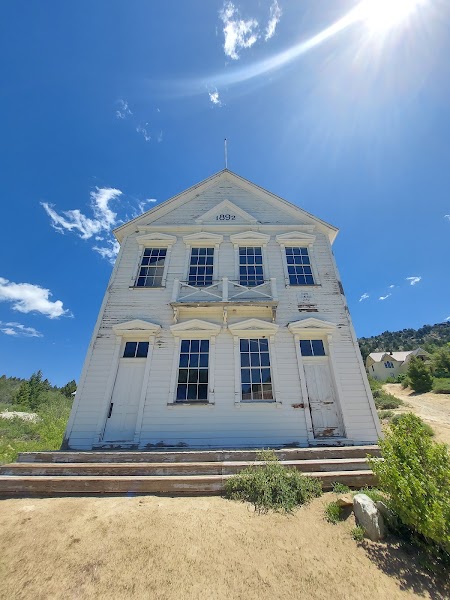
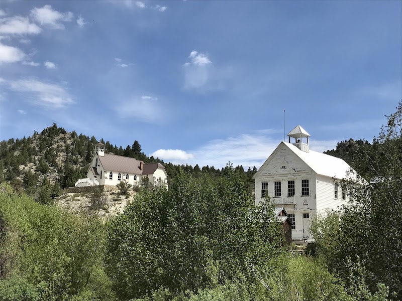
High in the Owyhee Mountains at nearly 6,200 feet sits Silver City, one of the best-preserved mining ghost towns in the West — a silver and gold boomtown of the 1860s that once held thousands of people, a newspaper, and dozens of mines, and that was simply abandoned rather than burned or bulldozed. Roughly seventy original wooden buildings still stand along its steep dirt streets, including the 1866 schoolhouse, the Masonic hall, and the atmospheric Idaho Hotel, still operating seasonally by lamplight. Wander the streets, read the interpretive markers, and climb toward the old mine workings and cemetery on the hillsides above. The road up is rough, narrow, and unpaved, typically snow-free only from late spring through fall; a high-clearance vehicle is strongly advised, and there is no fuel or cell service. Tread lightly — the town is a fragile historic site, largely privately owned.
🍽️
Lunch
Idaho Hotel dining room / Silver City picnic
4.6
The historic Idaho Hotel, in continuous seasonal operation since the 1860s, serves simple, hearty meals in a dining room frozen in the nineteenth century, lit by lantern and heated by woodstove — a genuinely memorable lunch if it is open during your visit. Hours are limited and seasonal, so never count on it; carry a full picnic and plenty of water as your reliable plan. Eating on the hotel porch or at a quiet spot among the old buildings, with the mountains rising all around and not a modern sound in earshot, is one of the highlights of the day. There are no other services in Silver City, so pack in everything you need.
11:00 AM📍 See location
☀️
Afternoon
War Eagle Mountain & the Old Mine Trails
4.6
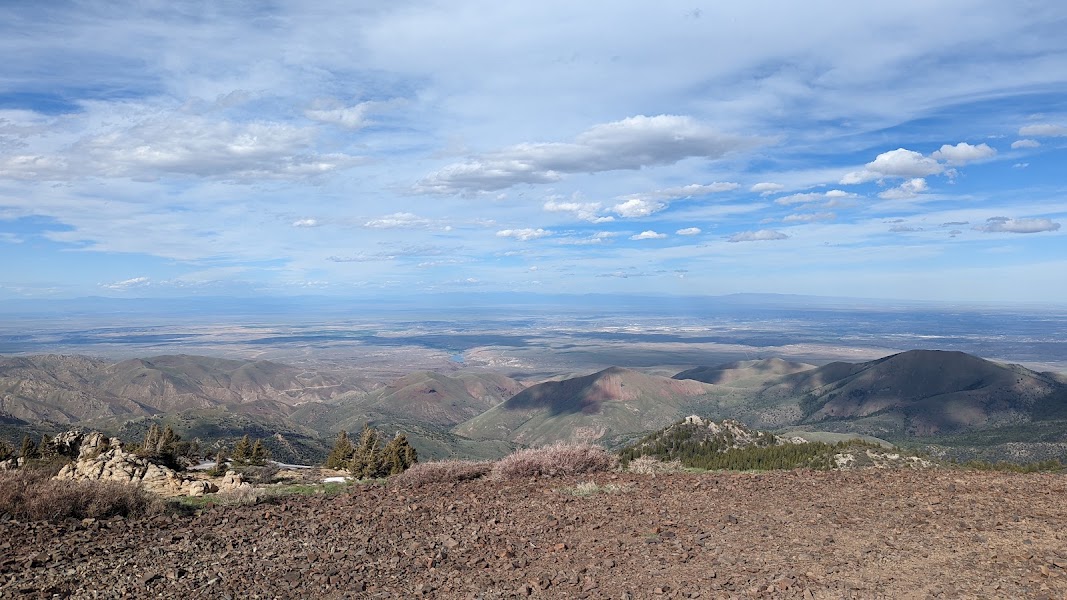
Above Silver City rise War Eagle and Florida Mountains, the source of the ore that built the town, laced with old mine roads and trails that make for excellent high-country walking. Routes climb past collapsed headframes, tailings piles, and abandoned workings to broad summit views across the entire Owyhee range and out over the desert toward the distant Snake River Plain. The alpine meadows bloom with wildflowers in early summer, and the solitude is total. Stay well clear of any open mine shafts and unstable structures, which are genuinely dangerous, and turn back with plenty of daylight to spare for the drive to your night's lodging. Carry all your own water; there is none reliable up here.
🌙
Evening
🛏️
Idaho Hotel (Silver City) or Jordan Valley lodging
For the full experience, spend the night in Silver City itself at the Idaho Hotel, where lamplit rooms with period furnishings and no modern amenities make for an unforgettable, if rustic, stay — reserve well ahead, as it is small and seasonal. Those who prefer more comfort, or arrive to find the mountain road or hotel closed, should descend and base in Jordan Valley, Oregon, a tiny ranching town at the edge of the canyonlands with a basic motel and the well-positioned launch point for tomorrow's Owyhee River and Jordan Craters exploration. Either way, top off fuel and water before nightfall — services in this country are hours apart, and there is no filling up once you are deep in the Owyhees.
Day 2Owyhee River Canyons & Jordan Craters, OR
Day 2Owyhee River Canyons & Jordan Craters, OR
🚗 2 hr 15 min driving📍 4 stops
🌅
Morning
🚗
Drive
Silver City / Jordan ValleyOwyhee River Canyon overlooks
1 hr 15 min8:00 AM9:15 AM
Owyhee River Canyon Overlooks
4.8
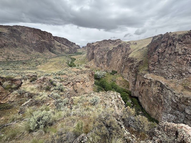
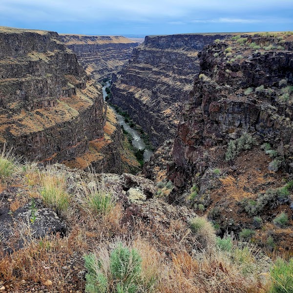
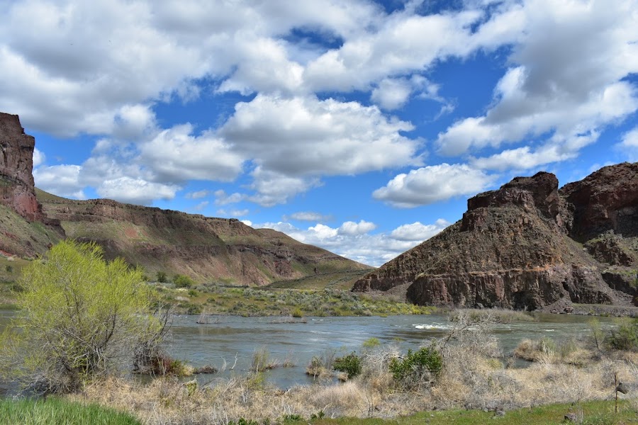
The Owyhee River has carved a system of deep, sinuous canyons through the volcanic plateau that rank among the least-visited great gorges in the country — sheer rhyolite and basalt walls in shades of rust, ochre, and rose dropping hundreds of feet to a green ribbon of river far below. Gravel spur roads lead to rimrock overlooks where the canyon suddenly opens at your feet, silent but for wind and birdsong, with no fences, no crowds, and often no other soul in sight. Short walks along the rim reveal new bends and side canyons; keep well back from the crumbling edges. This is the emptiest heart of the Owyhee canyonlands, sometimes called the Grand Canyon of Oregon, and the sense of remote wilderness is absolute. Navigation is by map and GPS, as signage is minimal and roads branch confusingly.
🍽️
Lunch
Owyhee rim picnic
Owyhee rim picnic
4.6
There is no food, water, or service anywhere in the canyonlands, so lunch is a picnic on the rim — and there is no finer table in Oregon. Spread out at a canyon overlook with the Owyhee gorge falling away below and eat what you carried in from Jordan Valley or Boise. This is deep backcountry: everything you consume you must pack in, and everything left over you pack out. Ration your water carefully in the desert heat, and treat this stop as a chance to rest in the shade of the vehicle before the afternoon's walk across the lava. The nearest reliable meal is back in tiny Jordan Valley, so plan your supplies accordingly.
10:15 AM📍 See location
☀️
Afternoon
Jordan Craters Lava Field
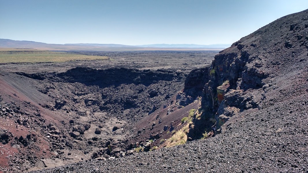
Jordan Craters is a young volcanic field — geologically recent, perhaps only a few thousand years old — of glossy black basalt spread across the sagebrush plateau, centered on the perfect spatter-and-cinder cone of Coffeepot Crater. A short walk from the primitive parking area leads to the crater rim and out onto the pahoehoe lava, a strange landscape of ropy flows, collapsed lava tubes, pressure ridges, and deep fissures still sharp-edged and raw. It is easy to explore on foot for as long as you like, though the footing over the broken basalt is rough and the sun brutal — wear sturdy boots, watch for hidden cracks, and carry far more water than you think you need. The access road is graded gravel that turns to impassable slick clay when wet, so check the forecast; never enter if rain threatens. There are no facilities of any kind.
🌙
Evening
🚗
Drive
Jordan Craters, ORJordan Valley, OR
1 hr5:00 PM6:00 PM
🛏️
Jordan Valley lodging (Basque country)
Jordan Valley, Oregon, is the only town for a great distance — a tiny high-desert ranching community settled by Basque sheepherders, whose legacy survives in the old fronton (Basque handball court) on the main street and in the occasional Basque dish on local menus. The handful of basic motel rooms fills fast with the ranchers, hunters, and backcountry travelers who pass through, so reserve ahead. The town's small cafe or bar-grill supplies a hearty ranch dinner and is the social center of the district. Fuel here is precious — fill the tank tonight, because tomorrow's run to Leslie Gulch and Succor Creek and then home leaves no room for error in this fuel-desert. Stock your water and any picnic supplies for the final day here as well.
Day 3Succor Creek & Leslie Gulch, OR

Day 3Succor Creek & Leslie Gulch, OR

🚗 3 hr 40 min driving📍 4 stops
🌅
Morning
🚗
Drive
Jordan Valley, ORSuccor Creek State Natural Area
1 hr 10 min8:00 AM9:10 AM
Succor Creek State Natural Area
4.7
The final day opens in Succor Creek, a narrow canyon where a small creek winds beneath towering walls of eroded volcanic tuff and rhyolite in bands of buff, gold, and green. A rough gravel road threads the length of the gorge, with a primitive streamside campground and informal trails that climb the side canyons and benches — rockhounds prize the area for thundereggs and agates weathering out of the ash beds. The canyon is intimate and quiet, a gentler-scaled prelude to Leslie Gulch just to the south, with cottonwoods along the creek and raptors riding the updrafts off the cliffs. The road is narrow and can be rough; take it slow and enjoy the changing rock as the canyon deepens. As everywhere out here, carry your own water and expect no services.
🍽️
Lunch
Leslie Gulch boat-ramp picnic
4.4
There are no restaurants anywhere in this country, so lunch is a picnic — and the Leslie Gulch boat ramp, on the shore of the Owyhee Reservoir at the mouth of the canyon, is a spectacular table. Spread out on the reservoir's edge with the glowing rhyolite walls rising all around and eat what you packed from Jordan Valley or Boise. Shade is scarce, so use the vehicle or a canyon alcove, and ration water carefully in the desert heat. This is deep backcountry: carry in everything, pack out everything, and take the break to rest before walking the side canyons. The nearest real kitchen is hours away back toward the Snake River, so plan supplies accordingly.
10:10 AM📍 See location
Leslie Gulch
Leslie Gulch
4.8
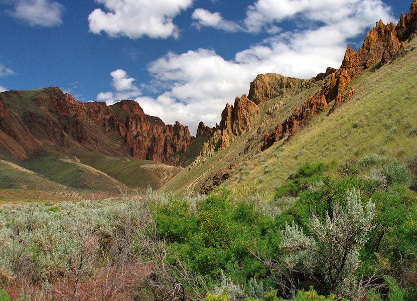
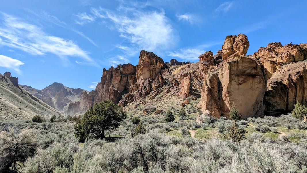
Leslie Gulch is the scenic climax of the whole loop — a canyon of astonishing eroded rhyolite tuff sculpted into honeycombs, spires, hoodoos, and cavernous alcoves in glowing shades of rose, cream, and gold, descending to the shore of the Owyhee Reservoir. A gravel road runs the length of the gulch, and side canyons like Juniper Gulch and Timber Gulch offer superb short hikes up into the rock formations, where the walls close in and the light plays across the sculpted stone. The gulch shelters California bighorn sheep, often visible on the crags, and rare plants found nowhere else on earth. This is one of the most photogenic places in Oregon and almost entirely unvisited. The road is rough gravel, impassable when wet; carry all your water, and give yourself unhurried time to walk the side canyons before the long drive home.
☀️
Afternoon
Owyhee Reservoir Shore & Juniper Gulch Trail
4.9
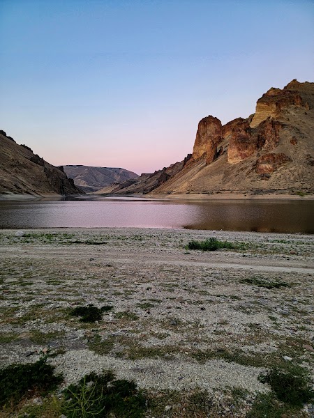
Where Leslie Gulch meets the water, the Owyhee Reservoir spreads its blue-green desert lake between colored canyon walls — a startling oasis after days of dry country. The boat ramp and shoreline make a fine spot to cool off and take in the reflections of the rhyolite cliffs, and the nearby Juniper Gulch Trail is the best short hike in the area, climbing a couple of miles into a tightening slot of hoodoos and honeycombed rock. Watch the crags for bighorn sheep. Save enough energy and daylight for this last walk, then begin the long drive back to Boise — the route out is gravel for many miles before you regain pavement near the Snake River, so allow generous time and top off fuel at the first town you reach.
🌙
Evening
🚗
Drive
Leslie Gulch, ORBoise, ID
2 hr 30 min5:00 PM7:30 PM
Plan your own escapeExplore more trips →